Erin is behaving as expected. It is a couple hundred miles offshore this morning, and it is moving to the northeast.
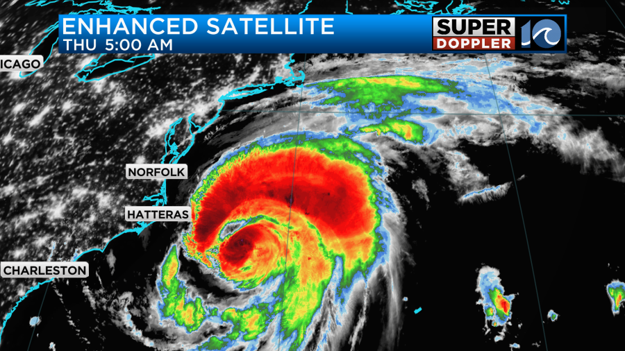
It was a category 2 this morning with sustained winds of 105mph near the center. It will move to the northeast today at a good clip. The bulk of the rain will be offshore, but a few showers will move into our area off of the ocean through the day.
Despite the storm being offshore we will still have some strong coastal winds. We’ve already had some wind gusts to over 40mph along the Outer Banks and near the mouth of the Chesapeake Bay.
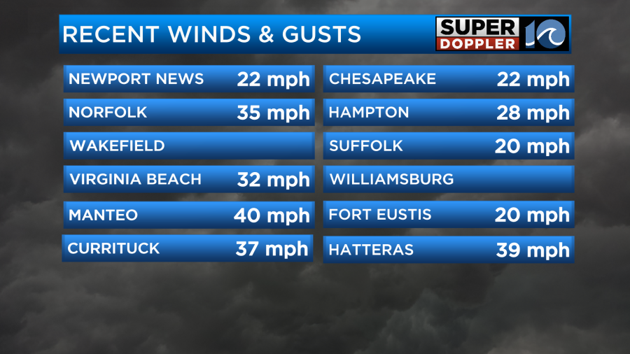
The data fell off, but there was a gust to 43mph earlier around Hatteras.
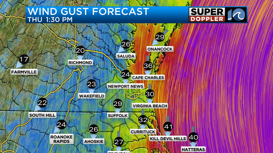
Winds will gust to around 35mph near the shore today and along the mouth of the Chesapeake Bay. It will gust to over 40mph over the Outer Banks.

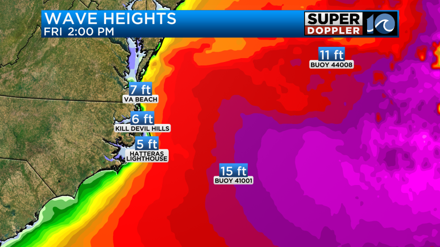
There will be some big waves. There have already been some waves reaching up close to the bottom of the Avon Pier this morning.
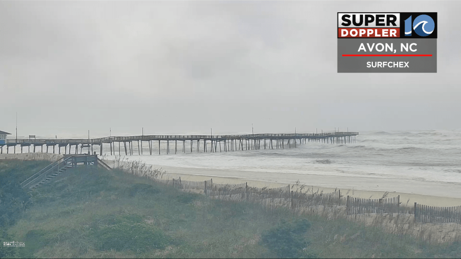
Waves will approach 10 ft around Virginia Beach. They will run about 10-15ft along the Outer Banks. Based off of the latest that I’m seeing, I’m backing off of the over 15ft wave wording. A few over 15ft will be possible.
There will be some minor tidal flooding this morning. Then there will be some moderate tidal flooding this evening.

The tide over the Outer Banks is expected to be major.
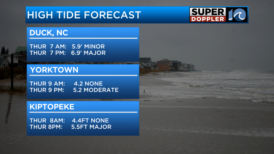
There could also be some major tidal flooding around Lynnhaven Inlet in Virginia Beach. It could be between moderate and major around Kiptopeke, but it will be less north of there.
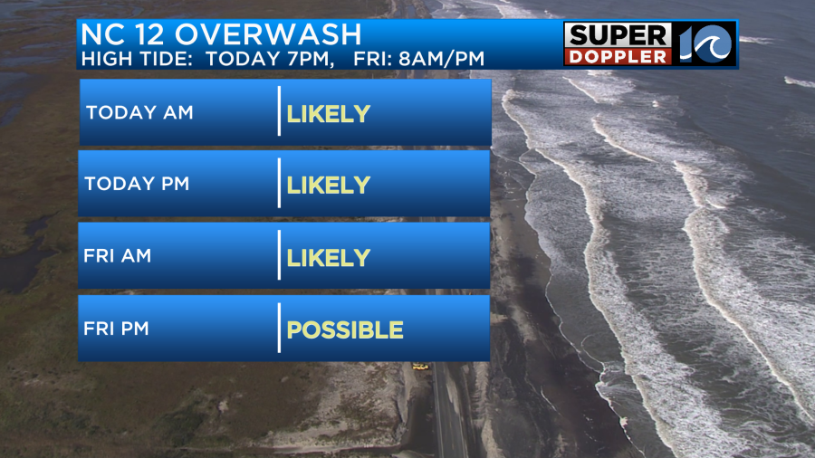
Ocean overwash is happening along highway 12. That will happen on-and-off through the day. However, it will be worse during high tide.
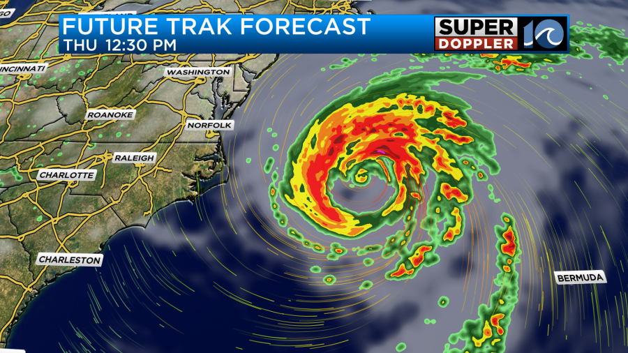
By this afternoon Erin will be jetting farther out to sea. By tomorrow it will be long-gone.
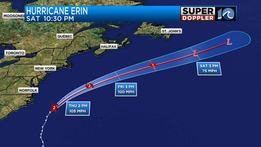
Conditions will improve quickly. A cool front is expected to drop in as Erin pushes farther out to sea.
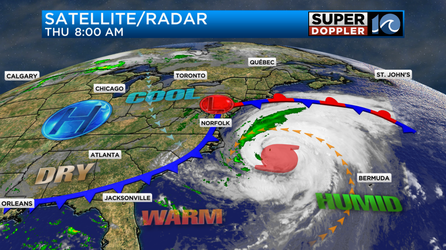
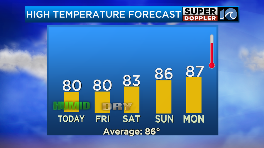
We’ll be near 80 today and very humid. However, we will be much cooler and drier as we go into the weekend.
muggy meter
The waves will stay up tomorrow. This will be good for the ECSC.
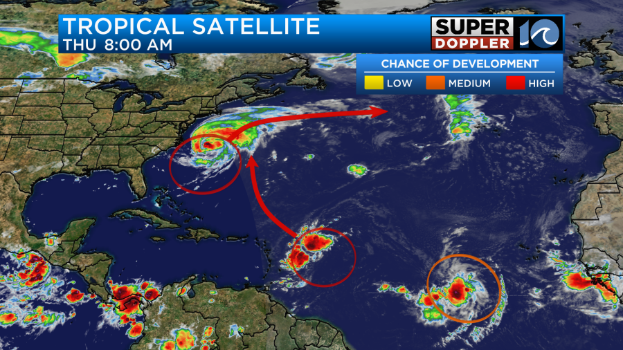
There are a couple of other features over the Atlantic. The disturbance over the central Atlantic has a high chance of formation, but it will probably stay out to sea.
We’ll have more updates through the day.
Meteorologist: Jeremy Wheeler


