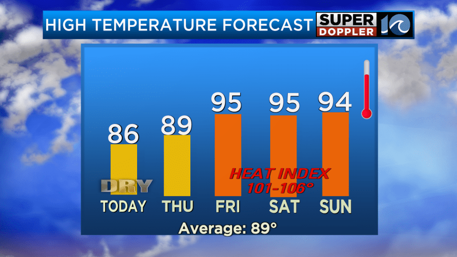
Yesterday was nice! It was still warm and a bit humid, but overall it felt pretty good. The evening was very nice! Today we will still have nice weather. It will be very similar to yesterday. High temps were in the mid-upper 80s yesterday, and I think we’ll be about the same today.

There may be a couple of 90s inland and south. High pressure is to our north with a stationary front to the south.

We’ll have fair skies through the day with a light breeze out of the east/northeast. So things are lookin pretty rosy overall. However, there is one big speed bump in the nice day if you are heading to the local beaches. There is a high threat for rip currents from Virginia Beach down to the southern Outer Banks.
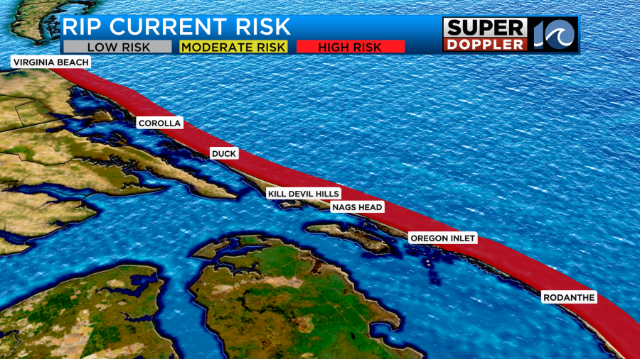
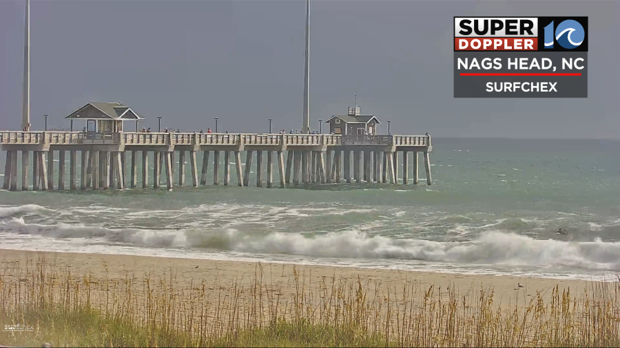
Be sure to swim near a lifeguard today. In some locations in may be too dangerous to swim. The surf was looking rough this morning on the cameras.
Tomorrow things will shift around a little bit. The front will eventually fall apart. Winds will turn out of the southeast. We’ll be partly cloudy, but this time there will be some isolated showers and storms over northeast North Carolina.

Humidity will start to build back in. Dew points will gradually climb above 70.

The temps will also rise some more. High temps will aim for the upper 80s to near 90 degrees.

The heat index will be in the low-mid 90s. The heat will continue to spill east as we go into Friday. High temps will reach the mid 90s. The heat index will be easily over 100.
We’ll be partly cloudy with only a stray shower or thunderstorm. We’ll be partly cloudy over the weekend with a few showers and storms, but the chances don’t look too high. There may be a few more during each evening. We’ll see. I’ll talk more about that in tomorrow’s weather blog.
There is one more thing to talk about today. There is a weak area of low pressure forming along the stalled-out front to our south. This feature is forecast to get into the Gulf of America over the next couple of days.
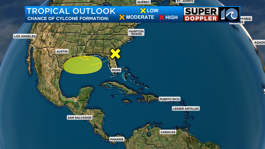
At that point it will have a low chance of formation.
Meteorologist: Jeremy Wheeler