
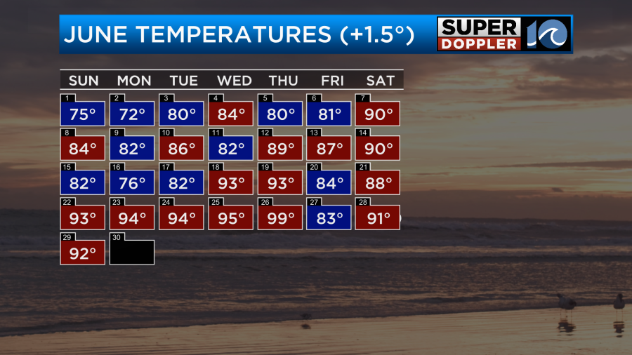
It’s been a rough couple of weeks in terms of the heat and humidity. We are wrapping up the month, and June will likely go down as 1.5 degrees above average.
We ended up pretty close to average for rainfall.
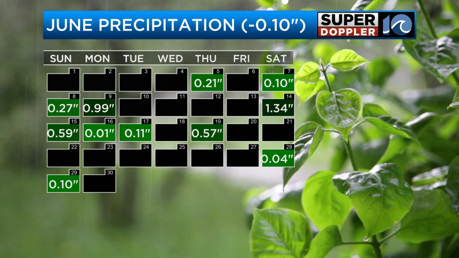
I think that was mainly due to the lack of rainfall over the last week and the first week of June. However, that is Norfolk. Some other locations had quite a bit more rain.
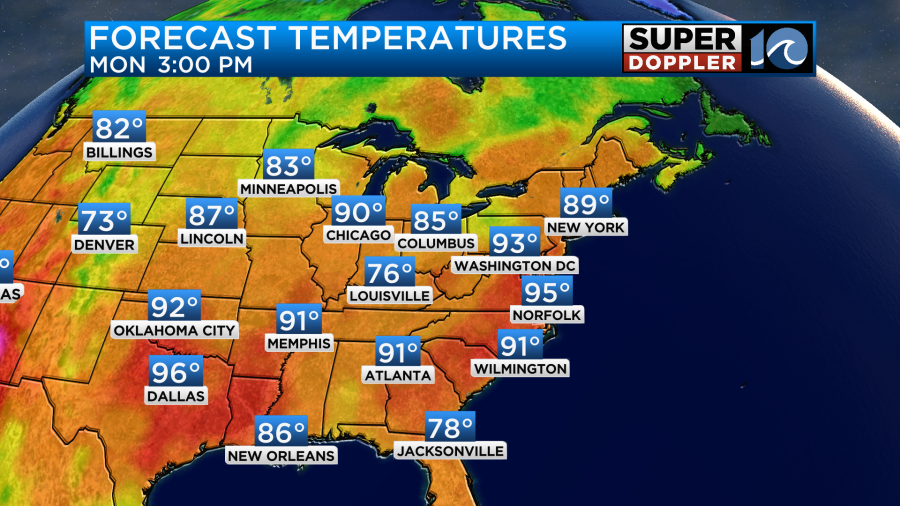
We won’t get much rain today, but it will be hot and humid again. High temps are aiming for the mid 90s.
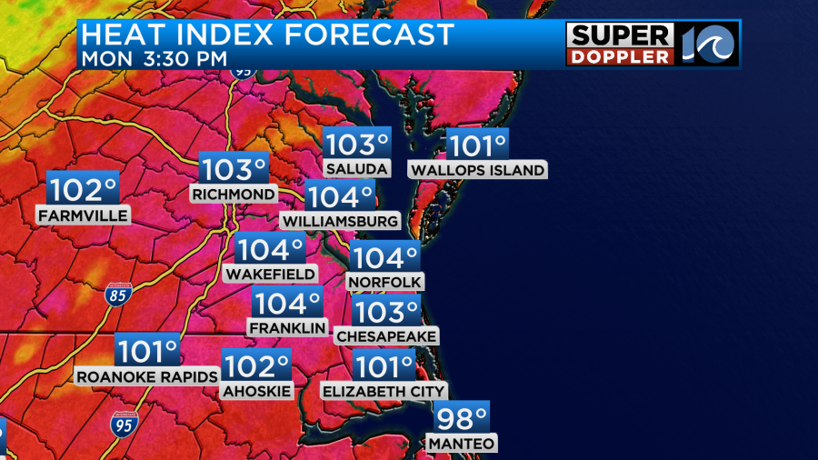
The heat index will be between 100 and 105 degrees.
High pressure is offshore with a stationary front to the north.
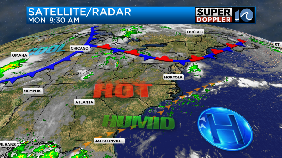
There is a cool front over the Midwest that will move in around mid-week. However, tomorrow we are going to heat up ahead of it. Highs will be in the mid 90s.
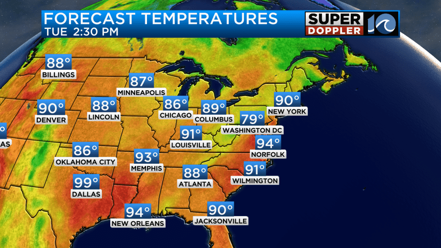
The heat index will be over 100 again. However, tomorrow there will be a nice breeze out of the southwest. Some of the gusts will be up to 25mph.
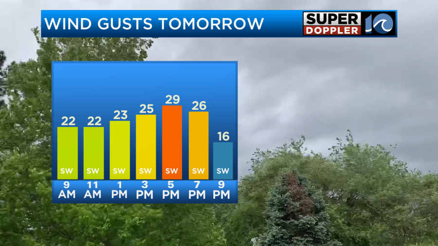
That will really help in how it will feel outside, but it will still be a very hot and humid day. There will be a few showers and storms during the afternoon. Then there will be some more scattered showers and storms tomorrow evening.
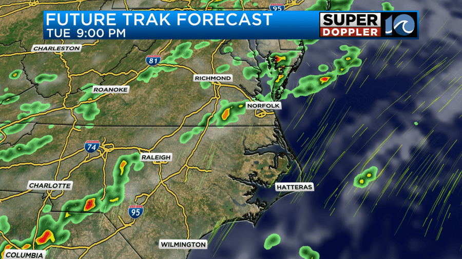
There may be a few strong storms during that time.
The cool front will then move-in Tuesday night into Wednesday morning. It will probably stall out briefly just to our south. This will create several rounds of showers and thunderstorms.
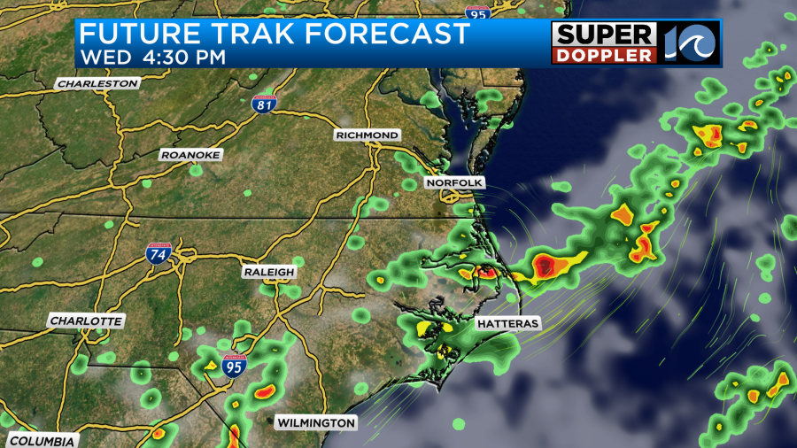
We’ll also have lots of clouds. These will both act to keep the high temperatures down in the 80s.
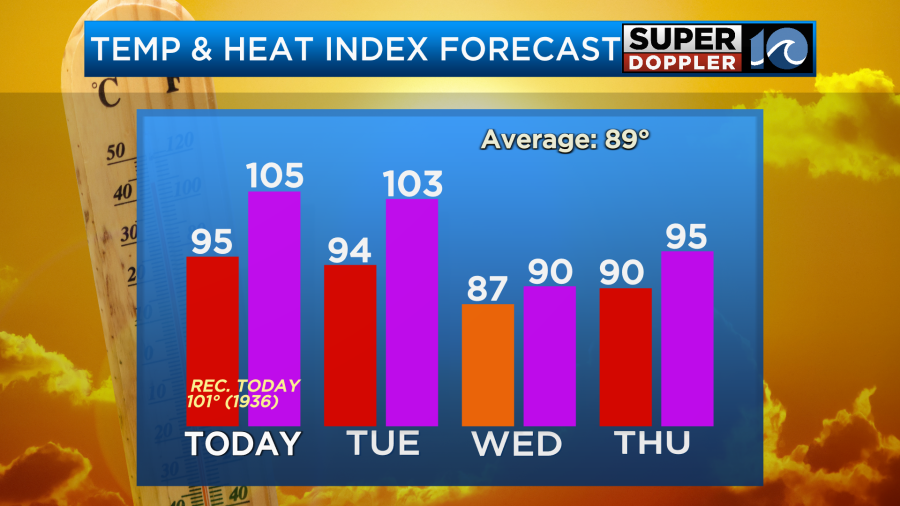
The humidity will also drop Wednesday. So the heat index shouldn’t be too bad. I’m hopeful that the humidity will stay down going into the weekend. For now the 4th of July’s weather is looking good with high temps around 90 degrees and lots of sunshine.
Believe it or not, there was a tropical storm in the Gulf over the weekend. The short-lived tropical storm “Barry” wasn’t a storm for long. It weakened to a tropical depression last night. Then it made landfall over eastern Mexico.
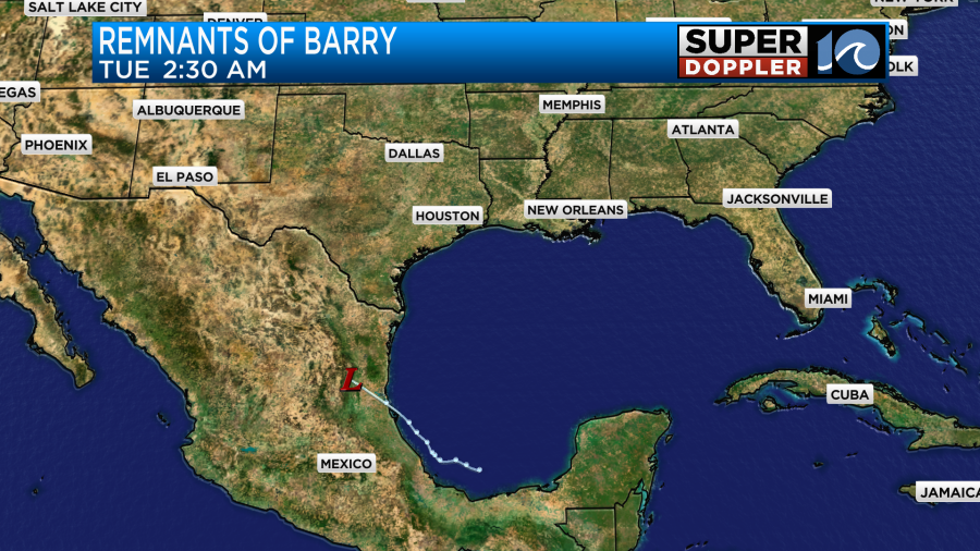
Now it is just a rainmaker for that part of Mexico. There is another potential system later this week that could form near northern Florida.
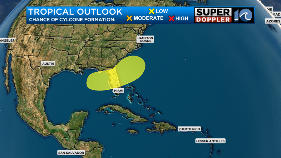
That will be a weak area of low pressure forming along a stalled out front. We’ll see what happens with that over the next few days. I’ll have updates on that and the 4th of July weekend coming up in tomorrow’s weather blog.
Meteorologist: Jeremy Wheeler


