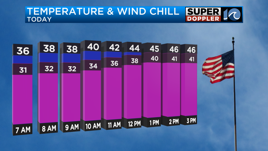
Well, I’m back today doing the weather. It was a nice break. I had some good family time. Got some good gifts. Saw some good movies… Heading back today was hard as my schedule has been off. It’s tough staying up until midnight one night (or two), and then getting up at 2:30 a.m. today. Oh well. So today is going to be a bit tough for other folks heading back to work. At least it will be dry, but it will be chilly. High temps will be in the mid-upper 40s. Wind chills will be in the 30s and 40s.
High pressure is to our west, and it is building in a bit. A cold front is dropping to our southeast.
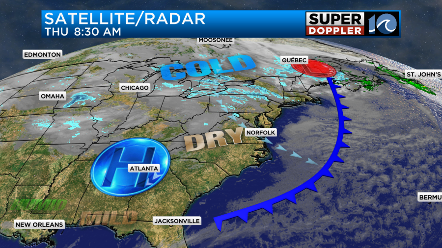
We’ll have lots of sunshine through the day, but the wind will be up out of the northwest then west. Some of the gusts will be up to 20 mph.
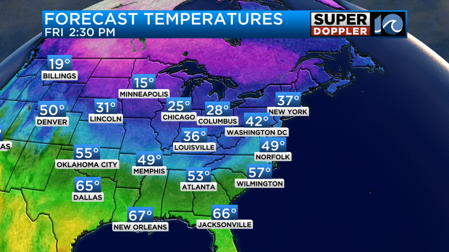
Tomorrow we’ll be dry at the surface, but moisture will start to increase in the upper levels. This means we’ll become mostly cloudy, but we should be dry for the bulk of the day. Winds will be out of the southwest. They will run at about 10-15 mph. This should be able to push our high temps up to near 50 degrees.
During the evening, another cold front will be moving in from the west along with a small area of low pressure. This will be a quick-moving “zipper” system. While the moisture won’t be too high, there will be enough moisture for some isolated rain showers. There will also be some isolated mixed precipitation.
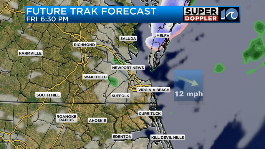
Temps will likely be above freezing. So I really doubt anything will stick. This should be very brief. So we should dry out by midnight either way.
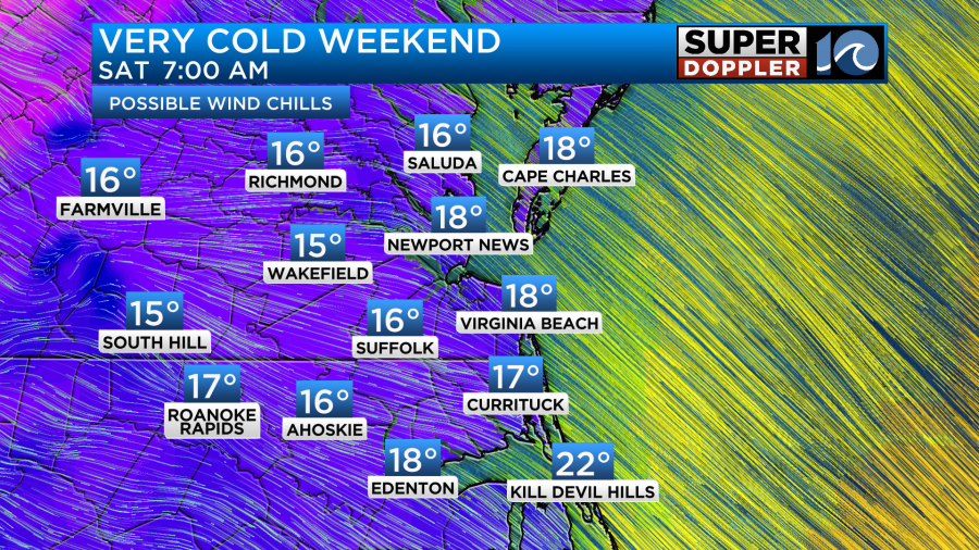
After the front passes cold air will pour into the region. Winds will pick up out of the northwest. We’ll drop to the 20s and 30s Saturday morning, but the wind chills will likely drop to the teens.
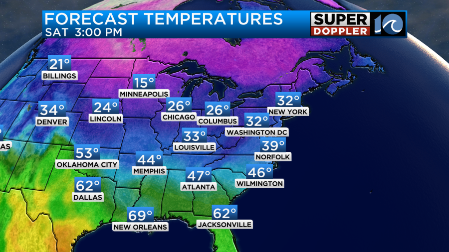
Then during the day Saturday our high temps will only rise to the upper 30s despite a good amount of sunshine.
We’ll be dry and chilly on Sunday. High temps will be in the low 40s. During the day a big area of low pressure will form well to our west. There will be warmer/more humid air rising up ahead of it. If the moisture push is strong enough, then we may have some overunning precipitation forming in our region by Sunday evening. It could begin as a wintry mix in our region.
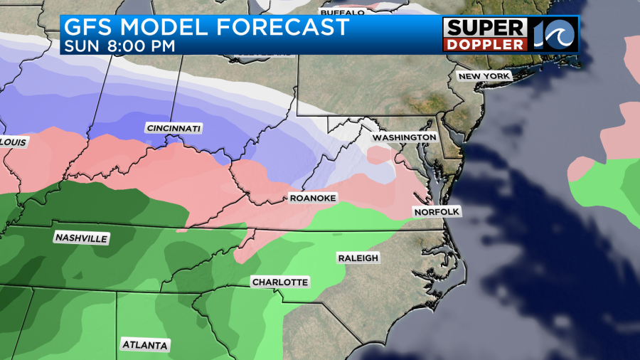
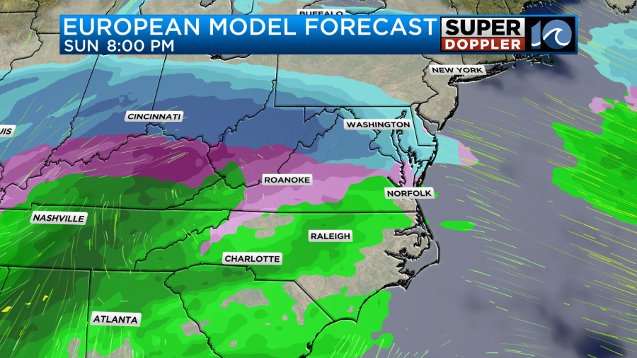
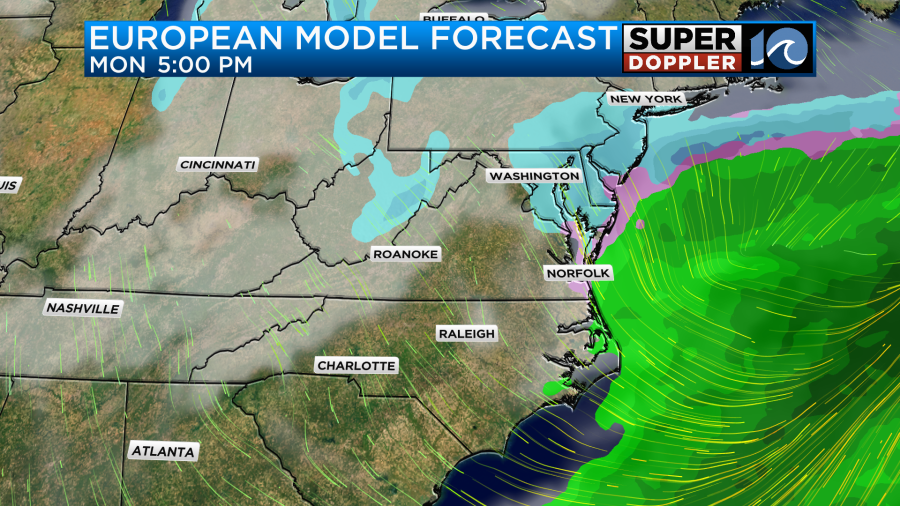
The models always handle overunning differently as they have different resolutions of the vertical layers. In English — some models can see the different cold, warm and moisture layers aloft better than others. If we’re cloudy with a southwest wind Sunday night, then I doubt surface temps will drop much during that time. The timing of the clouds, precip, and wind will be tricky. We’ll be able to pinpoint it as it gets closer. Either way the trend is for almost all of the precip to transition to rain during the day Monday as the area of low pressure slowly marches in from the west.
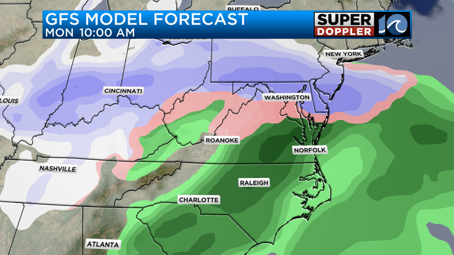
Surface temps should rise up into the mid-upper 40s during the day. It will be a chilly rain. That’s for sure.
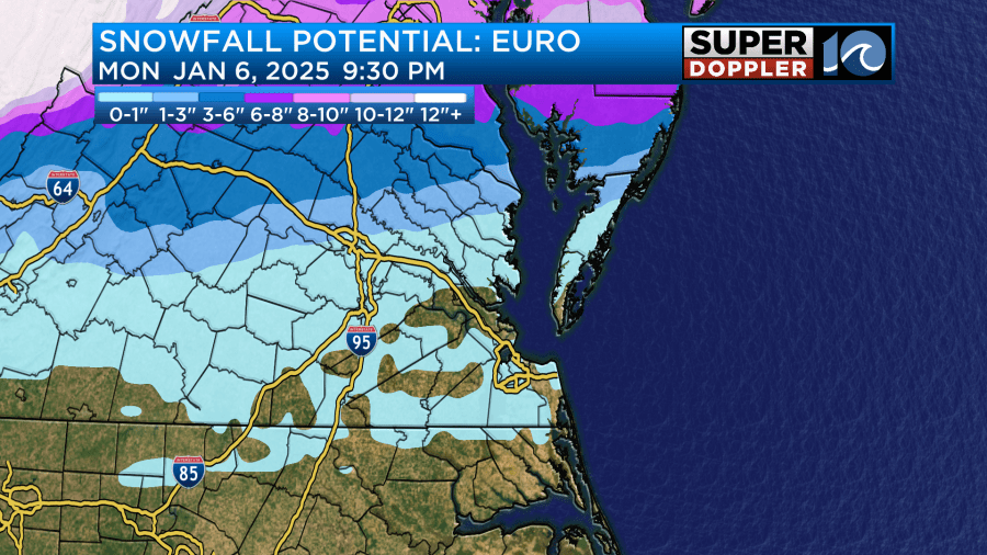
The low should be pushing out to the east by Monday night. However, moisture will wrap around on the back side. That’s also when the cold front will be swinging through (behind the low). If the moisture hangs around long enough for the cold air to come in then we may have some more mixed precip, possibly even some brief snow showers.
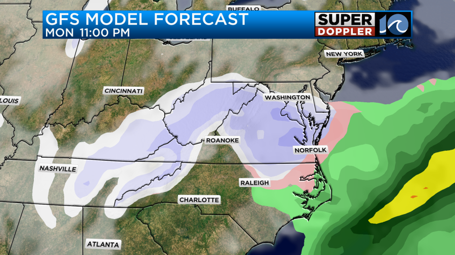
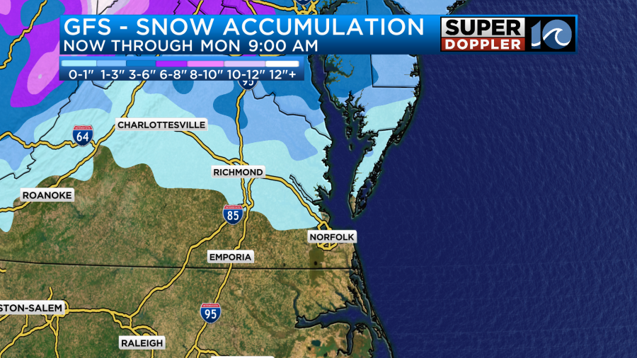
Typically we don’t get a lot of precip behind the lows as they move out. Especially if they are fast movers. Also, keep in mind that the resolution of the GFS is pretty low by that point. The bottom line is that it’s too early for specifics. A lot will probably change before we get there. It has been over 1,000 days since we had sticking snow in the Hampton Roads metro. While I doubt we’ll get much to stick in the metro this time, there may be some accumulating snow to our north and northwest.
Stay tuned for updates over the next few days.
Meteorologist: Jeremy Wheeler


