Things were a lot calmer this morning during the morning commute compared to yesterday. We had a mix of sun and clouds with only a few sprinkles. Over the last 48 hours we picked up about a half inch up to two and a half inches of rainfall.
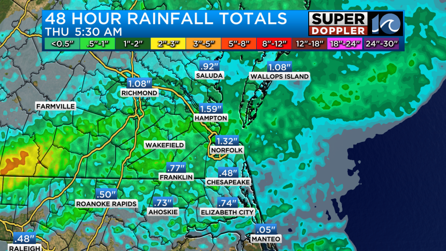
Some of the area still needed some rain. From what I’ve heard from some viewers a few areas really needed the rain like Mathews county and the Eastern Shore.
Since yesterday we’ve had one area of low pressure move offshore along with a cool front. There is another low to our north with a cool front to the northwest.
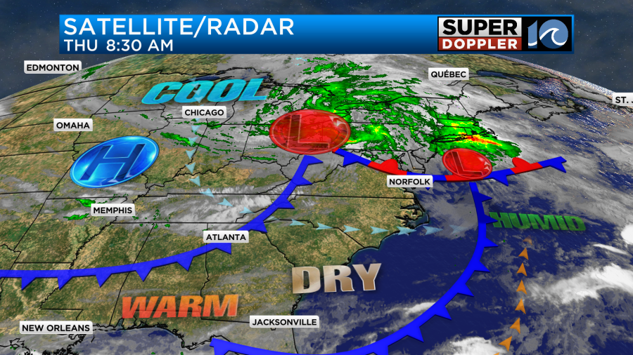
The offshore low will slowly move north today. However, the low over the Ohio River Valley will strengthen as it moves east. These two will merge over the next 24 hours. We’ve dried out a little bit here since yesterday. So we’ll have more of a mix of sun and clouds today, but the stationary front and offshore low aren’t too far away. Plus, there is an upper-level low overhead. Again! This could create a few rain showers as we go into the afternoon.

These should be fairly light and scattered, but a couple of thunderstorms will be possible. These will go into the early evening. Then we’ll dry out overnight.
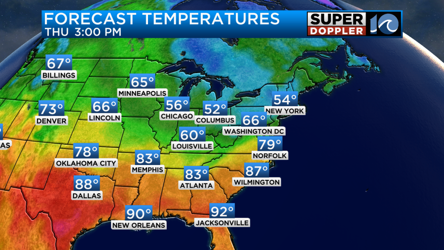
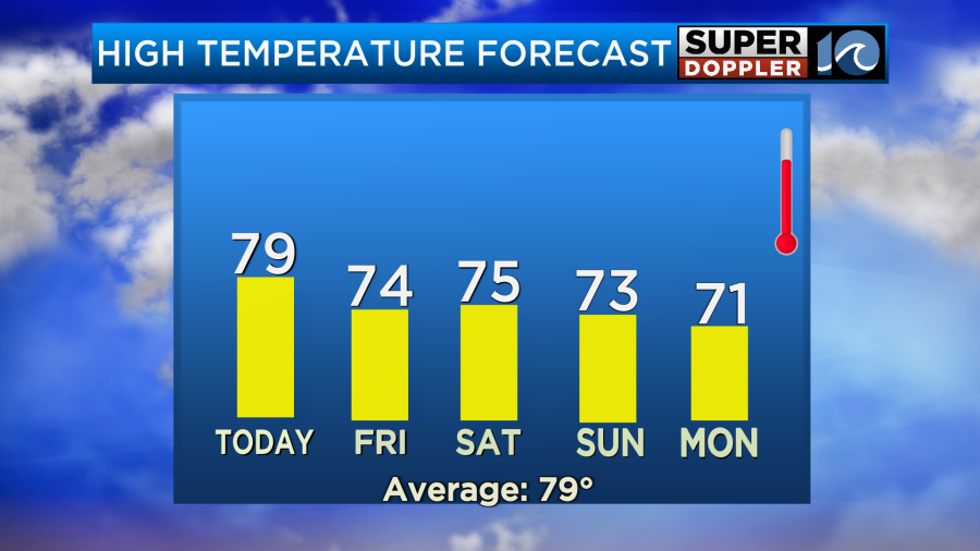
High temps today will be in the upper 70s to near 80 degrees.
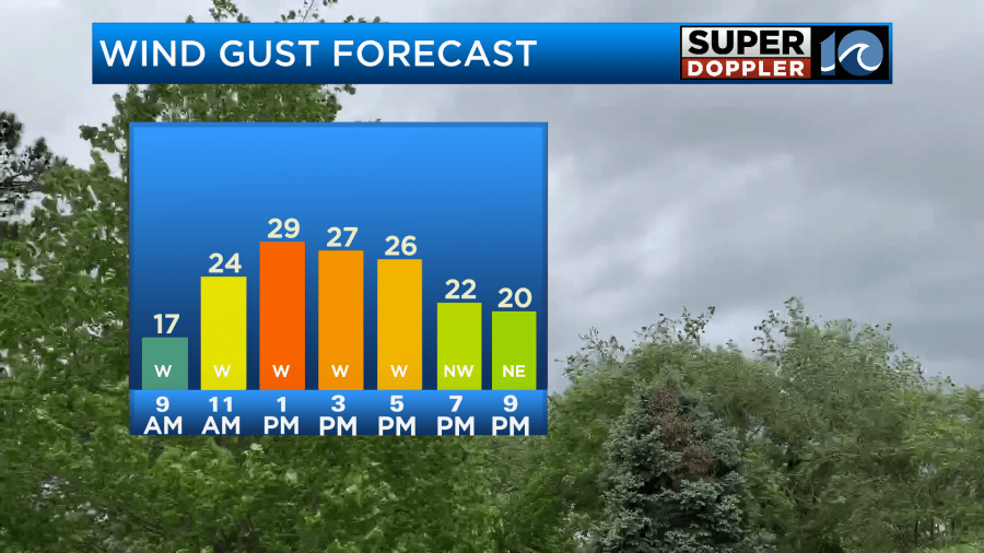
Winds will pick up through the day out of the west. Gusts will strengthen to 25mph by midday.
Tomorrow will be breezy as well. Our region will be to the southwest of a strong low that will spin over the northeast states. In fact, that system may become a nor’easter for those states. We’ll stay south of it. So our winds will be gusty and out of the west again. The good news is that the second cool front will slide east. Therefore we’ll be even drier and cooler than today.
High temps will be in the low-mid 70s.
It will be much cooler to our north and much warmer to our south. We’ll have partly cloudy skies with only a stray shower possible.
The weekend is looking good. It will be dry Saturday and Sunday with high temps in the low-mid 70s.
However, Rain may return by Sunday night. Then on Monday there will be some scattered rain showers.
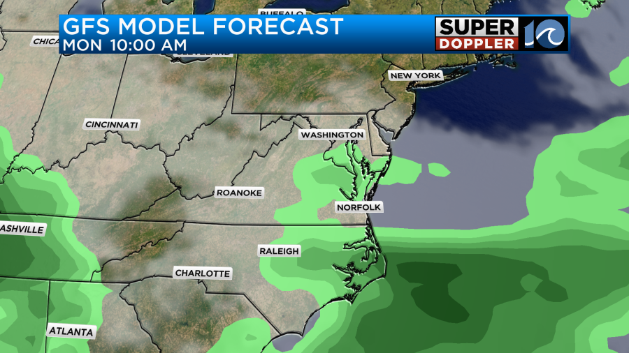
The good news is that Monday doesn’t look like a washout. Plus, the models (for now) seem to be trending a little drier. I’ll talk more detail about that in tomorrow’s weather blog.
Meteorologist: Jeremy Wheeler