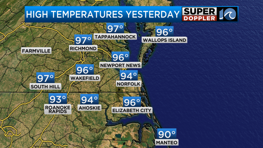
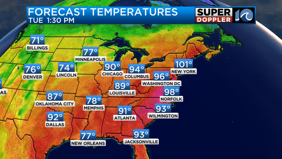
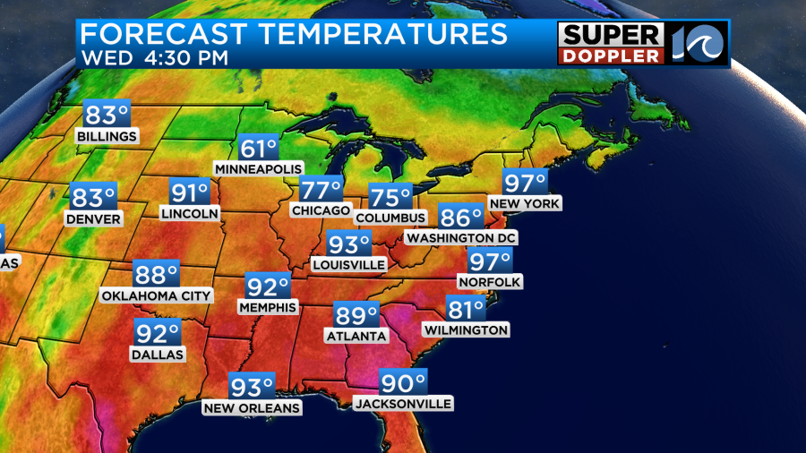
The heat has been rough over the last 24 hours. There was a bit of a breeze yesterday. So it wasn’t terrible in the shade at times. However, it was brutal in the sun when the breeze stopped. High temps did make it into the mid-upper 90s in most locations. However, the light northeast breeze kept it a bit less-hot in Norfolk.
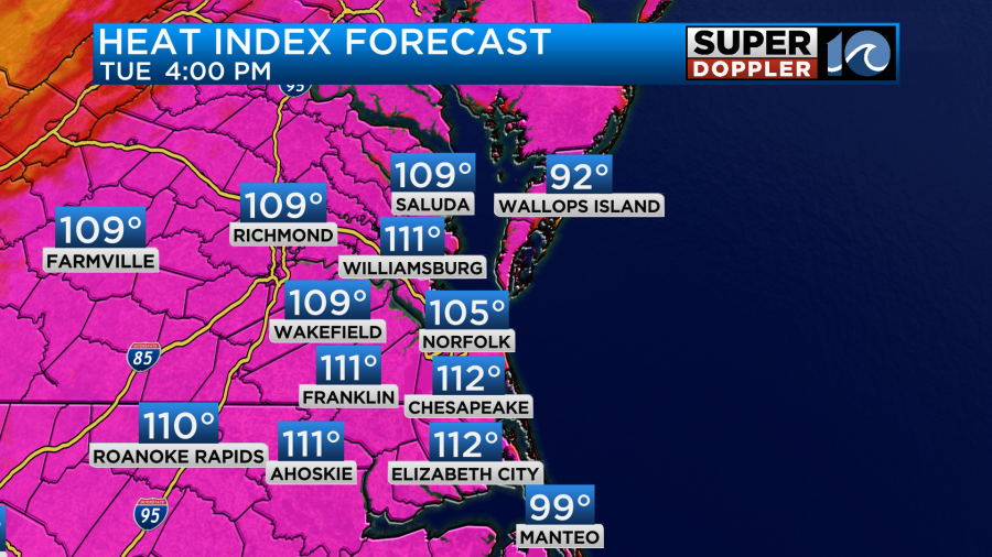
The heat index was over 100 and over 105 in many places. Today will be very similar. We still have strong high pressure over the region. In fact, it is a bit closer today.
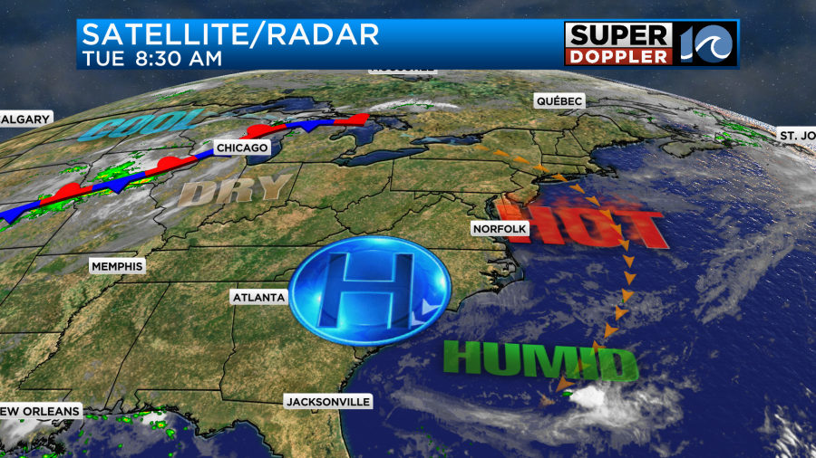
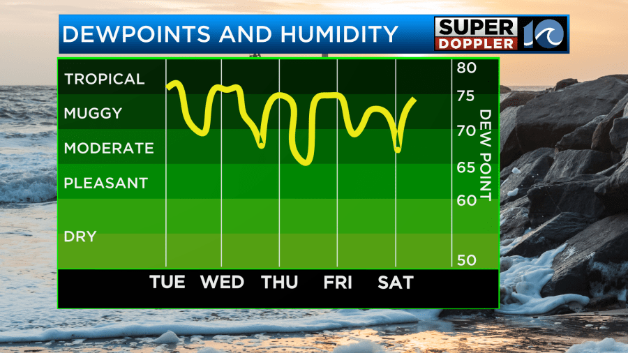
We’ll have lots of sun again today. There was a noticeable/thicker haze over the region this morning.
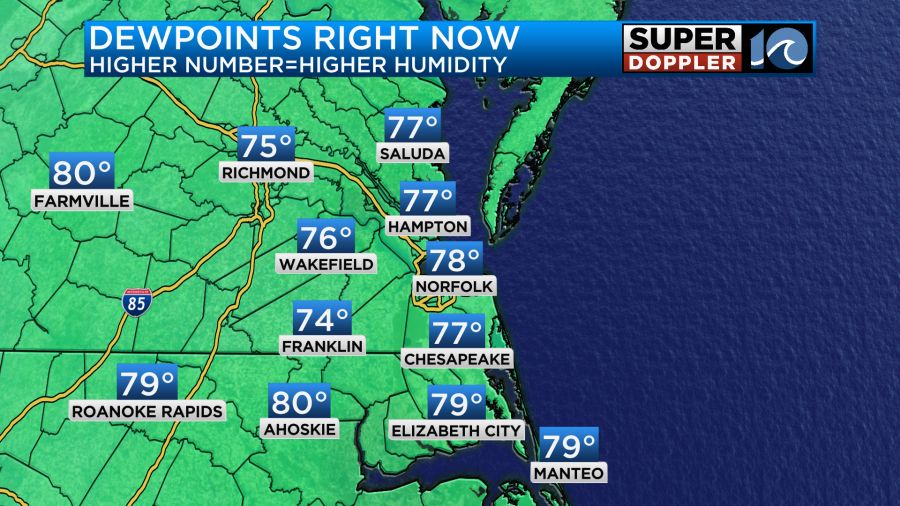
I think it’s indicative of the much higher dew points today.
So the odds are good that it will be hotter, and it will feel much hotter than yesterday. High temps will aim for the upper 90s this afternoon.
The forecast heat indices are in the 105 to 112 degree range.
There will be a light northeast wind again. It’s basically due to the position of the high pressure area. There’s a low chance that this could create a sea breeze. However, the water temps on the bay are now in the low 80s. Also, the high is very strong. This is causing a lot of sinking air. So the odds of a sea breeze are fairly small. If it does form, then it could cool down a few areas near the shore and in the metro. Don’t count on that though. Take all of the precautions.
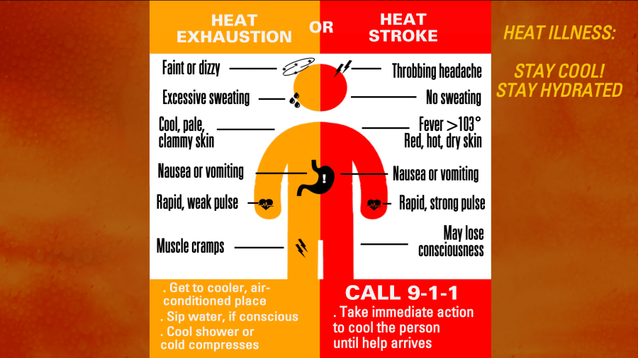
- Stay hydrated
- Limit outdoor activities
- Take lots of breaks in the shade or A.C.
- Bring the pets inside. If you can’t, then make sure they have shade all day and cool water periodically.
- Keep a close eye on the elderly and the young.
If you have to be outside today, then monitor yourself and others for possible symptoms of heat illness.
Tomorrow the area of high pressure will weaken a bit. There may also be a coastal trough (a line of lower pressure) coming in off of the ocean. These factors should allow for a few more clouds to form. There may also be a few showers and thunderstorms during the afternoon.
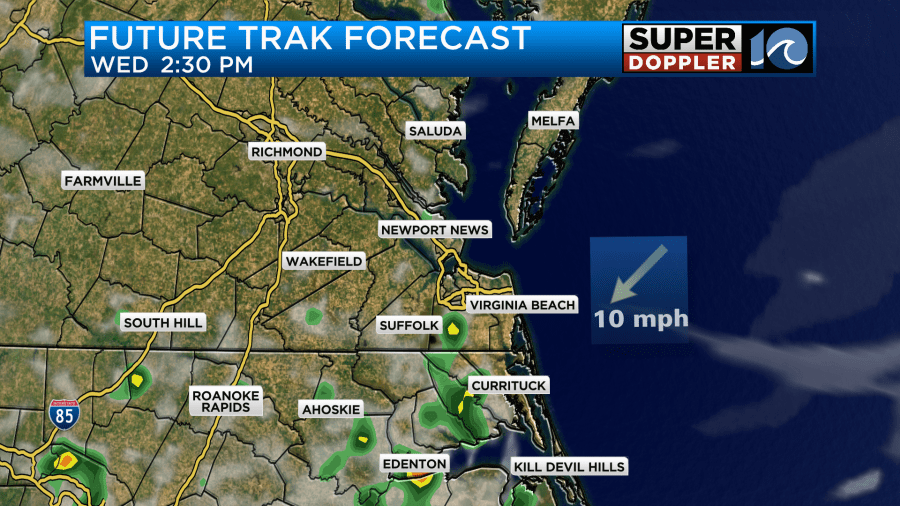
It will be far from a washout, but it may be enough to cool us down a couple of degrees from today.
The dew points will remain high. Maybe it will drop slightly.
So we will still have a heat index over 105 for many again. It could possibly reach up to around 110 again.
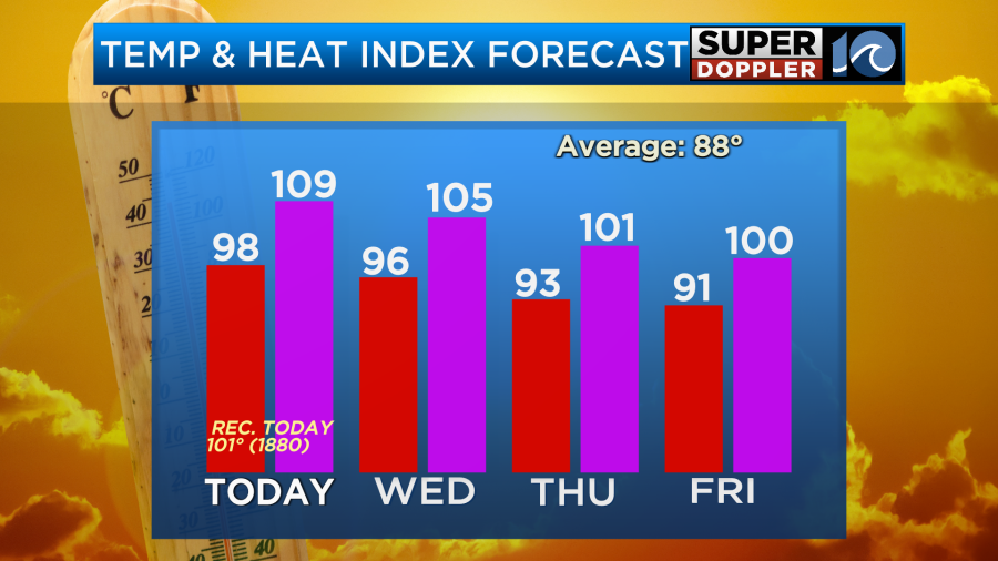
On Thursday and Friday the big/strong area of high pressure will break down. I believe this will allow for more in the way of partly cloudy skies to occur. Plus, the winds should change a big. Hopefully, we’ll have the temperatures more in the low 90s. However, the heat index will probably still be over 100. There may be some isolated pop-up showers and storms in the afternoons each day, but the chance looks low. I don’t see much rain on Saturday. High temps look to rise back to the mid 90s. It may stay in the mid 90s for a couple more days. I’ll have more details on the long-range forecast in tomorrow’s weather blog. Until then…Be safe…Stay cool!
Meteorologist: Jeremy Wheeler