Yesterday we did preeeetttyy good with the high temperatures. High temps warmed up nicely through midday. It did get a little warmer than expected over North Carolina.
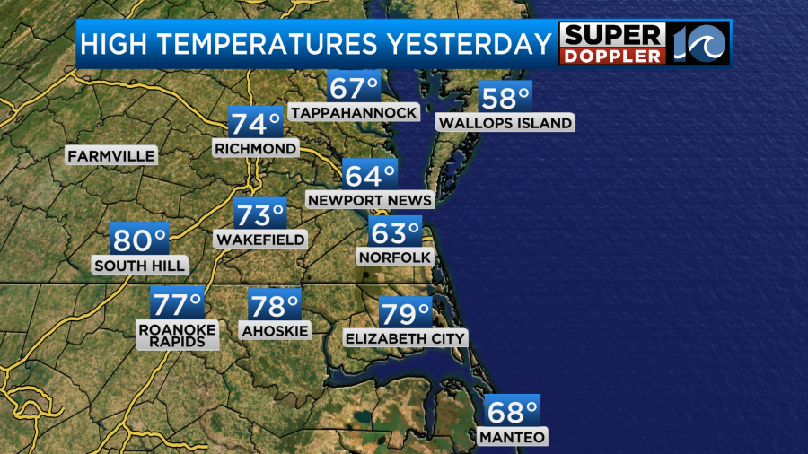
Having said that… Temps did drop in the afternoon, and I did not catch how much they would drop.
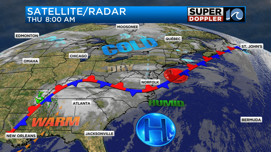
Basically, the cold front did drop a bit more south than forecast. Since then a weak area of low pressure has moved east along the front. The front wiggled a bit north. Now it is wiggling back to the south.
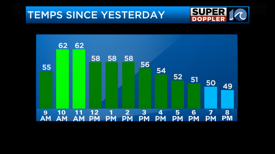
So temps will be cooler overall today. However, I do think they will still be mixed like yesterday.
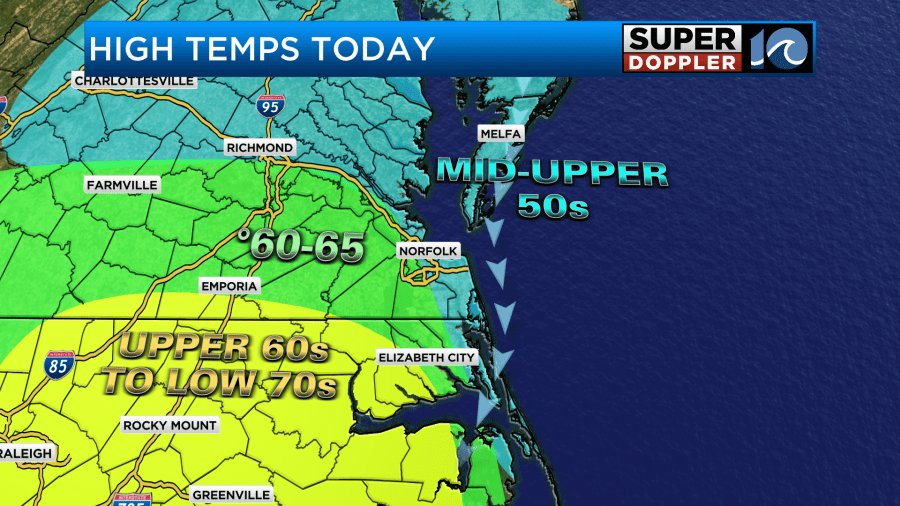
I also do think temps will drop again today. Winds will be out of the north at 5-15mph. That will push the front down more into North Carolina. So we’ll likely max out around midday.
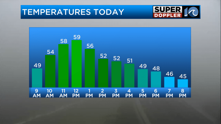
Then we will probably be more in the low-mid 50s this afternoon in the metro. It may stay mild to the south.
We had some fog move in this morning. It was thick in spots.
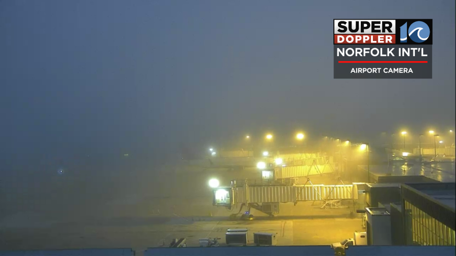
The fog will take a while to burn off today. It’s that time of year. We probably won’t have any rain showers, but we will have a mix of sun and clouds. I can’t rule out a sprinkle or two.
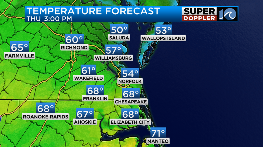
Tomorrow the front will sink a little more to the south. We’ll be even cooler with high temps more in the low-mid 50s. There may even be some 40s north of the metro.

With the front more to the south we will likely have overunning happening. So we’ll be mostly cloudy for the bulk of the day. There may be some patchy drizzle as well. There will be some clearing late in the day, but it may not get into the metro until the early evening. We’ll see.
We’ll finally start to warm up on Saturday. The breeze will pick up out of the south. High temps will rise up into the 70s.
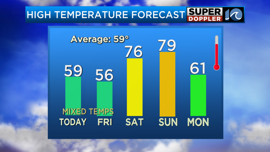
We’ll be partly cloudy with only some isolated showers in the area. We’ll warm up even more on Sunday. High temps will aim for the upper 70s. However, it will be windy. Winds may gust above 30mph (at least). We’ll have increasing clouds and moisture. There may be a few showers during the afternoon, but the bulk of the rain looks like it will arrive more towards the evening. There’s fair agreement in the timing of this on the models.
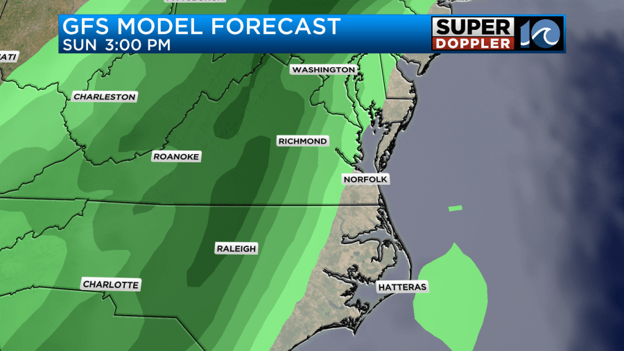
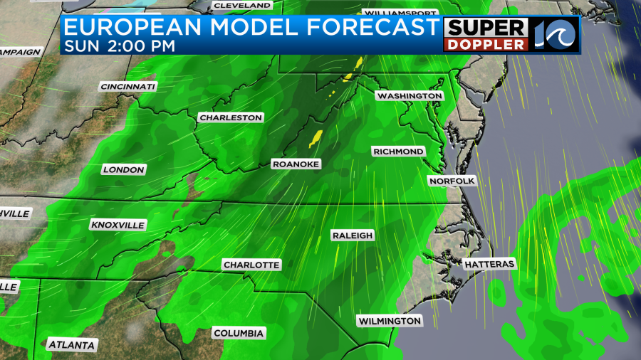
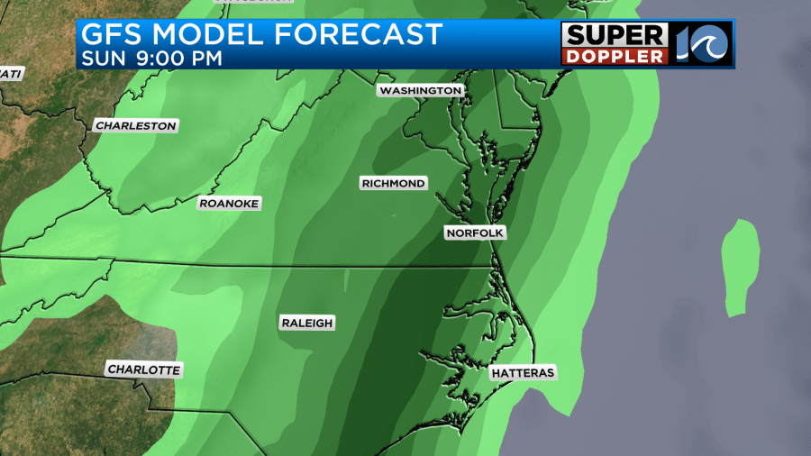
There will already be some strong gusty winds before the rain arrives. So when it does come in there may be a line of heavy rain and strong thunderstorms. There may also be a potential for severe weather, but it could be reduced if it does come in during the overnight. Stay tuned. I do think that some of the rain will linger into Monday morning. High temps will drop to the low 60s on Monday. This could affect some events for St. Patrick’s Day.
One last thing. A total lunar eclipse will happen tonight. However, it will be very late at night. It will kick off a little after 1am. It will max out around 3am.
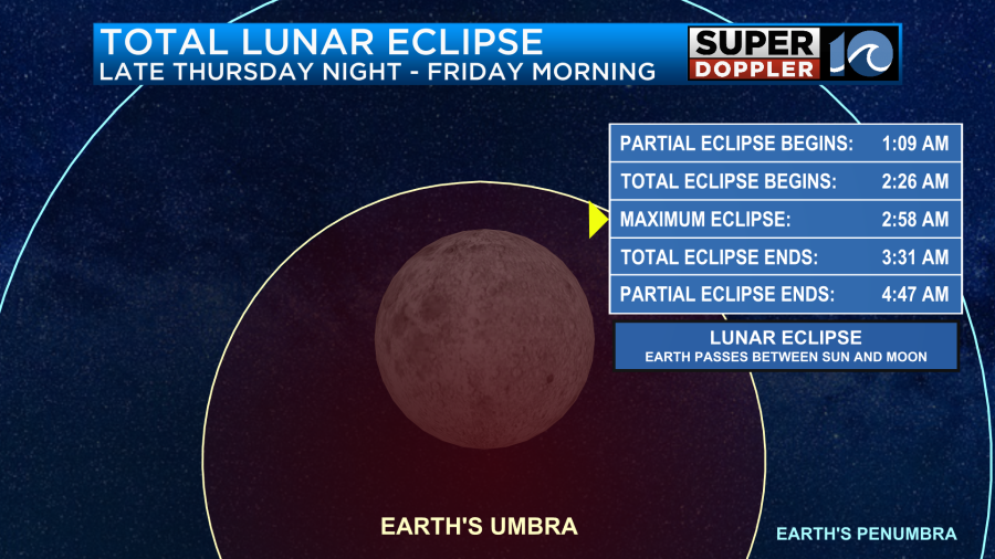
It should wrap up a little before 5am. The problem about this event is that I believe we’ll have a lot of clouds overnight. So it may be difficult to see. If you get a cool shot of it, then you can submit your photos here: Submit photos to WAVY.
Meteorologist: Jeremy Wheeler


