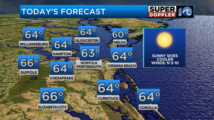
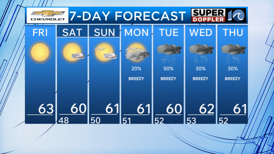
With high pressure filling in from the west our cool and sunny stretch of weather continues today and this weekend.
High temperatures today will be in the lower 60s for most of the area with light winds out of the north.
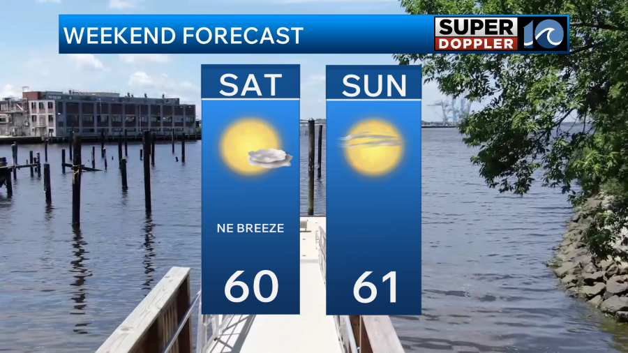
For this weekend expect high pressure to settle in to the north. This will allow for winds to remain out of the north and northeast keeping us cooler than average for afternoon high temperatures.


Saturday will be in the upper 50s to lower 60s under mostly sunny skies. Winds will be a bit breezy for the coastline. On Sunday, we remain cool but a few clouds in the upper levels may filter out the sunshine a little bit. These clouds are ahead of our next storm system.
Rain chances increases later in the day on Monday as an area of low pressure moves in from the southwest. As the system approaches it may get a little boost in energy from the Atlantic. Rainfall could be heavy during the day Tuesday and Wednesday with gusty winds at times. Gusts may be as high as 30mph through the middle of next week. Thursday and Friday the storm will pull north and allow for our area to dry out.
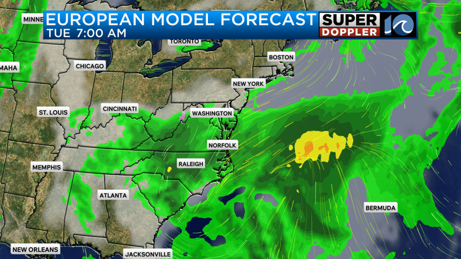
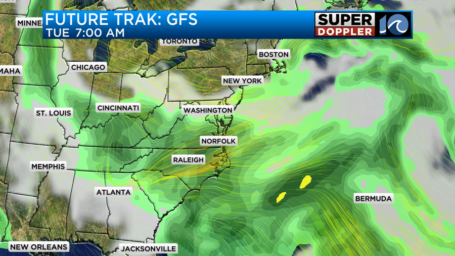
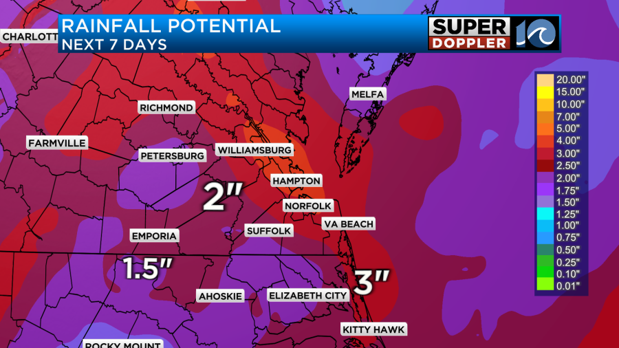
Rainfall over the next 7 days could add up to around 1-3 inches in some spots which is an increase compared to yesterdays forecast. Stay tuned for updates as things change.
In the tropics there are no major updates with Tropical Storm Melissa. It is still a slow moving and weak system. This weekend the environment will likely become more suitable for development and the National Hurricane Center is expecting Marissa to rapidly develop into a category 4 by Monday and Tuesday.


Have a wonderful day!
-Meteorologist Brian Michigan