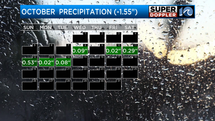
Before I go into the forecast I wanted to recap things a bit for the month so far. This month has been cool and dry overall, but there was a wet stretch. That seems like a theme for the past 3 months actually. So far we are about 1.55″ below average for rainfall.
We had some nice rainfall about a week ago, but we didn’t have much for a while before nor since. We’ve also been cool most of the time. We are a little less than a degree below average so far.

We did just finish a mild weekend. Highs were in the 70s, and it felt great! Going forward we’ll have more cool weather this week with one exception (tomorrow). Today we’ll be on the down swing.
Last night a cold front moved into the region. This did cause some scattered light rain showers in some areas. However, a lot of the area only had sprinkles or got missed altogether.
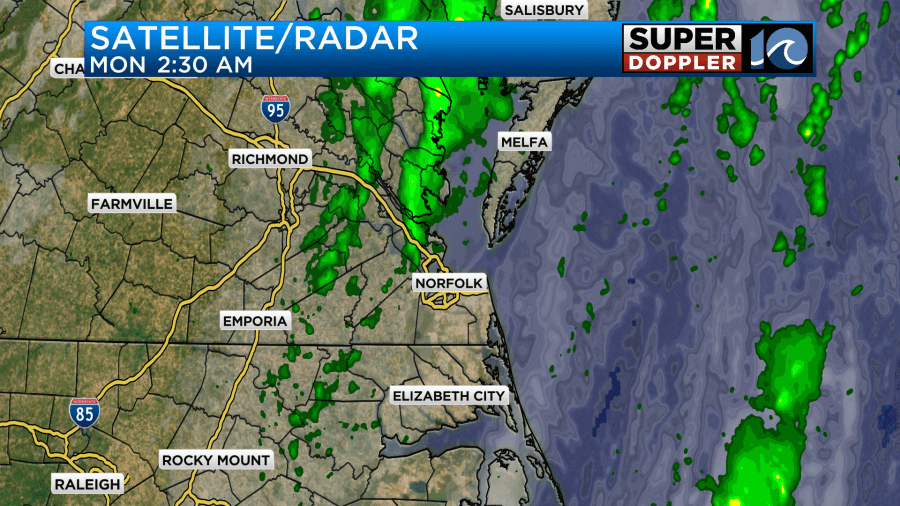
That front is now to our east/southeast.

We cleared out quickly this morning. We’ll have lots of sunshine today. High temps will be in the upper 60s.
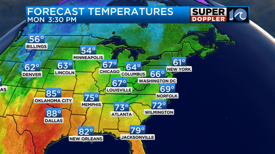
We’ll have the breeze out of the west/northwest. It will gust to around 25mph this morning, but it shouldn’t be that strong later today. It is very dry outside with dew points in the 40s.
We’ll be a little up-and-down in the short-term for temps. However, most of the time it will be cool and dry for the next few days.
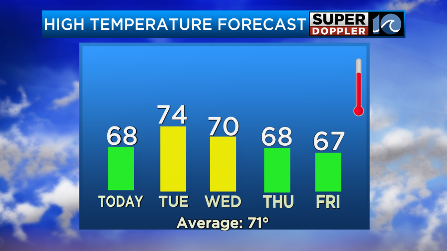
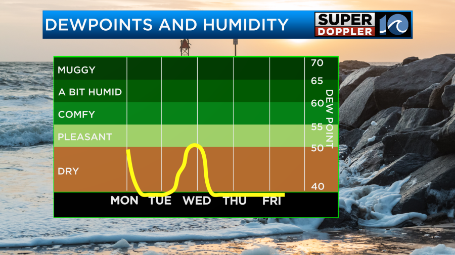
It should be nice this week. We’ll have cool mornings and mostly cool afternoons with lots of sunshine. Even next weekend looks pretty good.
There is a tropical disturbance moving quickly to the west over the Caribbean. It has a high chance of formation.
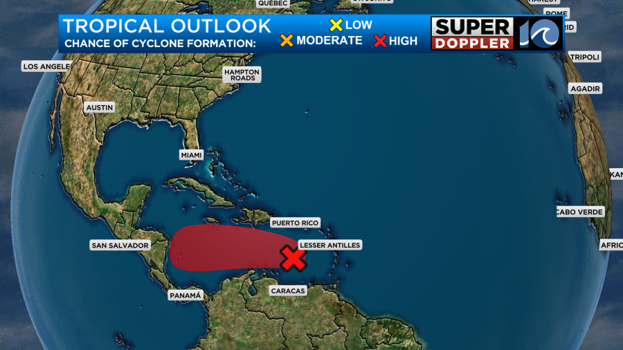
It does have some strong gusty winds around it, but it is disorganized. It may slow down later this week, and that could allow for some organization. We’ll be tracking that over the next couple of days.
Meteorologist: Jeremy Wheeler


