Yesterday, we had a nice/soaking rain for parts of the area.
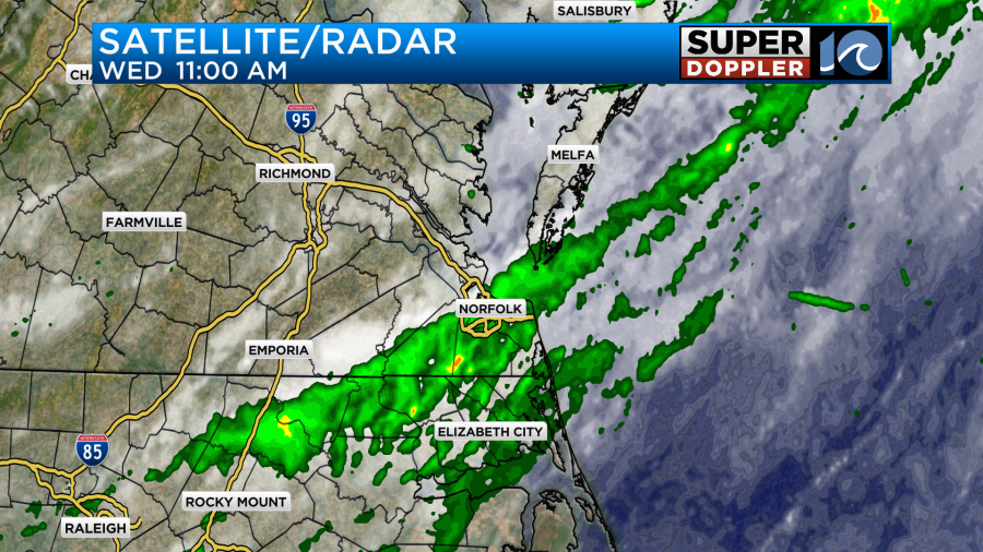
It didn’t add up to much in the rain gauges though. Most locations only had about a tenth of an inch. This was less than forecast. Don’t worry we’ll have more rain this weekend. Maybe too much.
Anyway, yesterday a cold front slipped through the region. Today that front has sunk to our south.
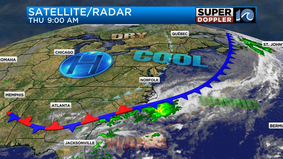
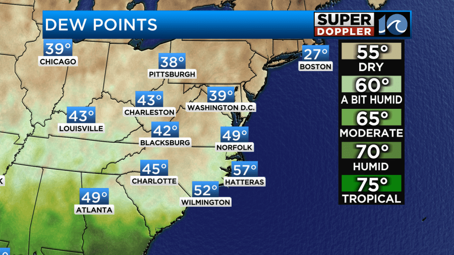
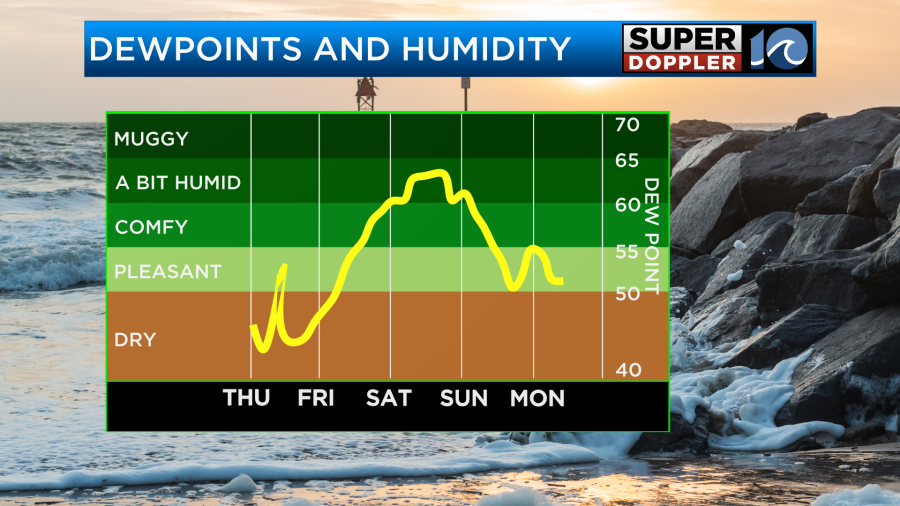
It will eventually stall out to our south today. We’ll have some much cooler/drier air filtering in. Dew points have already dropped to the 50s and 40s.
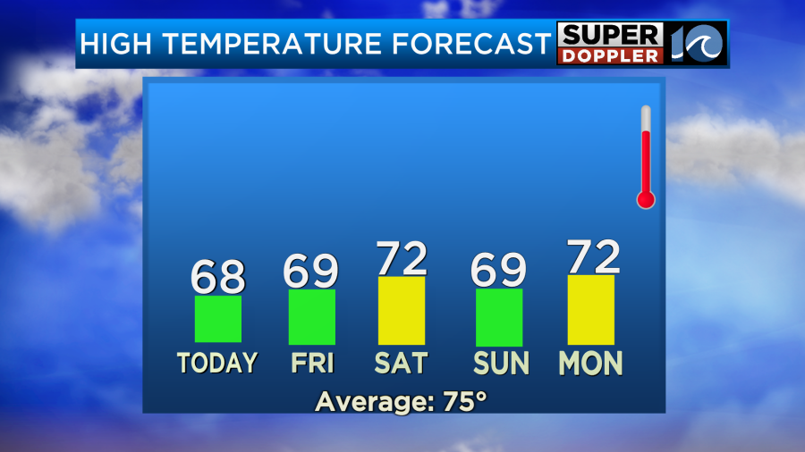
That is awesome! It is time to open up the windows again and get some fresh air in the homes. It will be cool and breezy with high temperatures aiming for the upper 60s.
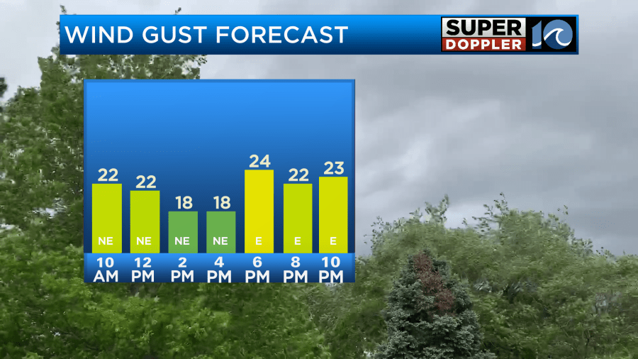
Winds will gust up to 25mph.
It should be a nice day, but there may be a sprinkle or two coming in off of the ocean.
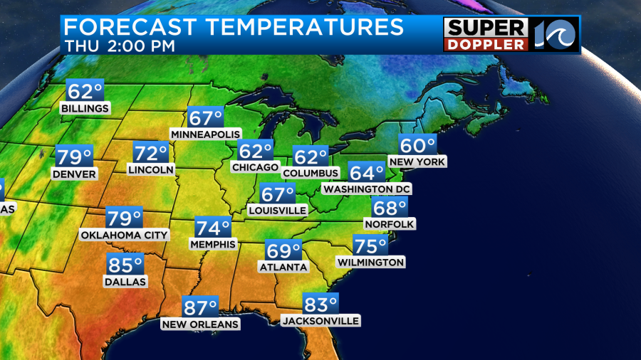
Tomorrow we’ll have another nice day overall. We’ll be partly cloudy with a little more clouds by the late afternoon. A sprinkle is possible to the south. High temps will be in the upper 60s again.
Winds will be out of the east at 10-15mph with a few higher gusts near the shore.
During that time an area of low pressure will form to our south while Jerry will be well to our southeast.
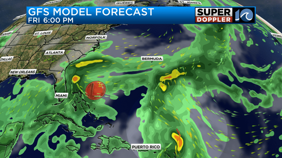
By Saturday the low will rise north a bit. It will still be to our south, but it will be close enough to push some moisture up into our region.
A weak upper-level trough (dip in the jetstream) will also help to pull the moisture north. We’ll probably start off with mostly cloudy skies and some spotty showers. However, through the day the rain chances look to increase.
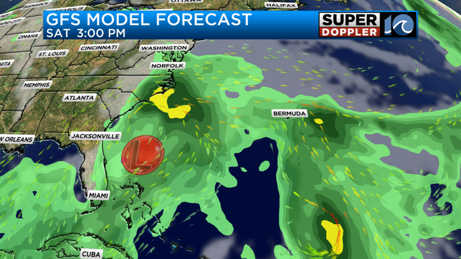
We’ll see if a big area of drizzle develops before the main area of rain arrives. It’s possible with this setup that will be similar to overrunning.
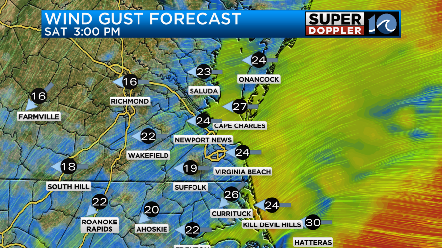
Either way winds shouldn’t be too bad. They will gust out of the east at about 20mph with some higher gusts over the Outer Banks.
High temps will aim for the low 70s.
The models handle the moisture push and rain timing a little differently. However, the theme seems set with an increasing chance for scattered showers. It could become widespread by the early evening. I will say that the NAM model shows more breaks in the rain compared to the other models.
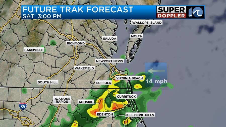
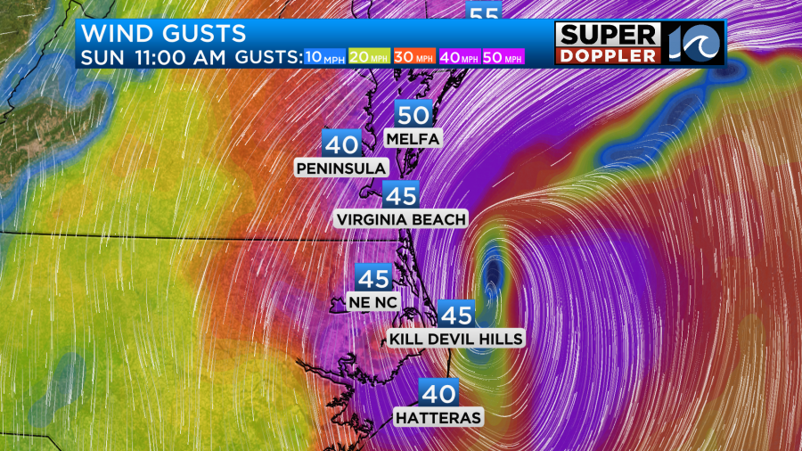
By Sunday we could have a real mess. The low is forecast to move up along to coast. It may sit just offshore or right over the coast near the state VA/NC state line.
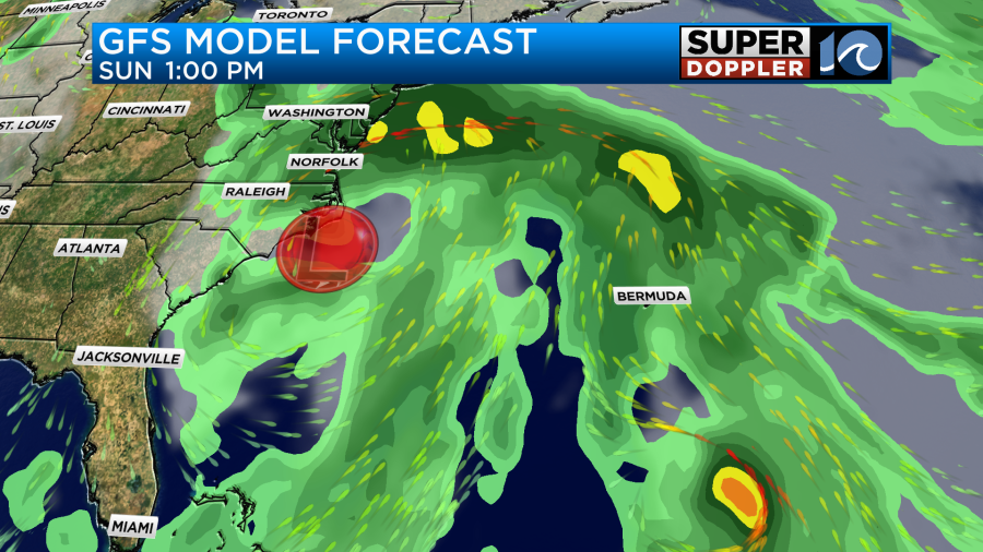
With the latest forecasts it looks like we’ll have rain for most of the day with heavy rain possible. Winds will be strong. They could gust up to 35mph with gusts 40-50mph near the shore.
The low will then slowly drift east through the day on Monday. So the weather should gradually improve.
The rainfall potential is big. Between Saturday and Sunday the GFS model is painting a swath of 2-4 inches over a large part of the area with some areas possibly getting over 6 inches.
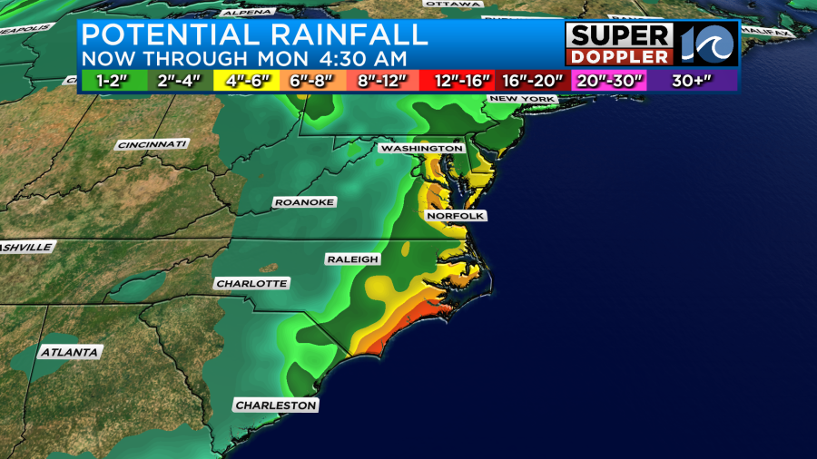
I do think the GFS is a little overdone. Also, this will be spread out a little over the course of 3 days. Regardless, there is a potential for some flooding just from the rain. The problem is that we could also have some tidal flooding. The natural tide is a little higher due to the King tide. That happens twice a year, and occurs when the Moon is at a closer distance to the Earth. However, it’s the features over the ocean that will be the main cause of the problems. Tomorrow and Saturday there will be some minor tidal flooding during high tide.
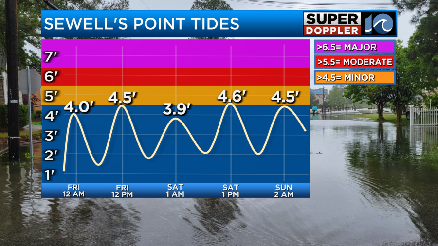
This will be mainly from the persistent northeast/east winds that will be around due to the developing weather pattern. The above graphic goes out to Sunday morning. However, the next tide Sunday afternoon/evening could be up to moderate levels. It could even be major in some areas. We’ll also have some wave action from tropical storm Jerry (more on that in a moment). That could lead to ocean overwash again across the southern Outer Banks.
Tropical storm Jerry has gained some more strength. It is to the east of the Lesser Antilles, and it is on a west/northwest track.
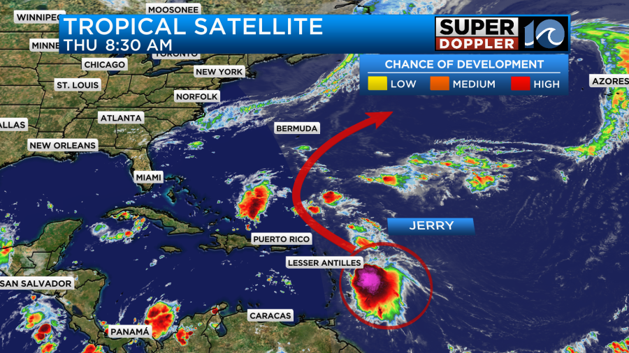
The forecast calls for Jerry to pass near the north end of the Lesser Antilles over the next 24 hours. Some of those islands will experience tropical storm force winds.
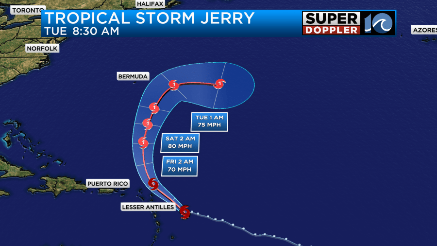
After that it will turn north. It could become a hurricane during that time. Then it will move to the northeast and east. This should keep it east of Bermuda and well east of the United States. Again, it will likely send us some waves though. Those will add to the high tides and waves we’ll already have from the coastal storm. Some are calling it a nor’easter. I wouldn’t call it a classical nor’easter, but I also won’t argue with those folks.
Stay tuned for updates to the forecast. We’ll have a lot of finer details by tomorrow for the entire weekend including the overwash potential.
Meteorologist: Jeremy Wheeler


