Update: I updated the 4 models with the mid-morning update. Future Trak (GRAF) has come more in line with the others. See below (bold).
It’s on. The Jeremy Wheeler snow tracker is up and it is at 100%.
This means that there is a 100% chance for accumulating snow of 1″ or more in the Hampton Roads area. That’s the easy part. The tough part is how tall is the snow going to get. Let’s talk about it.
First off, today is going to be quiet, dry and chilly. We still have high pressure in the region. There is a weak area of low pressure over Texas. There is a developing (and weak) area of low pressure over Florida.
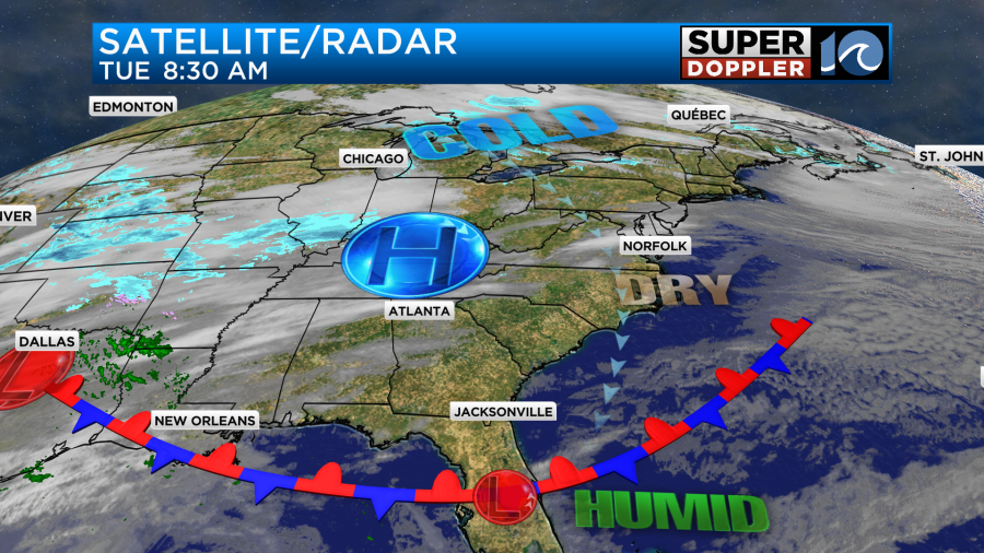
Currently, there is a big dip in the jet stream over the United states.
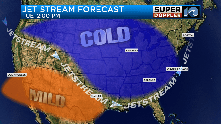
Remember storms tend to track along the jet stream. Most of the time. So the surface low in Texas will meet up with the low over Florida and strengthen tomorrow. Then it will run up along the southeast Coast.
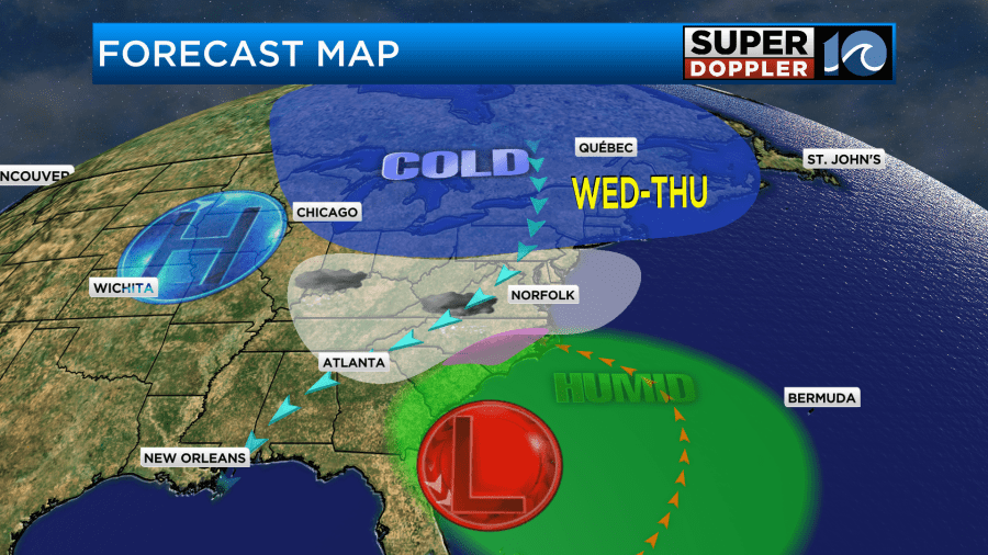
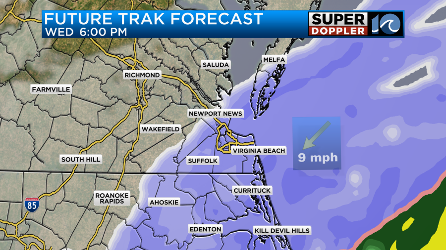
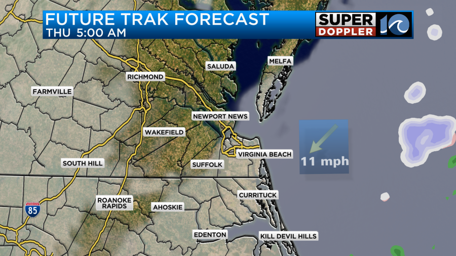
The Low will then push offshore on Thursday.
This means that today we have plenty of time to prepare for tomorrow’s snow. It’s time to get your medications in case you can’t get them over the next 2-3 days. It’s time to maybe get a little extra food, but you probably don’t need to fill the pantry. It’s also time to get out the snow shovels and salt for the walks and drives.
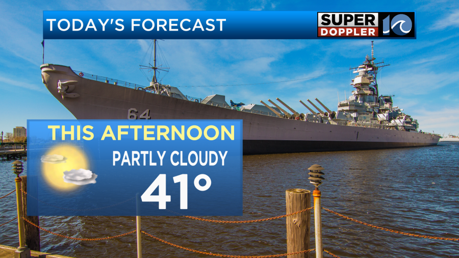
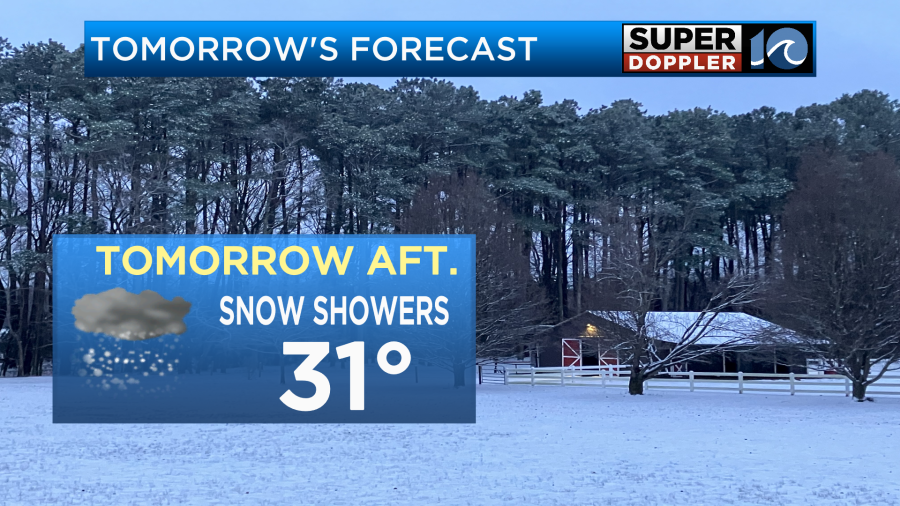
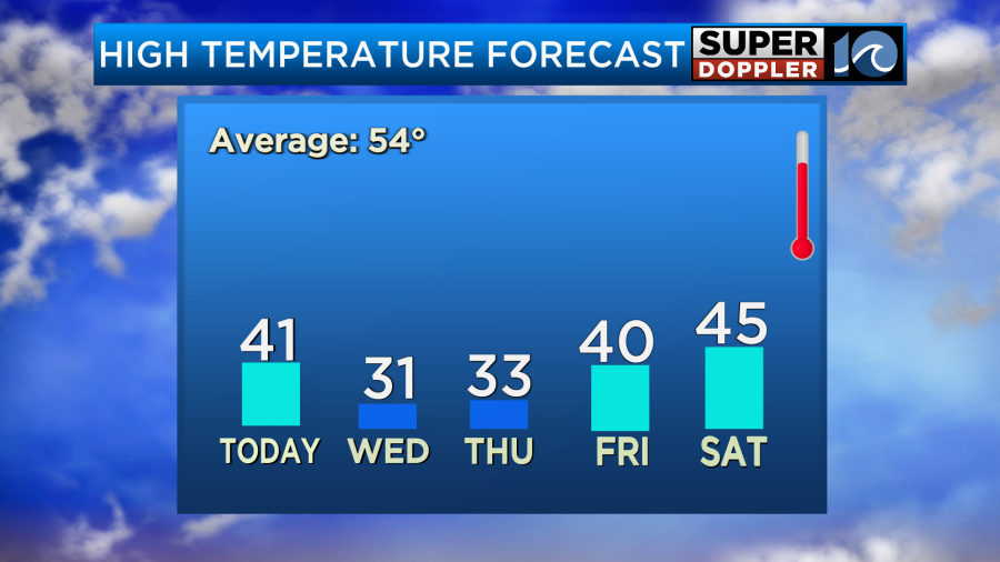
We’ll be partly cloudy through the day with high temps in the low 40s.
Winds will be light and out of the northeast. Tomorrow morning the low will still be developing to our south, but moisture will lift up (in the upper levels) into our region. Eventually, the air will saturate. This should happen by the mid-morning. That’s when a few scattered snow showers are expected.
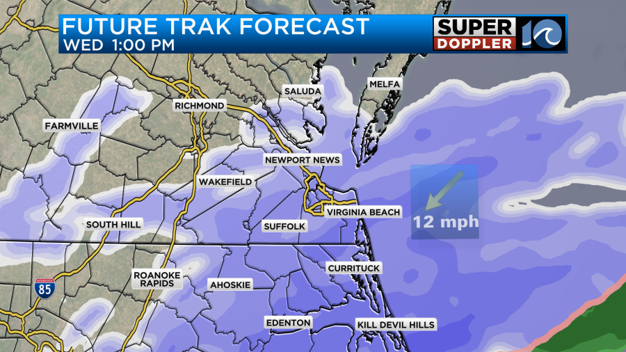
As we go through the midday and afternoon the low will get closer to the region, and the moisture will increase. We’ll go from a few scattered snow showers to a large swath of snow.
Temps will start in the 20s in the morning. They will only top off in the low 30s in the afternoon.
So the snow will stick, and whatever sticks will stay for a while.
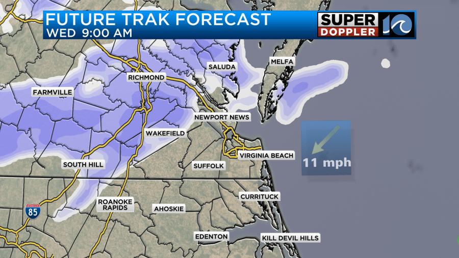
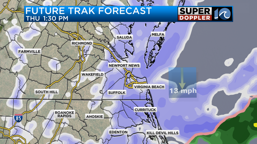
Tomorrow evening the snow will still be in high gear, but it may trim off north/northwest of the metro. At least that’s what Future Trak shows.
The GFS and Euro have less snow north, but they do have some snow in that area during that time.
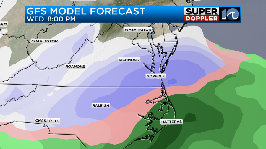
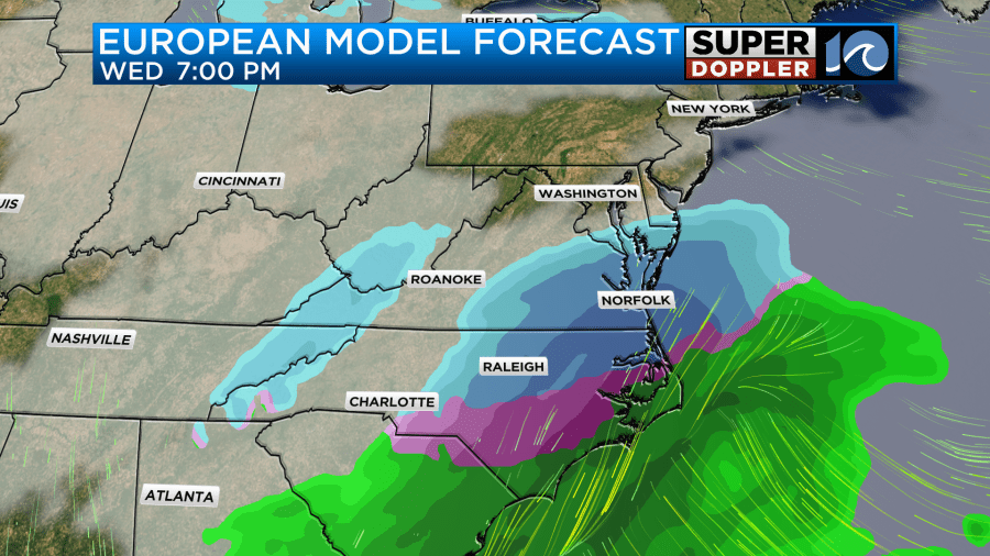
You’ll notice that they GFS and Euro also bring that mix zone (and rain) farther north than Future Trak. I do believe they are right. The NAM even brings that mix zone up to the state line for a time. It’s the farthest north with that feature. Regardless, areas of heavy snow appear on all the models. They slowly taper them off going into Thursday morning.
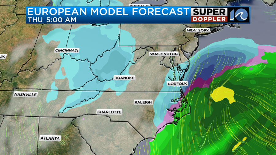
In fact, our Future Trak model stops the snow for a time around 5am.
The hi-res NAM keeps light snow going through the morning. I think it will taper off for a bit, but I also think that at least a few flurries will continue. The models then have a second round of snow during the afternoon.
That will probably be an upper level shot of energy behind the surface low. This could put down another inch or two of snow if it verifies. All the models agree on this feature forming as of this morning’s updates. Either way all of the models have things wrapping up by the evening as the surface low pushes out to sea.
High temps will be in the low 30s again during the afternoon Thursday. We’ll drop to the 20s Friday morning, but we’ll rise up to near 40 in the afternoon with sunshine. We’ll be more in the mid 40s on Saturday with mostly sunny skies.
This means that there will be some melting after this event, but not a lot of melting. If we get some of the higher amounts on the models, then we may have snow on the ground for a while.
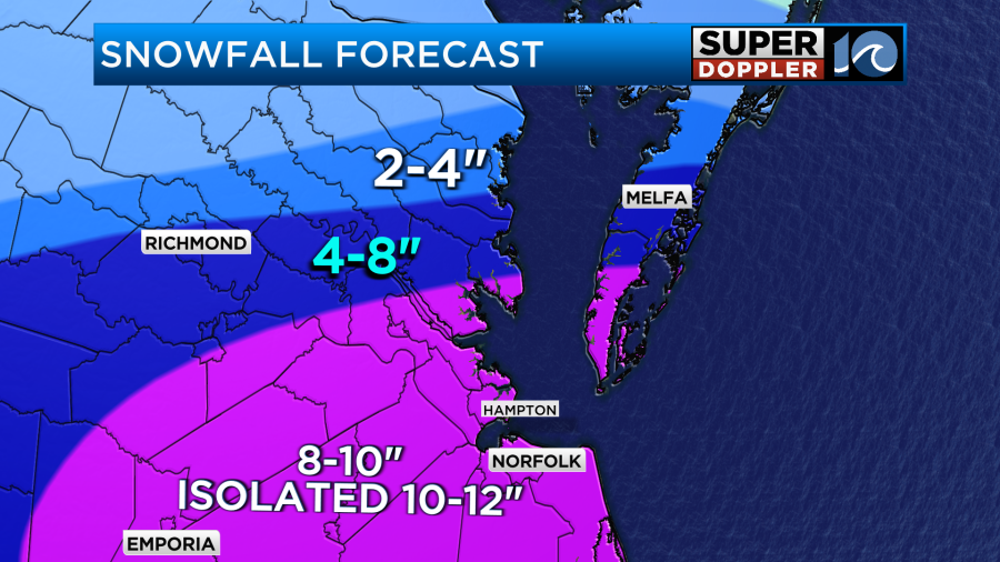
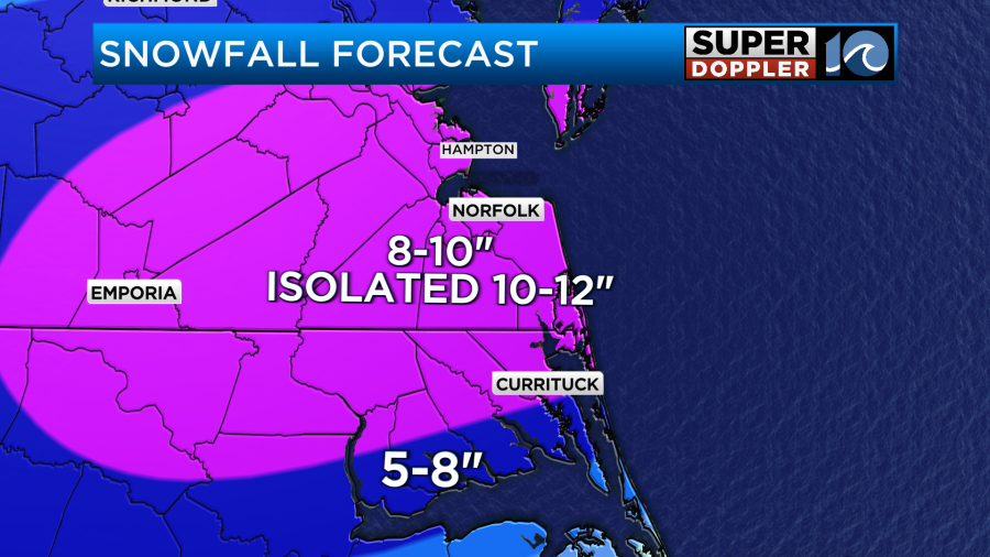
That’s a good lead-in to the snowfall forecast. When I came in this morning I was hoping the models would come together a bit. Well, overall they dropped the amounts with the 10-12″ zone now forecast only in some isolated areas.
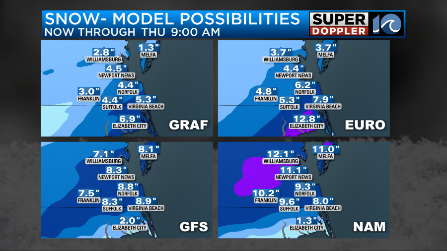
Update: Our Future Trak model, the NAM, and the GFS have updated this morning. Here are the updates.
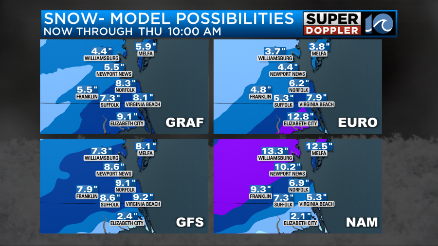
However, most of them still show some hefty amounts. One big problem was the difference between the Euro and the NAM models. The Euro had about a foot of snow in Elizabeth City, but the NAM only had about an inch. Wow! What do you do with that type of difference? It’s reversed to the north of the metro too. Our Future Trak model (GRAF) now has the least amount of snow. I think it backed off too much. I think the big difference comes from it ending the precip for a while Thursday morning. Most of the other models keep at least some snow going through the second wave. So we’ll see. Another model to factor in is the National Weather Service’s.

With all of that in mind. Here is my latest snow forecast.
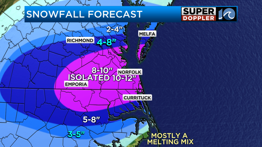
I have a large area of 8-10″ with isolated 10-12″. This includes all of the Hampton Roads metro. It goes down to Elizabeth City and up to Mobjack Bay. You’ll notice that there is a sharp gradient to the north and south of the 8-10″ zone.
This is due to 2 things that we are still trying to figure out. 1. How far north does that mix zone get in North Carolina? And 2. How far north does the snow cut off?
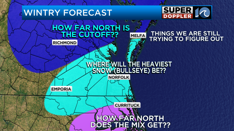
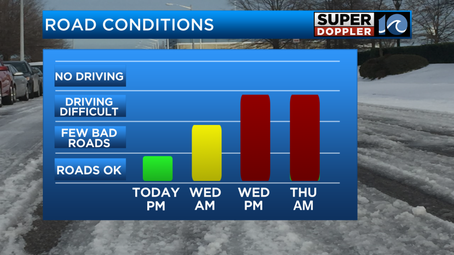
We should have a better idea of both of those features by later today. Either way it looks like most of the region will get significant and impactful snow. It will impact businesses, schools, roads, and travel. Possibly for 2-4 days. Here is my forecast for local road conditions.
The forecast is still likely to change, but I do think no matter what we will see significant snow. Kids will be out of school again for a while. How many schools have run out of snow days? Everyone be safe out there. Especially if you have to head out for work tomorrow or Thursday.
Meteorologist: Jeremy Wheeler