Yesterday there were a few flakes of snow moving through the area as a strong cold front entered the region. Ironically, this was just the (warmup) for a potential snow coming in late Sunday and again late Monday. Let’s talk about it…
Today the strong cold front is driving quickly out to sea. There is also an area of low pressure out there.
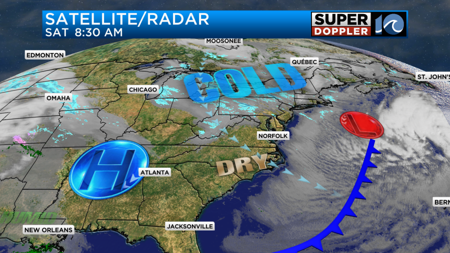
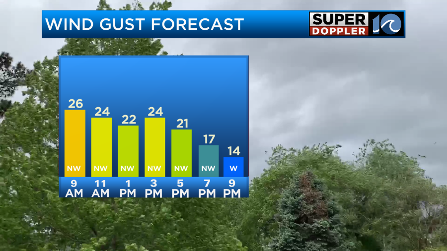
High pressure is building into the region. There is a northwest wind that is going to stay up for a while. Winds will gust up to 25mph through the day.
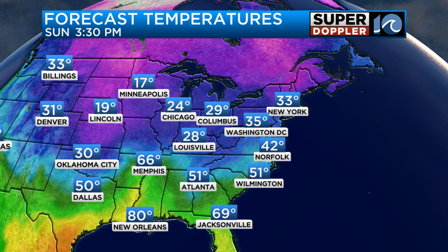
So despite a lot of sunshine it is going to stay cold. High temps will only be in the upper 30s this afternoon. Wind chills will be in the 20s for most of the afternoon.
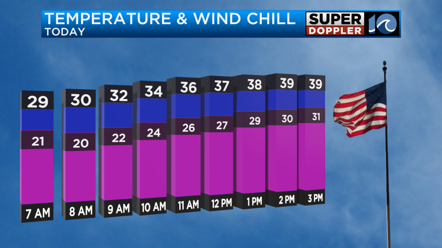
As we go into the evening and overnight the winds will calm down. Skies will be mostly clear. It will get COLD. Low temps will drop to the teens and 20s. It will be a good night to slow-drip the faucets.
By tomorrow a big area of low pressure will be forming off to our west. We’ll still have high pressure and dry air locally. Moisture will start to increase in the upper levels (gradually). So clouds will slowly increase through the day. There shouldn’t be any precip through the late afternoon.
We’ll have much lighter winds tomorrow. They will be mainly out of the west. High temps will warm to the low-mid 40s.
The moisture will increase tomorrow evening, but there will still be some fairly dry air at the surface. Milder air aloft will push up into the region from the south. This will create a band of overunning precipitation over the area. It may start as virga (evaporating precip), but then it should start to reach the ground as a wintry mix and/or some light snow showers.
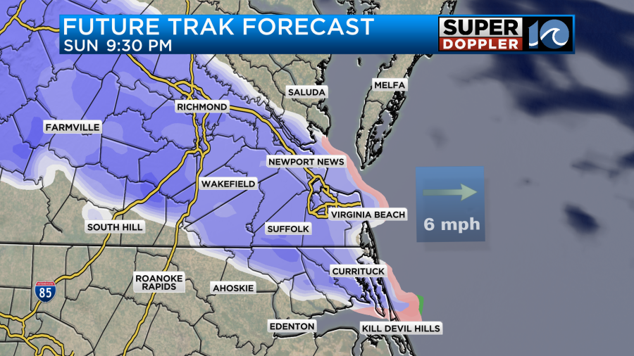
The wintry mix may continue for a while Sunday night into early Monday morning.
There is even a potential for some brief freezing rain in some of our inland locations.
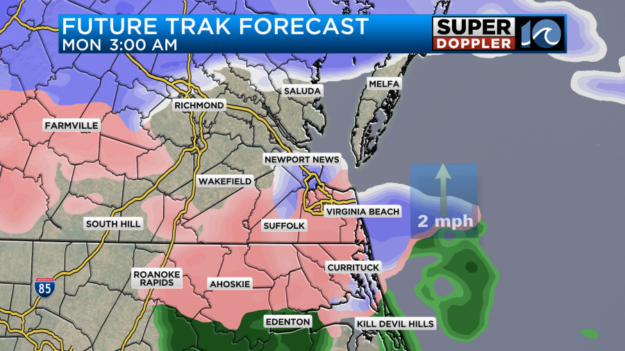
Eventually the milder air will come up from the south. This should change the mix over to mostly rain in the region.
The models all vary as to how far north the warm air gets between late Sunday into Monday. They do all have the same trend though with the bulk of the area changing to rain.
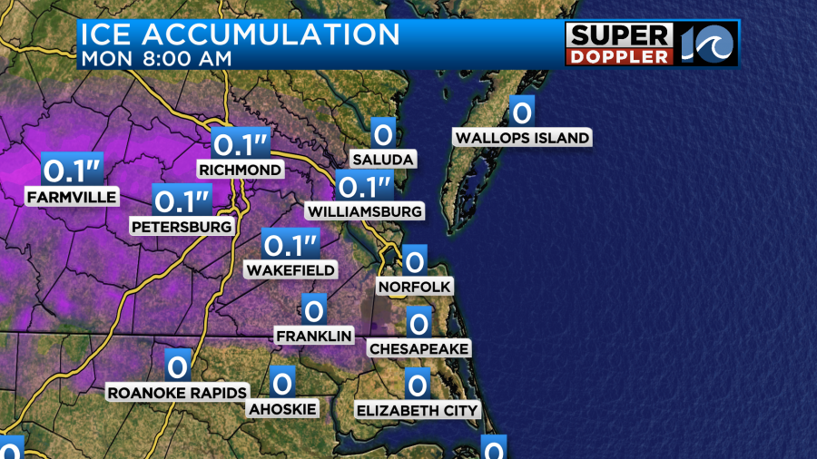
Keep in mind that a lot of the snow that falls up until Monday morning will likely melt by Monday afternoon. That may not happen though for some areas north of the metro. This is why there are already Winter Storm Watches out for those counties.
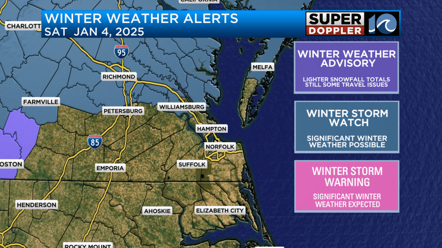
You can check here for updates to those watches. NWS Winter Watches/Warnings.
The NAM model (not shown) has a stronger low. Hence it has a warmer scenario and less snow overall. As the low departs and moves offshore there will be cold air wrapping in on the back side. This may create a brief period of a mix or some light snow again.
I’ve mentioned a couple of times now that we don’t typically get much snow on the back side of departing lows. That is unless they stall out or are very slow moving. This one should be moving at a good clip. So we’ll see.
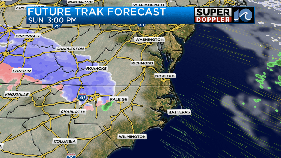
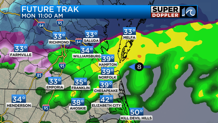
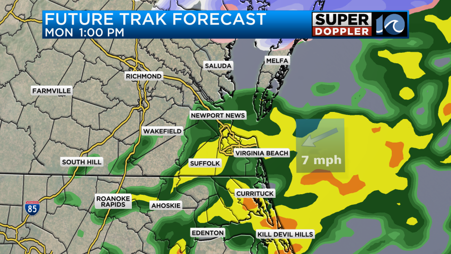
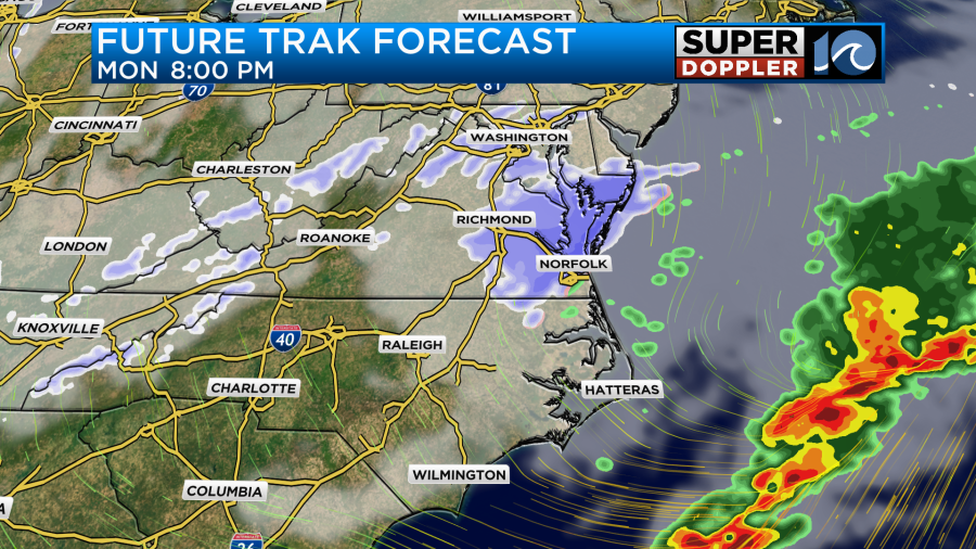
Snow totals vary, and they are also complicated. Here is what our Future Trak model is showing for the forecast.
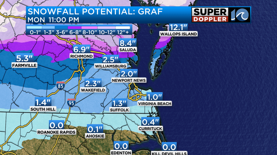
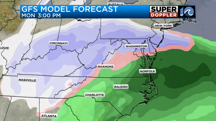
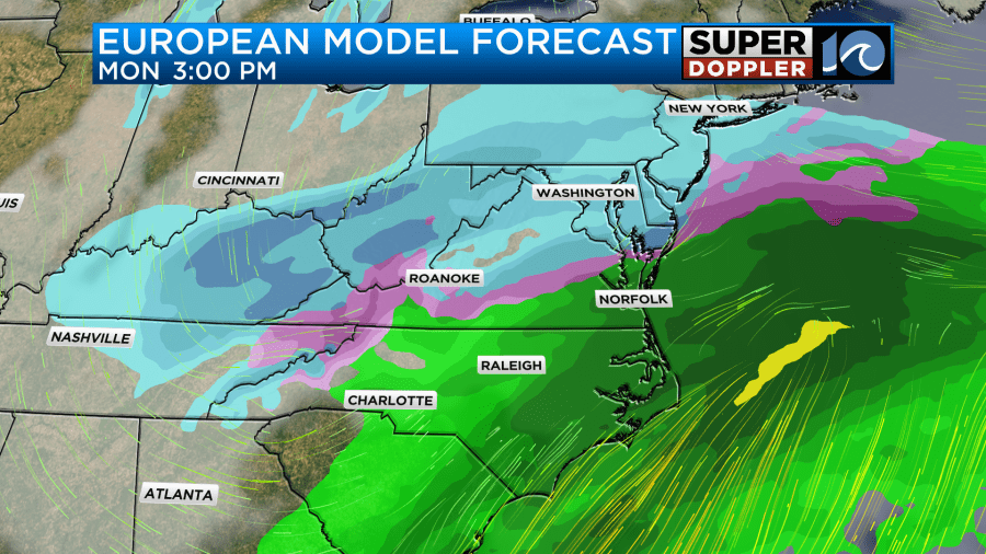
It doesn’t have much for the metro (but something). It definitely has some high amounts to the north. The GFS model has less overall. The Euro has some high amounts to the north as it did yesterday.
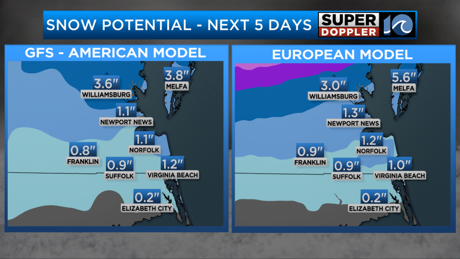
Here are 4 models, but they only go out to Monday morning. This does include the NAM model.
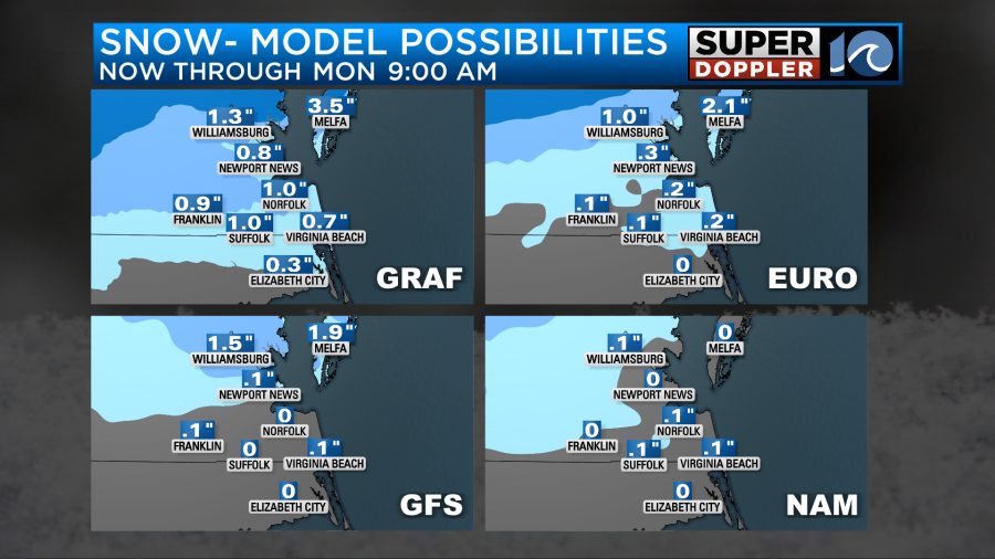
They don’t (yet) include the Monday evening precip.
Here are some things to keep in mind. The weather pattern is pretty complicated due to the warming layers coming up from the south. The ground temps should be above freezing for a while for the inital batch of precip. The Bay temperatures are in the mid-upper 40s. So a wind off of the water may affect snow totals near the bay. The ground will be wet Monday evening. So that may be tough for the second batch of snow to stick. However, temps will probably fall fast Monday evening.
All of the models have a little something in the Hampton Roads metro. However, the initial batch will likely melt. There could be some melting initially and then there will definitely be melting on Monday as the precip changes to rain. Either way the snow may really stack up over the northern parts of the viewing area up to the D.C. area. It could shut down travel for a time. This will be as many folks head back to work. I think the Hampton Roads area will be fine overall, but I am concerned about the Monday morning commute. Also areas north of Hampton Roads could potentially see several inches of snow.
There is still a lot of time for the forecast to change. Especially since this is a complicated system (precip type wise). By tomorrow this will be more into view of the higher resolution models, and that’s important as they should be able to handle the vertical layers of temperature and moisture better. So stay tuned for updates.
Meteorologist: Jeremy Wheeler