
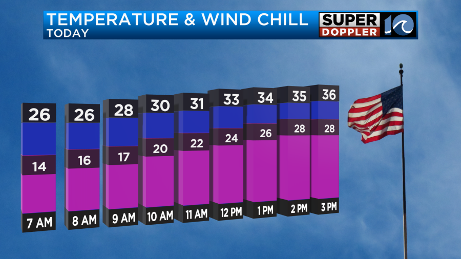
We have had a few days lately that have definitely felt like a cold Winter for our region! Today is going to be one of those days. We started the morning with lots of sunshine, but temps were only in the 20s.
A cold front moved through last night. It is now dropping quickly to the south. Meanwhile, high pressure is building in from the west.
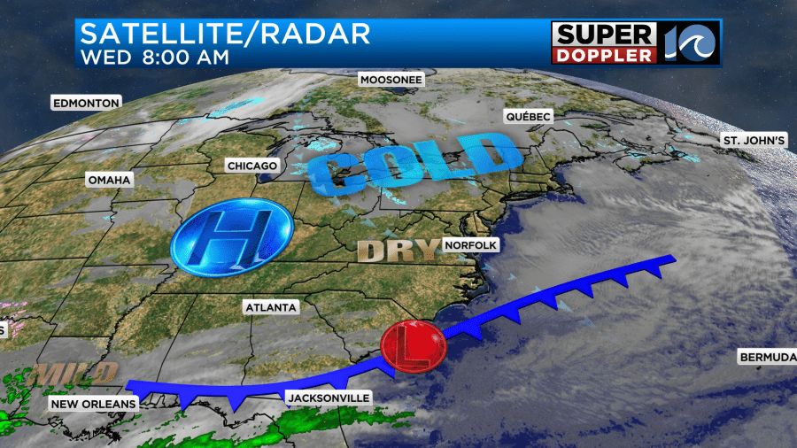
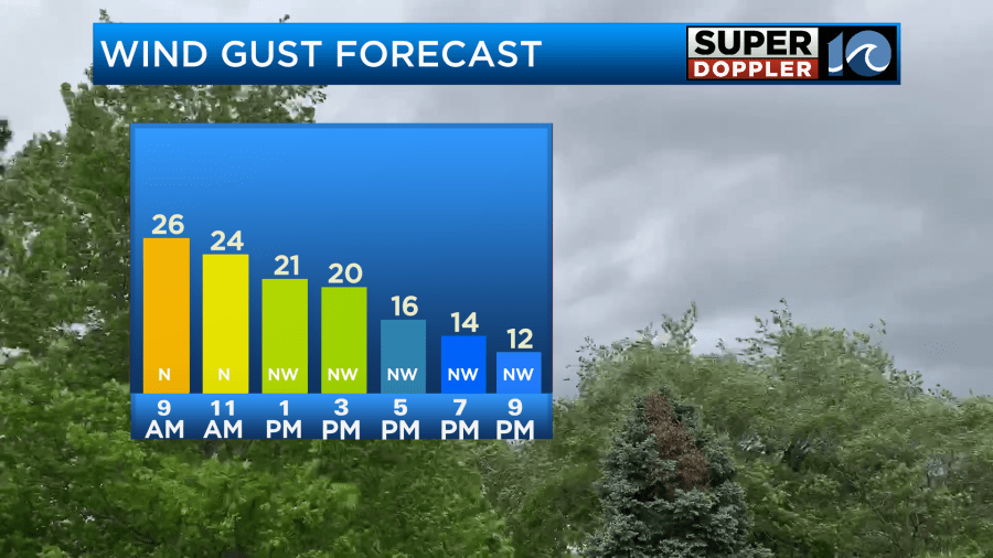
We’ll have lots of sunshine through the day, but the wind will only gradually decrease. There were a few gusts to 30mph near the shore this morning. Winds will gust to 25mph through midday.
While they won’t be too bad this afternoon. We’ll only top off in the mid 30s for highs. That means that wind chills will be in the 20s.
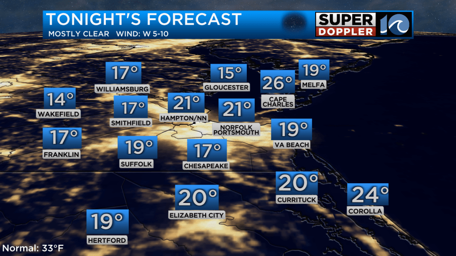
Tonight we’ll have clear skies, dry air, and light winds. This will allow temps to crash. They will drop down to the teens and 20s.
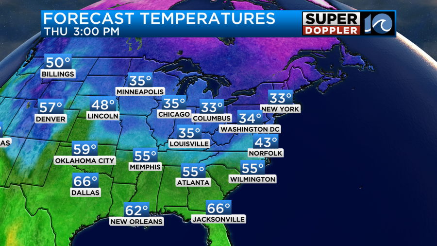
Tomorrow the wind will turn out of the southwest as high pressure shifts around. We’ll be dry, but there will be more clouds. High temps will warm slightly to the low-mid 40s.
We’ll be dry on Friday with high temps in the 40s. Then we’ll warm to the 50s on Saturday.
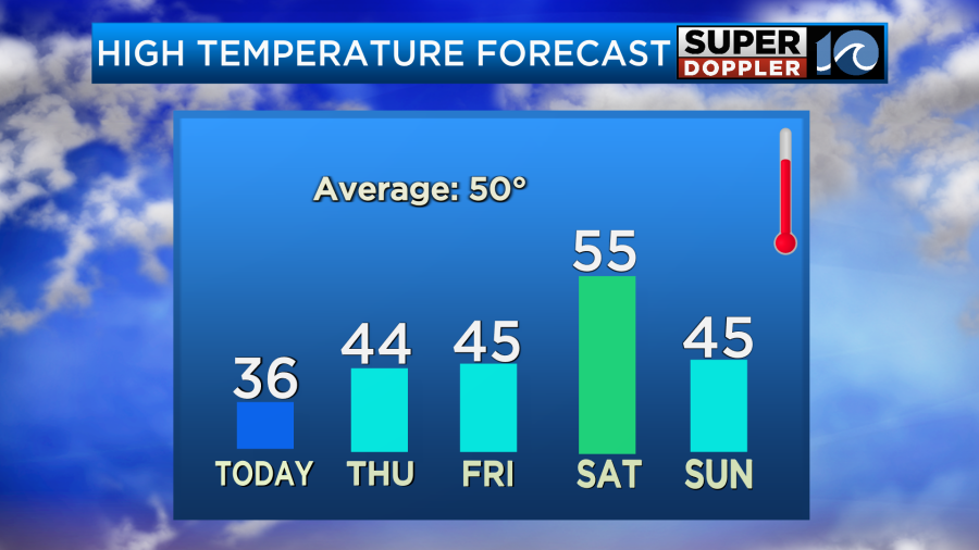
While we will warm up on Saturday. The trade-off is that there will be an increasing chance for rain showers. The models are in agreement in bringing in rain by Saturday afternoon.
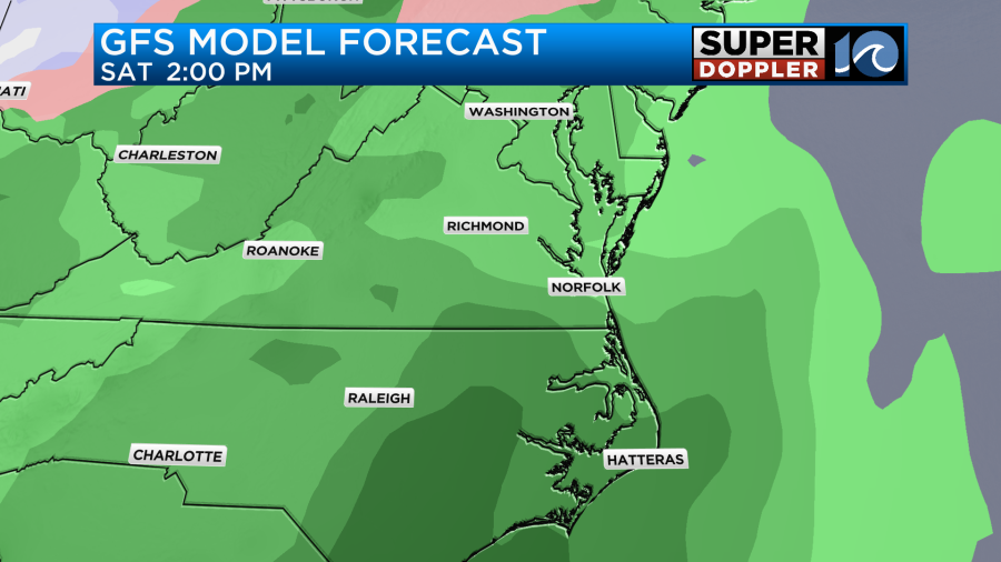
The European model and GFS model have lots of rain late Saturday into Saturday night late. However, the GFS model dries things out for a while on Sunday. On the other hand, the European model has precip coming back by the afternoon.
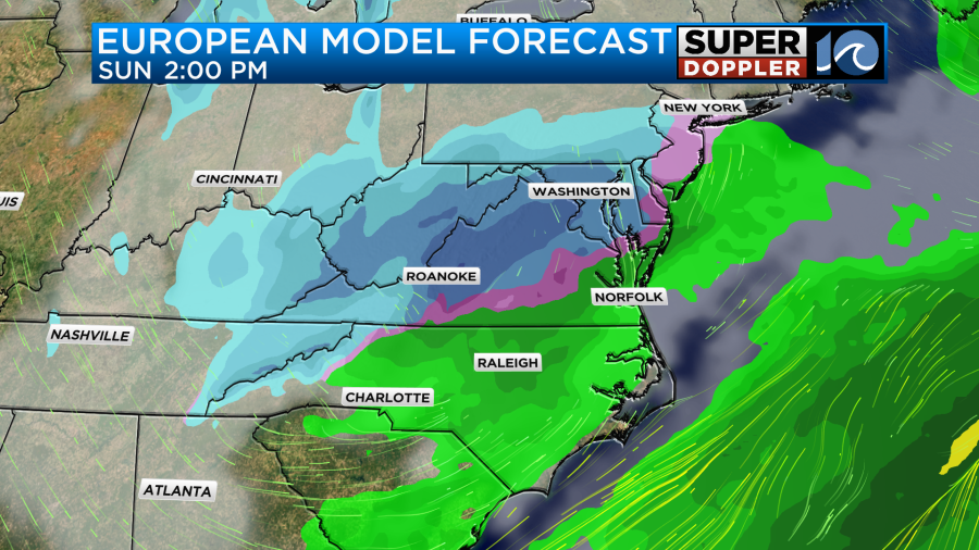
They both show some type of mixed precip by Sunday evening.
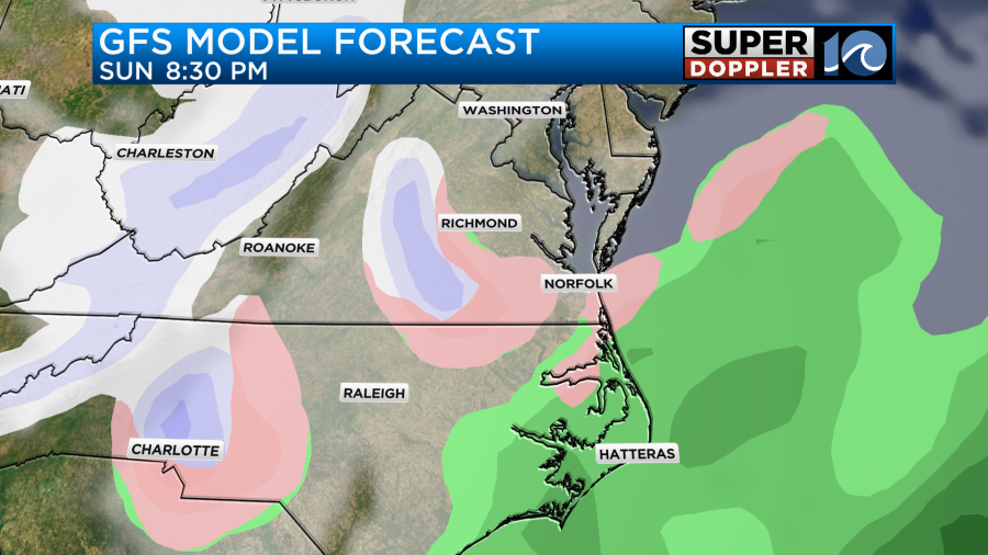
We’ll see how much of a mix or some snow tries to form during that time. It does look like Monday will be cold and breezy.
Some folks are asking about a possible big system towards the middle of next week. IT IS TOO EARLY for any kind of good forecast. You need a little patience for these things. We’ll focus on it once it gets a little closer in time.
Meteorologist: Jeremy Wheeler


