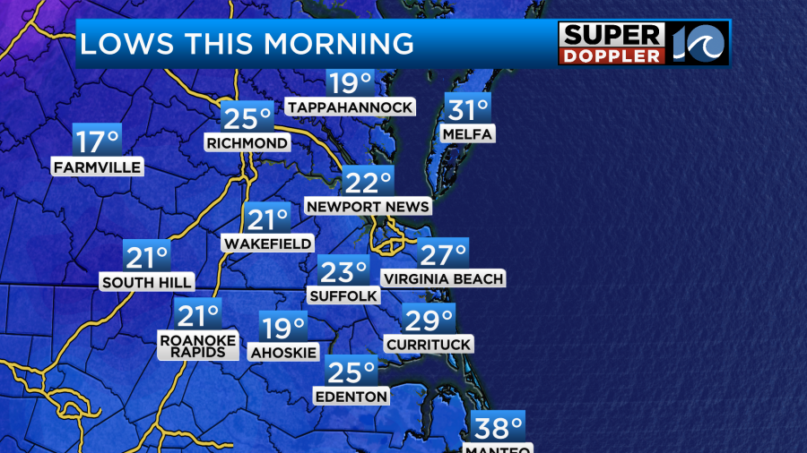
This morning was very cold for this time of year. It’s not unheard of to get teens and 20s in early December, but it’s not a common thing.
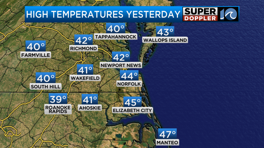
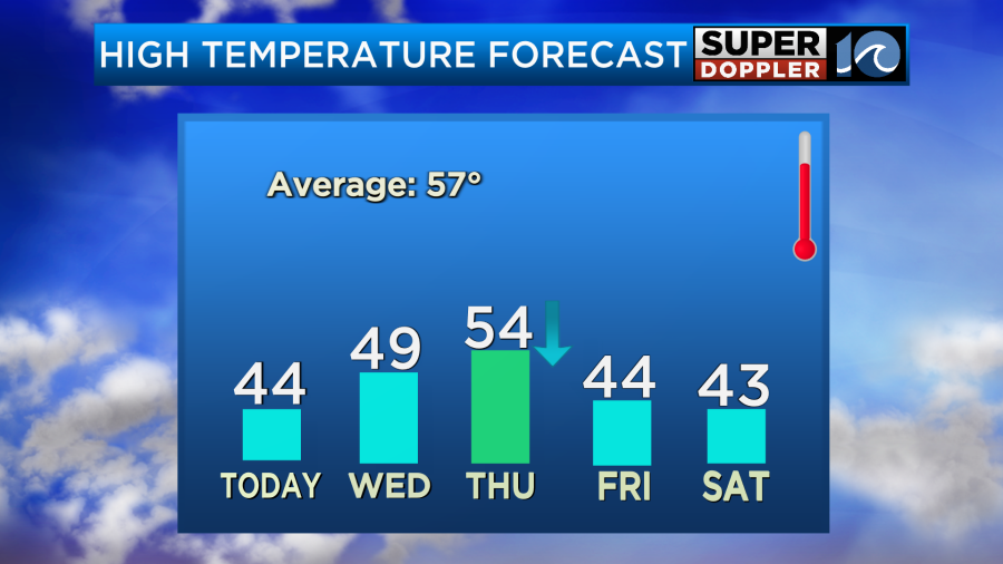
We are in the middle of a cold streak. Yesterday, high temps managed the mid 40s, and that was it.
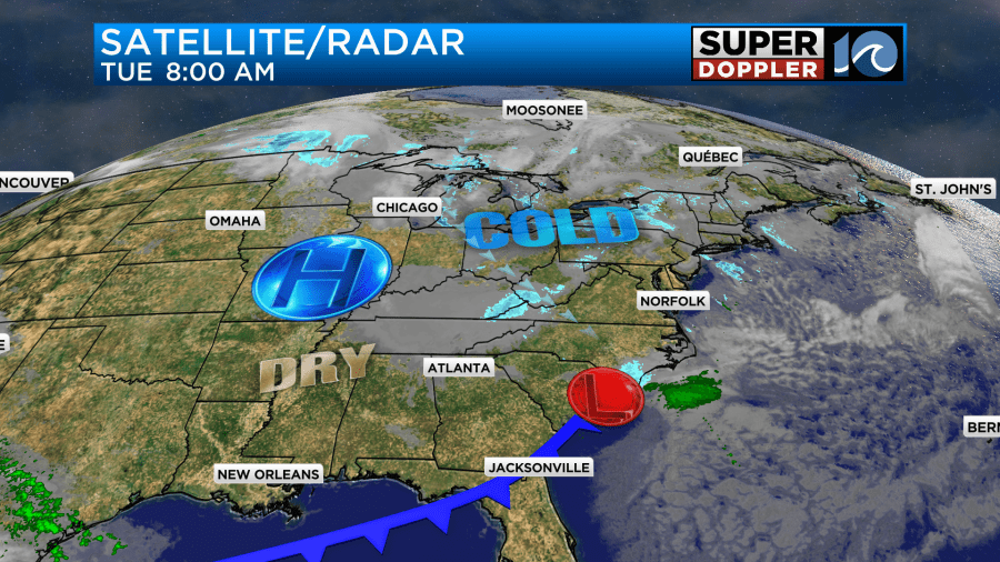
We’ll have similar weather today. There is a weak disturbance to our south with high pressure building in from the west.
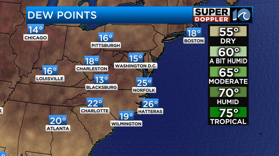
We are also super dry. Dew points are in the teens and 20s.
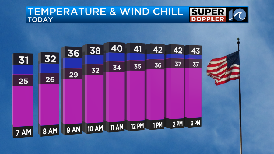
We’ll have lots of sunshine today, but the wind will stay up out of the northwest. It will run at 10-15mph with a few gusts to 20mph. High temps will only make it into the mid 40s, but the wind chills will be in the 30s.
Tonight we’ll have clear skies and light winds. Temps will drop back down into the teens and 20s. There will be a few 30s near the shore.
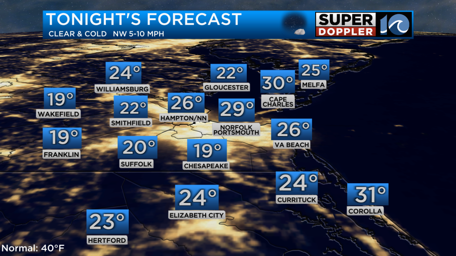
You may want to slow=drip the faucets tonight if you live in those colder areas.
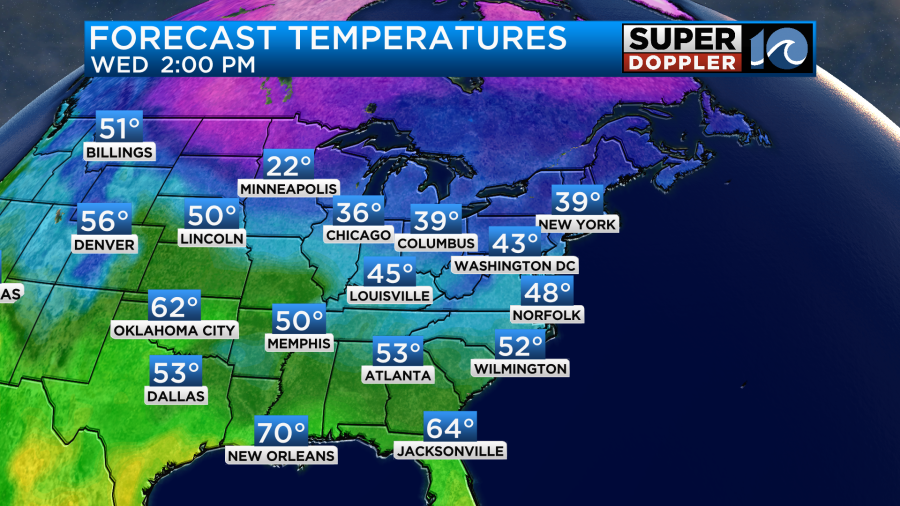
Tomorrow we’ll still have lots of sunshine, but the winds will turn out of the southwest. That should help to warm us up to the upper 40s to near 50.
We’ll warm up on Thursday to the 50s, but a cold front will slide through the region. This will actually drop temperatures back down to the 40s in the afternoon. Then we’ll stay in the 40s Friday and Saturday.
We’ll be mostly dry through that time. There is only a slim chance for a shower on Thursday.
The long-term forecast is coming in clearer. (pun intended) Saturday looks dry with highs in the 40s. Then we’ll likely warm to the 50s on Sunday with increasing clouds. However, we may have some rain by Monday. The good news is that I think temps will make it into the 60s or at least near 60. Beyond that the models look milder for a while. I’ll have more updates on that over the next few days.
Meteorologist: Jeremy Wheeler