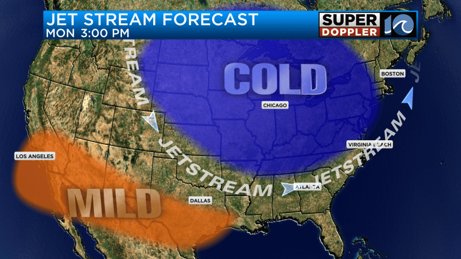
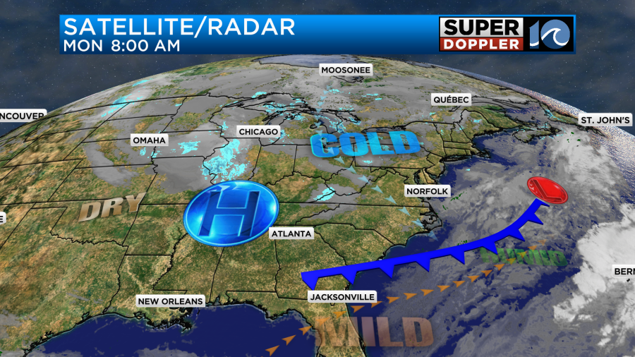
A lot of the country is experiencing an early shot of Winter-like temperatures. The jet stream is taking a large dip over Canada and the United States, and it is wrapping around an Arctic air mass.
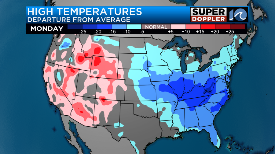
High temperatures today will be about 10-20 degrees below average for many in the eastern United States.
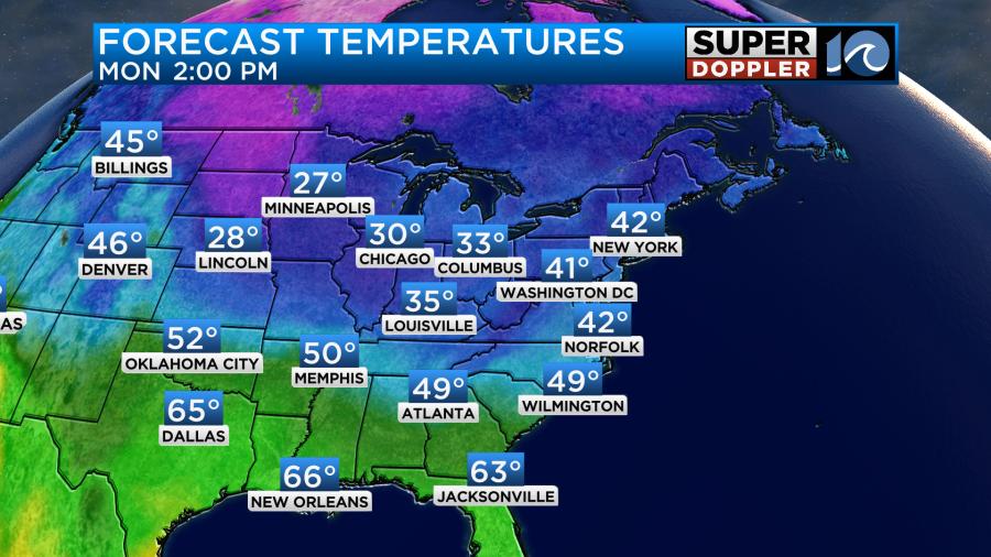
They will only top off in the 20s over parts of the Midwest. We’ll only be in the low 40s here.
This after hitting low 50s in the region yesterday. The good news is that a lot of the country is still dry for last minute travelers.
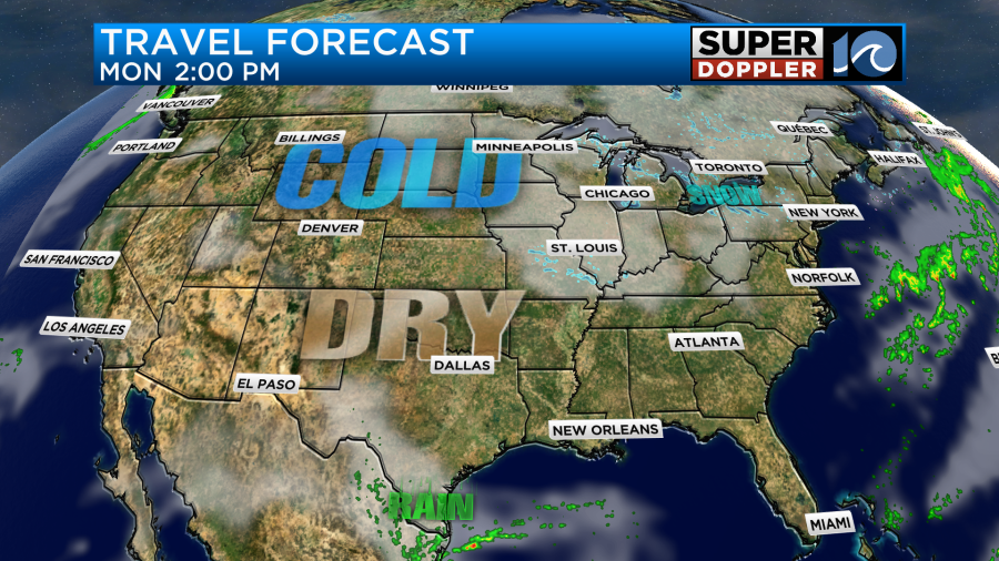
The exception is the large amount of lake-effect snow near the Great Lakes. Luckily that area is very localized. We’ll be dry, chilly, and breezy here today. A cold front is dropping to the south with high pressure building in from the west.
Tonight the winds will let up a bit. We’ll have a few clouds, but very dry air at the surface. This will allow temps to drop down to the 20s over much of the area. It’s even possible that a couple of teens may form far inland.
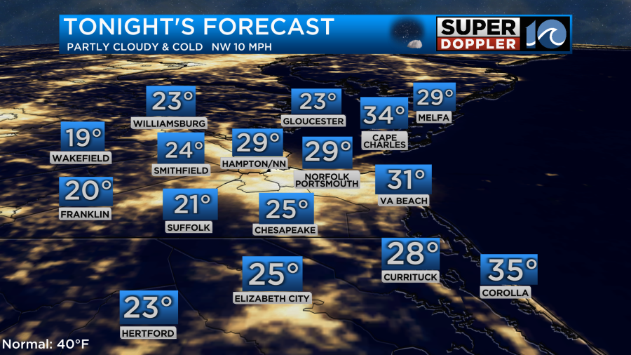
If you’re in some of those colder locations, then you may want to slow-drip the faucets overnight. That is more important to do when daytime highs don’t get much above freezing. That’s not the case here, but you could just to be safe.
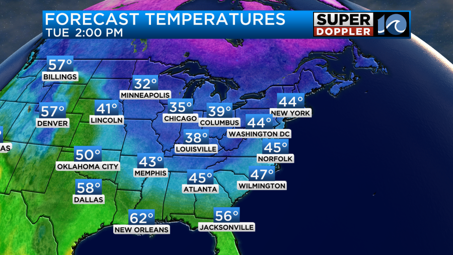
Tomorrow we will have highs in the 40s, but that will still be chilly for this time of year.
We’ll be dry and chilly for most of the week. High temps will be in the 40s most of the time through Saturday.
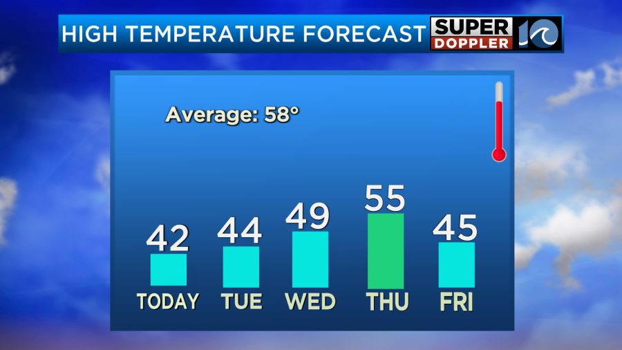
There will be a slight chance for a shower late Thursday. Friday and Saturday look dry and chilly. There may be some isolated precip by Saturday evening. However, the models are very split on Sunday. I won’t even say which way they are split as they’ve bounced around a lot over the last 48 hours. The word snow has even been thrown around a time or two. For now I have a mix of sun and clouds with isolated showers. We’ll have updates on that part of the forecast over the next couple of days.
Meteorologist: Jeremy Wheeler


