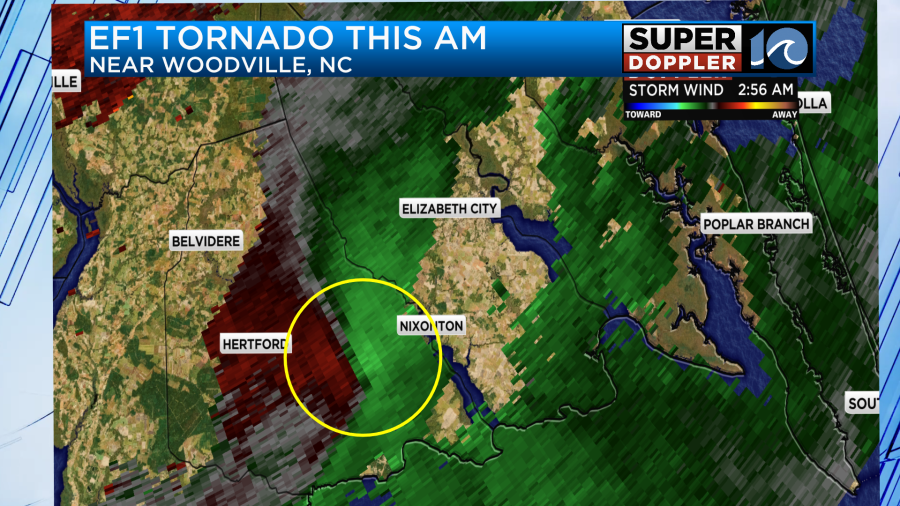
We talked about it yesterday, but I wanted to get the official information into the weather blog. There was a confirmed tornado in North Carolina yesterday morning. It happened a little before 3am. It ended up being an EF-1 tornado with maximum winds of 110mph.
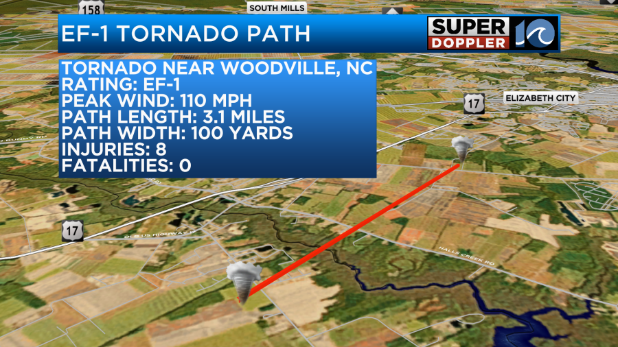
Remember, the scale goes from an EF-0 up to EF-5. The path width was small, but the length was about 3 miles long. It did damage over a dozen structures. As typically happens with smaller tornadoes some homes were destroyed while others nearby were left virtually untouched.


There was definitely rotation on the radar during that time. You can see it highlighted here.
Luckily no one was killed, but there were injuries. This adds to the list of over 120 tornadoes in the U.S. over the last 3 days with (unfortunately) over 40 deaths as well.
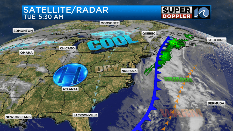
Today things are much quieter for us and for most of the U.S. The cold front that helped cause our local bad weather has now pushed offshore.
High pressure will build in from the west today. We’ll have lots of sunshine all day, but the winds will stay up out of the north for a while. They will gust up to 25mph at times.
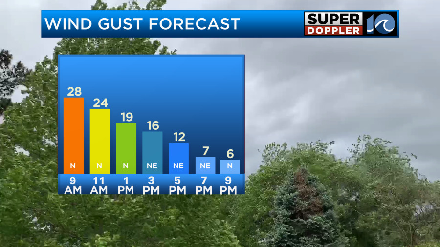
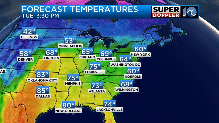
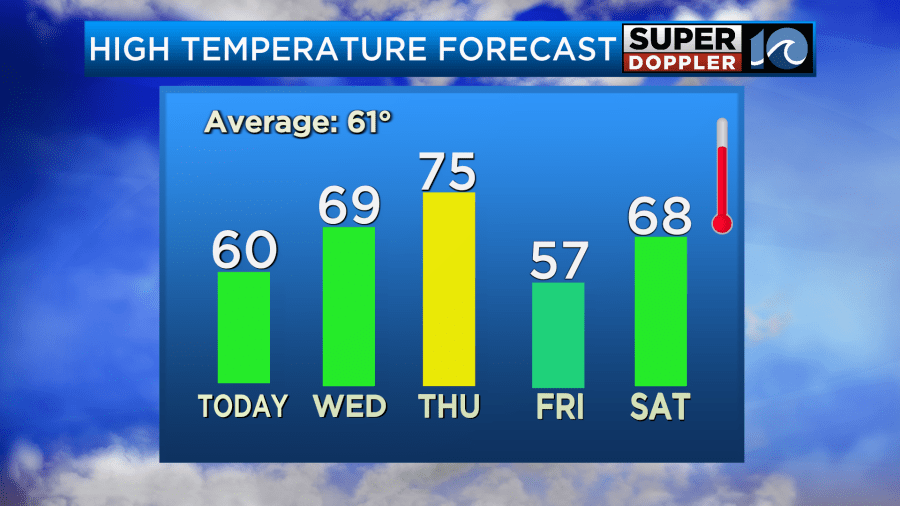
This will keep our high temps in the upper 50s to low 60s.
Tomorrow we’ll still have lots of sunshine again, but the wind will be much lighter and out of the east. So temps will be able to warm up some more. Our model is calling for low 70s for highs.
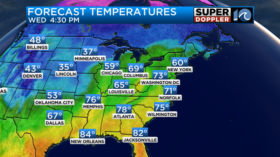
I do think there will be some 70s in the region, but I think it will be more in the upper 60s in the metro and a little cooler near the shore.
On Thursday we’ll have the winds pick up out of the south again. This will warm things up, but it will also pull up a lot of moisture. High temps will aim for the mid 70s.
We’ll have increasing clouds. There will be some scattered showers and a few storms in the afternoon, but there will be a higher chance for rain during the evening.
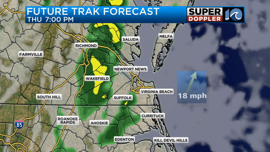
While there will be a few storms in the region, it shouldn’t be anything like the last storm system. It should be much weaker. Rainfall will be much less. That will be ahead of a cold front. That front will sweep through and cool us down on Friday. High temps will drop to the 50s with a mix of sun and clouds. We’ll be dry through the day. Then we’ll be dry and mild for the weekend with highs in the 60s.
The first day of Spring is Thursday.
Meteorologist: Jeremy Wheeler