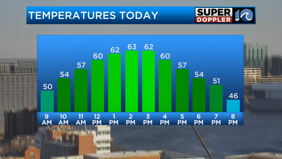
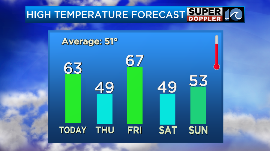
The deep freeze is behind us for now. However, we are going to get a few brief shots at colder weather over the next few days. They will be very brief though as temps will be jumping up and down for a while. Today we’ll be on the upswing. High temps will aim for the low-mid 60s.
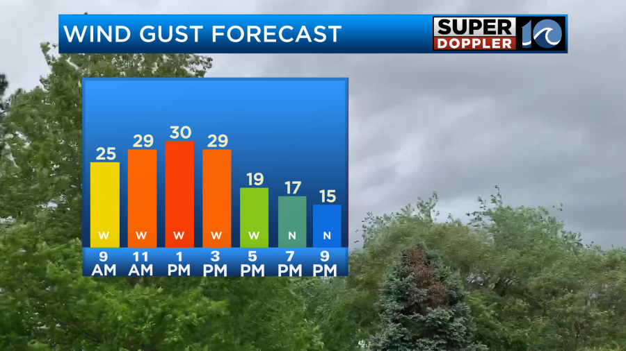
We’ll have lots of sunshine with a westerly breeze. Winds will gust up to 30mph for a time.
The reason for this is that there is a strengthening area of low pressure over the northeast states with a strengthening high to our southwest.
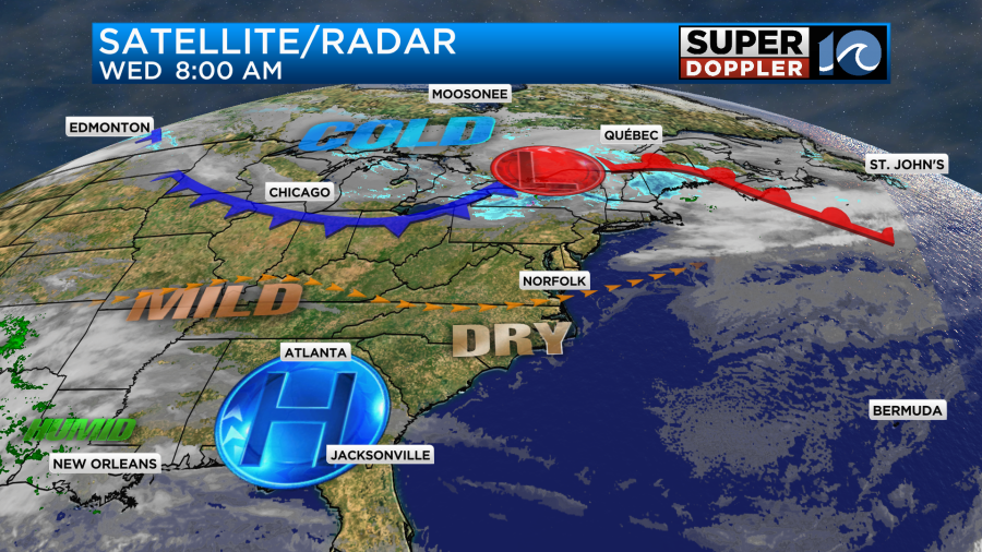
By tomorrow morning a cold front will drop in from the north and sink to our south. We’ll still have a good amount of sunshine (partly cloudy). However, high temps will be knocked down to the upper 40s.
Part of that is from the cold front itself, but the other part is that water temps are still pretty cold. They are in the upper 30s on the Bay and in the low-mid 40s over the ocean.
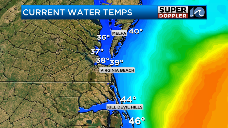
Any wind off of the water will be a cooling wind. That’s why it will be cooler on the Eastern Shore and over the Outer Banks today as the winds will be out of the west. Tomorrow we’ll all be cooler as the winds will be mainly out of the northeast. By late tomorrow afternoon the winds will actually turn out of the south, but it will be too late to warm us up. The cold front to our south will turn into a warm front, and it will start to move north. It is forecast to arrive late Thursday night. Higher moisture will return with the front. So we’ll have some scattered rain showers during that time.
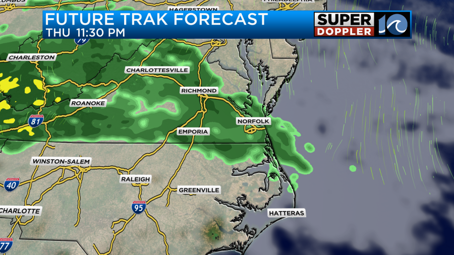
On Friday the warm front will slowly rise northward. The position of the front will determine where the rain sets up (or lingers). Our Future Trak model has the front and the rain hanging around through the morning. The models then have the rain pushing north for a time. They do vary in how long that break lasts. They do agree though that a cold front will sink to the south and create an increasing chance for rain into the evening.

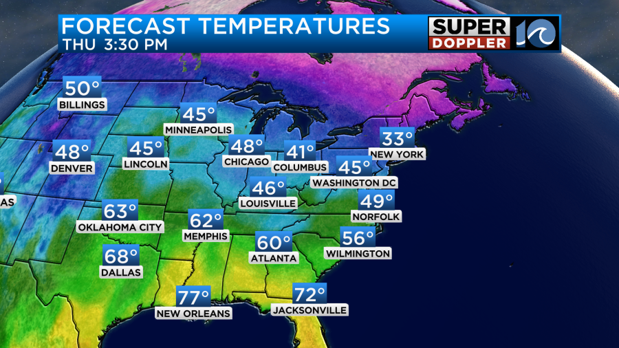
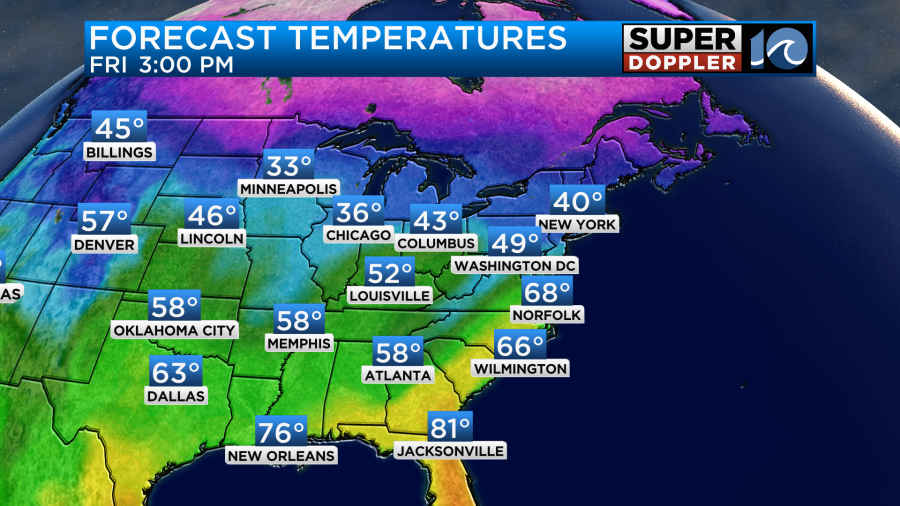
During the day Friday we are definitely going to warm up. For now I have high temps in the upper 60s.
That number may very a bit depending on how long the rain lasts and how far north the front gets. Overall though I am forecasting a warm day.
Confidence is growing for the weekend forecast. High temps will likely drop to the upper 40s on Saturday after the cold front drops to the south. Then we’ll be in the low 50s on Sunday.
We should be dry over the weekend, but some isolated showers may occur over parts of the Outer Banks on Sunday.
Meteorologist: Jeremy Wheeler


