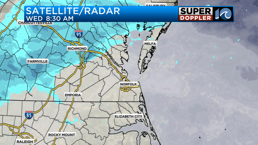
This morning was still fairly quiet across the region. It was the calm before the storm. We definitely have had a lot of clouds, but there were a few flurries and light snow showers well north/northwest of the metro.
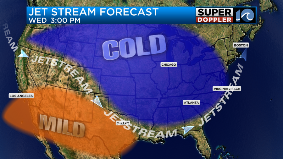
The overall forecast and pattern is coming together. The models still disagree somewhat, but they have fairly similar numbers for snow totals. More on that in a moment. For now I’ll set the scene. High pressure is moving farther away to the northwest, but it is strengthening. That is allowing for the wind to stay up out of the northeast over the Mid Atlantic.
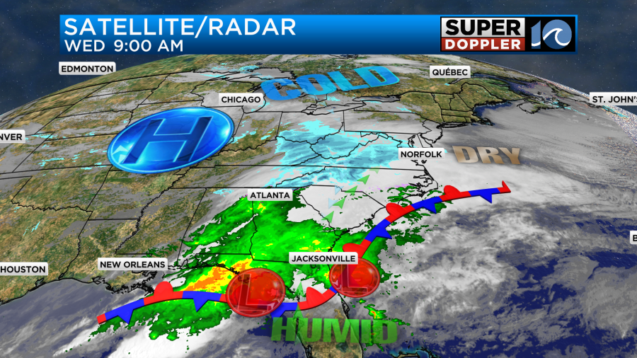
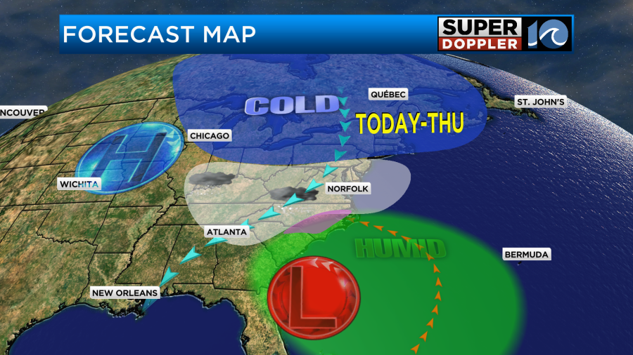
Meanwhile two weak areas of low pressure are merging near Florida. At the same time there is a large dip in the jet stream overhead.
Storms tend to track along the jet stream. So that would put the merged low just to our south by the late afternoon or early evening.
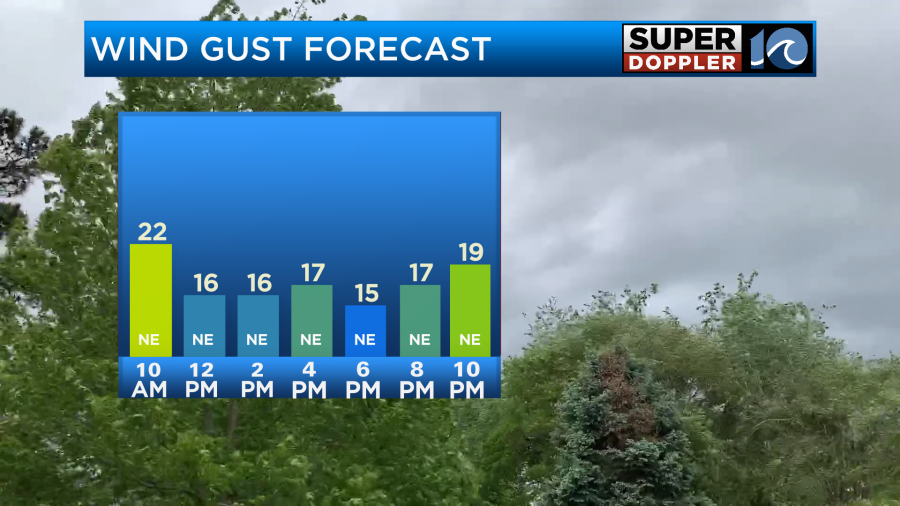
This will force more deep moisture up into that cold airmass. The strong high pressure to the west will force the winds to keep coming in out of the north/northeast. Gusts will be up to 20mph.
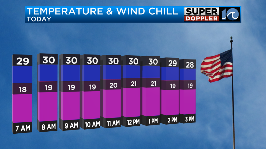
That will make this mainly a snow event for the region, but it may be mild enough for a wintry mix to the southeast. High temps will be in the low 30s, but wind chills will be in the 20s.
We’ve had some pretty dry air at the surface, but eventually the air will saturate. Scattered snow showers will develop between about 8 and 11am.
The chance for the snow will rise fast between 10am and noon.
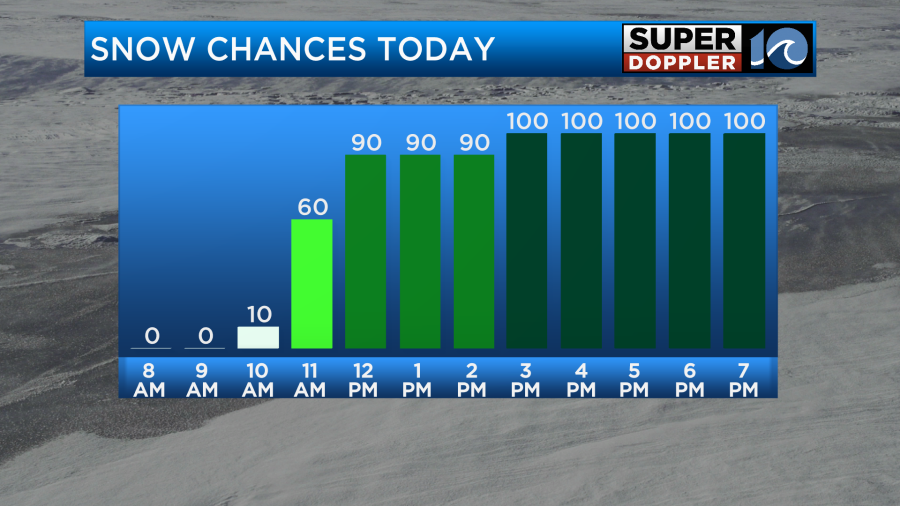
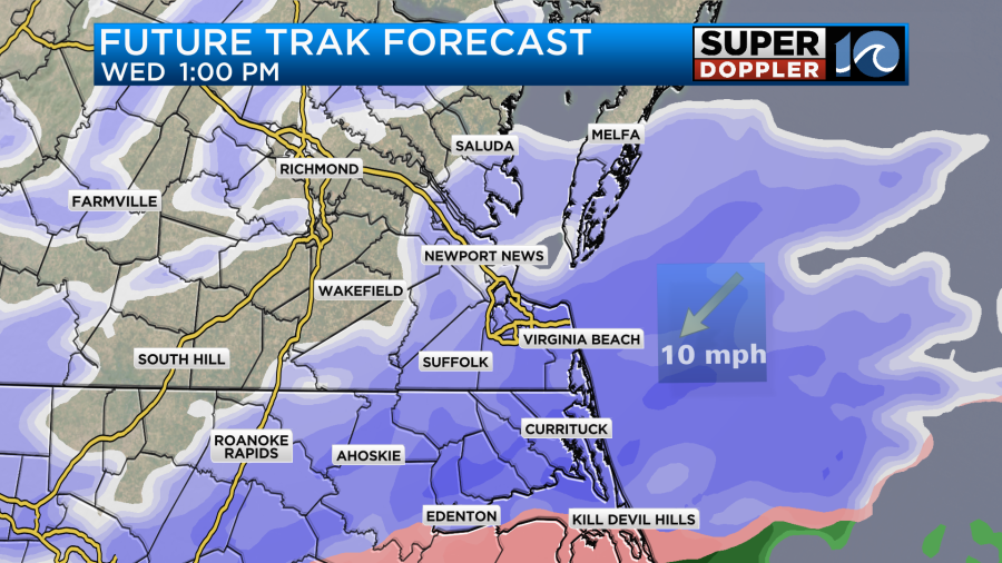
There may already be some pockets of moderate to heavy snow by that time. If not, then it will definitely come around by the later afternoon.
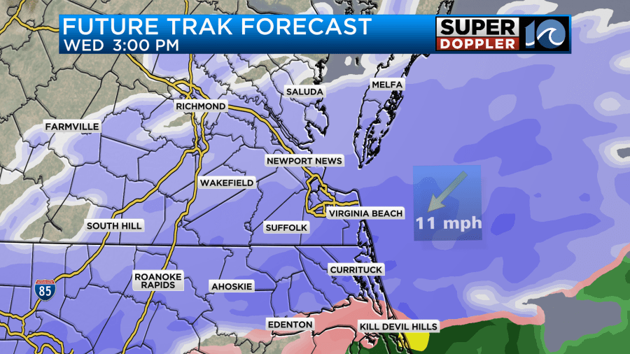
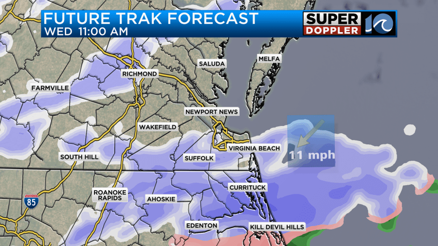
You’ll notice that some areas to the southeast show a wintry mix developing between the afternoon and evening.
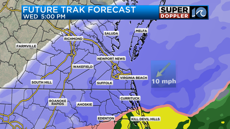
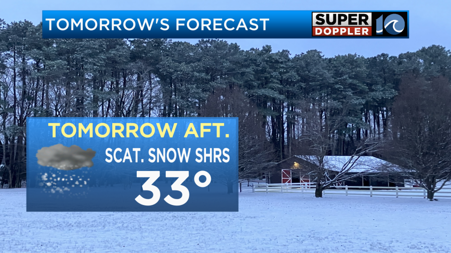
That will likely lower snow totals down there, but it could also create some iciness down that way. This could reach as far north as Elizabeth City. At least for a time. It will probably be rain for a while across the southern Outer Banks. Regardless, the rest of the region will be deep into the snow. Literally! Snow will continue until about 9-11pm. Then it should taper off. There will probably be a break for a while after midnight. Some flurries and a few light snow showers will still be possible into early tomorrow morning, but they should all be light and very scattered. Tomorrow, the surface low will push out to sea, but a small pocket of upper-level energy will swipe in behind it. This will create a second round of scattered snow showers.
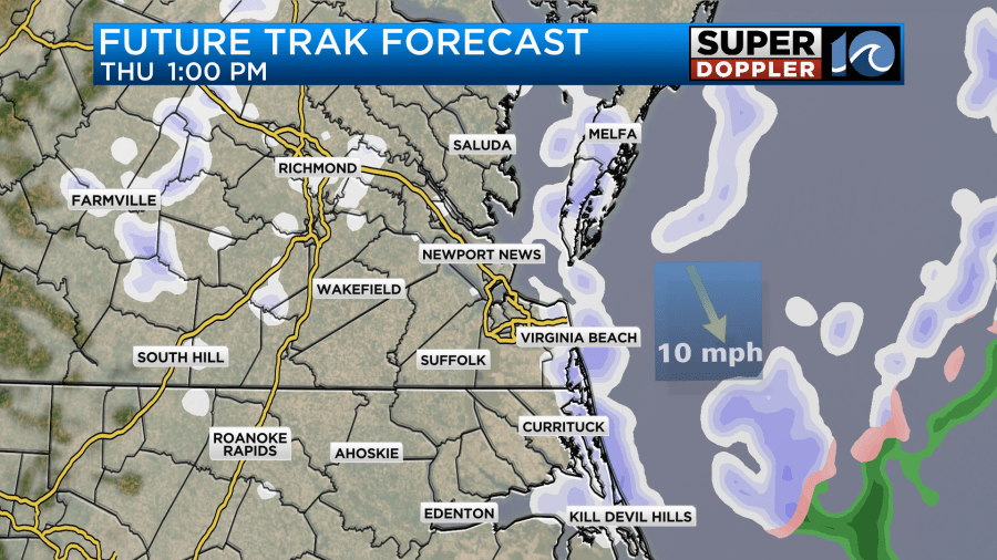
This could put down another half inch to an inch of snow in some areas. The snow should then wrap up by Thursday evening. After a few flurries we’ll clear out through the rest of the evening. High temps will only be in the low 30s tomorrow.
We’ll then dry out Thursday night into Friday. Highs will only be in the upper 30s Friday despite a good amount of sunshine. We’ll then be in the 40s Saturday and Sunday with fair skies. This means that there won’t be a lot of melting as we go into the weekend.
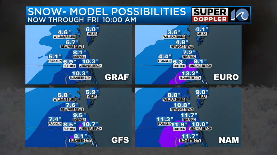
So that leads us to the snow totals. The models came into decent agreement this morning. They all have a large area of about 6-9″ with isolated locations getting 10-12″.

Update: Some of the models just updated and came in a little higher. Especially, the NAM.
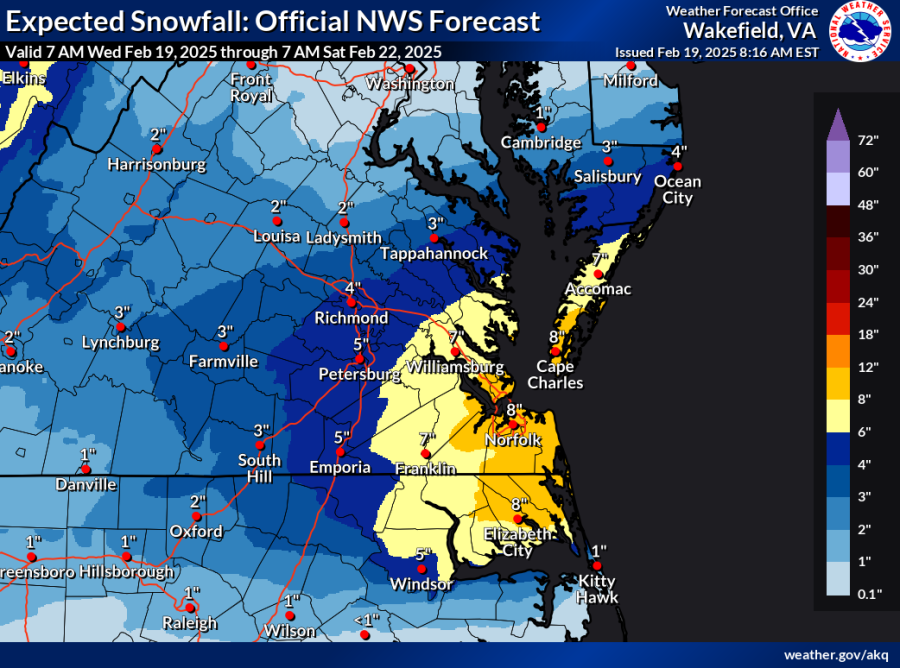
The National Weather Service model has been pretty steady since yesterday. Here’s its latest forecast:
Putting it all together, here is my latest snow forecast.
Update: I increased the totals back to what I had at 4am this morning due to the model updates coming in a bit higher. So went from 7-9″ back to 8-10″.
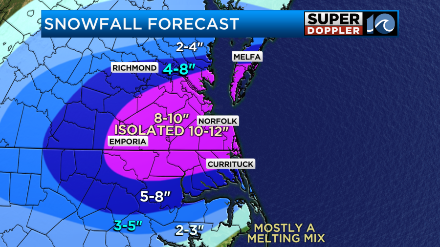
I had a large area of 7-9″ with isolated 9-11″. Now I have 8-10″ with isolated 10-12″. This includes all the major cities of Hampton Roads and a little to the north and south of it. It even goes out west to Franklin and Emporia.
The southern areas will get complicated due to that mix zone. If the mix reaches up to Elizabeth City, then it will definitely lower the snow totals along the Albemarle Sound.
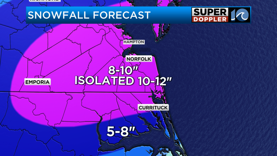
If it doesn’t then the totals will be more in the pink down there. North of Hampton Roads will be a bit tricky as it’s hard to tell how far north the heavier snow will get. I have a fairly sharp gradient from the metro north.
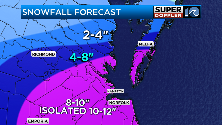
That also goes for the Eastern Shore. For now I do expect a lot less snow up towards Chincoteague compared to Cape Charles. However, I have trended the amounts up there since yesterday.
Roads will be difficult for travel this afternoon. Some roads may become impassable if heavy snow falls for a long time. So if you are driving for a long time, then make sure you take plenty of warm clothing and perhaps a warm blanket. Just in case you get stuck somewhere. A little water and a snack couldn’t hurt.
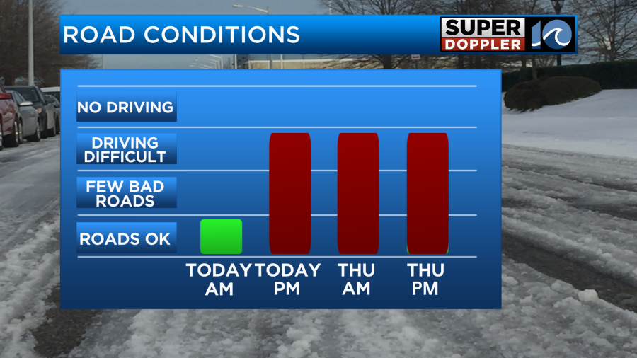
Road conditions will still be tough on Thursday. Things should improve by the evening as the main roads get plowed. However, a lot of secondaries and neighborhood roads could be bad for a couple of days. Maybe even into the weekend. Hopefully, not. Be safe out there. Have fun in the snow.
Meteorologist: Jeremy Wheeler