
Over the last couple of weeks we have had some pockets of heat, but there haven’t been any long stretches.
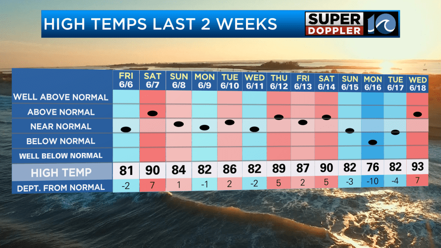
We even had a really cool day recently on the 16th. However, it looks like we are going to go into a fairly hot pattern for a while going forward. Yesterday was the start of this hot stretch. We ended up in the lower 90s with the heat index over 100. It was ok if you were in the shade with the nice breeze. However, if you were in the sun and out of the breeze then you were cookin.
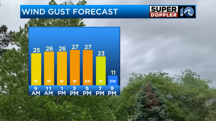
Today will be very similar to yesterday. We’ll have lots of sun with a southwest breeze. In fact…We’ll probably have even more sun than yesterday until late in the day. The wind will be out of the southwest at 10-15mph with gusts up to 25mph.
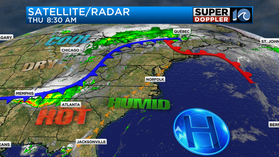
We have high pressure to our southeast with a cool front to our west.
High temps will aim for the mid 90s today with a few upper 90s inland.
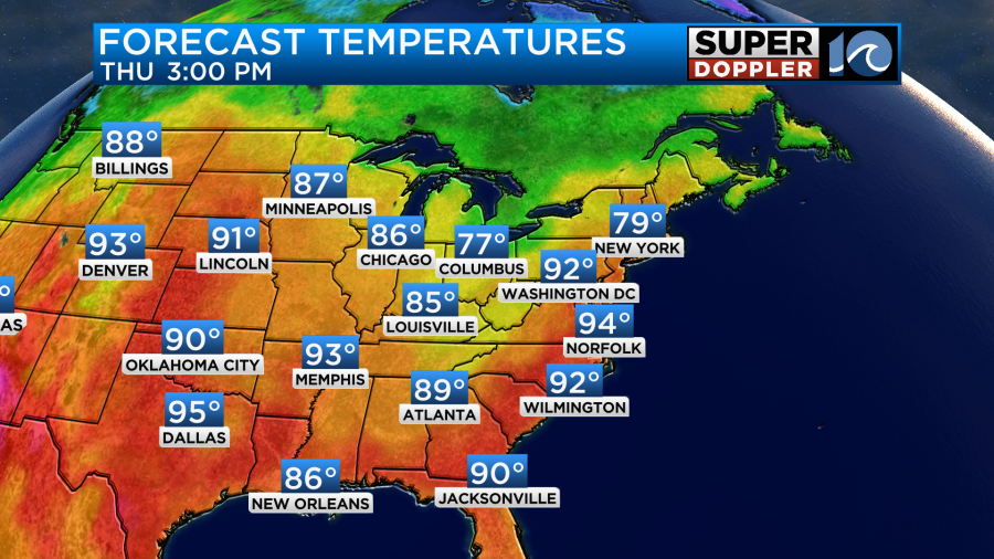
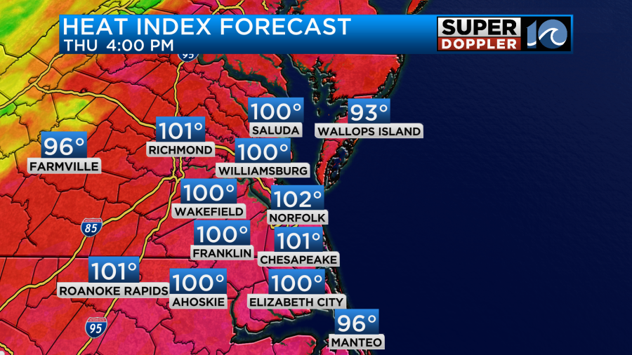
The heat index will be over 100 for many during the afternoon and early evening.
I’m not expecting any rain during the day. However, as we head into the evening a line of showers and storms will move into the area. This will start up inland/west between 7 and 9pm. It could hit the metro between 8 and 11pm.
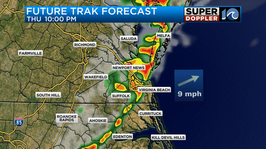
They should end by 1-2am. During the evening there is a risk for severe weather.
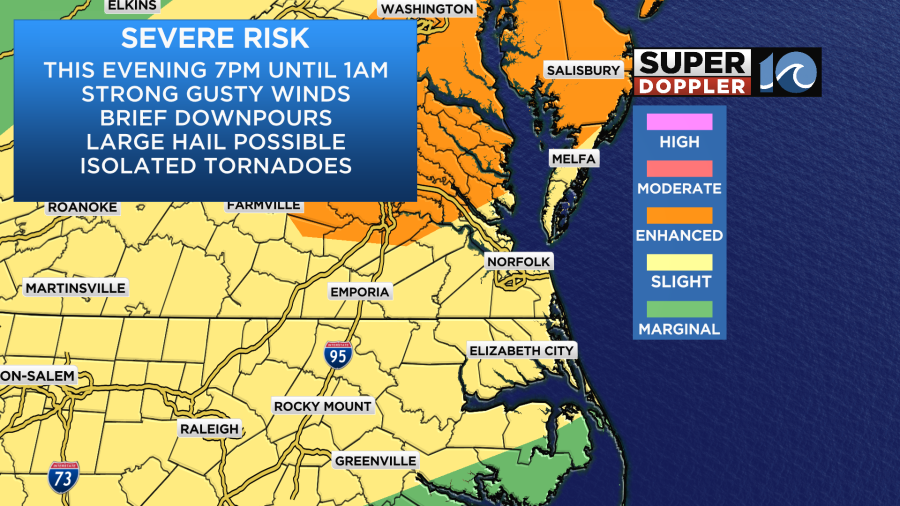
The main threats will be strong/gusty winds and heavy downpours. However, large hail and isolated tornadoes will also be a threat.
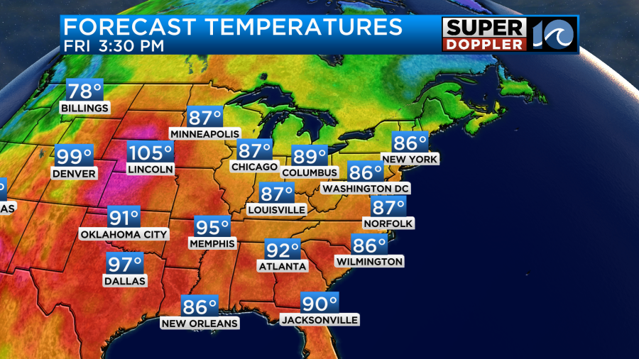
Tomorrow the front will sink to our south and stall out. We’ll have some nicer/drier weather. High temps will drop to the upper 80s.
The humidity will also drop tomorrow through the day.
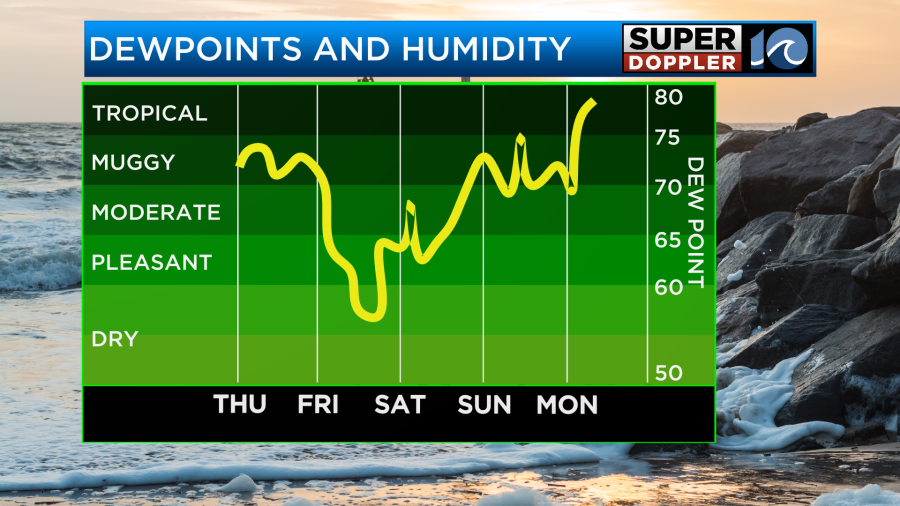
Winds will be out of the northeast at about 8-12mph. It should be a great weather day! Saturday and Sunday’s weather still look quiet. We’ll have lots of sunshine both days. However, it will start to warm up again.
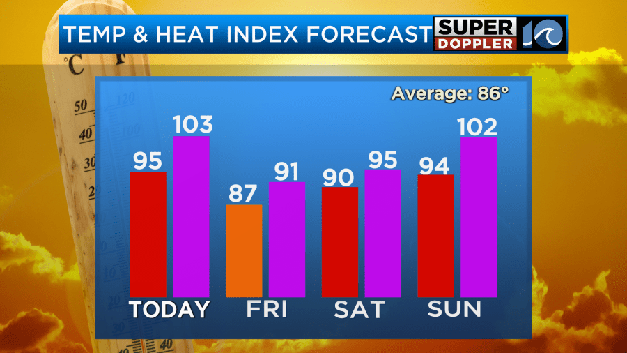
High temps will be near 90 on Saturday. It won’t be too bad. However, we’ll warm to the mid 90s on Sunday with the heat index returning to over 100 degrees. We’ll stay hot next week with highs in the 90s probably all next week. We may even hit the mid-upper 90s on a day or two. Stay tuned for updates.
Meanwhile, in the Pacific Ocean… Hurricane Erick made it up to a category 4 hurricane for a time last night. It then weakened to a category 3 before making landfall over the southern coast of Mexico early this morning.
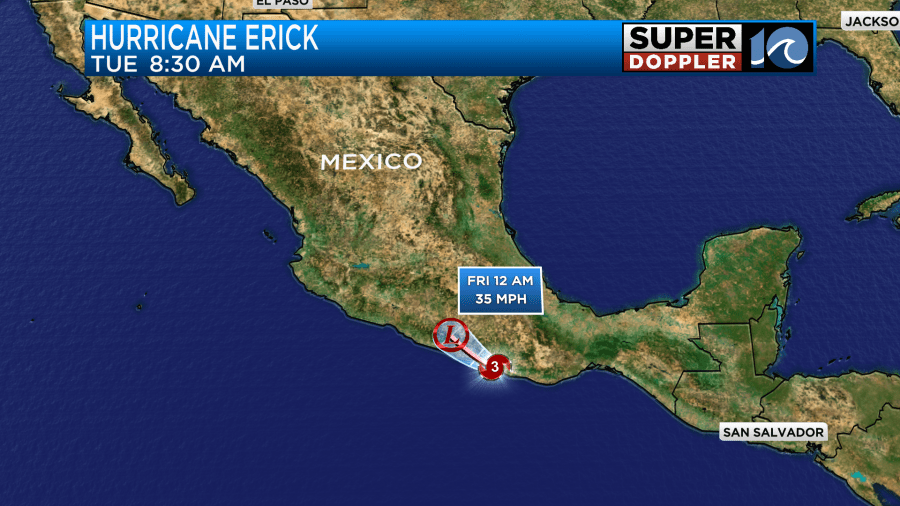
It will weaken quickly, but heavy rain will affect the Acapulco area. Luckily things are still quiet in the Atlantic.
Meteorologist: Jeremy Wheeler
Hurricane Erick


