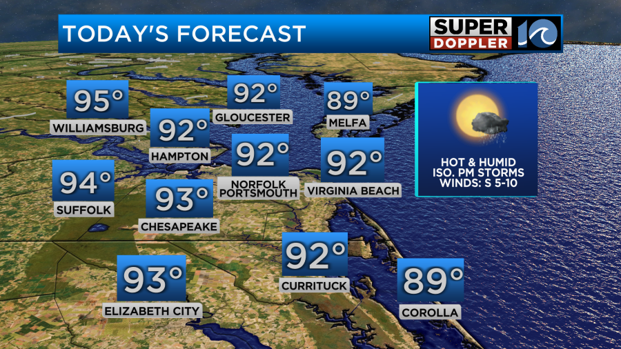
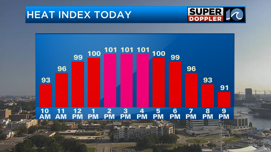
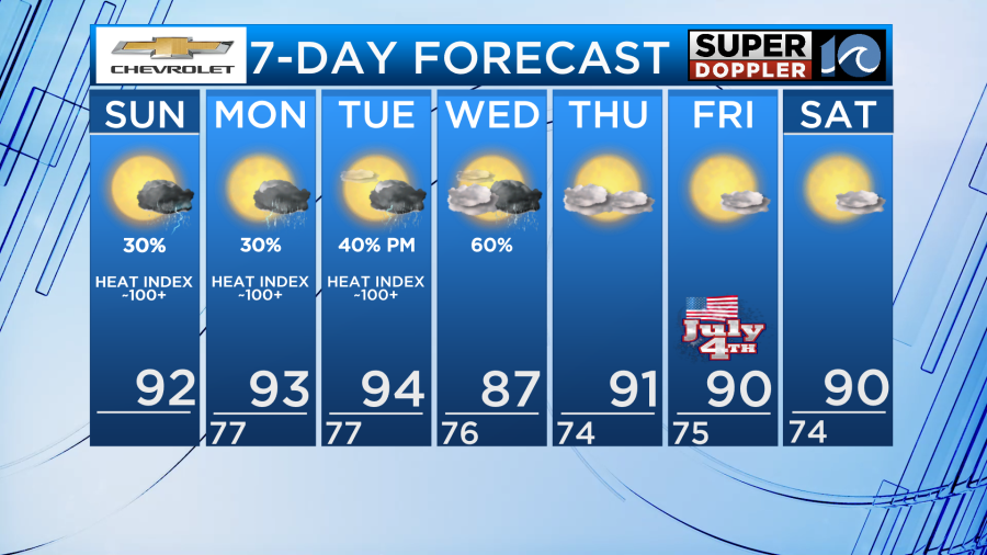
Get ready for yet another hot one across Hampton Roads as a mostly sunny sky and southwest winds will help get our afternoon high temperatures back into the 90s!
There will be another opportunity for relief as storms fire up this afternoon but similar to yesterday, the coverage will be isolated. Any storm that does form this afternoon with the sea breeze is not expected to become severe as heavy rain will be the main concern. These storms overall will be quite weak and short in duration.
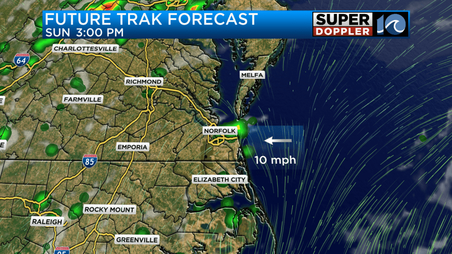
High temperatures away from the coastline will be in the lower and middle 90s with southwest winds at 5-10mph. Along the shoreline, the afternoon sea breeze coming off the water will hold temperatures in the 80s. Winds may gust to around 20mph at times so hold onto your umbrellas if you plan on being at the beach.
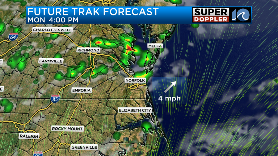
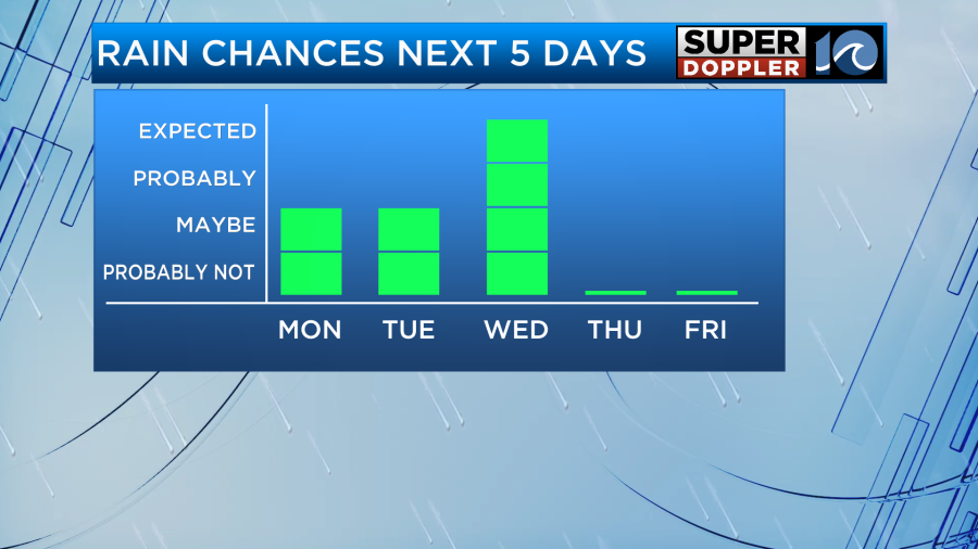
As this warm and unstable airmass remains in place, more storms will fire up tomorrow afternoon. They could become more numerous for areas north like the Peninsulas while North Carolina will have less of a rain chance.
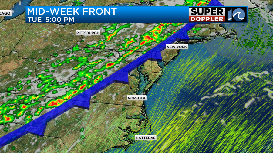
The threat for more widespread and strong storms comes late Tuesday into Wednesday as a cold front moves into the region. Damaging wind gusts will likely be the primary concern but we will keep you updated as we get closer and gather more specifics.
The good news about rain falling during the middle of the week is that after the front pushes through we should be able to dry out just in time for Independence day across Hampton Roads. High pressure will fill back in for the end of the week so expect calm weather with lots of sunshine. Evening firework shows will likely be good to go!
When it comes to the temperatures for this week and beyond, they will remain around 90 degrees with the exception of Wednesday due to the nearby front. Stay cool and hydrated this week!
-Meteorologist Brian Michigan