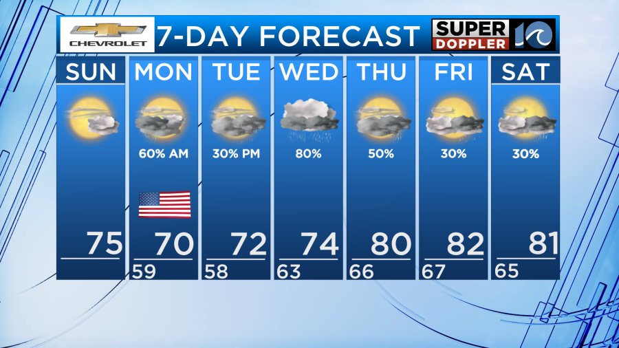
We’ve got an active week of weather ahead across Hampton Roads and it all begins tonight as a stationary front drifts north into our area. This will bring rounds of rain and a cloudy sky as we head through the week so enjoy today’s sunshine while we have it.
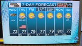
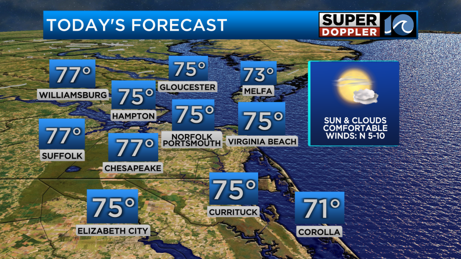
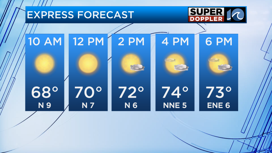
Despite the sunny weather for your Sunday it will be a bit cool due to northerly winds of 5-10mph. High temperatures will be in the lower to middle 70s with low humidity.
Rain will arrive late overnight, likely after midnight for portions of North Carolina as the front is moving from south to north.
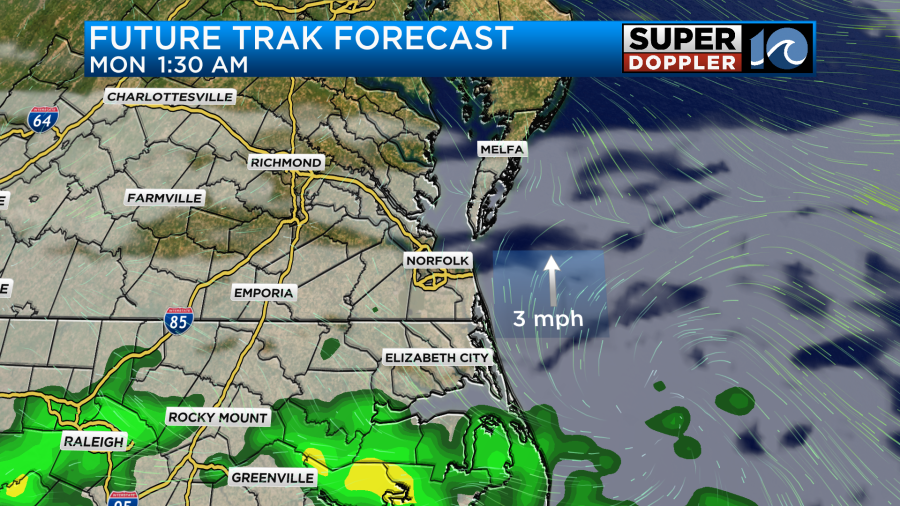
Rain could be heavy at times in North Carolina since those areas will be closest to the boundary. The southside will experience scattered showers early tomorrow morning and they will be on and off through the midday hours.
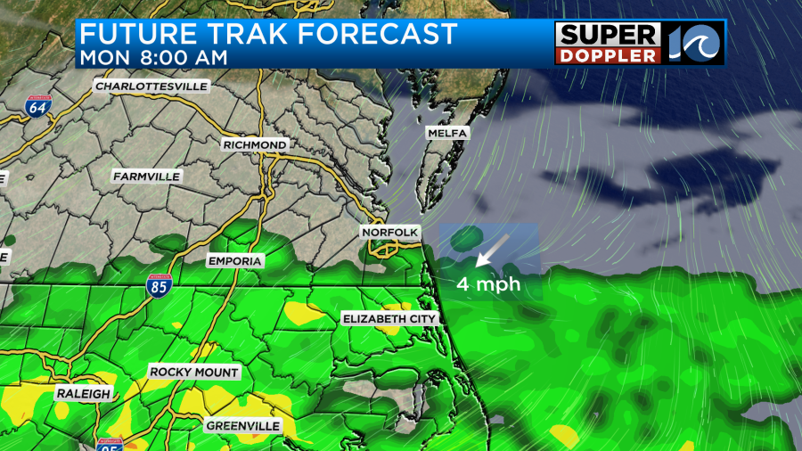
For the Peninsulas, rain chances will be more isolated as northerly winds will bring in dry air which may erode the northern fringes of the precipitation.
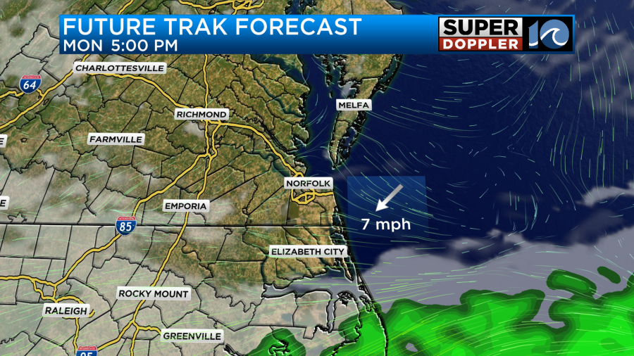
With rainfall ongoing and a cloudy sky for most of the day, high temperatures will only make it near 70 degrees along with breezy northeast winds. There is a possibility for some clearing during the afternoon as north winds push dry southward, but that will mainly be for the Peninsulas and the southside later in the afternoon.
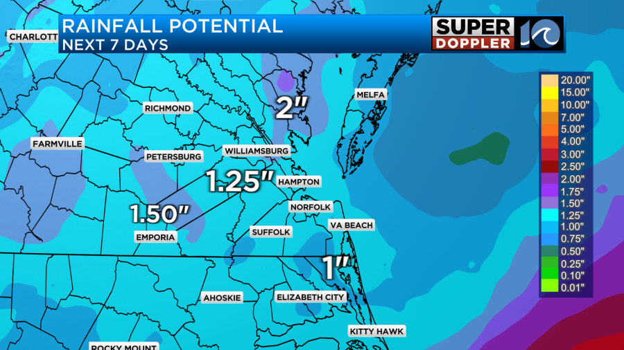
Our weather pattern remains active throughout the week as another area of low pressure rides along the lingering stationary front. This system could bring another inch or two of rainfall on top of ground which is already saturated with all the rain we have received this month.
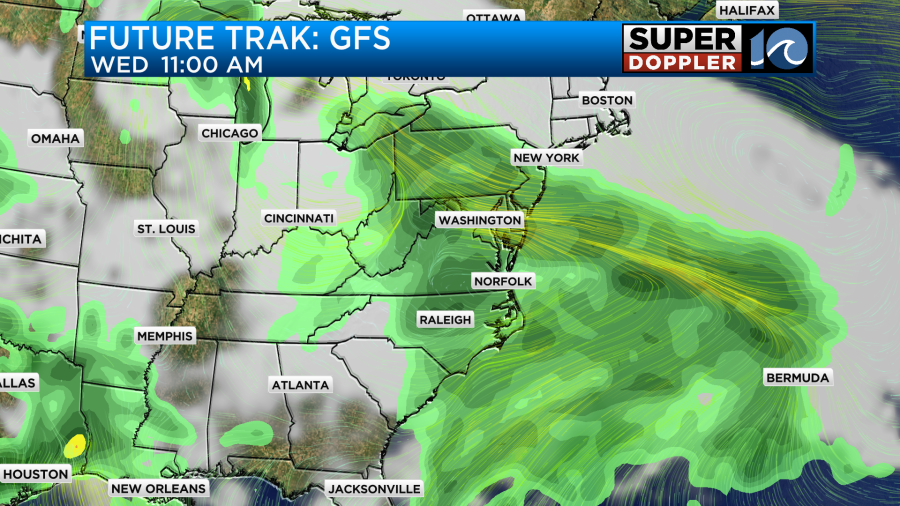
Our models have been pretty consistent with showing the potential for widespread rain during the day on Wednesday.
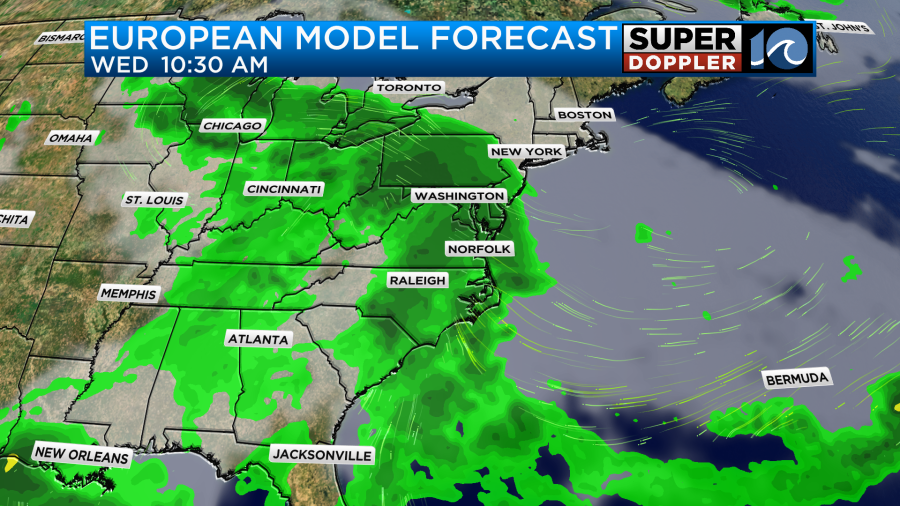
Rain could even be heavy at times leading to localized flooding. We will keep you updated as we learn more.
-Meteorologist Brian Michigan