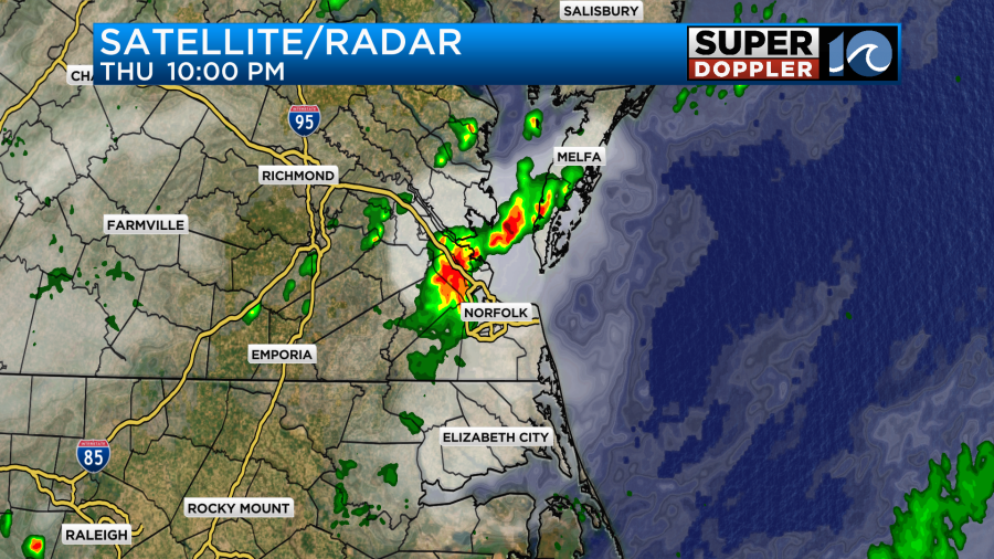
Over the last 24 hours we had a few rounds of heavy rain and thunderstorms. A cool front moved towards the region, and a few strong storms got out ahead of it. Here was round 1.
Then another round of heavy rain came in around 4am.
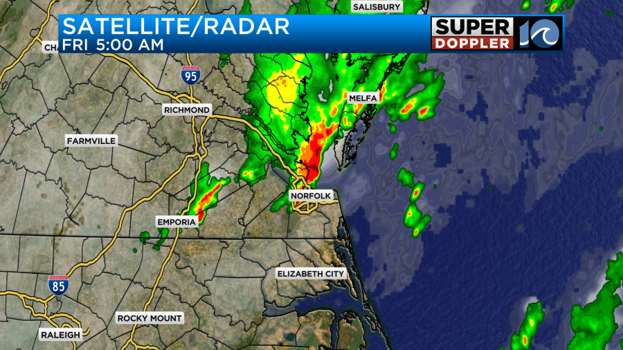
Scattered showers and a few storms kept going until 7:30am. There was one cool image that I captured. It was at the Lesner Bridge in Virginia Beach.
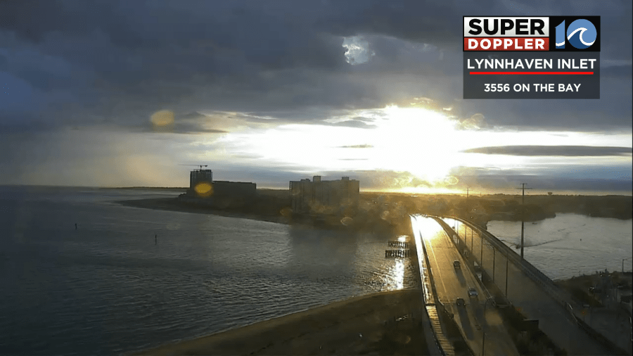
I’d never seen the sun shining through the clouds like that and reflecting off of the bridge that way.
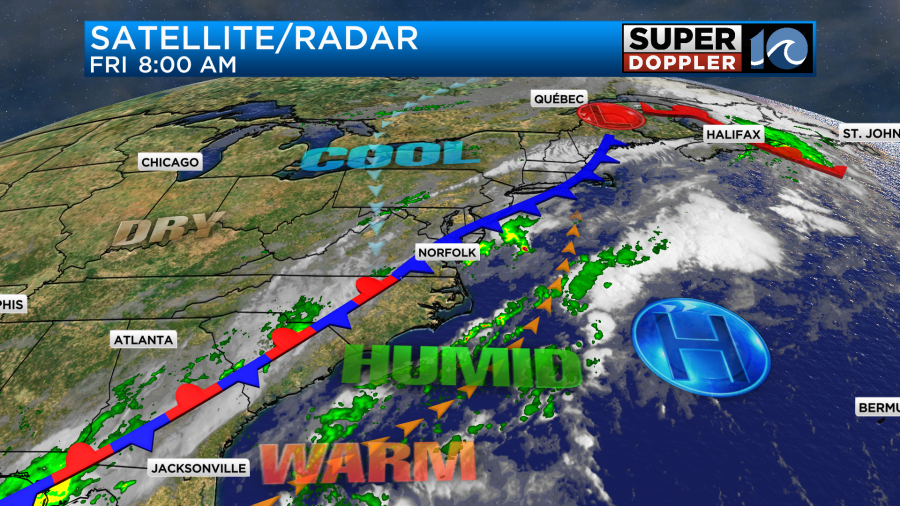
The cool front is moving slowly into the area. It is in the process of stalling out already.
High temps will be more in the upper 70s to low 80s today. We’ll have a light north breeze develop. We will have some more scattered showers and a few storms later today.
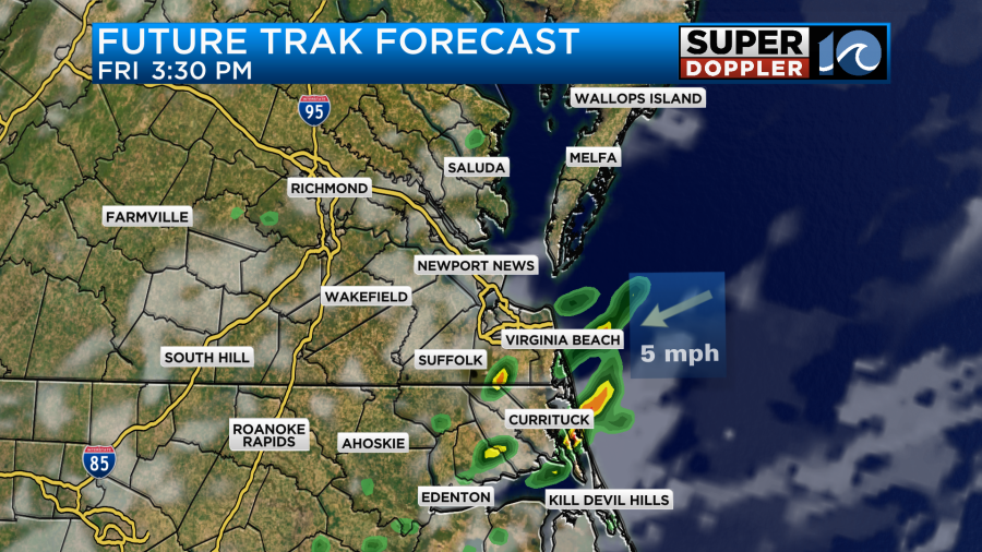
Tomorrow the front will be sitting on top of us. Plus, there will be an upper-level low overhead. This is going to create a lot of clouds. We’ll also have an increasing chance for rain showers with a few thunderstorms later in the day.
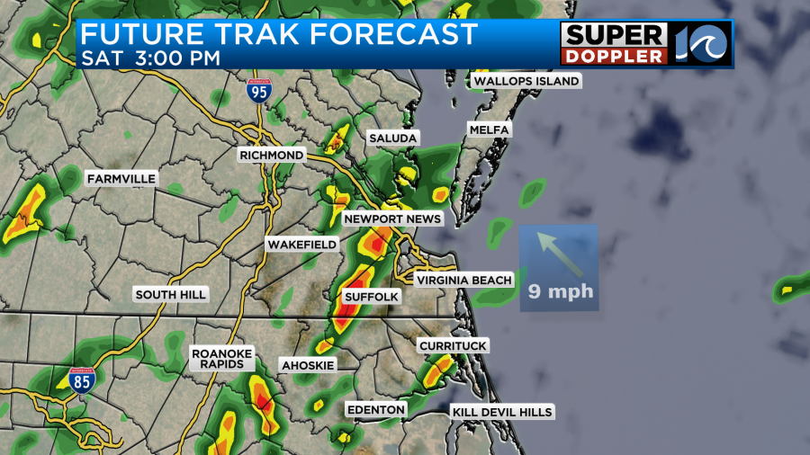
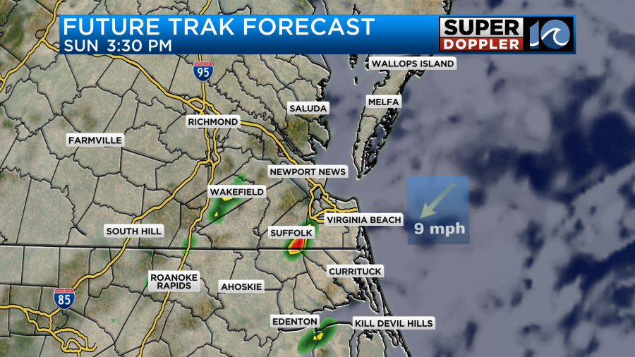
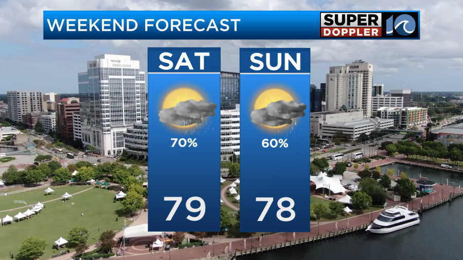
Heavy rain will be possible. High temps will be in the upper 70s. We’ll have a light east breeze. Then we’ll have similar weather on Sunday. The front will still be nearby with the upper-level low overhead. This will create more scattered showers. However, some of the models show more breaks in the rain on Sunday.
Luckily the wind doesn’t look too bad over the weekend. High temps will be in the upper 70s again.
Then there may be more rain with the wind increasing Monday into Tuesday. That will depend on what happens in the tropics.
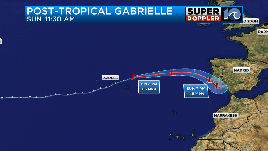
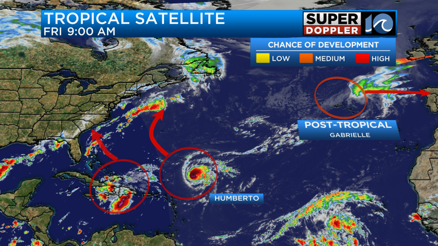
The tropics are busy, but things are in-flux. Hurricane Gabrielle weakened over the last 24 hours. It also became post-tropical. However, it did bring some hurricane forced gusts to the Azores islands. Now it will impact western Europe as an area of low pressure.
The next thing we are focusing on is hurricane Humberto. As of the 5am update it had become a category 1 hurricane.
The forecast calls for Humberto to move to the northwest and quickly strengthen into a category 3 then 4 hurricane.
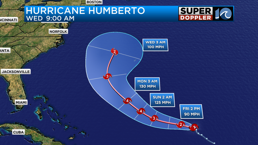
As of this time it looks like the center of Humberto will miss Bermuda. It’s pretty set that it will stay east of the U.S. Coast. However, this thing is expected to become very strong and become very large from the weekend into next week. This will likely send us some large waves and rough surf Sunday into next week. There could be some more beach erosion as well.
Meanwhile, there is a cluster of showers and storms around Haiti that will likely form into the next tropical system. This could happen by later today, or it may happen during the weekend.

This feature will likely move to the north/northwest and eventually head towards the southeast coast. The latest models are in pretty good agreement in sending it towards the South Carolina coast. However, a cool front comes in and either sends it east or west, or even turns it back to the south a bit.
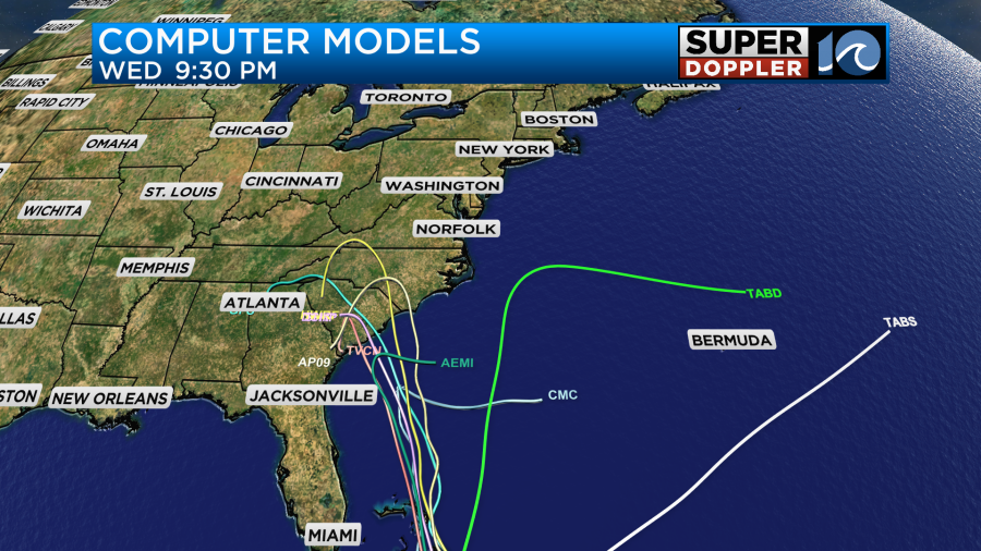
The GFS and European models are in good agreement on all of this up through Sunday.

However, they are different in the timing and placement of these features going into Monday.
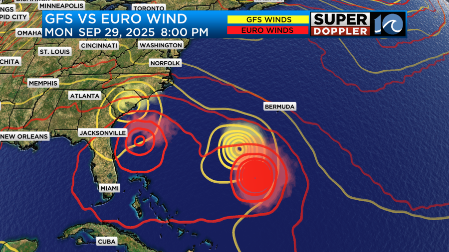
The GFS Brings the potential system (Imelda) up into South Carolina, and then it has it falling apart and going back to the southwest. Meanwhile, the European model has it drifting back to the south but maintaining some strength.
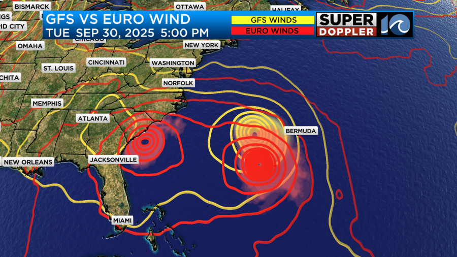
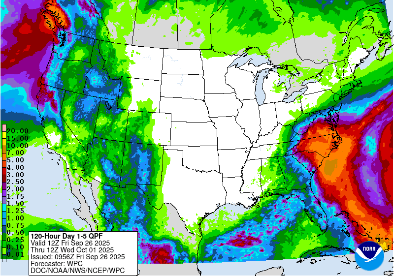
They would likely be interacting with a cool front. I do feel like the GFS handles fronts better while the Euro does better with tropical systems in general. So we’ll see which way the models trend over the weekend. Regardless, even with the system hanging to our south. It would push lots of rain up our way. So we could see a lot of rain over the region from that characteristic. Here is the Weather Prediction Center’s rainfall forecast for days 1-5:
By the way…Take a look at how large the GFS makes Humberto by next Thursday. Wow!
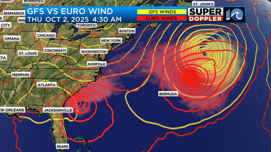
Luckily it would be out over the middle of the Atlantic by that point. Either way I think we will have some much cooler air arrive by later next week on the back side of that system.
Stay tuned for updates over the weekend on all of this.
Meteorologist: Jeremy Wheeler