Get ready for a weekend split! It will be warm and humid for today before a cold front moves through giving us a Sunday refresh. Let’s break it down.
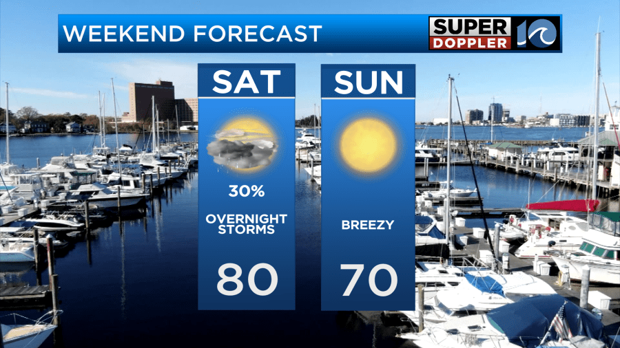
It will be a warm and humid day today as southwest winds ahead of an incoming cold front increase our temperatures and humidity. There will be a few opportunities for rain throughout the day today but the best chance for heavier rain and strong thunderstorms moves through this evening.
We have already dealt with a few light showers early this morning. Otherwise, we have a mostly cloudy sky overhead with more rain on the way for the midday hours. Any rain that falls will be light with little accumulation.
After the midday rain, I think we will break into a good amount of sunshine mixed within the clouds. A few spotty showers are possible but most of the region should be dry for most of the afternoon. It is at this point when temperatures reach the upper 70s to lower 80s and it will be pretty humid due to all the moisture around from previous showers.
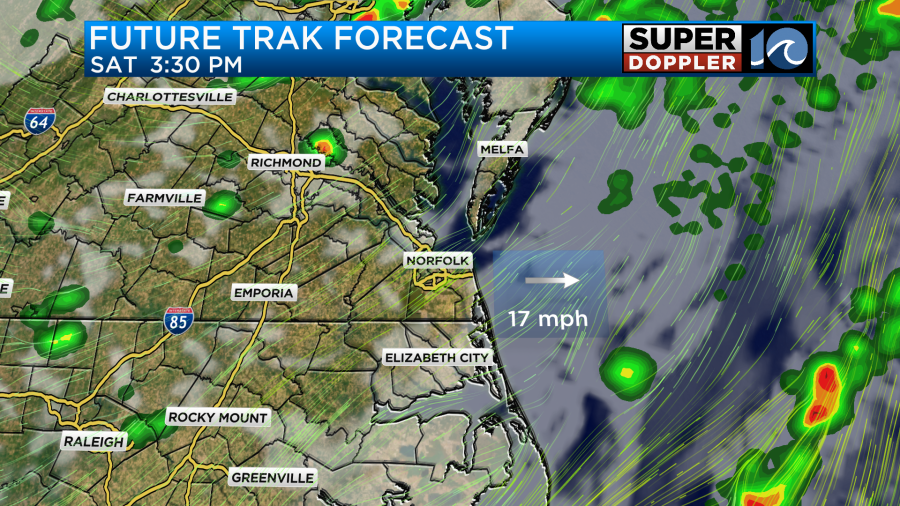
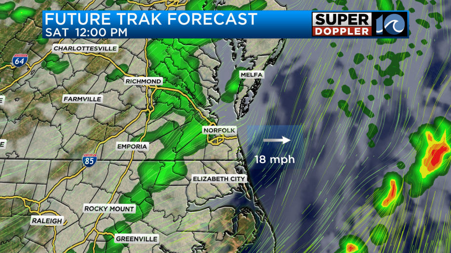
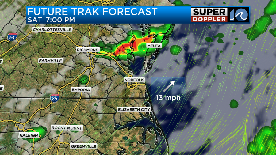
We will not stay dry for long as the cold front later this afternoon will be getting closer. We will watch for a line of storms to develop off to our northwest during the late afternoon and early evening hours and drop through our area. These storms will be along the cold front and there is the potential for some stronger storms. The primary risk will be gusty winds over 60 mph and small hail.
Storms will impact the Eastern Shore and the Peninsulas first with heavy downpours and isolated damaging wind gusts. This will take place around dinner time before moving southeast over the course of the early evening. The Hampton Roads cities and into the southside should expect storms to arrive between the hours of 8 and 10 pm. Then around midnight, storms will push into northeast North Carolina and the Outer Banks as the cold front passes and brings in cooler and drier air.
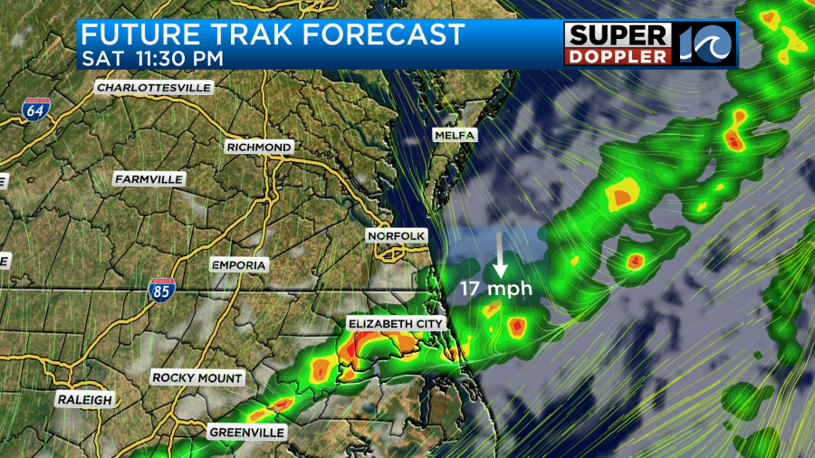
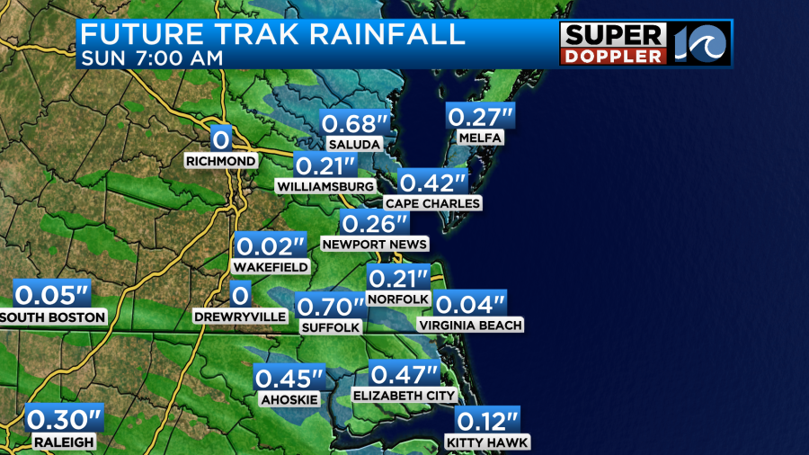
Portions of the area could get a quick half an inch of rainfall as the storms move through but that will only be for isolated areas that experience the strongest storms.
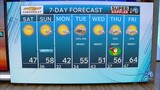
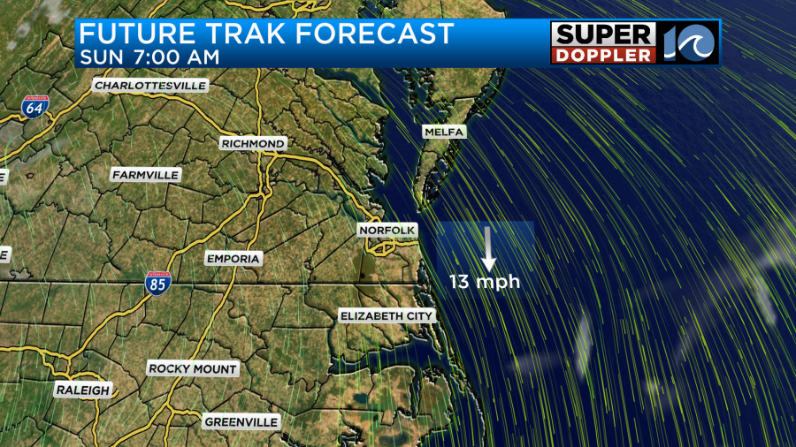
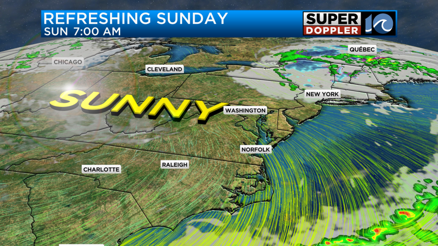
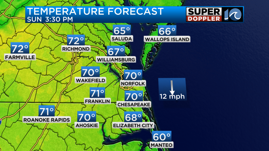
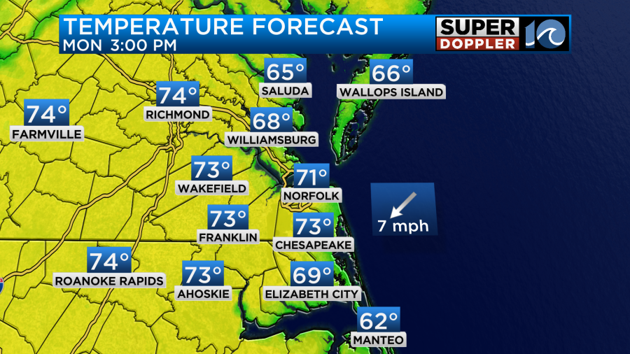
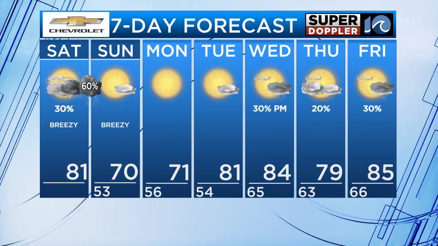
As winds turn northwesterly heading into Sunday morning our air will feel nice and refreshing with much lower due points. High temperatures Sunday and Monday will be in the upper 60s to lower 70s with sunshine overhead as high pressure settles in across the area.
As high pressure slides offshore and our next weather system approaches later in the upcoming work week, high temperatures will soar back in the 80s with daily chances for rain.
Have a great weekend!
-Meteorologist Brian Michigan 🤙