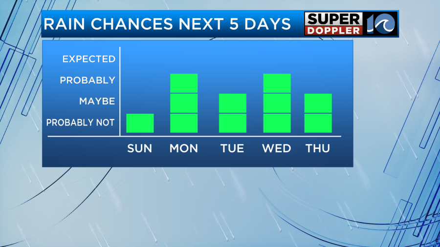
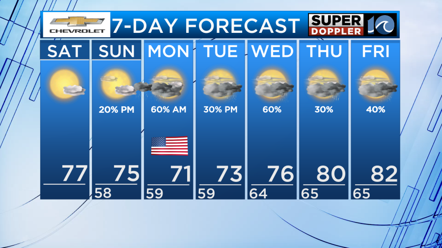
This weekend will mark the start of an active weather pattern across Hampton Roads as rain chances increase. This will all be due to a stationary front lifting northward allowing for waves of rain to move into the area over the course of the week ahead.
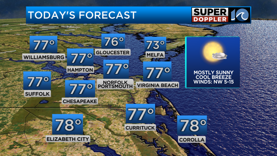
It will be important to take advantage of the dry time while we have it this weekend but it will be hard to come by as we go from Monday to Friday. For today, dry air will allow for sunny and dry weather. It will be a little cool from time to time with winds out of the northwest at 5-15mph but generally highs will be near average in the upper 70s.
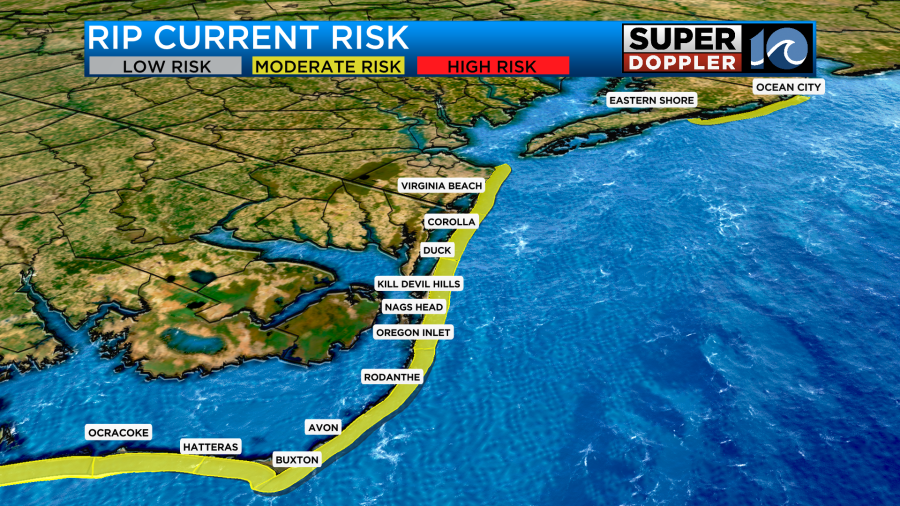
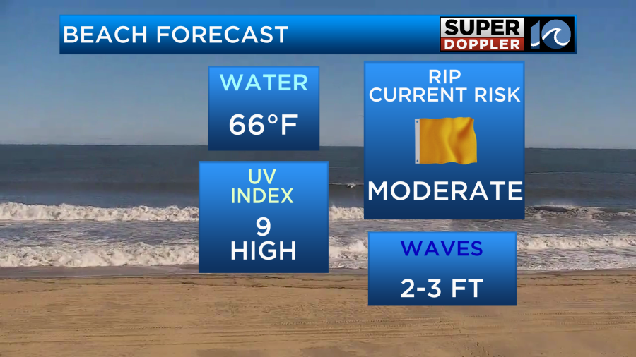
Headed to the beach? Make sure you bring lots of sunscreen! The sun is strong this time of year and with a UV index of 9 it will not take long for sunburn to set in. Additionally, there is a moderate risk for rip currents up and down our coast. If you plan on taking a dip in the water, make sure you are near lifeguards and if they give you any warnings about the conditions it will be a good idea to listen.
As we head into the day tomorrow it will once again be sunny and dry. The sun will be out for the entire morning and early afternoon period. This will allow for temperatures to return to the mid 70s. This is still below normal for this time of year because of a northerly wind direction.
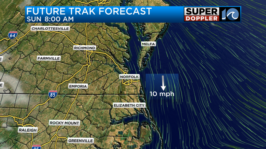
During the middle and late afternoon hours of Sunday, clouds will increase as a front off to our south drifts north near our area.
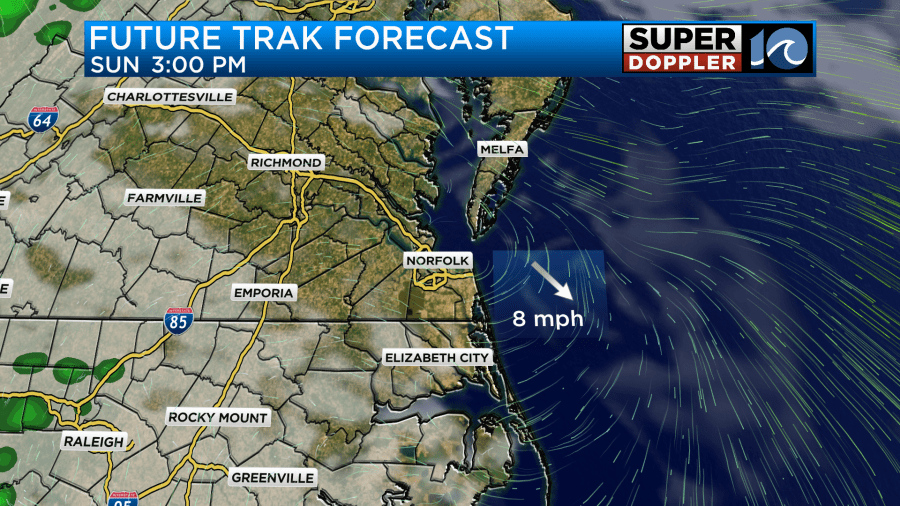
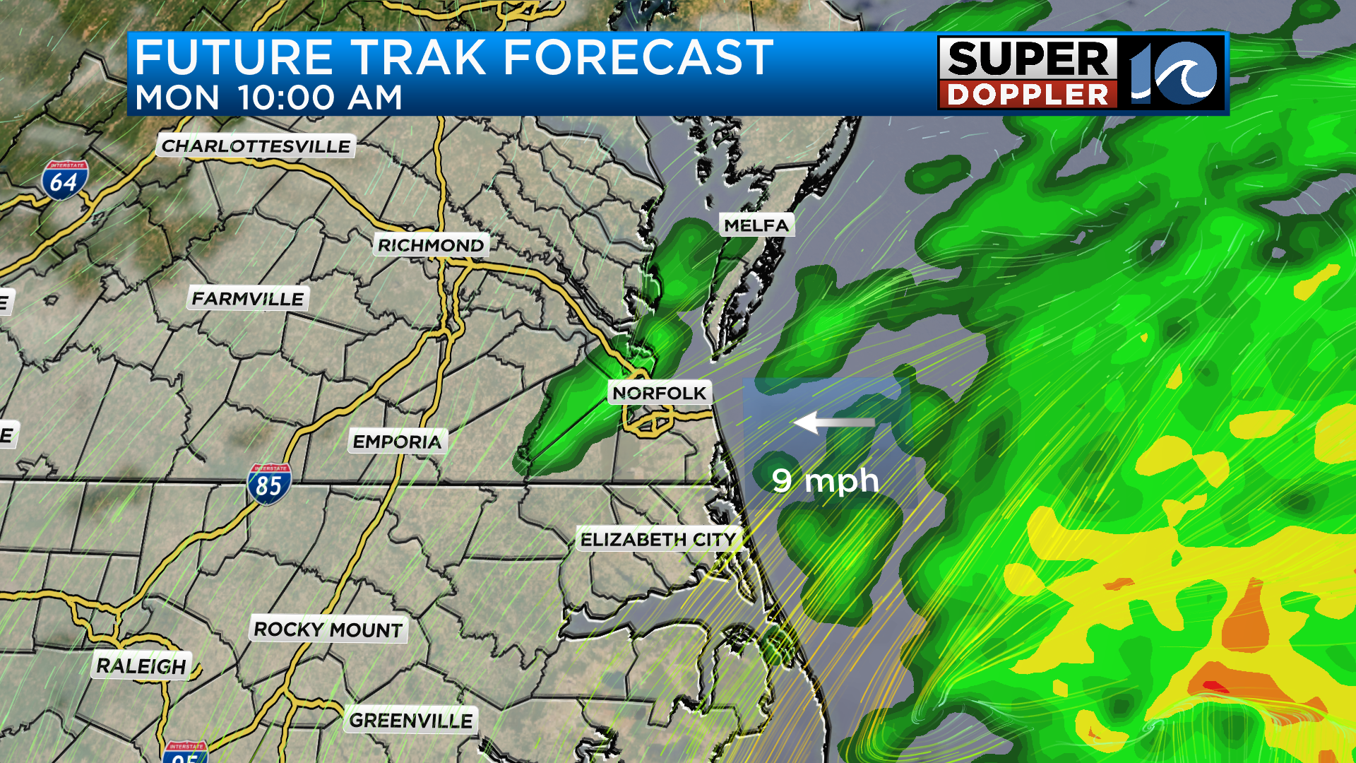
As the front continues to lift north, rain chances will increase during the late evening and throughout the overnight.
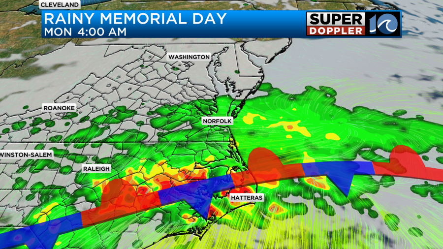
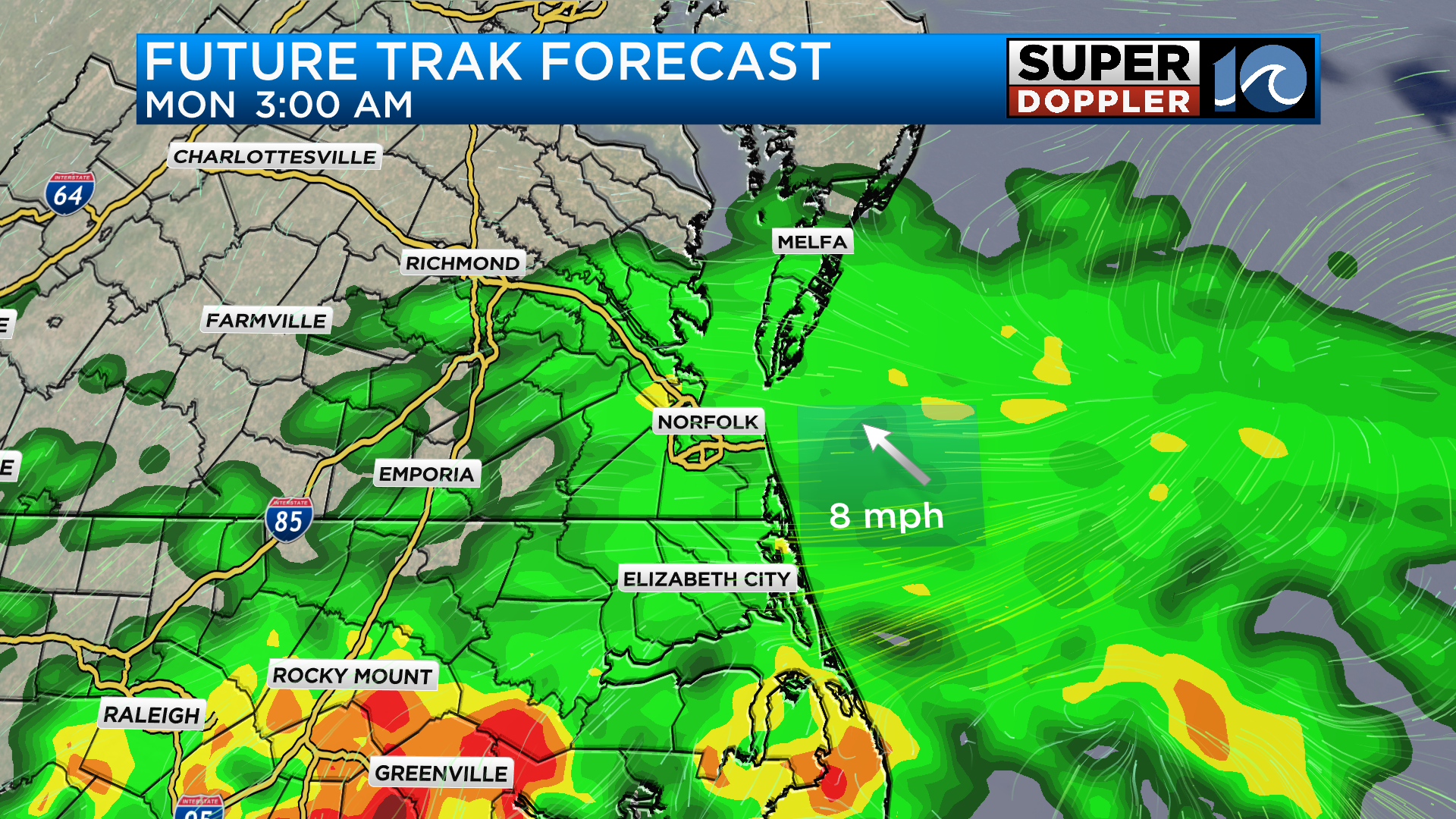
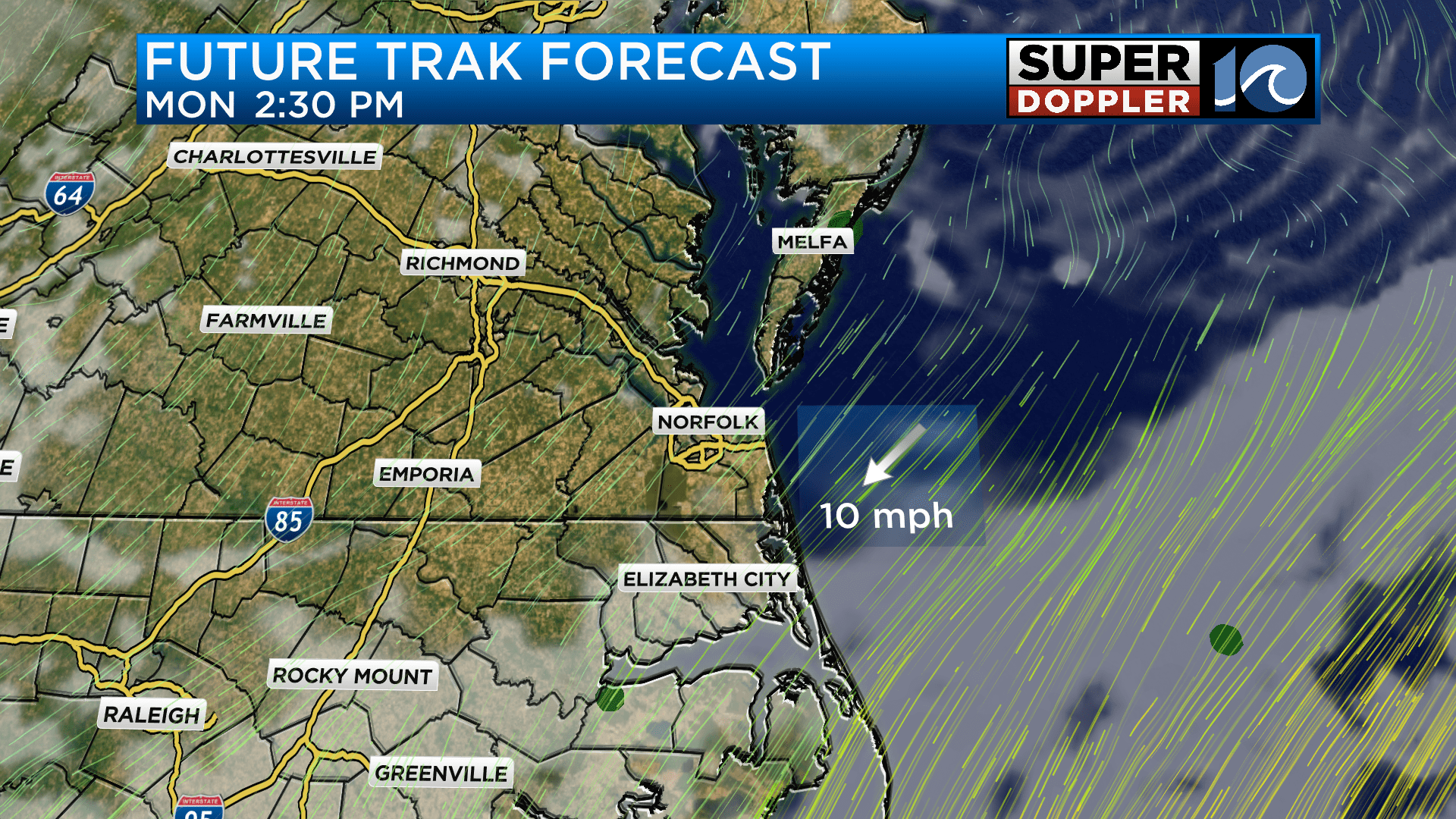
Heavy rain will be possible at times especially in northeast North Carolina. The timing for the heaviest rain will likely be early Monday morning. As we approach the middle of the day on Memorial Day, rain will start to taper off and sunshine could fill back in during the afternoon. High temperatures will be cool regardless of how much sun manages to return with highs around 70 on Memorial Day.
With this stationary front lingering during the week ahead, rain chances will continue as this front will act as a conveyor belt for moisture to ride along. Temperatures as a result will stay below normal through the middle of the week.
-Meteorologist Brian Michigan 🤙