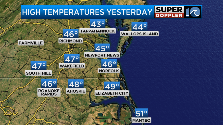
Yesterday was the last chilly day for a while. As expected, we ended up in the mid 40s with a few spots near 50 degrees.
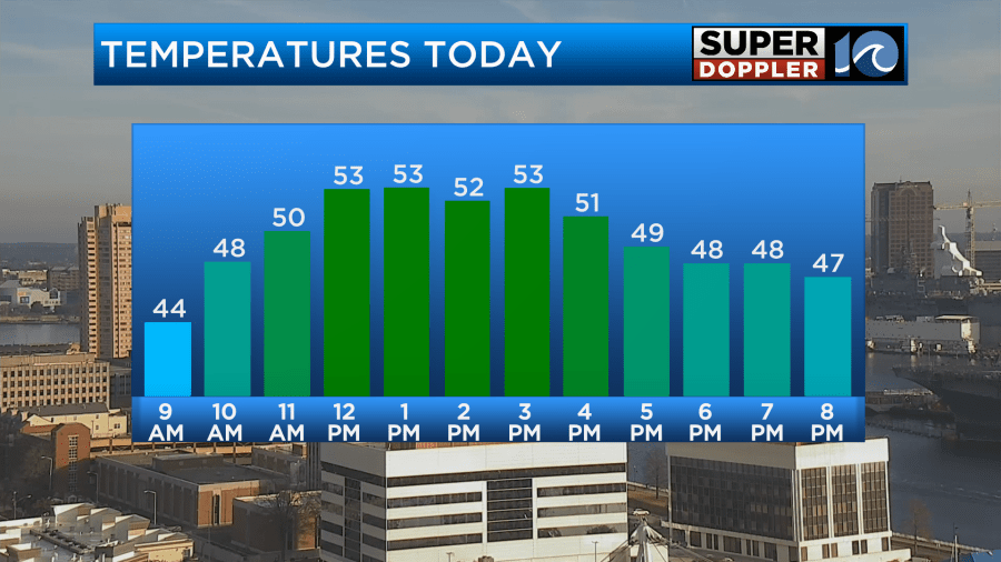
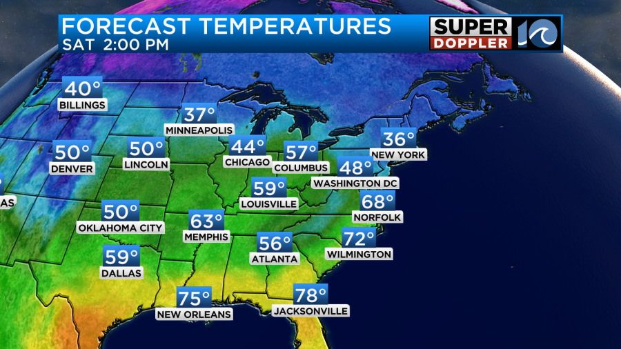
Today we will start to transition to some warmer temps. Highs will be in the low 50s this afternoon despite increasing clouds.
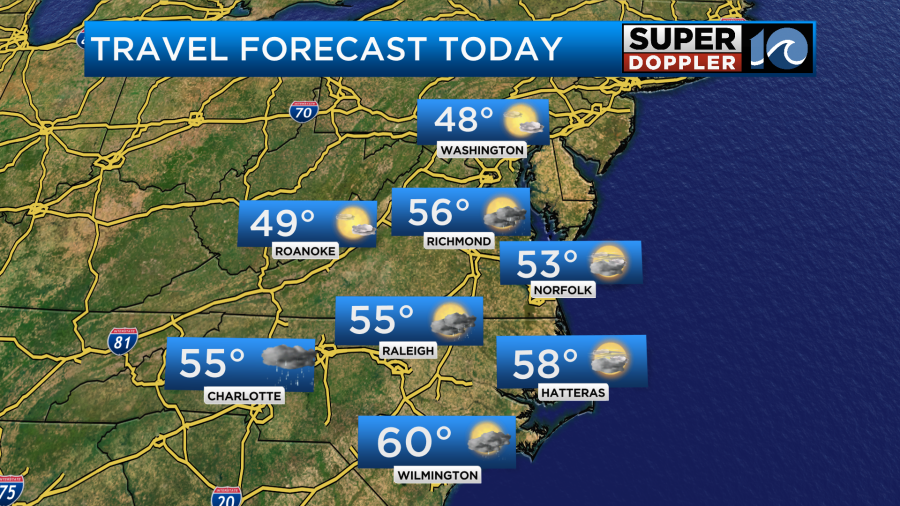
A lot of locations will be in the 50s today. There will be some rain in the region, but it should be in the form of scattered/light showers.
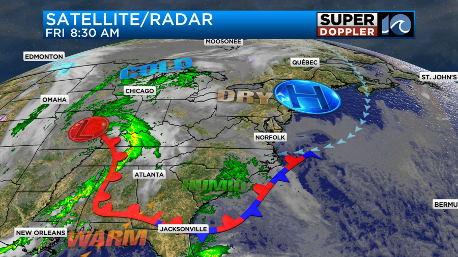
Our local area won’t see much rain. As mentioned, we’ll have increasing clouds. However, I think we’ll only have some stray showers with a few sprinkles. The reason is that the air is still fairly dry at the surface. It’s overhead where the moisture will be increasing. High pressure is to our northeast. There is a stationary front far to the south that is turning into a warm front.
There will be some problem areas for travel today across the country.
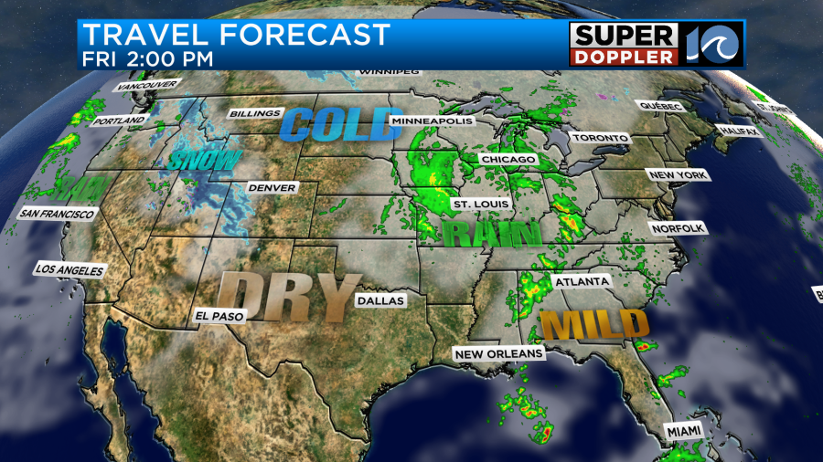
Parts of the Southeast and Midwest will have rain showers and even some thunderstorms. Snow will fall again between Denver and Boise. Tomorrow’s travel will also have some problems.
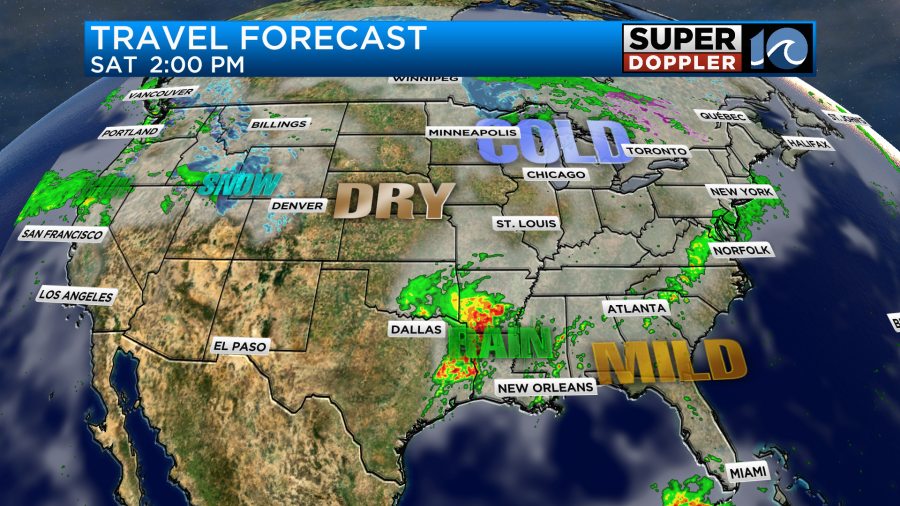
The rain over the Midwest will travel east. We’ll have a few showers here with more rain just to our west.
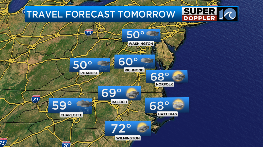
We’ll have a few showers here tomorrow, but there shouldn’t be too many.
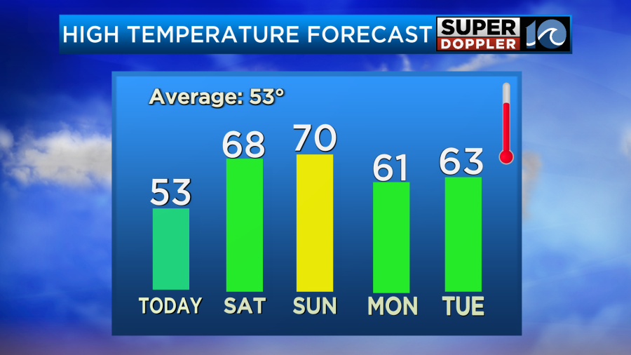
There should be a good amount of time to get outside and enjoy the warm temps. Highs will be in the upper 60s, and it’s possible that a couple of 70s show up.
It will be warm for much of the country. We’ll be about 15 degrees above average here. Skies will be mostly cloudy, but the sun may pop out a little at times. Winds will be light and out of the south. Humidity will increase through the day. Dew points will rise into the 40s and 50s.
By Sunday we’ll warm up even more. High temps will rise to near 70 degrees.
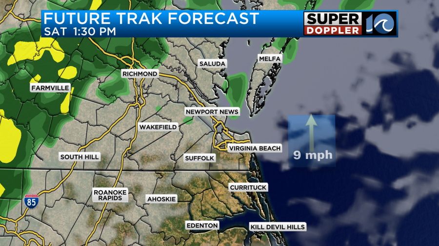
We’ll have a stronger breeze out of the south. That will push up the temperatures, but it will also increase the moisture. We’ll have a few showers during the afternoon. Some models bring in a lot of rain by the mid-late afternoon. However, our Future Trak model brings most of the rain in during the evening.
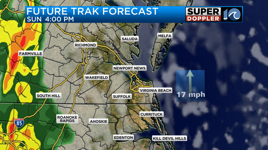
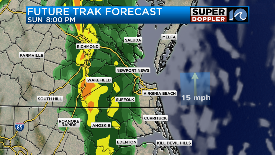
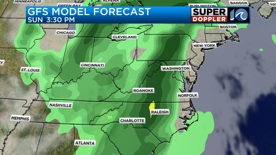
This will be a big line of rain showers with some heavy downpours. There may also be a few thunderstorms. If we get some sunshine prior to the line coming through, then it’s possible that a few strong storms may form. We’ll see. Either way that is just ahead of a cool front that will slide through on Sunday night. We’ll only cool down to the low 60s though for Monday and Tuesday. That means that we’ll be pretty mild going into the New Year. We will cool down quite a bit later next week.
In national news… There were a few tornadoes across the Deep South yesterday. A couple of them were caught on camera. There was some damage. I’d say this is unusual, but due to Global Warming tornadoes have become almost common during the Winter Months now.
Meteorologist: Jeremy Wheeler


