There wasn’t much rain in our region yesterday during the afternoon. However, last night a big line of showers and storms headed towards our area.
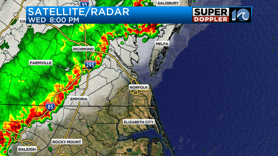
Once again there were heavy downpours around the Richmond area, but as the line moved east it rapidly weakened.
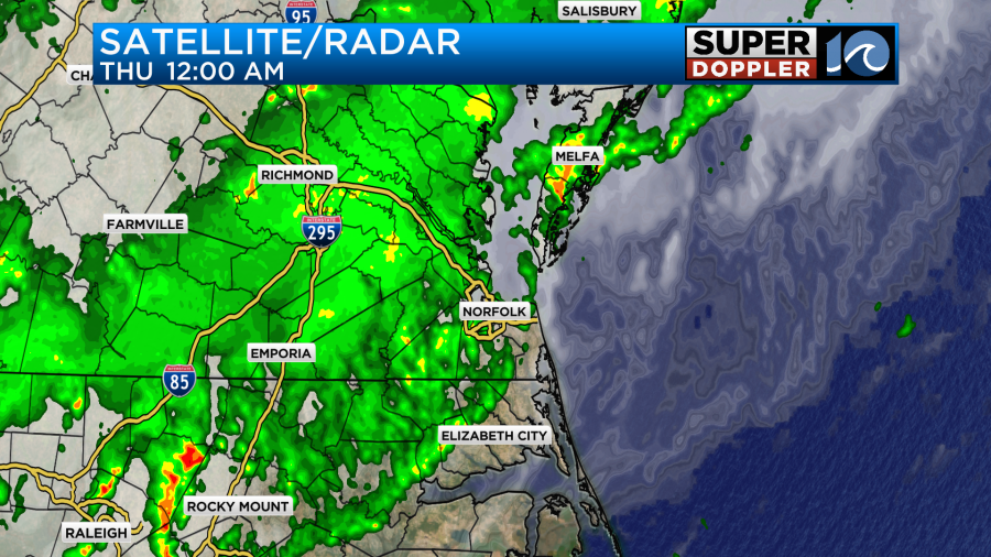
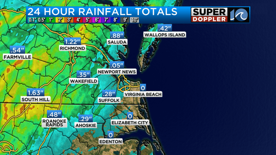
So we did get some rain in our region, but it really did fall apart as it moved into Virginia Beach and Currituck county.
Rainfall amounts were light, but some inland and northern locations had a good soaking.
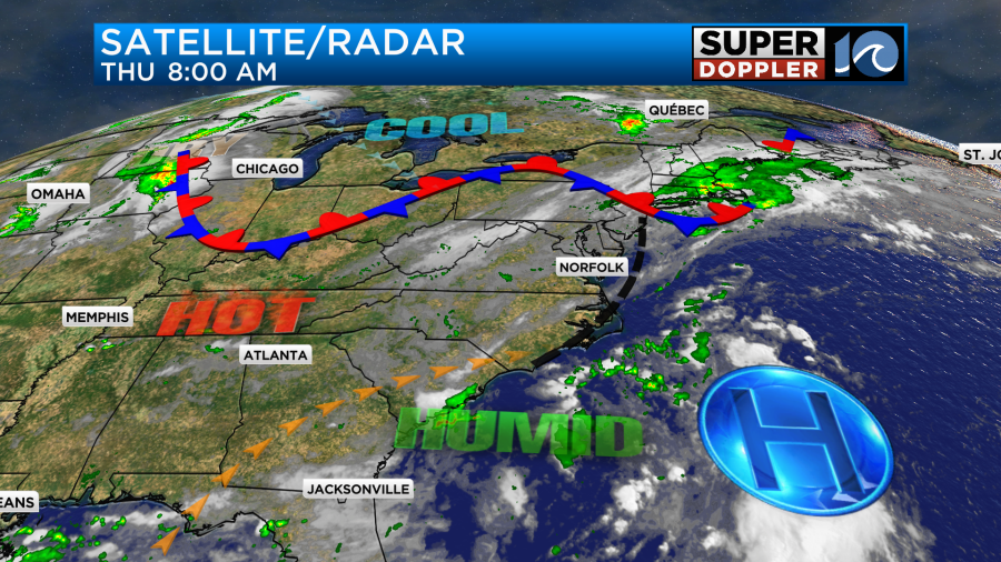
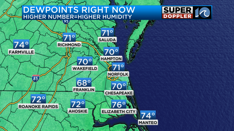
There was plenty of heat and humidity for the storms to feed off of. However, a focus formed along the storms. It was an outflow boundary. This boundary moved through and cooled us down a little last night. It also dried us out slightly. That boundary is shown as the broken black line below.
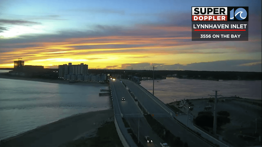
So this morning it was pretty nice out as folks headed out the door. Here is one of the nice views from one of our tower cams this morning.
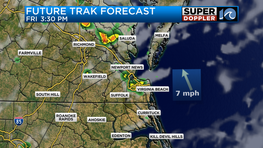
With that boundary in the area and a weak disturbance overhead there will be a better chance for rain during the day today, and it should be more into our region. We already had a few showers this morning. We’ll have more develop through the day.
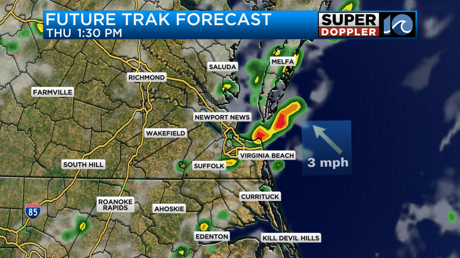
Heavy rain will be possible between the early afternoon and the evening.
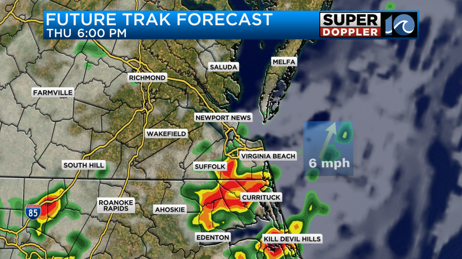
There is a Flood Watch north and west of the metro again. HOWEVER, this is where there has been a good amount of rain recently. Heavy rain will be possible outside of the watch. It’s just that the watch area has a ground that is much more saturated. So keep that in mind. We do also have a marginal risk for severe weather later today.
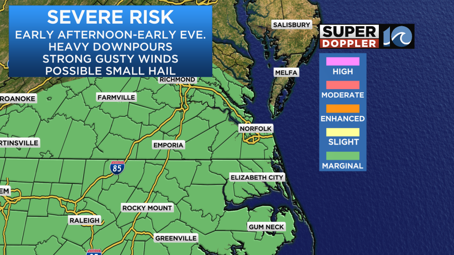
Heavy downpours and strong/gusty winds will be the main threats. Small hail will also be possible.
The update has temps a little cooler today. High temps will aim more for the mid-upper 80s.
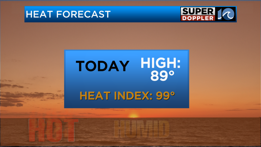
If the storms really flare up, then that could even drop the temps this afternoon for a time. The heat index could briefly be up into the mid-upper 90s, but that’s better than the 100s that we’ve had recently.
Tomorrow we’ll be partly cloudy. There will be a few showers and storms during the afternoon.
It doesn’t look like there will be as much coverage tomorrow. That could be because the upper-level disturbance is forecast to move out. Plus, the boundary should fall apart. There may be an onshore breeze for a bit Friday. So for now I have high temps in the upper 80s again. The heat index will be in the mid-upper 90s.
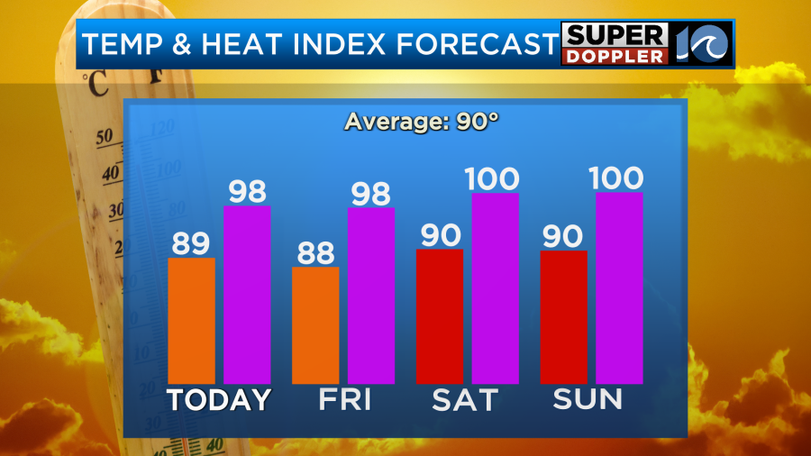
It will be nice to get a bit of a break from the high heat and humidity. Yet over the weekend, we’ll have lower rain chances, and the temps will go back up a bit. High temps will be around 90 degrees. The heat index will be near 100. I have a 30% chance for rain Saturday afternoon, but only a 20% on Sunday. Stay tuned for updates on that.
Meteorologist: Jeremy Wheeler


