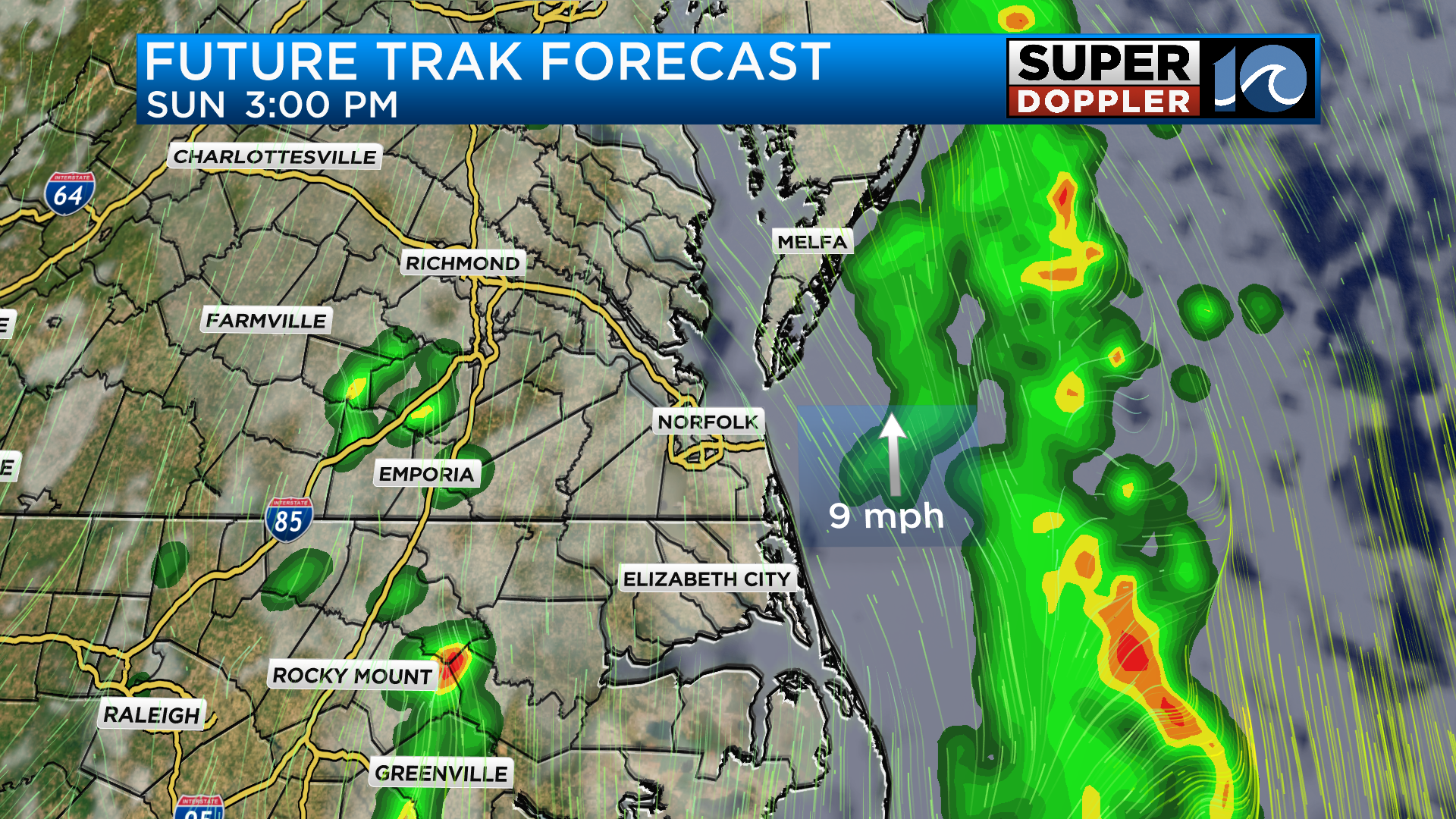
After a summer-like day yesterday we’ve got some rainfall moving through the region and some pockets of rain have been heavy throughout Sunday morning. An area of low pressure to our west will be in no hurry to move out over the next 24 to 36 hours which means we will likely have a few more rounds of rain to deal with heading through tomorrow.
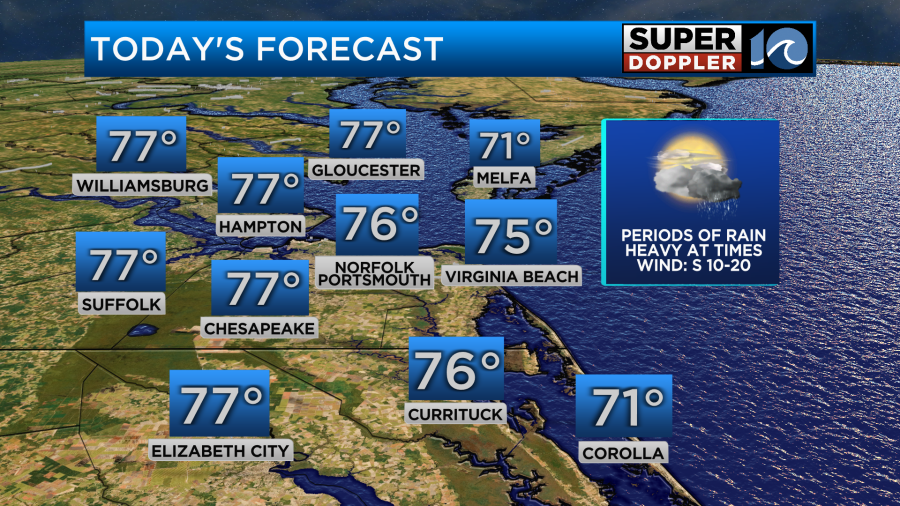
High temperatures yesterday got into the upper 80s due to an abundance of sunshine and a strong south westerly breeze. Today will be a different story as a mostly cloudy sky and periods of rain hold temperatures in the 70s this afternoon.
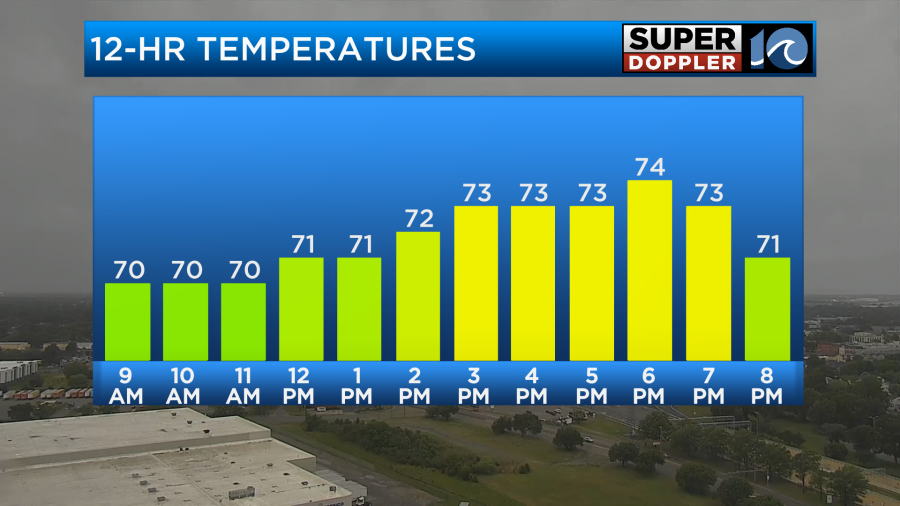
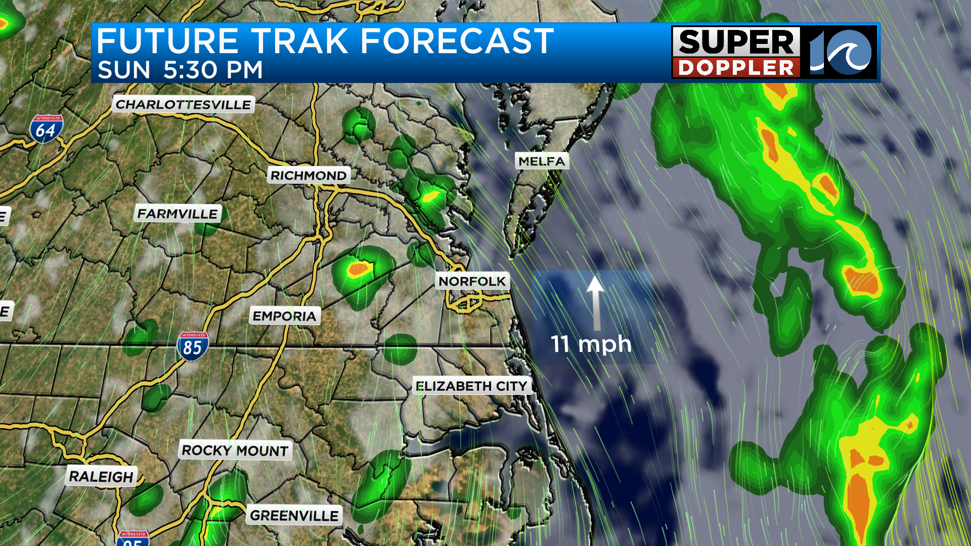
While there is widespread rain outside this morning, the whole day will not be like this. In fact, I think through the midday and early afternoon we will be dry with potentially some glimpses of sunshine. However, later in the day around dinner time, we could get a few more pop up showers and maybe even a thunderstorm.
Monday will be a much more dry day for the region but the cloud cover will remain across the area especially near the coast. High temperatures with south winds continuing will reach around 80 degrees during the afternoon. Later in the day, there will be more chances for storms but it will be hit or miss as a boundary remains across the area.

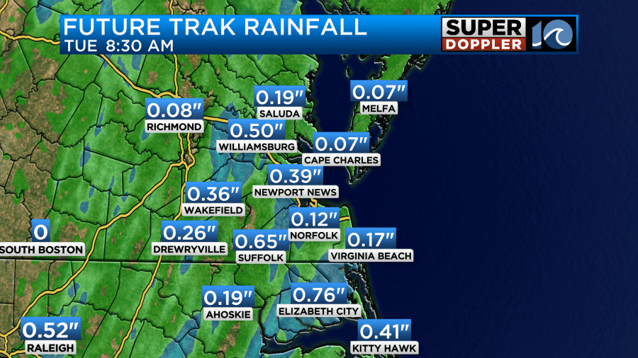
As we head into the middle of the work week conditions will be dry and westerly winds will start to pull in some drier air. As for total rainfall amounts, it will heavily depend on where the heaviest cells set up but we could get around a quarter to a half inch before this system moves away.
Stay dry and have a good week ahead!

-Meteorologist Brian Michigan 🤙