We are in store for a nice Fall weekend. A cold front is sinking more to our south today with high pressure building into the region.
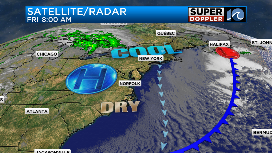
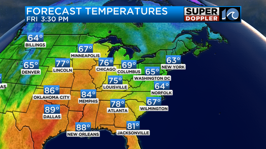
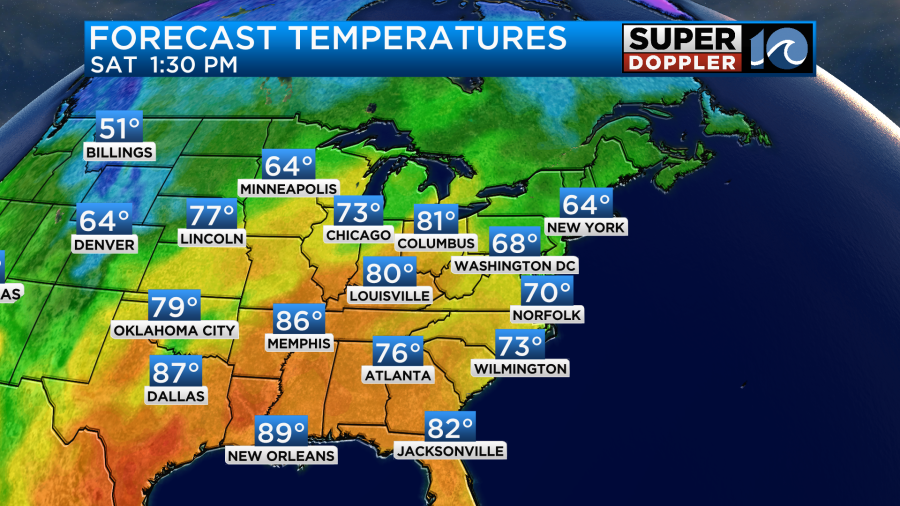
We’ll have lots of sunshine over the area today. There will be a light northerly breeze, but it won’t be too strong. High temps will make it to the low-mid 60s.
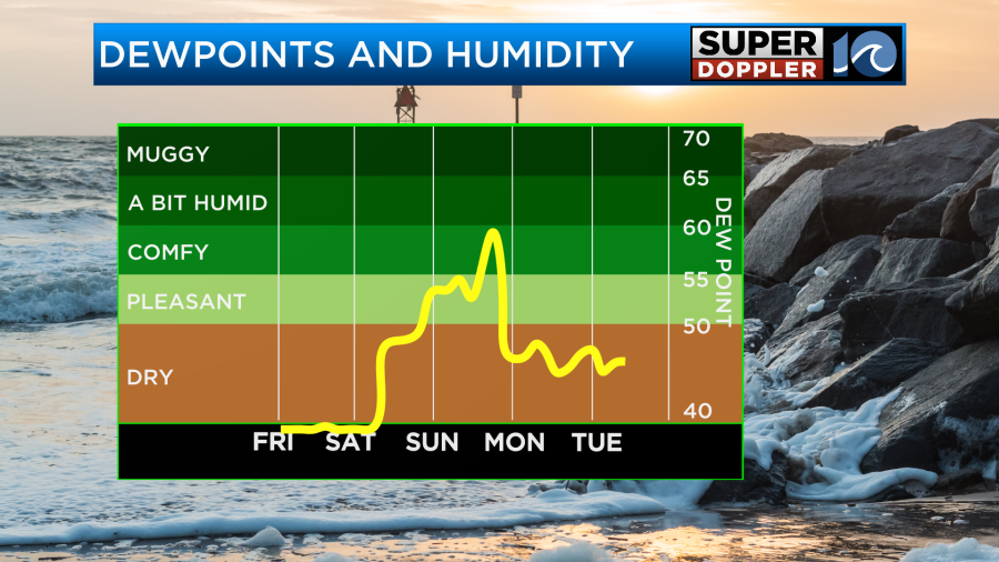
It is very dry outside. Dew points have dropped to the 30s, and it feels great! It is definitely time to open up the windows and let the fresh air in.
Tonight will be chilly. Low temps will be in the 40s with a few upper 30s inland.
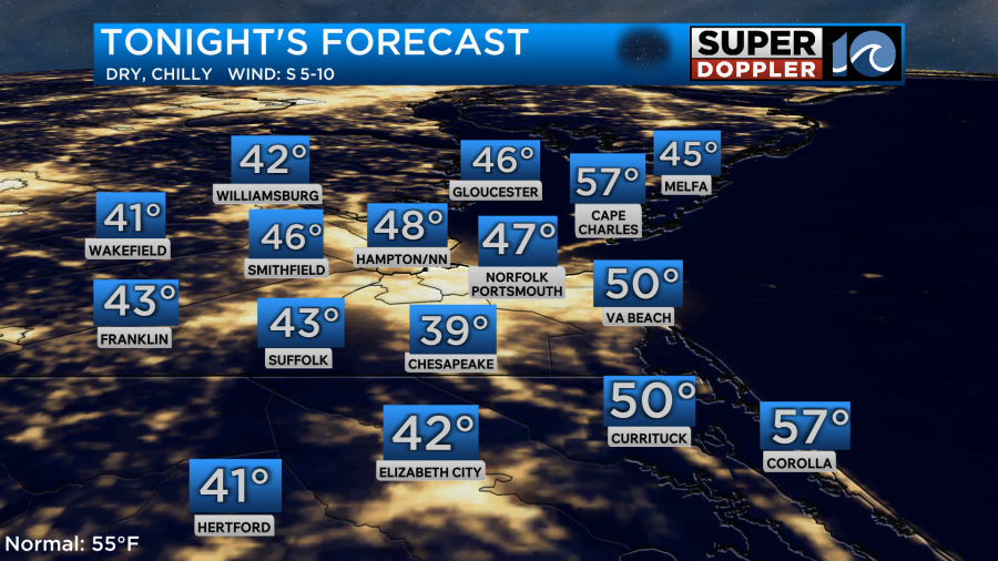
There will be a few 50s near the shore.
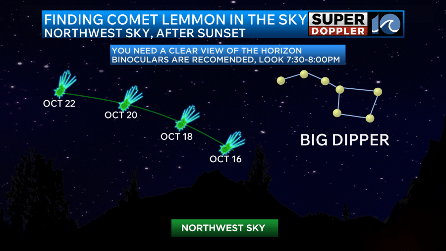
It should be good viewing for viewing the comet this evening. Comet Lemmon (2 m’s) should be visible in the sky over the next couple of evenings. A little after sunset look to the northwest sky a little above the horizon.
Tomorrow we’ll have similar weather, but there will be some slight differences. We’ll be partly sunny instead of sunny. Also, winds will be light and variable. That will let the temps warm up to around 70 degrees.
The super dry air will continue through Sunday morning. However, the humidity will increase through the day.
I’m not expecting any rain during the day Sunday. We’ll be partly cloudy with highs in the mid-upper 70s.
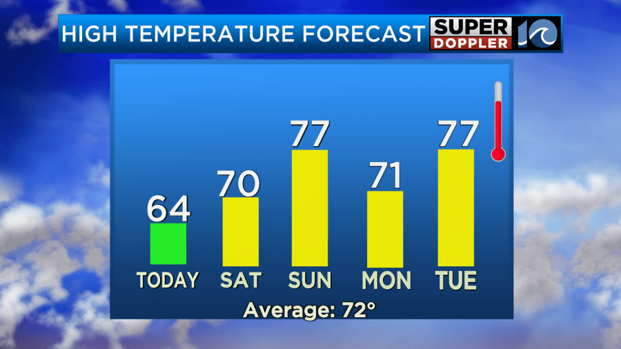
There will be a cold front moving into the area Sunday night. It may create some scattered rain showers. Those showers could continue into Monday morning. I say “may” because there is a chance that the moisture gets pinched off before it gets here. If that happens it will limit how much rain we get. We’ll see. We’ll cool down a little on Monday to the low 70s. Then we’ll warm to the upper 70s Tuesday with another cool down later next week.
There are two weak disturbances in the Atlantic that have a low chance of formation.
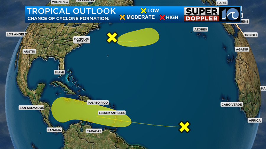
Neither of these should affect the United States.
Meteorologist: Jeremy Wheeler


