
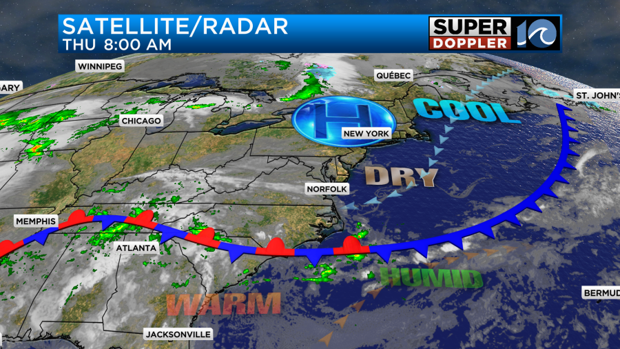
Today is the first day in a while that I’ve been able to just relax and talk about a nice weather day. Seems like there’s always something big or bad coming down the pike. Anyway, today we have high pressure to the north with a stationary front to the south.
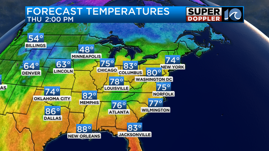
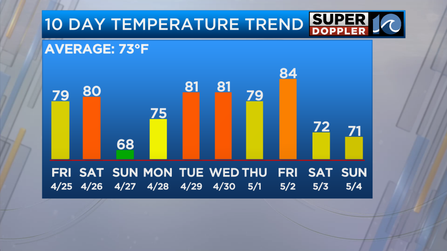
We’ll have fair skies through the day with a light east breeze. High temps will aim for the mid 70s
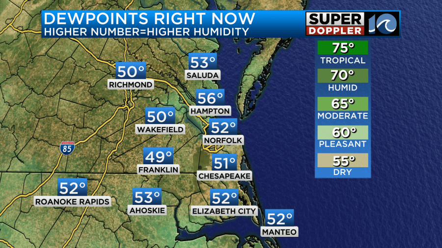
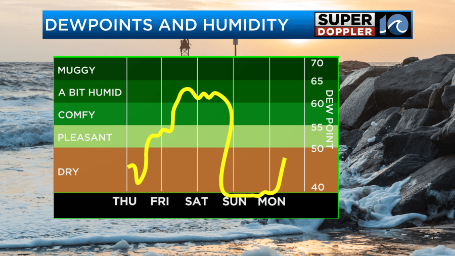
The best thing about today is that the air is very dry. Dew points are in the 40s and 50s.
There has been a little smoke entering our region from the wildfires in New Jersey over the last 24 hours. We might get a bit of haze from it today, but overall I don’t think it will be an issue. The bigger issue will probably be the pollen. Both tree and grass pollen will rise to moderate to high levels.
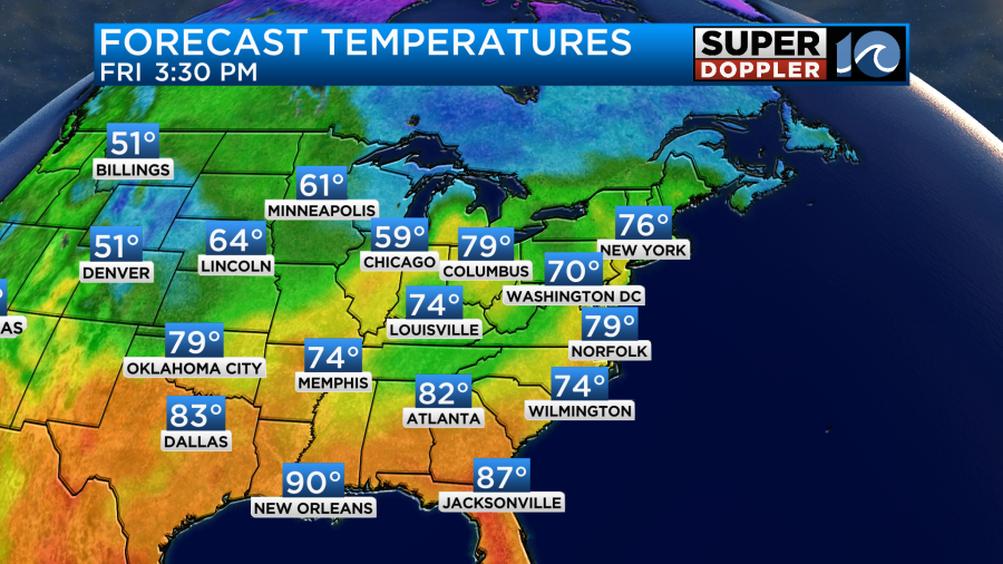
Tomorrow the wind will turn more out of the southeast. This will help to build both the temperatures and the humidity. Temps will rise to the upper 70s to near 80.
Dew points will rise into the 50s to near 60.
We’ll be partly cloudy most of the day. There may be a few more clouds during the late afternoon. Some isolated showers will be possible later in the day, but the chance for rain is low.
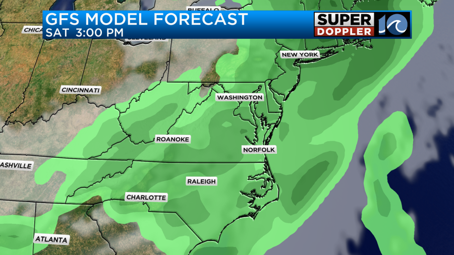
We’ll have even more clouds and humidity on Saturday. There may be some spotty showers in the morning, but there is a higher chance for scattered showers and a few storms during the afternoon.
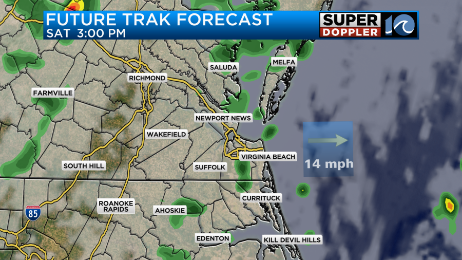
Some of the other models connect the dots (with the showers). So they have higher coverage.
High temps will be near 80. It will be warm, humid, and breezy.
A strong cold front will move through the region Saturday night. It will drop the temperatures and the humidity big-time on Sunday.
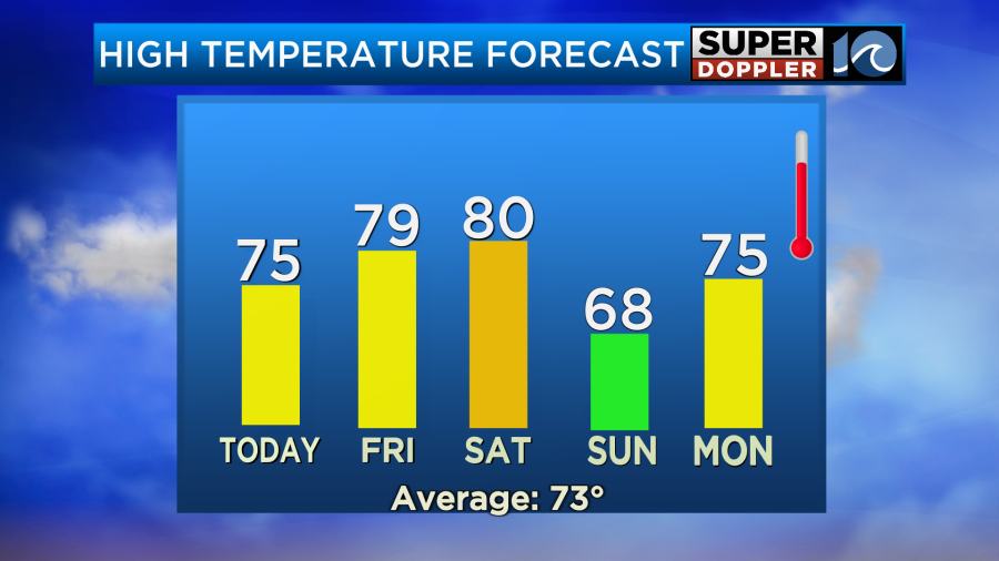
After that temps will rebound. We’ll likely go back to 80s for most of next week.
I don’t mind some warmer temps, but I just hope the humidity stays down. We’ll see.
Meteorologist: Jeremy Wheeler


