
Before I go into the more recent weather I want to back up and talk about the wind. Last year we had a very windy March. This year’s March has also been pretty windy. Take a look at the max gusts for each day this month.
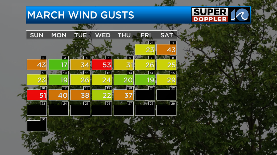
It’s a common time of year for transitions to happen in the weather. The up-and-down temps are very common this time of year. Winds were gusty again yesterday. There were several gusts to over 35mph. This morning the wind was also very strong near the shore. There were a few brief gusts to over 40mph near Virginia Beach.
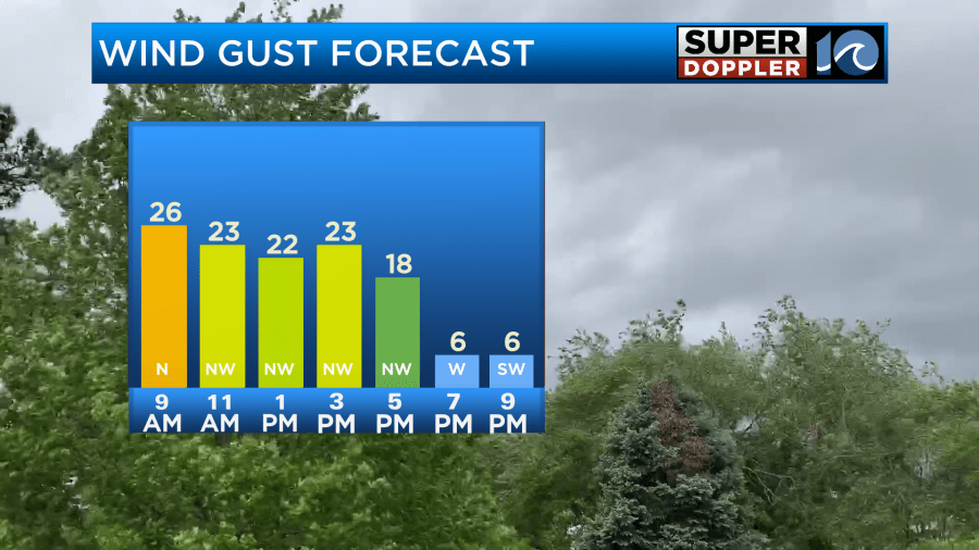
Winds won’t be that strong all day. The majority of the gusts will be around 25mph. This will last through the early afternoon. Then winds should taper off.
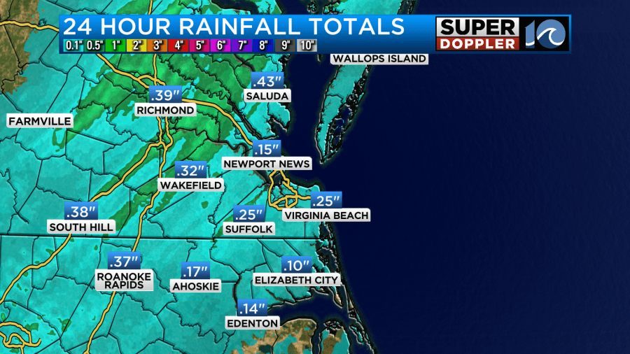
We had 3 rounds of rain over the last 24 hours. The first one arrived late in the day yesterday. The second one was the strongest. We had areas of heavy rain between about 7 and 10pm.
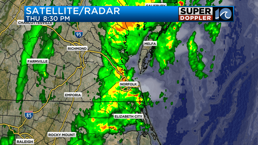
Then there was then some light and scattered rain showers before dawn. In total most of the area picked up about a quarter of an inch of rainfall. There were some spots with higher amounts. Especially northwest of the metro.
Today we will dry out and clear out. A strong cold front has pushed offshore. High pressure is building in from the west.
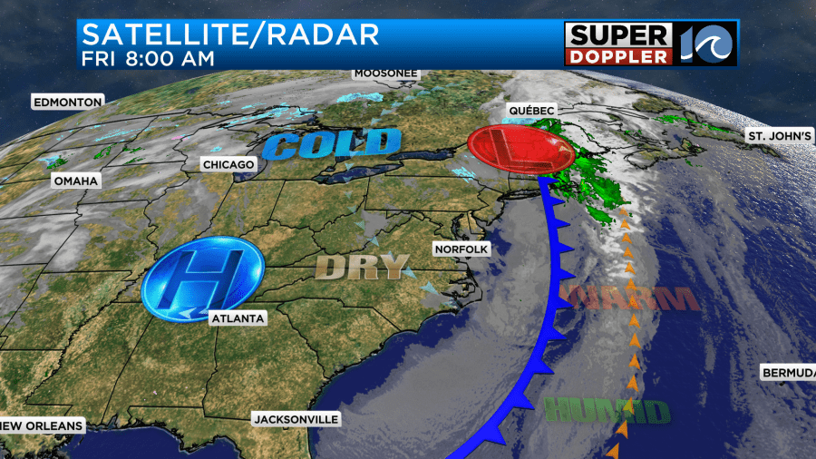
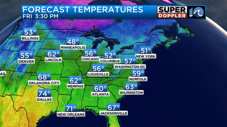
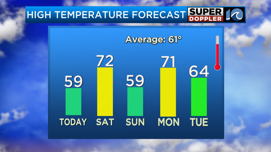
The northwest breeze behind the front will pull down some much cooler air into the region. Yesterday we hit 80 degrees at Norfolk International Airport. However, today high temps will aim for the upper 50s.
At least we’ll have more sunshine as we go into the afternoon.
The weekend is looking pretty dry, but there will be mixed temps. We’ll warm up tomorrow into the low 70s, but temps will drop to the upper 50s again on Sunday.
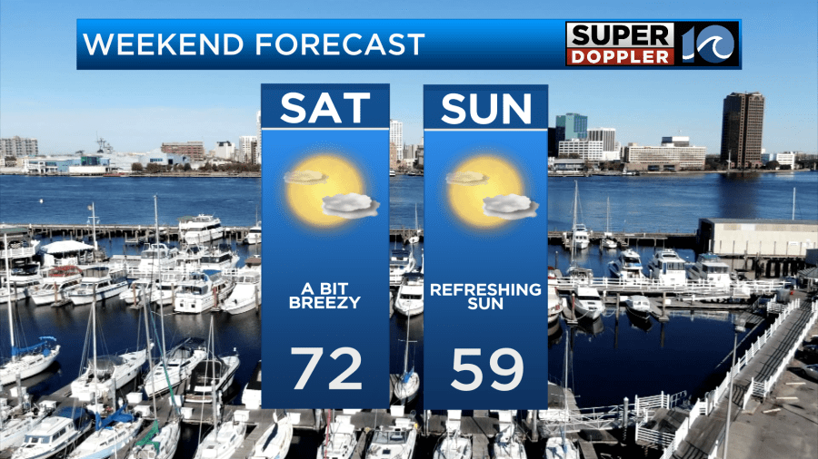
Other than a stray shower or sprinkle Saturday evening we should have dry conditions overall.
We’ll have some rain return on Monday, but it doesn’t look like much. There will be some scattered rain showers with high temps returning to the low 70s.
Meteorologist: Jeremy Wheeler


