
Before I get to the Labor Day weekend forecast I want to back up a bit and talk about climate. I looked up the info for rainfall for the year so far. If you just look at the raw numbers, then it has been a dry year for sure. Take a look!
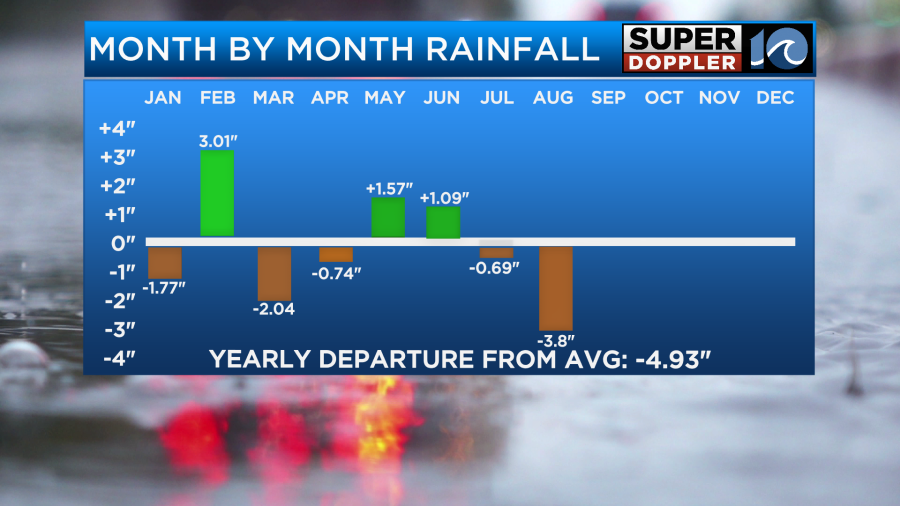
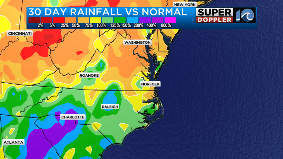
Wow. We are down 4.93″ for the year. The climate site is Norfolk, and the info comes from the National Weather Service in Wakefield, VA. Keep in mind that there were a couple of areas that had flooding over the last couple of weeks. So the number may not represent those areas very well. That shows up in the 30 day rainfall compared to average.
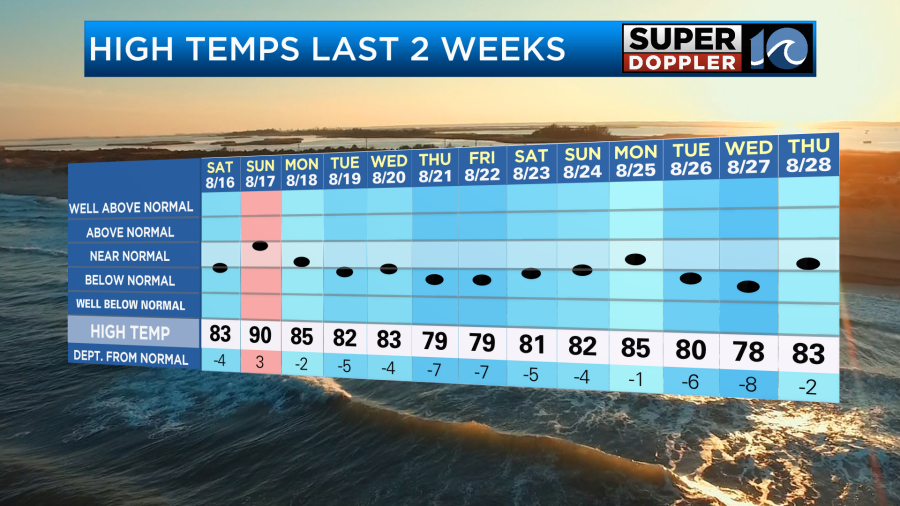
At the same time the temps have been seasonably cool over the last couple of weeks.

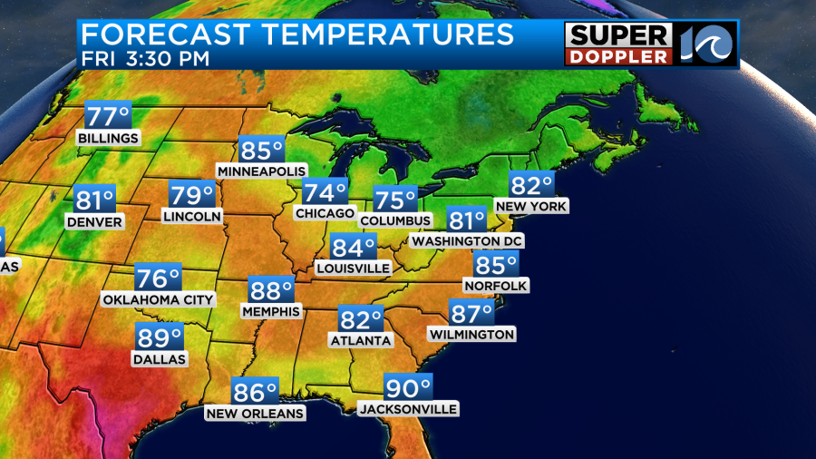
We ended up in the low-mid 80s yesterday. It was still really nice out as dry air was still over the area. We did start with a lot of clouds yesterday, but today we started off with lots of sunshine.
The strong sun this morning will allow for quick warming. We’ll also have a light west/northwest wind. So high temps will reach up into the mid 80s.
We’ll have a few more clouds this afternoon, but we won’t have any rain over the region. There is a weak area of low pressure offshore, but it is moving away from us. There is a cool front to the north with a small area of high pressure overhead.
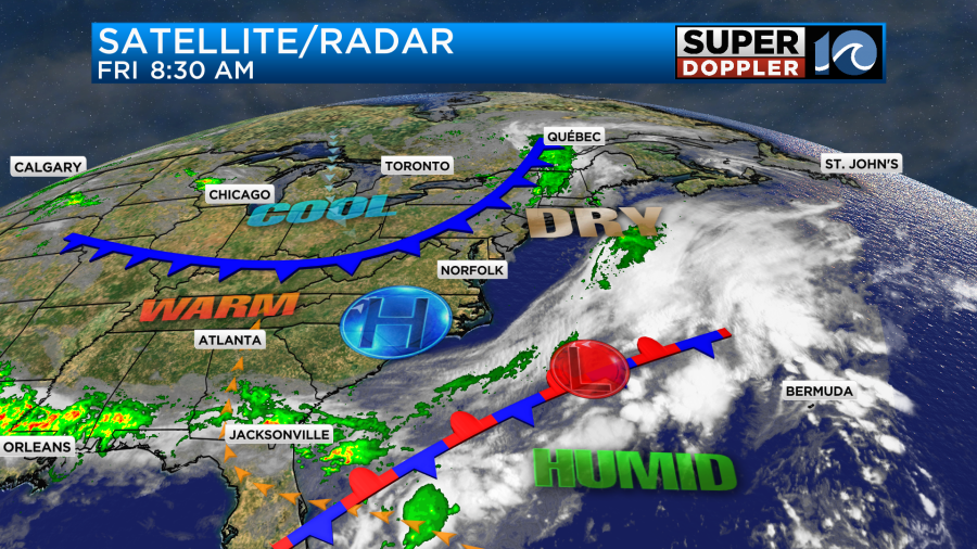
Tomorrow that cool front will slowly passing through the area. It should still be dry enough that we’ll only have a stray shower or two. We’ll be partly cloudy for the bulk of the day. Winds will turn out of the northeast. So we’ll cool down to the upper 70s to low 80s.
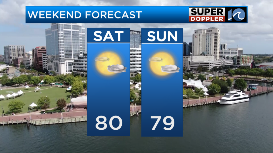
We’ll stay cool on Sunday with high temps in the upper 70s and partly cloudy skies. The humidity may rise a bit on Saturday, but overall it should stay comfortable for the next few days.
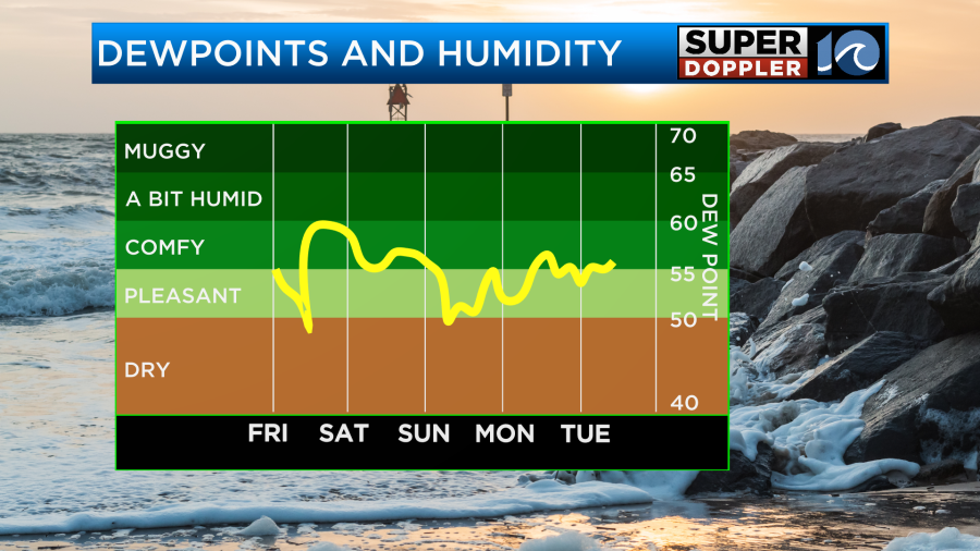
We should stay cool and dry as we go into early next week.
Things are pretty quiet in the tropics. There is one disturbance in the east/central Atlantic that has a low chance of formation as it moves west.
It could develop as it gets into the Caribbean next week. We’ll keep an eye on it.
Have a fun and safe weekend!
Meteorologist: Jeremy Wheeler


