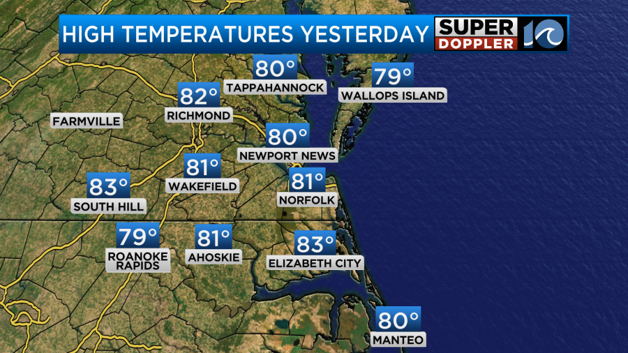
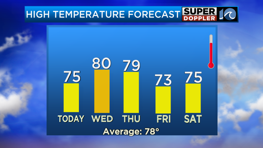
We had a great weather day Monday! It was a bit warm, but it was pretty dry and mostly sunny. High temps made it into the lower 80s.
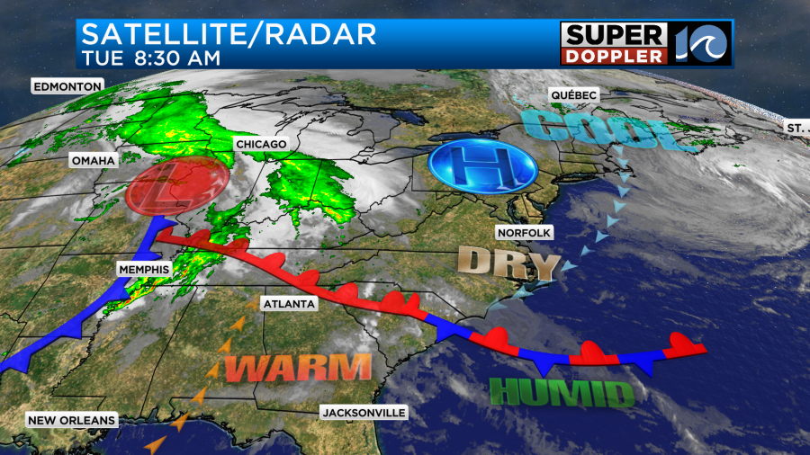
Today will be even better! We’ll be slightly cooler and drier, and we’ll still have a lot of sunshine. High pressure is to our north with a stationary front to our south.
Now before I go into how nice our weather will be I do want to mention that it has been a rough 24 hours to our west. The central U.S. got hit with a lot more bad storms. Look at all of the damaging wind and large hail reports from yesterday and last night.
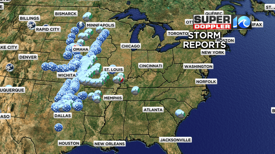
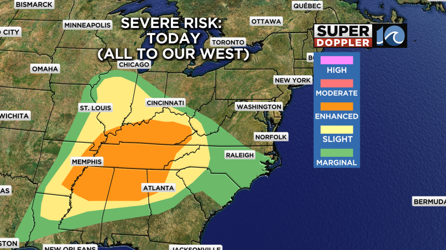
There were even a couple more tornadoes. The St. Louis area, which is in recovery mode from the recent tornado, had more storms over the region. Today the threat for severe weather will push east. However, it will be more towards the Tennessee River Valley… Not here.
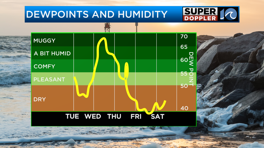
Today we’ll have fair skies. We’ll be nice and dry with dew points in the 50s. We’ll also have a nice northeast breeze at 5-15mph. This will keep our high temps in the mid 70s.
This is the kind of weather that is in the Goldilocks zone for many people this time of year. It is straight-up my kind of weather now. (I used to love warm/hot weather when I was younger). Anyway, today will be very comfortable outside.
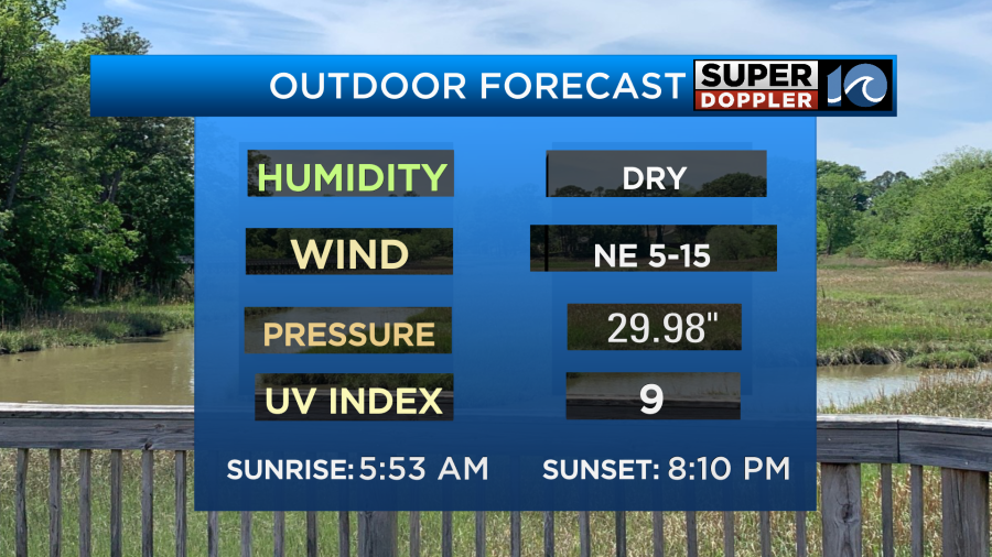
Be sure to put on the sunscreen if you are outside for a long period of time.
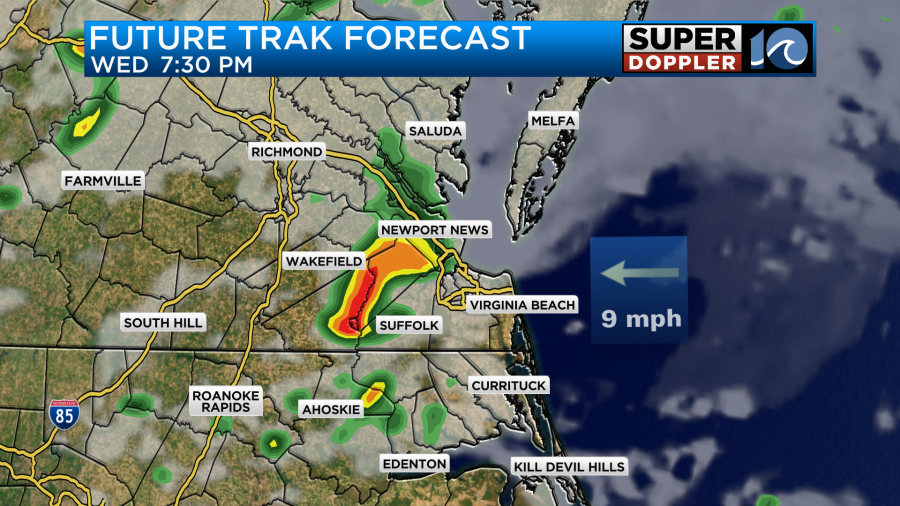
By late tonight the front will move up from the south as a warm front. There may be a few showers after midnight. Then tomorrow morning there will be some scattered showers and storms as the front arrives.
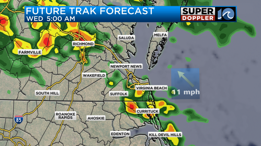
A few of the storms could be strong in the morning. At a minimum there could be some heavy downpours that could slow down traffic. As of right now it looks like a few rounds of showers and storms will move through during the day. The area of low pressure will be sliding east during that time.
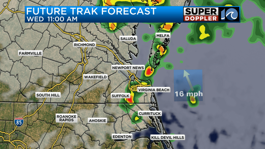
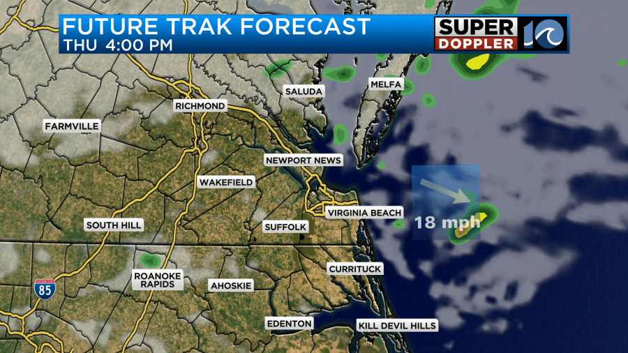
Future Trak suggests a break in the rain for a while in the afternoon, but some other models keep the rain going. Future Trak does have the last round rolling through during the evening with a few strong storms possible.
There is a marginal risk for severe weather tomorrow.
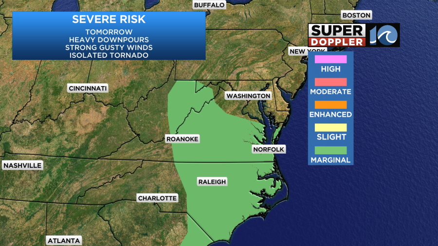
Strong/gusty winds and heavy downpours will be the main threats. An isolated tornado can’t be ruled out, but the chance is low.
We’ll have a southeast wind at the surface running at 10-15mph with gusts to 25mph. So it will be a bit breezy even outside of any storms that form. That breeze combined with a mix of sun and clouds will push our high temperatures back up to around 80 degrees.
Humidity will climb quickly tomorrow too. So it will feel pretty muggy outside with or without the rain.
By Thursday the area of low pressure will push offshore, and it will pull a cool front through behind it. However, moisture will wrap-around on the back side of the storm. So we’ll have a mix of sun and clouds with some scattered rain showers. There could be some isolated thunderstorms, but I doubt we’ll have any severe weather.
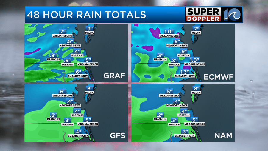
Before it ends we could see a quarter to three-quarters of an inch of rainfall with some isolated amounts around an inch.
High temps will be in the upper 70s Thursday. On Friday and Saturday we’ll return to some cooler/drier conditions. High temps will be in the low-mid 70s.
There may be a few showers returning on Sunday. Possibly some more rain on Monday for Memorial Day. Stay tuned for updates.
Meteorologist: Jeremy Wheeler