This morning was cold for late March. We had temperatures dropping down into the 30s, and there were even a couple of upper 20s in a few inland spots.
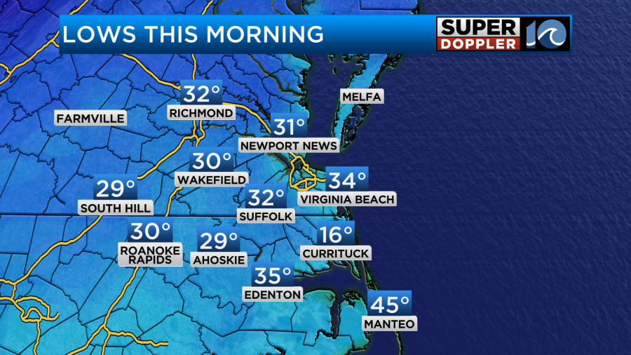
It wasn’t a surprise that there were low 30s inland, but I didn’t expect the 20s. Folks need to remember that you can still have some very cold air in March. Here is the (average) last frost dates.
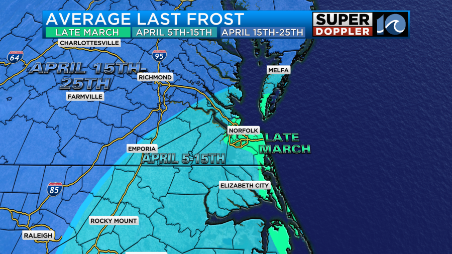
I would say that it’s still possible to get a frost near the water in Virginia, but it’s doubtful over coastal North Carolina. Remember though, we have had snow before in April. 2007 comes to mind. So I would wait to plant anything in the garden (except broccoli and cabbage) until at least another week or two.
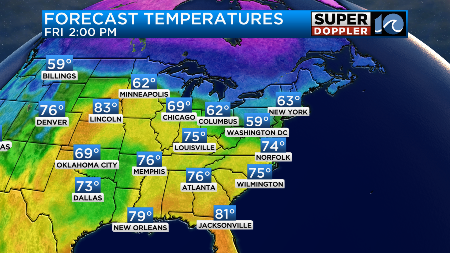
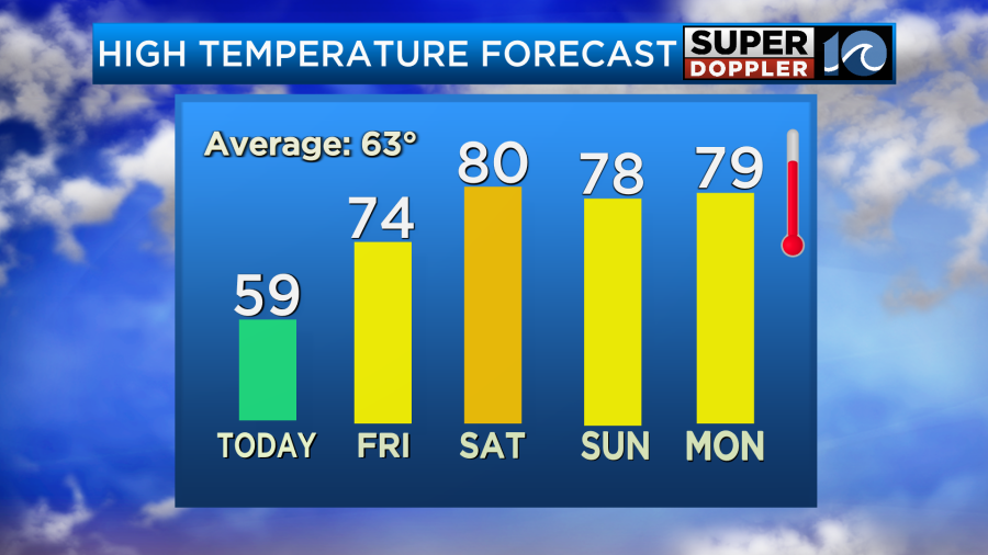
Anyway, so we did have some cold air this morning. We will have a dry and chilly day today. High temps will only warm to the upper 50s with some low 60s inland/south.
A cold front is rolling offshore with high pressure building in from the west.
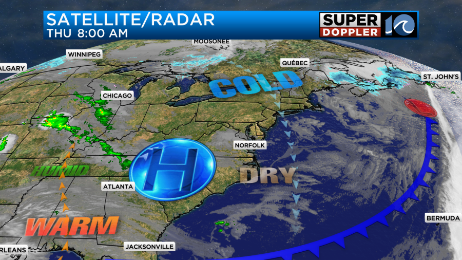
We’ll have a lot of sunshine today, but there will be a persistent/light northerly breeze. That will keep things cool and dry.
By tonight the winds will turn out of the south/southwest. It won’t be a strong wind, but it should be enough to prop the temps up a bit. So we’ll probably bottom out more in the 30s and 40s Friday morning. Then through the day tomorrow we’ll keep warming up. We’ll have a mix of sun and clouds. Winds will gust up to 20mph out of the southwest. Temps will rise to the low-mid 70s in the afternoon.
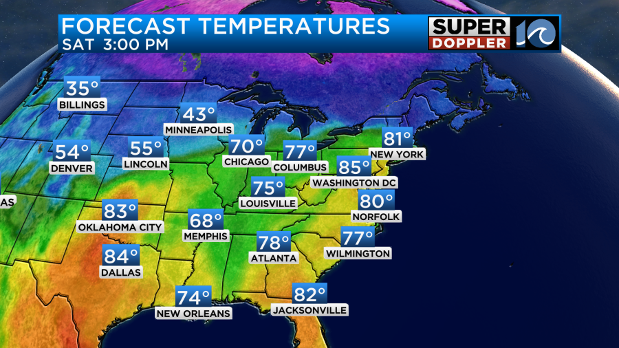
A warm front will also lift up from the south. That front may create some isolated showers in the afternoon. I will say that the models have trended drier over the last 24 hours. For now I have the chance for rain only at 20%. By Saturday the warm front will be well to our north. We’ll have a mix of sun and clouds with a stronger southwest breeze. So high temps will push up to near 80.
We’ll stay warm on Sunday. Highs will still be in the 70s.
However, the moisture and clouds will increase. We’ll be mostly cloudy with some scattered showers in the afternoon.
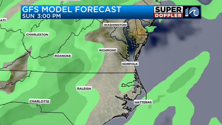
The models have trended a bit drier for Sunday as well. It will be breezy though. Then on Monday we’ll still be warm with highs in the 70s. However, we’ll have lots of clouds with scattered rain showers at times. There will be some thunderstorms later Monday as a cold front approaches from the west. There could be a few strong storms. We’ll see. We’ll definitely cool down on Tuesday.
Meteorologist: Jeremy Wheeler