
The upcoming weekend forecast is looking pretty good. For a while it looked like we might catch a lot of rain showers from an offshore low, but over the last 48 hours confidence has increased that any impacts (besides the rip currents) will be minimal. The low that I’m talking about is currently drifting over a stationary front offshore. Meanwhile, high pressure is to our northwest.

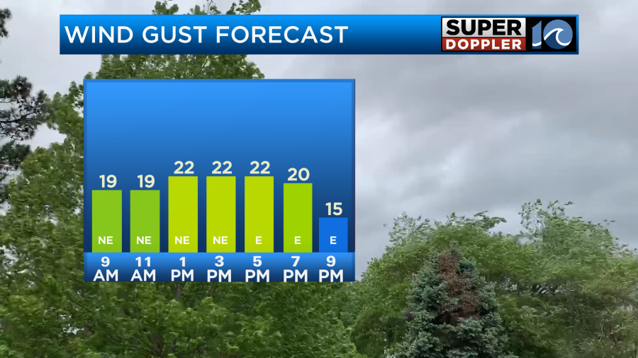
The effects from the low itself will be small, but the combination of the offshore low and the strong high to the northwest will allow the winds to pick up out of the northeast today. They will gust up to 25mph near the shore with gusts between 15 and 20mph inland.
For sky conditions we are looking pretty good. We’ll have a mix of sun and clouds through the day. There may be a few showers coming in off of the ocean, but I only have the chance for rain at 30%. That may even be a bit high. High temps will run in the upper 70s to low 80s.
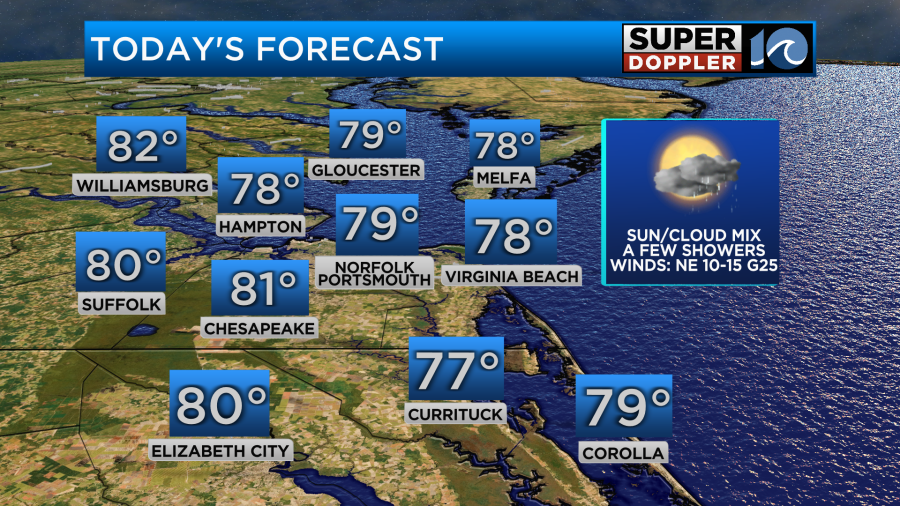
Unfortunately, there is that high risk for rip currents up and down all our beaches again today.

The surf is definitely rough. Waves are running 4-7 ft, but it even looks too rough for surfers.

The waves will probably stay up tomorrow, but hopefully things will settle down by Sunday.
The weekend forecast looks pretty good. The low will head out to sea. It could strengthen a little, but that likely won’t happen until it is pretty far away. So we’ll have partly cloudy skies both days with only a stray shower or two on Saturday.
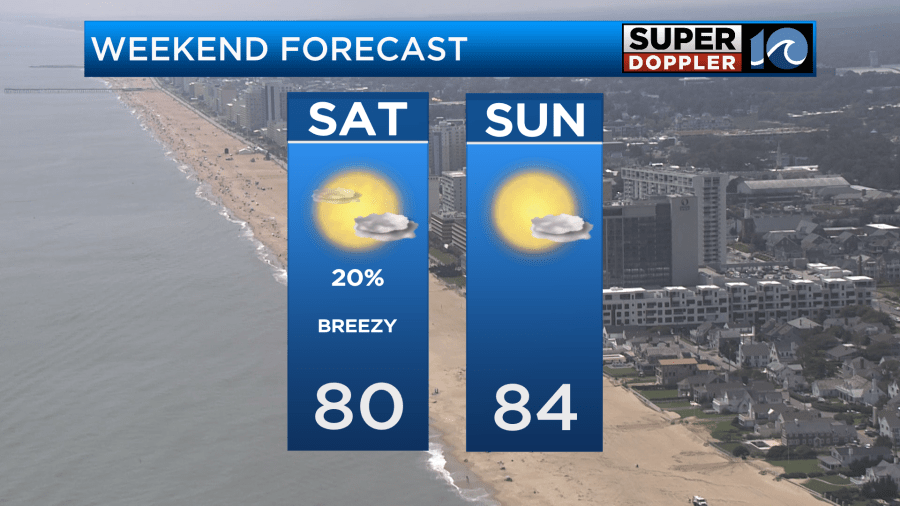
Winds will be out of the northeast tomorrow at 10-15mph, but the gusts shouldn’t be high. Winds will be light and onshore on Sunday.
I haven’t talked about it too much, but there may be some nuisance tidal flooding this evening during high tide.
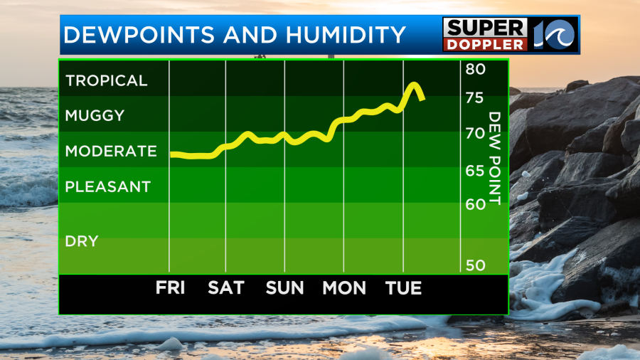
We’ll have quiet and warmer weather early next week with highs mainly in the 80s. Humidity will build through that time.
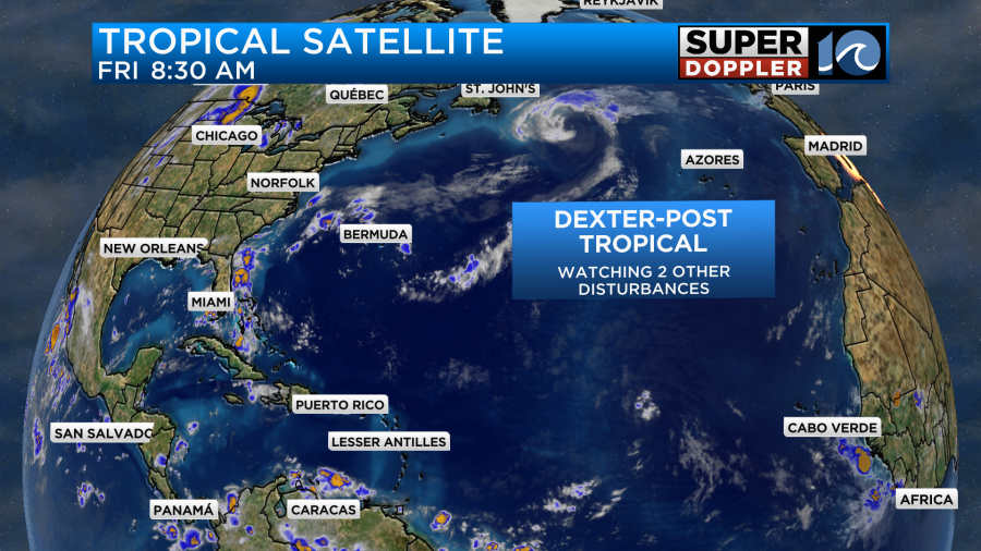
Meanwhile, tropical storm Dexter has become post-tropical. It is roaming the north Atlantic as a nor’easter-type storm.
We are still watching the tropical disturbance over the central Atlantic. It still has a medium chance of formation over the next few days.
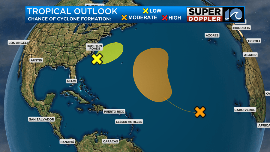
A lot of the models take it near Bermuda or east of Bermuda. However, there are still a few models which take the storm more to the west.
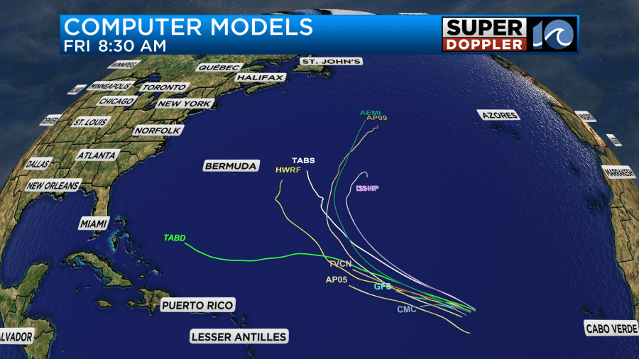
We’ll bring you updates on that over the weekend.
The long-traveled wildfire smoke became fairly thick yesterday. Today it should be much better.
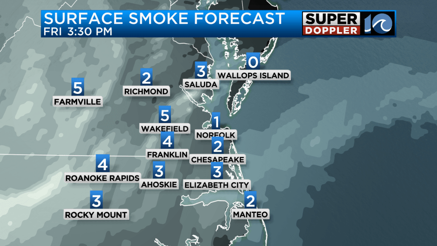
It should stay ok over the weekend.
Meteorologist: Jeremy Wheeler


