
I started some of my main weathers this morning talking about this past month’s climate. It’s been an interesting (and active) month. We started off with lots of heat and warm temps thinking that it was going to be a long/hot month. Well….
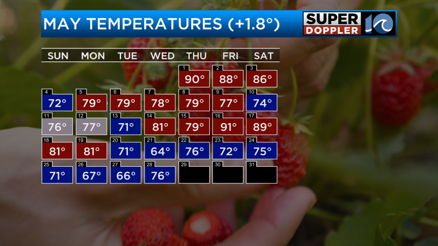
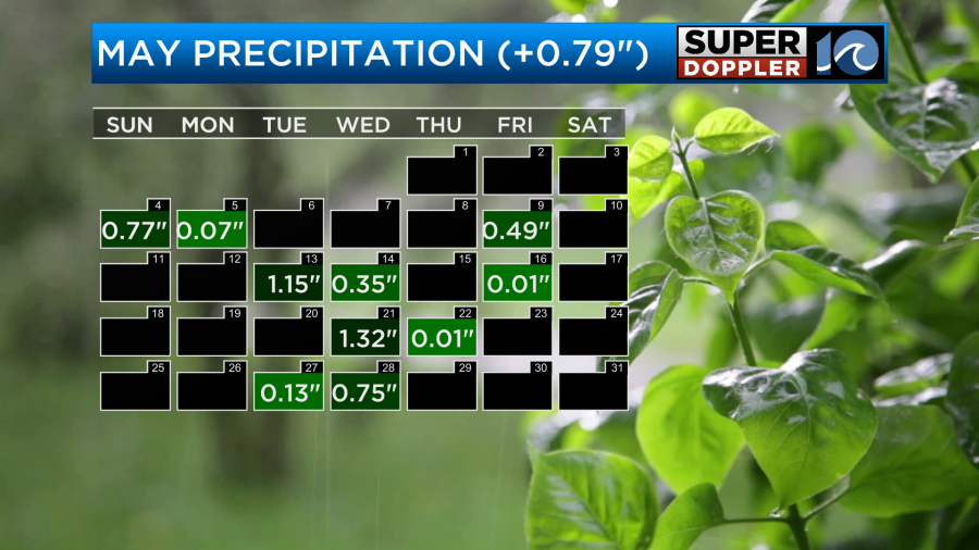
We recently had an unseasonably cool streak of temps with highs in the 60s for a handful of days. It’s almost like the month flip-flopped. On top of that I feel like we’ve had a chance for rain about every other day for the past couple of weeks. Here’s the recorded rainfall.
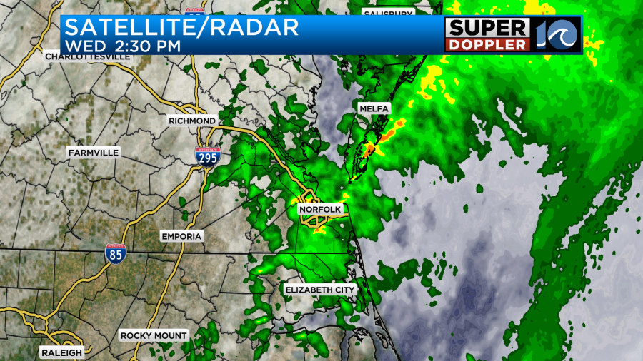
Over the last 24 hours we have had varying amounts of rainfall. The soaking rain did cover a large area for a good bit of the day. The second round in the afternoon brought in some heavy rain for a few areas.
Some locations only got a tenth of an inch. Some had about 2 inches.
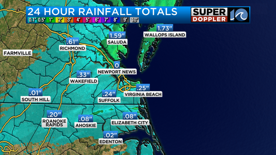
For some reason the sensor in Newport News stopped recording, but Fort Eustis had about 6 tenths of an inch. The green area is where there was about 1-2 inches of rainfall. There was a strip of that higher amount north of Interstate 264 in Virginia Beach. Norfolk recorded about three quarters of an inch.
The rain cleared out last night. Then we had a mix of sun and clouds this morning. The weak area of low pressure that helped to create yesterday’s rain has now moved off to the north. However, a stationary front still lingers over the region.
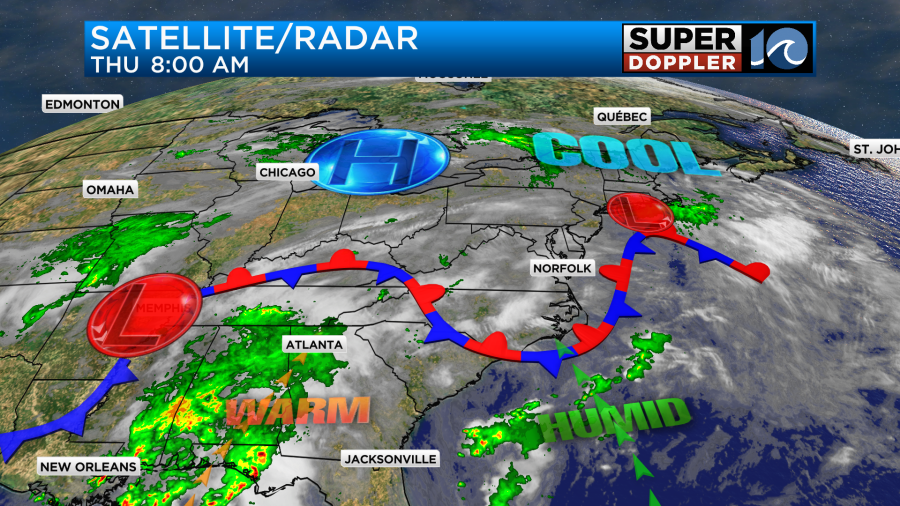
There is a bigger area of low pressure to our west along with a cool front.
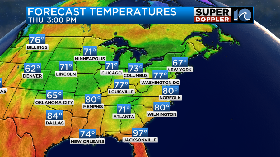
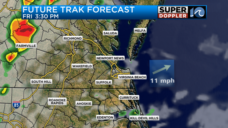
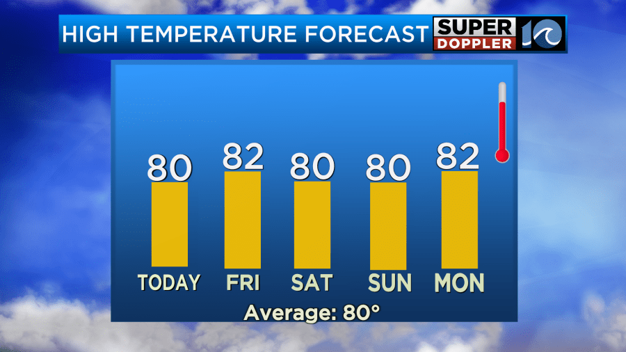
Through the day today we’ll have a mix of sun and clouds with some isolated showers and/or storms trying to pop up. Winds will be light and variable. High temps will rise to near 80 degrees.
By this evening a couple of clusters of showers and storms will move in from the west. This may happen more towards the late evening, but the exact timing varies a bit with the different models.
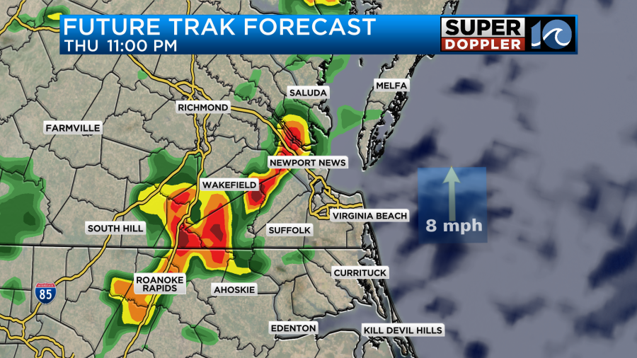
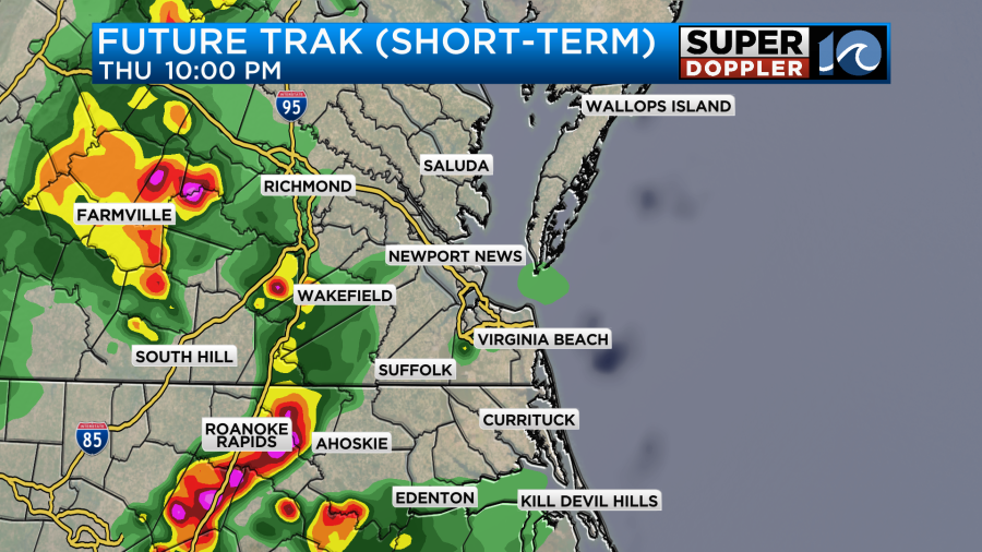
There could be a few strong storms between the late evening and a little past midnight. Eventually, they should weaken. This will probably be from the front bumping north a bit up into our region. Some leftover/scattered showers will likely continue into tomorrow morning.

This could impact the morning commute….Again! They should move out. Then we’ll have a break for a while. Some more scattered showers and storms will form during the afternoon as the area of low pressure gets closer to our area.
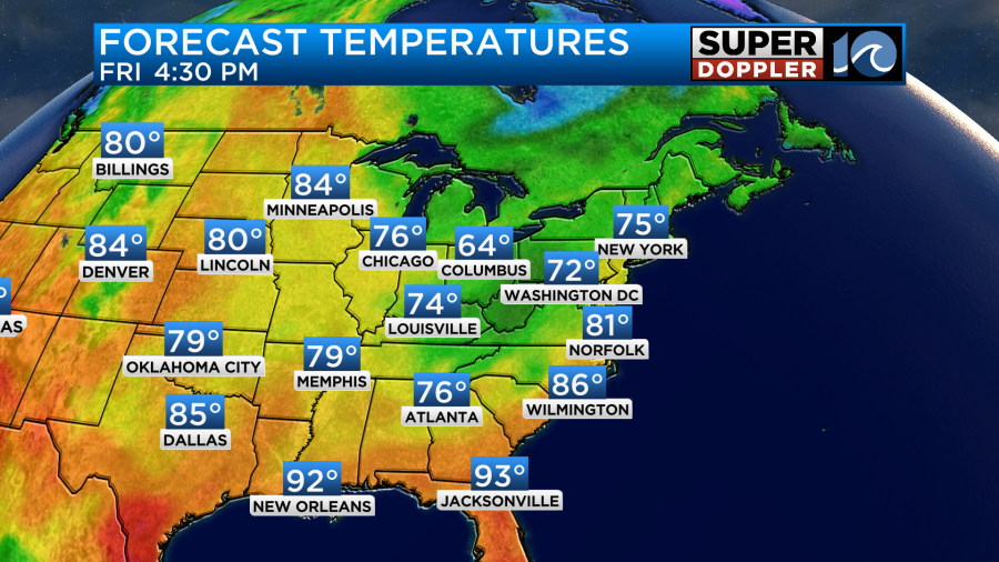
We’ll have a mix of sun and clouds again tomorrow with high temps in the low 80s.
As we head into the evening the low and the cool front will be sliding in from the west. We’ll have (at a minimum) clusters of strong showers and storms in the region.
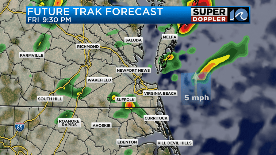
It’s possible that this will be a continuous line of showers and storms. That’s what a previous run of our model showed before. Either way there could be some strong to severe storms during that time.
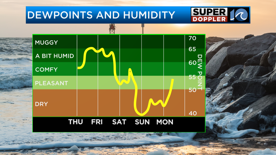
These storms will move out by tomorrow night. Then we’ll have quiet weather going into Saturday morning. High temps will be near 80 on Saturday. Humidity will drop late in the day.
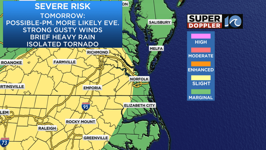
Unfortunately, we’ll have one more round of scattered showers and storms Saturday afternoon.
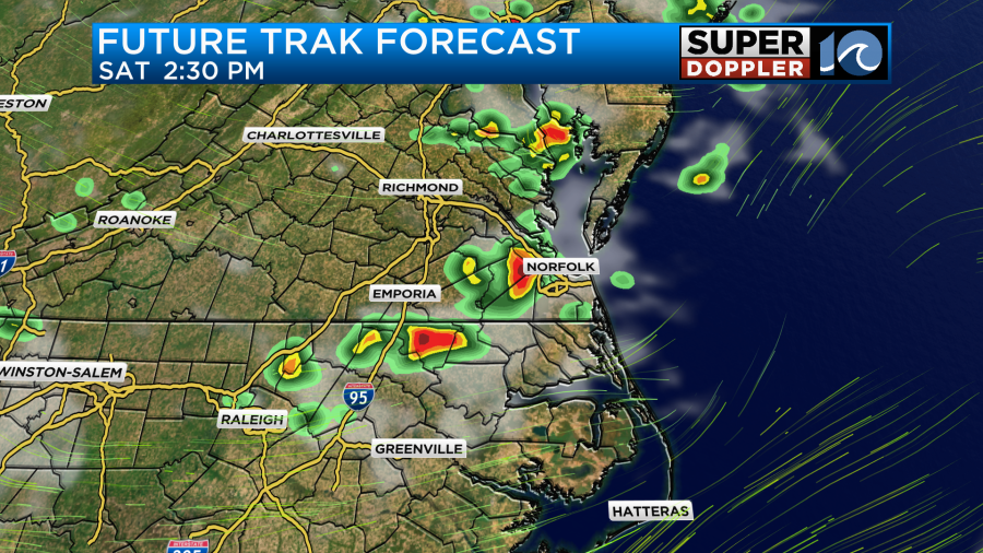
This will be from an upper-level trough swinging through the region. This seems a bit strong for an upper level system. Maybe as we get closer we’ll be able to lower the rain chance. We’ll see.
The good news is that we’ll be dry Saturday night and Sunday. Then we’ll stay dry for a few days. High temps will be near 80 on Sunday with low 80s Monday. However, we’ll heat up quite a bit more by later next week.
Meteorologist: Jeremy Wheeler


