Meteorologists Steve Fundaro and Don Slater did some work recently on our local climate. They found out that we tied 8th and 9th place for the hottest Junes on record.
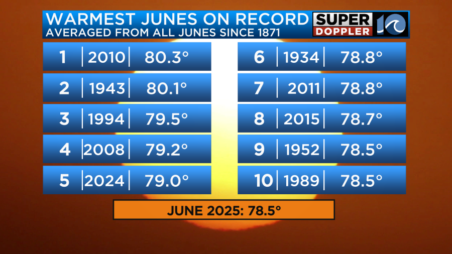
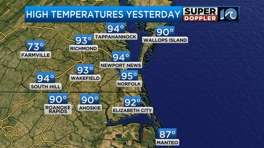
2 things about that. First off, I feel like we had a lot of humidity this month. So I think it was the heat index that made it feel so hot, and not the temperature by itself. Some of the other top 10 months may have been much drier. That’s hard to know though. Also, there were 3 days when we had northeast wind. So the Norfolk temperature (the main climate site) was about 3-4 degrees cooler than surrounding sites during that time. Regardless, we ended up in the mid 90s yesterday.
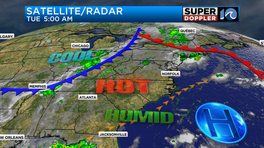
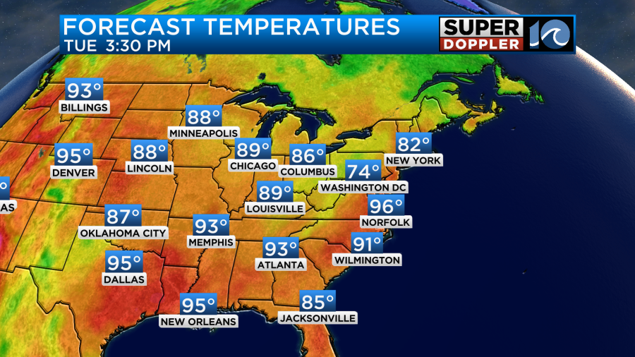
It was very hot and humid again, and it was just another tough day to be outside with the heat index up to 105. Today there are some slight improvements to the weather. We have high pressure offshore with a cool front far to the west.
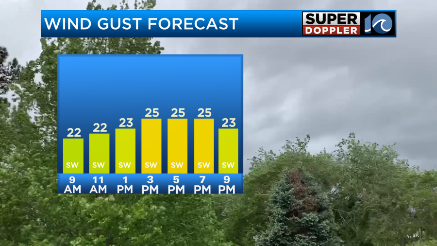
With that setup today we’ll have a nice breeze out of the southwest. It will run at 10-15mph with gusts up to 25mph.
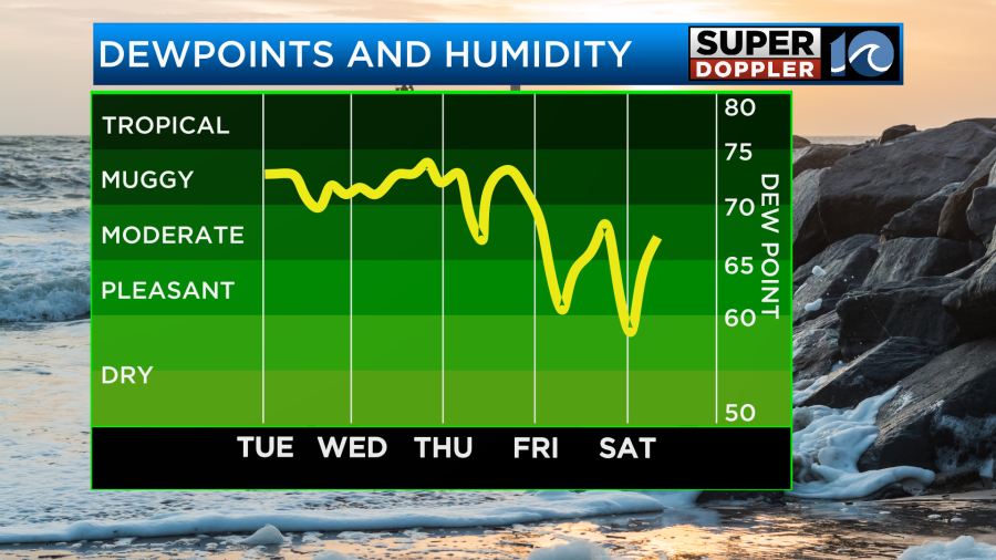
That will really help out in how it feels outside. Also, the humidity is down (slightly). Dew points are more in the low 70s today.
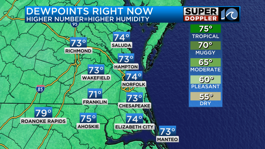
They were in the mid 70s yesterday. So that combo should make it feel a little more comfortable tolerable today. Having said that, high temps will aim for the mid-upper 90s this afternoon.
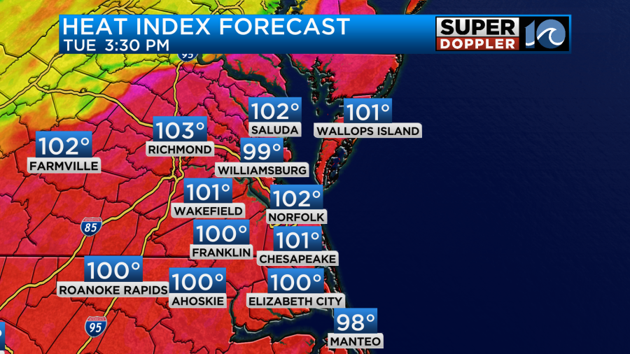
We’ll be partly sunny. There will only be a stray pm shower or storm. The heat index will be over 100, but a couple degrees less than yesterday.
Tonight there will be a few showers and storms trying to come in from the west, but I think the bulk of the storms will stay to our west. However, that cool front will be moving into the region tomorrow. It will likely stall out over the area. This will bring us a lot of cloud cover. It will also create a few rounds of showers and thunderstorms.
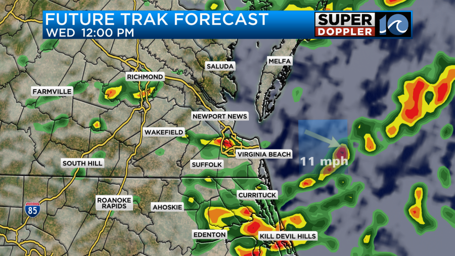
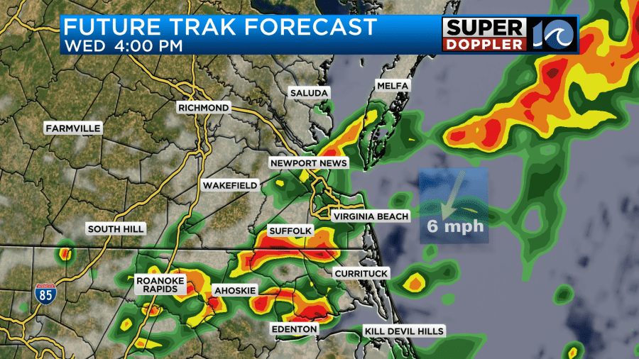
These storms will be able to feed off of the high moisture in the region. Hence, heavy downpours will be possible. If a few stronger storms form, then there may also be some gusty winds for a time. We could get about a half inch up to an inch of rainfall.
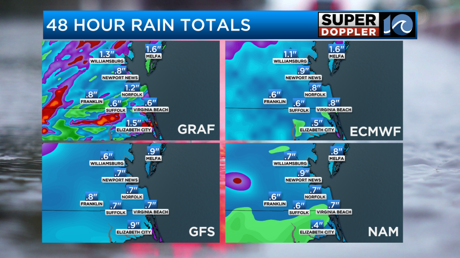
The payoff is that the high temps will be knocked down to the 80s.
I have our highs in the mid-upper 80s, but if the rain continues for a long time, then we may only be in the low-mid 80s. Either way it will be a nice break from the heat.
The front will start dropping to our south during the day Thursday. There may be an isolated shower as the front sinks south. However, drier air will be working into the region.
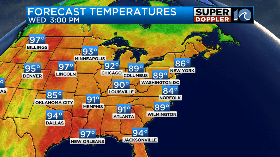
We’ll have clearing skies for most of the area. High temps will be in the upper 80s to near 90. Then for the 4th of July we are looking good. High temps will be around 90. However, it will be drier. The heat index will only be in the low-mid 90s. Skies should be mostly sunny.
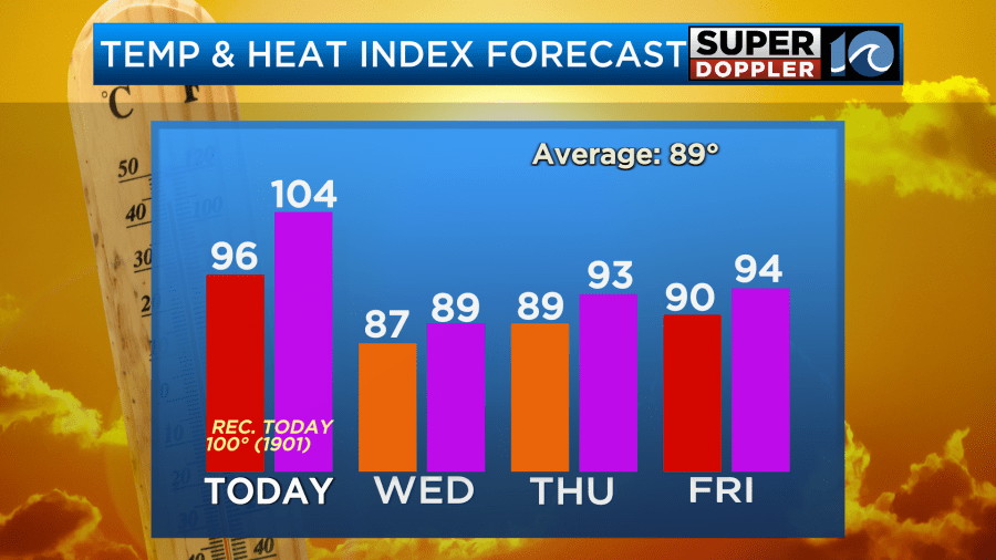
That is typical heat for early July, but I’m glad it won’t be so muggy. It should be good beach weather. Skies will be mostly sunny. For now it looks good for the evening for fireworks, but check back for more specifics as we get closer. Saturday also looks good. We’ll be mostly sunny with highs in the low 90s.
Parts of the United States have been in a heat wave recently. However, we are not alone. There was a recent heat wave in western Europe that was pretty rough. A couple of countries had their hottest June on record. Here is an article with the details: Europe heat wave.
Meteorologist: Jeremy Wheeler