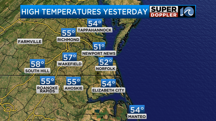
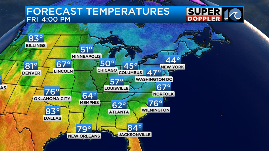
Over the last 2 days we had some cool/cold air. It was enough that the bay temperature actually dropped from the low 60s to the upper 50s. Our high temps made it into the 50s Thursday afternoon, but it was in the low 50s for a lot of the metro.
As expected it was nice in the sun out of the breeze, but chilly in the shade when the breeze blew.
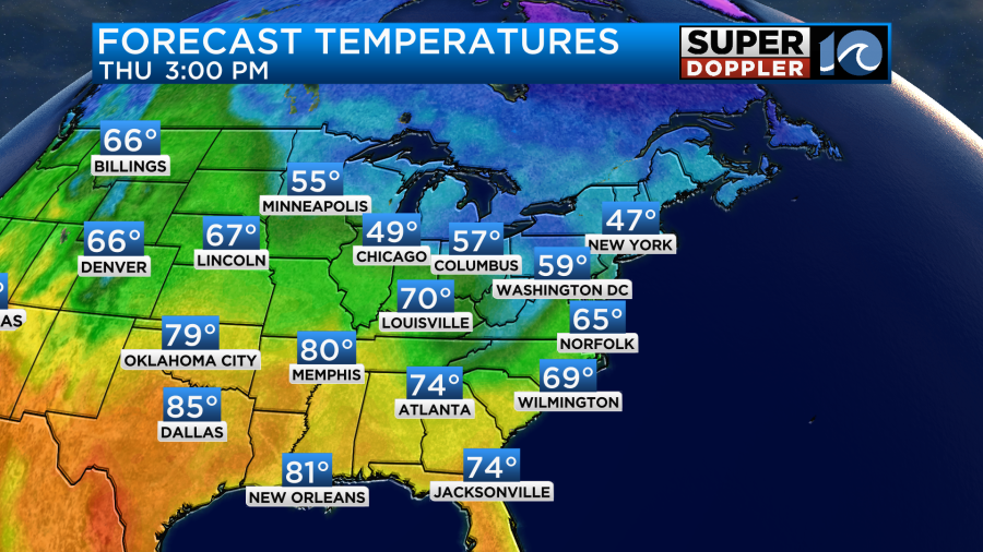
Today we’ll warm things up a bit. High temps will be more in the 60s. We’ll have increasing clouds with a southeast breeze. High pressure is to the northeast with a weak area of low pressure over the Ohio River Valley.
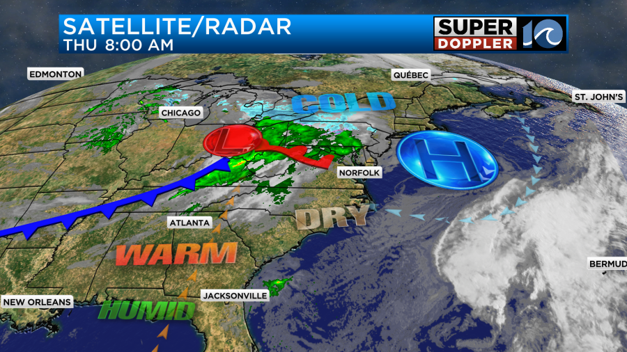
That area of low pressure should more to the northeast today (missing our region). However, moisture will increase. It may increase enough that we could get an isolated shower or two by the end of the day into the evening, but there won’t be much. High temps will make it to the mid 60s this afternoon.
Tomorrow the cold front will move towards our region. We’ll be mostly cloudy through the day. An area of low pressure will form along the front. This will create some scattered showers and thunderstorms as it moves into our area.
The timing is tricky due to the models having a tough time figuring out when the rain bands will actually move in. The trend in the models this morning is for there to be 2 rounds of showers and storms. Our Future Trak model has a large band or showers and thunderstorms in the morning between 8 and 11am.
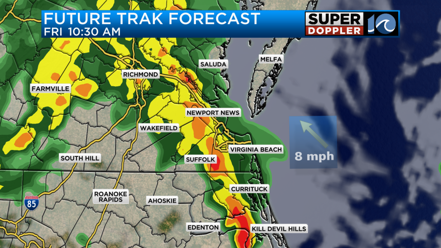
It then has a break with another round in the late afternoon and early evening.
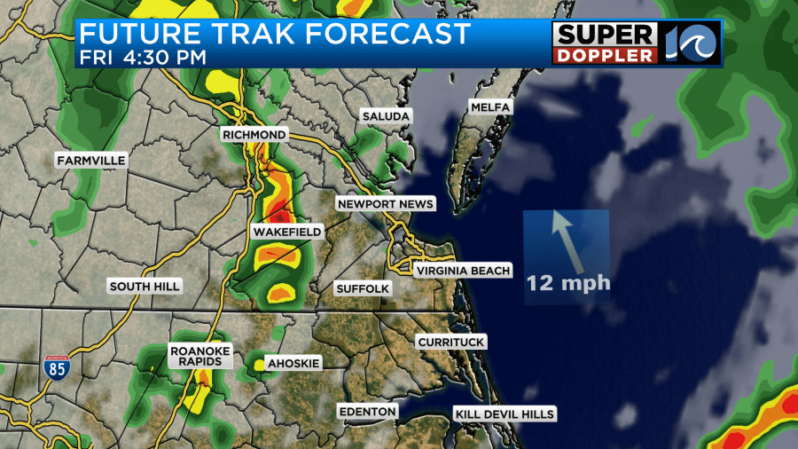
However, the Hi-resolution NAM has the first round around sunrise. Then it has some clearing for a bit. This would allow for some heating and a stronger second round of showers and storms. The GFS model is also following this scenario for now.
If the first round is bigger, then that may take some punch out of the afternoon storms. If the first round is earlier and weaker, then that might allow some more warming to happen. That could then allow the afternoon storms to become strong to severe. There is a marginal risk for strong gusty winds and large hail tomorrow. We’ll definitely want to check the updates on that later today though. Either way there is a good shot at rainfall. High temps will aim for the mid-upper 60s.
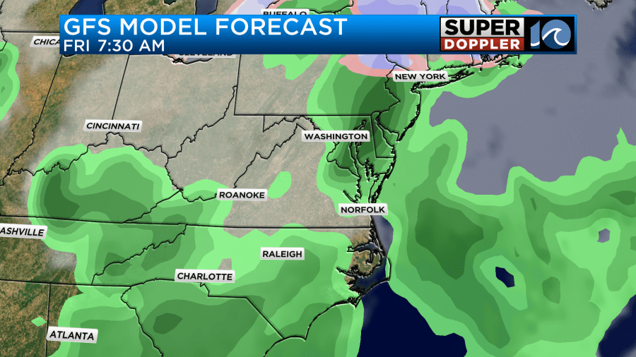
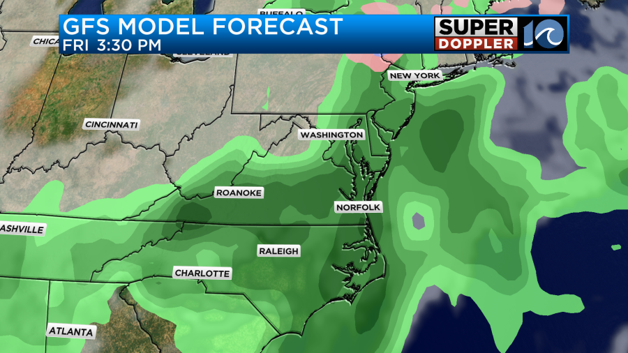
On Saturday the surface low and front will push out to sea. However, a large upper-level system will sit right on top of the region. This will definitely bring us a lot of clouds. However, it also might bring us some scattered/light rain showers or at least some drizzle. Our Future Trak model doesn’t show much more than thick clouds.
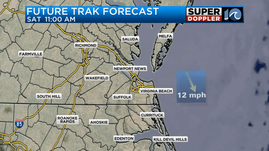
However, it doesn’t do too well with very light precipitation, and the air should be pretty dry at the surface. In contrast…here’s the GFS for that day.
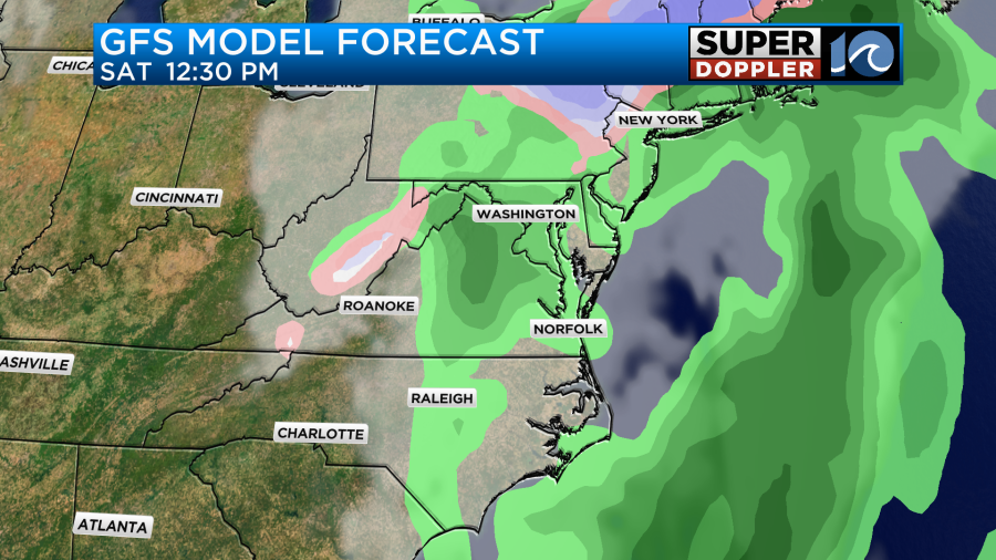
Either way the models are trending cooler for the day. For now I have high temps near 60, but I may have to put it down to the upper 50s before we get there.
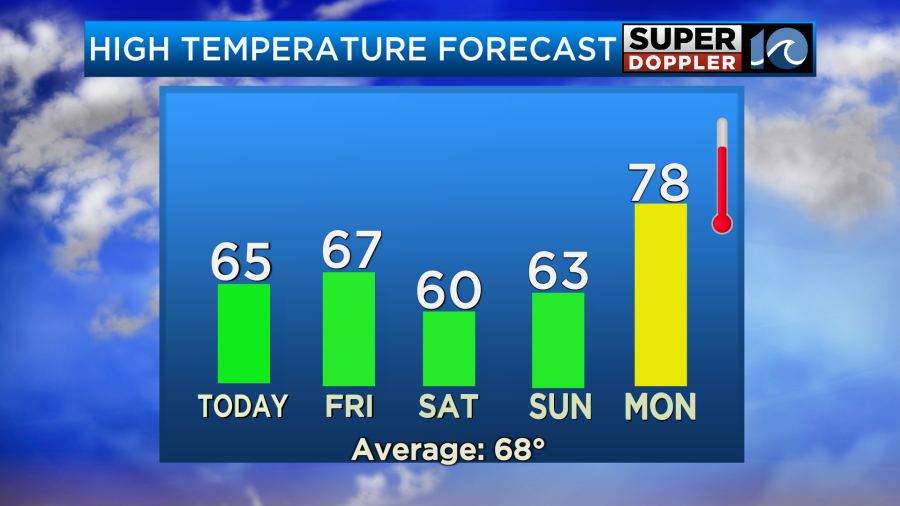
We should dry out by Sunday with high temps in the low 60s. Then warmer temps arrive by early next week.
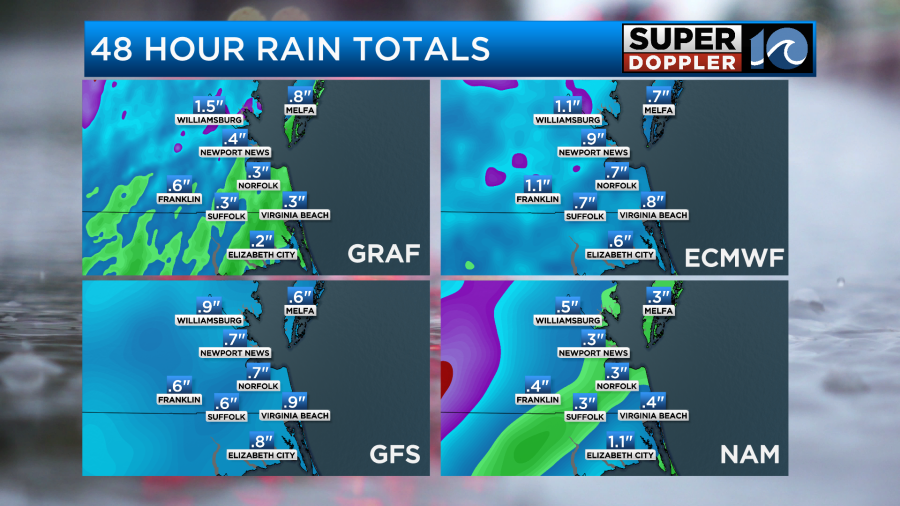
For rainfall we are looking at about a quarter to three-quarters of an inch. The models, at least, are starting to agree on that.
Finally, pollen levels have increased. Unfortunately, tree pollen is in the solid “high” category today. Grass pollen is moderate to high, and mold is moderate.
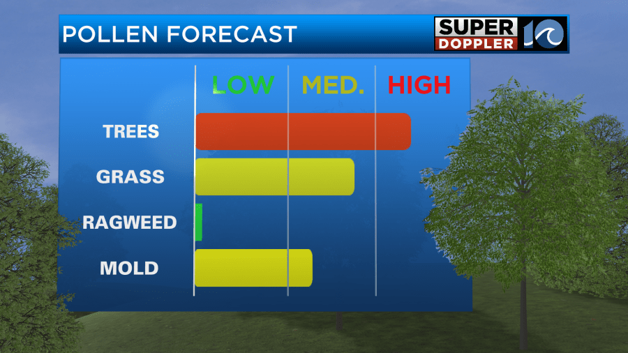
The trees and grass got that much-needed rainfall the other day. Now they are going nuts with the pollen output as we warm up a bit. A lot of it should get washed out tomorrow.
Meteorologist: Jeremy Wheeler


