(WAVY) — Temperatures are heating up for parts of this weekend ahead of an incoming cold front. On Friday we will have lots of sunshine and strong south winds at times. This will allow for highs to climb into the low 90s for some spots. With the increased humidity it will feel like the mid-90s in some areas so getting into the water will be a good idea.
On Saturday, most of the day should stay dry with just a few clouds around. During the afternoon, a cold front will move closer to the region and afternoon storms will fire up across central Virginia and drift into Hampton Roads during the late afternoon and evening. If you plan on getting on the water try to avoid the late day hours.
On Sunday, the cold front will be slowly drifting to our southeast but more storms will fire up along it during the day. Highs will drop from the 90s on Saturday to the mid-70s on Sunday afternoon.
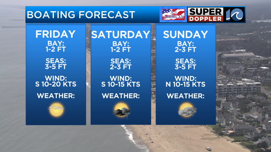
For boating, the Bay will be the place to be if you are looking for smoother waters. The open ocean may be a bit bumpy as winds increase during the weekend. Try to target Friday for the best chance for dry weather all day long. If you have plans to head out Saturday and Sunday, keep an eye to the sky.
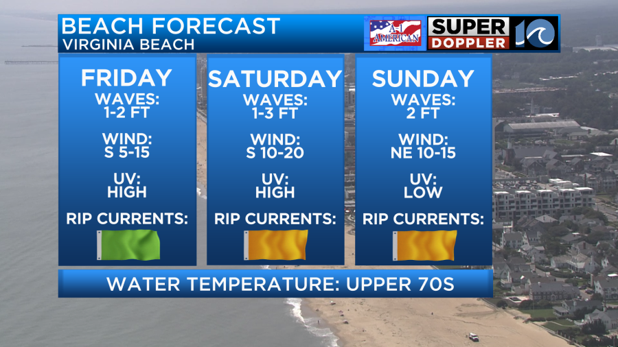
For those looking to take a dip, Friday will be the pick of the weekend with a low rip current risk and sunny skies. Water temperatures are still in the upper 70s, so it will feel refreshing to cool off, as highs get into the 90s Friday and Saturday.

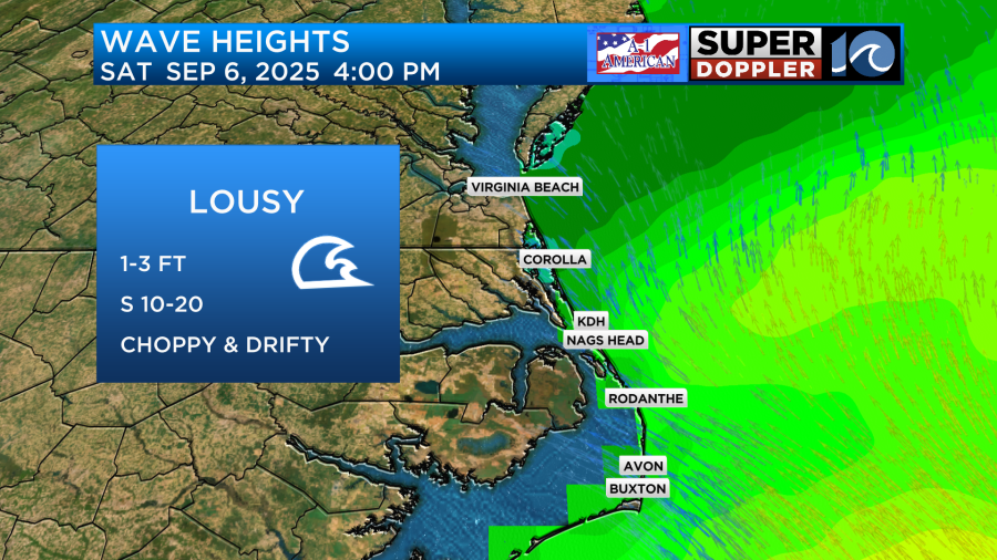
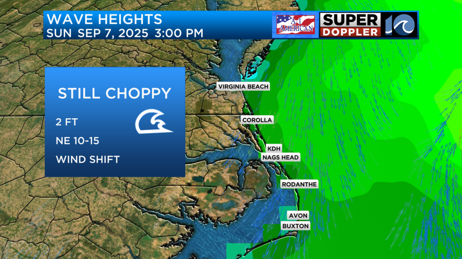
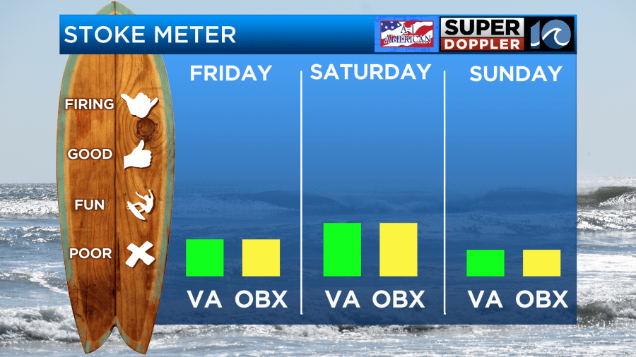
Attention all surfers! There will be a few short windows to target this weekend, but you will likely need the bigger boards for better luck catching waves. Friday and Saturday will be the best bet at locations with southerly wind protection. On Sunday, winds will switch out of the northeast behind the passing front making for very choppy conditions.
See you in the water!
— Meteorologist Brian Michigan 🤙