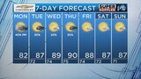
After a week of cloudy and gloomy weather along with messy surf it looks like this trend will continue for parts of the weekend.
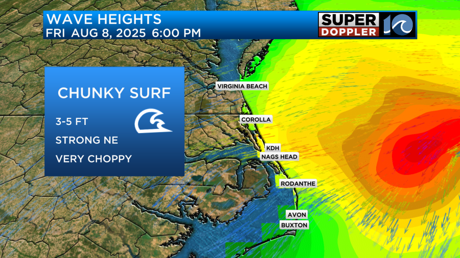
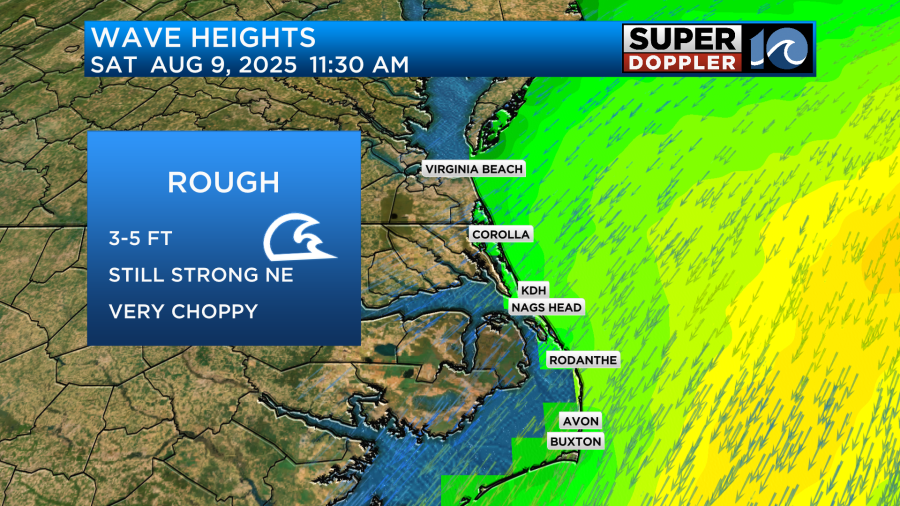
As a stationary boundary remains to our south along with high pressure to the north that is allowing for a strong onshore wind. This wind picks up for the day Friday and Saturday at 10-20mph with gusts as high as 30mph in some areas. This means open ocean seas will be a bit dangerous for boating and the rip current risk for swimming will likely keep people out of the water for the next two days.
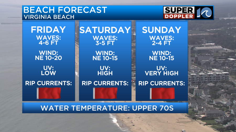
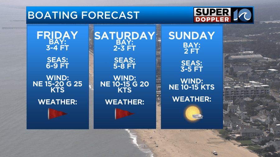
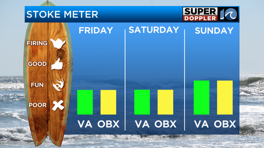
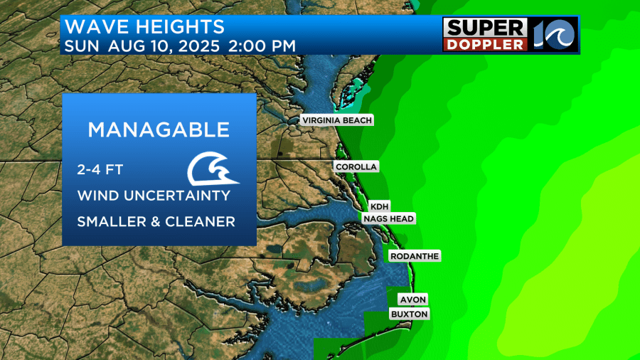
On Sunday, conditions are looking a little more manageable for swimming and boarding as winds start to relax. It will be best to use caution however, due to an area of low pressure which will be passing offshore. This system may keep the surf elevated especially over open waters.
Let’s talk surfing! Northeast winds will keep the surf conditions very choppy all day Friday and Saturday but with wave heights in the 3-5ft range it may be worth it to head out for a session! As for Sunday, what we lose in size we will make up for in quality. Winds will be easing throughout the day and models are still going back and forth on if an offshore switch will occur. Keep up to date with the local weather for a potential brief window of clean and fun surf on Sunday.
See you in the water!
-Meteorologist Brian Michigan 🤙