All eyes are on Tropical Storm Erin in the Atlantic basin as it will be strengthening into our first hurricane and major hurricane of the year this weekend. Regardless of how close the storm gets to the east coast, the surf will build and the rip current risk will increase but not until the upcoming work week.
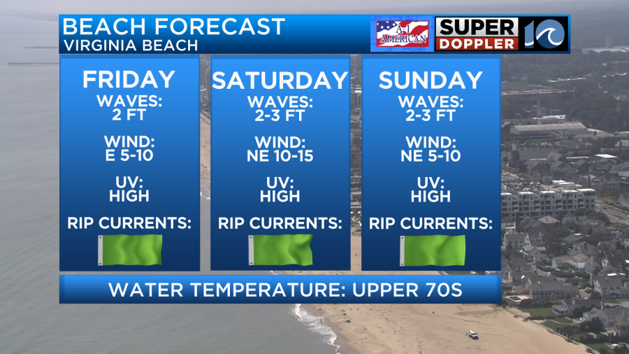
For those looking to spend some time at the beach, you are in luck! Rain chances drop as we head into Saturday and Sunday and temperatures cool into the lower and middle 80s. Humidity may be up a tad but with a low rip current risk a quick dip should help cool you right off.
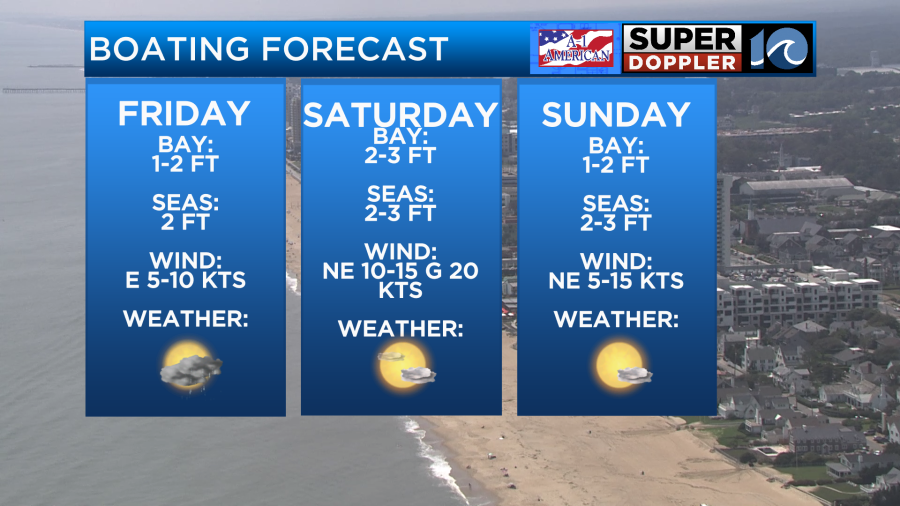
Friday is not expected to be a total washout. In fact, most of the day will be dry with a fair amount of sunshine. It will be during the afternoon hours though that you will have to keep an eye to the sky for storms. As they pop up, heavy rain and frequently lightning will be the primary risks. With that being said, boating will likely be safest on Saturday and Sunday.
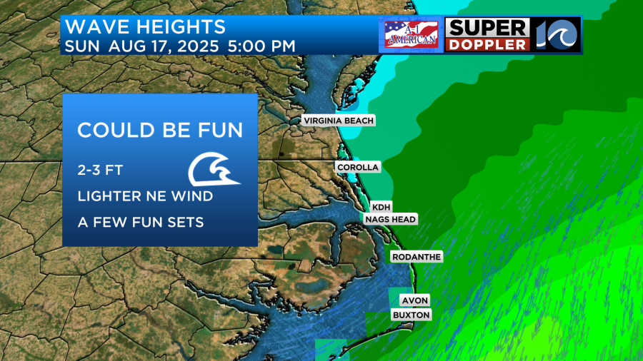
Alright, now lets talk surfing! This weekend will not feature anything impressive as Erin will still be far to the southeast near Puerto Rico at the time. Waves will be small for the most part in the 2 foot range with onshore winds providing a bit of texture to the face of the waves. If you are looking for a time to target this weekend, try Sunday as long period swell from Erin may slowly creep in. Surf should be in the 2-3 foot range especially in the outer banks and while the wind will be onshore it should be lighter during the day.
For those competing in ECSC, good luck and have fun! Erin swell will build throughout the day Monday and last throughout the competition window. There is still a ton of uncertainty as to how close the storm will come to the east coast. If it passes to close to land, winds may create very large and choppy conditions to dangerous for surfing. If the storm passes closer to Bermuda we will have the size without the wild winds. STAY TUNED!
-Meteorologist Brian Michigan 🤙