(WAVY) — Hang on to your hats!
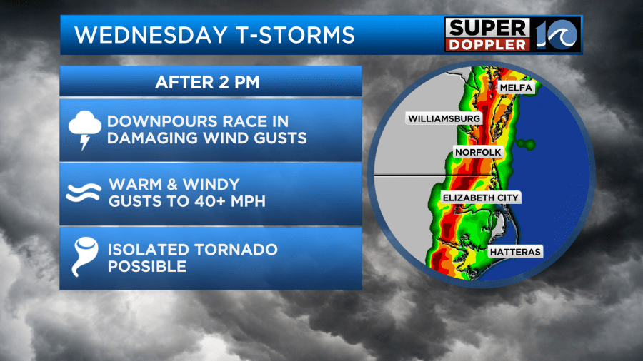
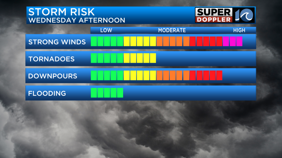
The warm spring breeze picks up tonight as a round of strong thunderstorms blasts into the region Wednesday afternoon. Strong to severe thunderstorms are possible, so let’s be sure to stay weather aware!
Off to the west, a big frontal system marches on and produces severe weather for the southern United States. The threat of strong thunderstorms then shifts towards the East Coast by Wednesday afternoon, which includes us here at Hampton Roads.
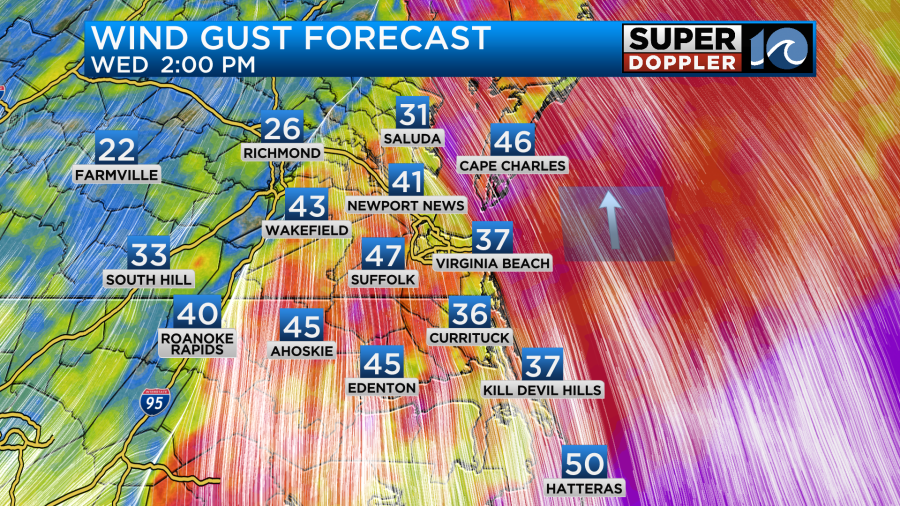
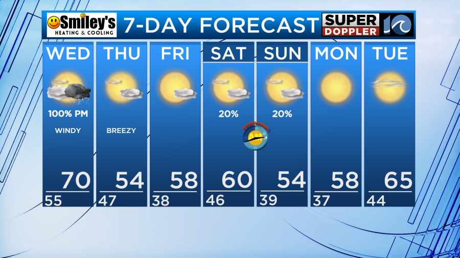
But outside of any of these thunderstorms, the wind will be howling! The southwest breeze cranks to around 25 mph to 30 mph, with winds gusting over 35 mph, even 40 mph by the lunch time hours. Temperatures as a result will climb to near 70 degrees!
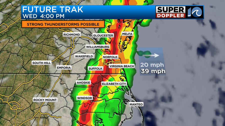
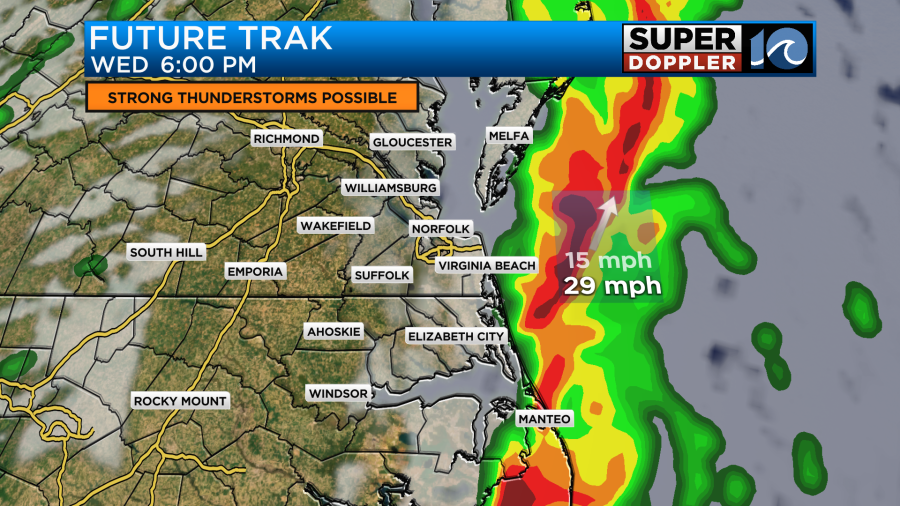
It won’t be a rainy day by any means, in fact, it’ll only rain across the region for part of our afternoon. The broken line of thunderstorms should blast into Hampton Roads after 2 p.m., and honestly it could be offshore and moving out of town around 6 p.m., maybe even earlier. Some of these thunderstorms could be capable of producing damaging wind, and even a few tornadoes. Let’s stay weather aware Wednesday, make sure you have a way to receive weather alerts.
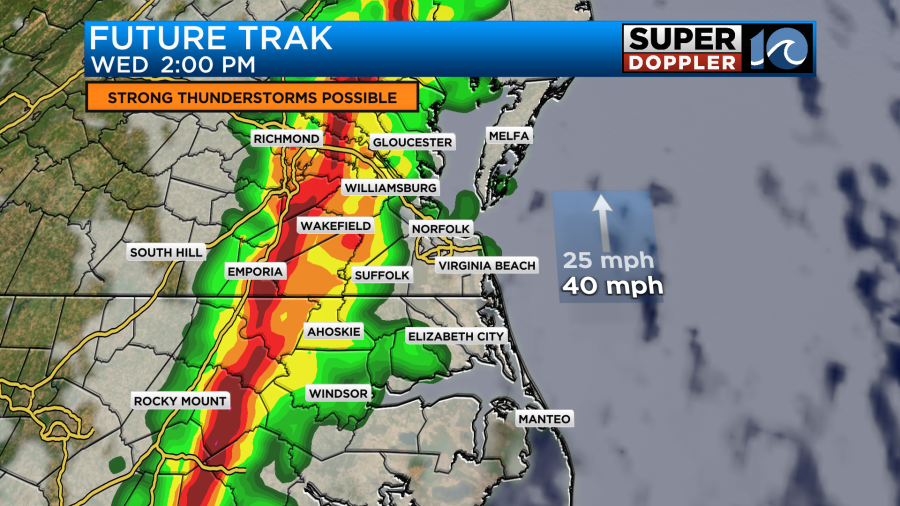
In the near future, tonight and Wednesday morning, it wouldn’t be the worst idea to secure any loose objects or furniture you have around the yard. Also, a few power outages wouldn’t be surprising either.
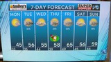
The front and storm activity quickly moves out Wednesday night and a fresh breeze resets things on Thursday and Friday. Temperatures should sit in 50s to wrap up the week before a nice weekend could be in store.
-Steve