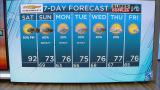
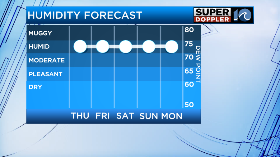
The muggies are here to stay!! …you know, the muggies, the summer muggies! That dreaded humidity that makes you sweat in only a few minutes when you’re out in the sizzlin’ summer sun. And with the muggies, comes those daily downpours! Unfortunately, over the next several days and through Father’s Day weekend, we won’t be able to escape those.
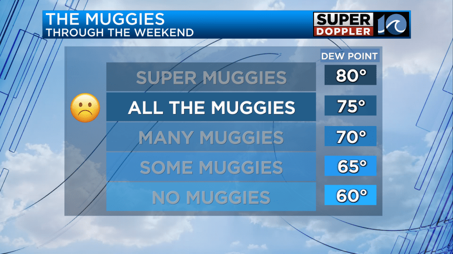
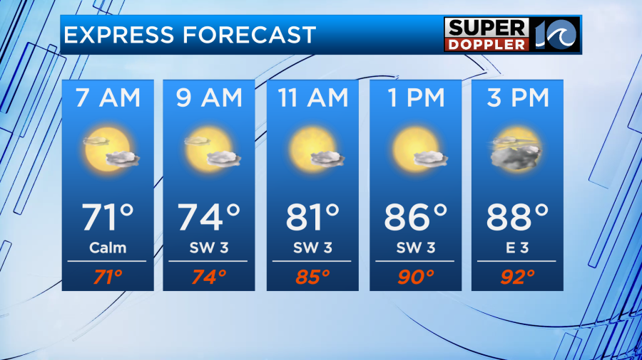
There’s some fog out there this morning, patchy, but dense. It’ll likely hang around through sunrise, or mid/late morning before clearing. Expect bright skies, and the summer sunshine will boost our temperatures to near 90°. With the muggies out and about, a slight wind shift or sea breeze could pop off a downpour or brief thunderstorms. Keep an eye on the skies as they’ll be hit or miss, but some of us could get soaked. The heat index may also make it feel close to 92°-95°!
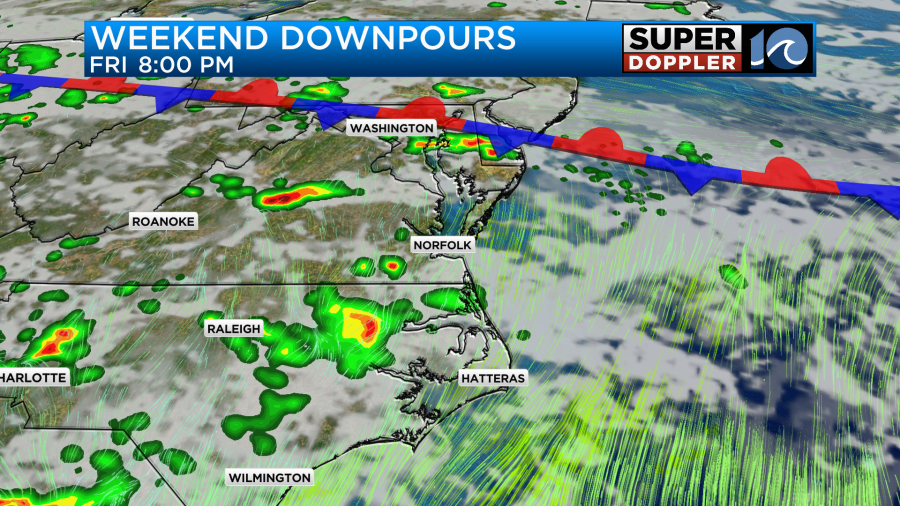
On Friday, there’s more of a front approaching from the north that provides us a better chance at thunderstorm activity. Temperatures will climb to near 90° again, heat index values may approach 95° in a few locations, and the cumulus clouds will bubble up into the afternoon. By mid to late afternoon, a round of scattered downpours and thunderstorms will develop across the region. With a front nearby, these could last longer into the evening – something to keep in mind if you have those evening plans. Showers and thunderstorms could even persist into the late night hours as well.
Through the upcoming weekend, temperatures will remain in the upper 80s to near 90° and the humidity will remain pretty ripe. Heat index values on Saturday could be somewhere between around 95°+. Scattered showers and thunderstorms are still expected by the afternoon and evening. Expect the same pattern on Sunday as well, temperatures near 90°, humid, with scattered downpours and thunderstorms popping up here or there.
Best advice for weekend plans for Father’s Day – get out early! You’ll beat the heat, and beat any shower or thunderstorm that pops up in the afternoon.
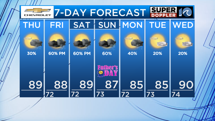
Stay cool out there – the dog days are upon us!