
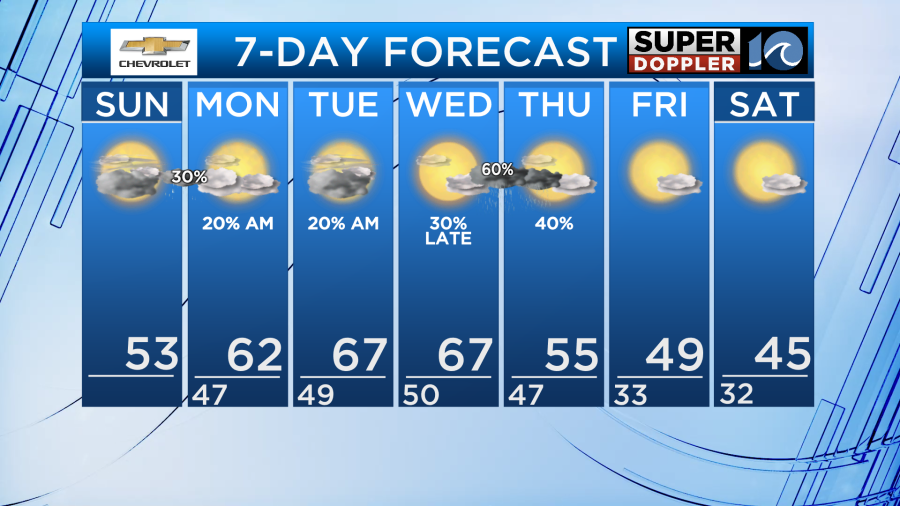
By Sunday, temperatures rebound into the upper 40s/near 50 north and low to mid 50s metro/south. Our average this time of the year is in the mid 50s, so that’s about what we would expect. The southern Outer Banks will climb into the low 60s.
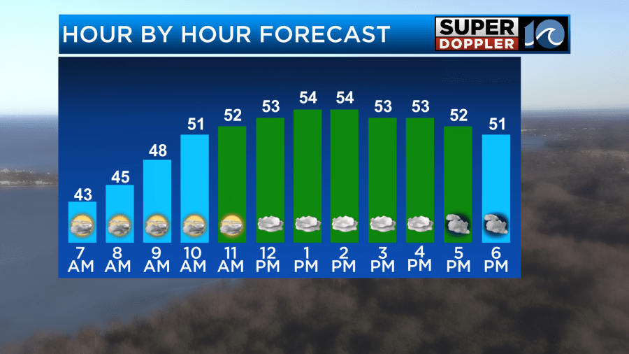
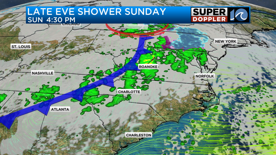
We’ll notice some increasing clouds on Sunday, but much of the daytime hours should stay dry. As we head into the overnight, a rain shower or two is possible.
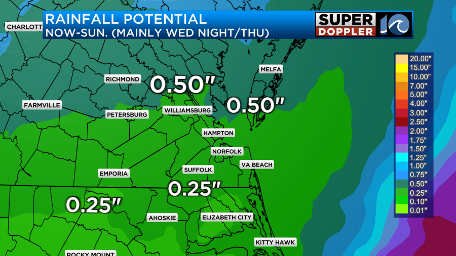
Lingering, but very slight rain chances continue into Monday and Tuesday as we await a better, more widespread chance of rain Wed night into Thursday. Showers will increase in coverage Wednesday night, with scattered areas of rain likely. These rainfall chances continue into Thursday, with a good chance for showers, especially in the morning. Rainfall totals look to be around 0.25″ to 0.50″ in spots. These numbers have come down a bit.
Ahead of this system, temperatures will climb into the 60s for the early half of the week. Monday, it will still be a little cooler to the north, with upper 50s across the Middle Peninsula/Eastern Shore. By Tuesday, we all should solidly be in the 60s, close to 70 in spots. These temps won’t last though! Still in the 60s for early Wednesday, we’ll fall back into the 50s as those higher rain chances move in late in the day. Much cooler to end the week, with highs by Friday in the upper 40s and mid 40s as we head into next weekend.
Hope you have a great Sunday!
Meteorologist Ricky Matthews
Follow Ricky on Facebook and Twitter


