
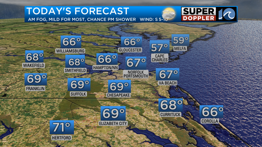
Starting off Wednesday with quite a bit of fog. This is happening as a warm front to our south starts to slowly lift north. As this front lifts northward through the afternoon, we should briefly get some sunshine and warmth. Highs for most should return to the 60s today!
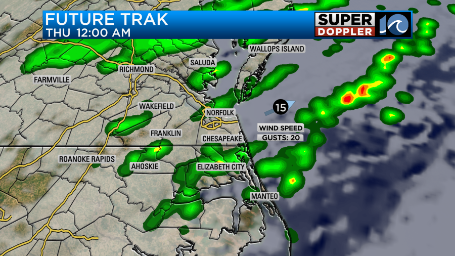
A cold front drops in tonight, and with it, some late night rain is expected. Rain activity will move out early Thursday morning before cold, dry air returns to the region for the afternoon.
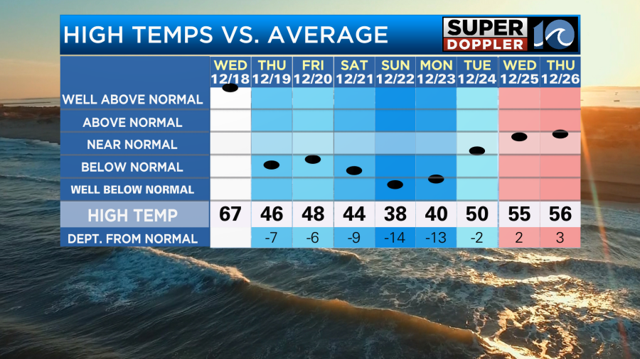
Highs back in the 40s with stubborn clouds on Thursday and Friday. A few showers are likely Friday, especially at the coast. As we head into the weekend, MUCH cooler air is expcted, with highs only in the 40s or 30s by Sunday and into Monday!
As we head towards Christmas Day, temperatures warm up a bit with highs in the 50s by Christmas Eve and Christmas Day. A warmer than average trend is expcted for the end of December. We’ll likely see one or two chances for rain too before the end of the year – with the best chances right now appearing Wed night (Christmas Day night) into Thursday.
Hope you have a great weekend!
Meteorologist Ricky Matthews
Follow Ricky on Facebook and Twitter


