
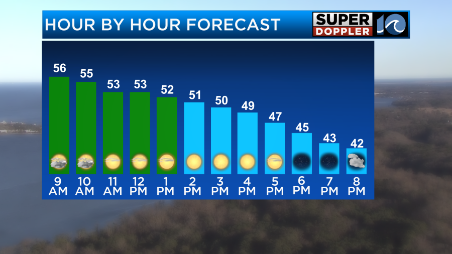
A midday wind shift will take the morning 60s and drop them into the 40s by late afternoon. This 20-25 mph wind will make things a little breezy through the afternoon.
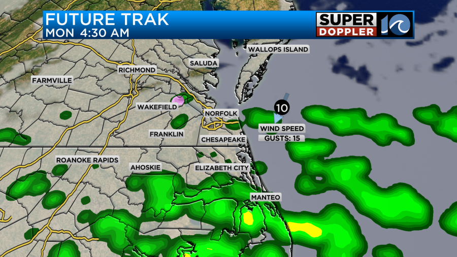
For tonight, we’ll see increasing clouds as another weak system slides by. This could bring us a few showers Monday morning. The best chances for this will be across NE NC and southside. A few showers likely linger in the southern OBX through the morning. We can’t 100% rule out a few snowflakes/sleet pellets mixing in too across VA, but shouldn’t be a huge problem.
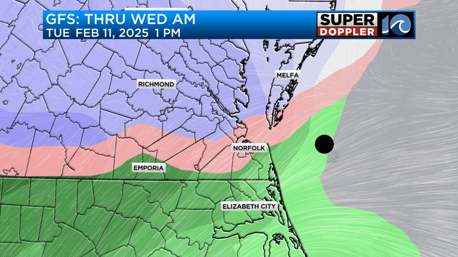
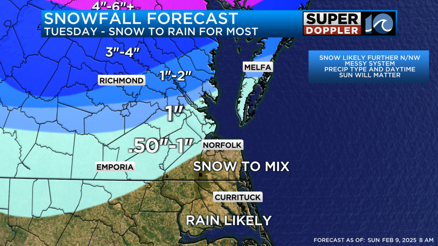
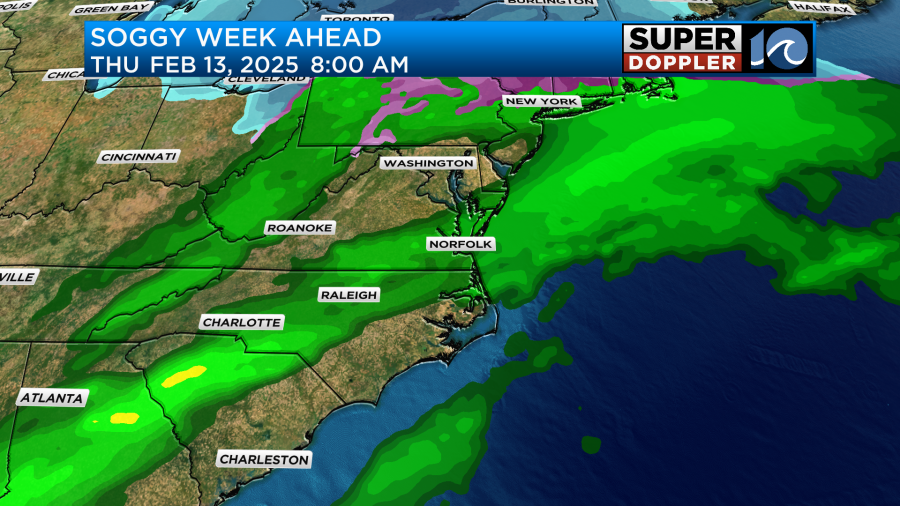
Attention then turns to the active and soggy week. As the moisture moves in Tuesday morning, it could start as some snow, or at least a wintry mix, before turning over to mostly rain. Accumulations will be limited (0″ to 0.5″) across much of the metro but the further N and NW you go up the Peninsula, there is the potential for a light accumulation. Better chances of anything sticking near Richmond. These numbers are HIGHLY SUBJECT TO CHANGE so check back for an update later today and tomorrow as more high resolution data becomes available!
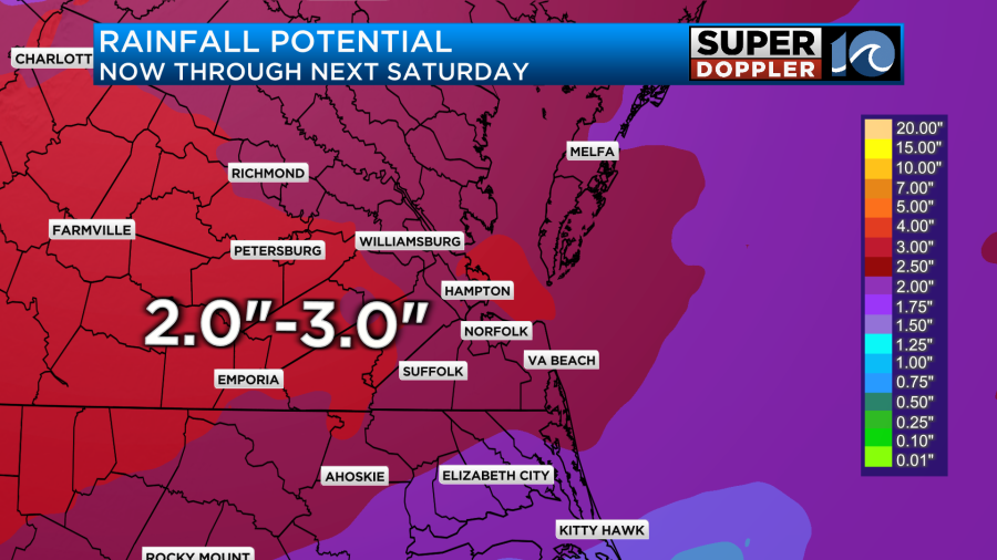
Things will remain soggy through Wednesday and Thursday of this week as well! We’ll see basically daily rainfall chances – with periods of heavier rain at times. When all is said and done by the end of the week, 2″ to 3″ of rain will likely have fallen. We may even see a t-storm or two on Thursday.
Hope you have a great weekend!
Meteorologist Ricky Matthews
Follow Ricky on Facebook and Twitter


