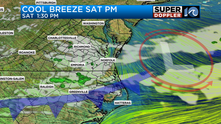
A nice start to the day Saturday, with temperatures climbing through the morning into the upper 50s. A weak front drops into the region around lunch and cools us down into the low 50s by the late afternoon. Some passing clouds and maybe a stray shower are expected; otherwise, the day (and weekend) looks dry. Brighter conditions arrive on Sunday, with lows in the 30s and highs in the low to mid-50s.
Next week looks pretty nice, but some showers are possible on Monday. The highest chance for these will be in eastern NC and the OBX on Monday, but I wouldn’t be shocked to see a few across parts of SE VA, too. Temperatures rebound quickly to the low 60s Monday, then the sunshine guides us into the 70s for Tuesday and Wednesday. On Wednesday afternoon, a backdoor cool front may drop in during the afternoon, helping to cool some of our region down.

Now, a follow-up to Wednesday’s storms. The survey team from the National Weather Service has determined that a waterspout moved onshore from the York River near Gloucester Institute in Gloucester County on Wednesday, March 5th, 2025. Several large trees were downed on this property, a large propane tank was displaced several hundred feet, shingles were removed from a cottage, and a small pillar was shifted off the awning that it was supporting. The tornado quickly moved north northeast and lifted soon after crossing Allmondsville Road.
The rating was an EF-0, with winds of 75-85 mph. The Gloucester Institute posted a video on Facebook showing some of the damage. In addition to this, numerous trees were downed throughout Gloucester County, consistent with thunderstorm wind gusts of 65 to 75 mph.

Another area of damage at Ginney Point Marina in Mathews was determined to have been from damaging straight-line winds. These winds were estimated at 80 mph. You can read the entire statement from the NWS here.
Hope you have a great weekend!
Meteorologist Ricky Matthews