The weather pattern is going to change this week, and it will feel like a change in the seasons. I’d say that last week almost felt like fall. We had a lot of clouds most days, lots of rain, and cool temperatures.
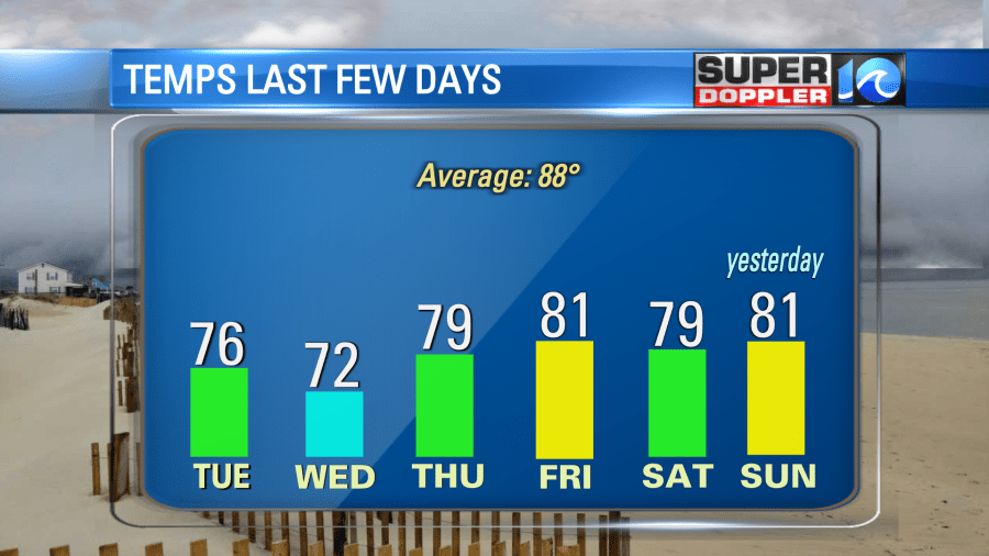
Some of the high temperatures over the last few days were actually closer to our average low temperature for this time of year. Yeah! Some folks loved the cooler weather while others pined for more beach time. Temperatures will return to reality this week.
We’ve also had a lot of rain recently. I think there is a large scale stuck pattern happening, and there are many areas of drought and also several areas of flooding. Recently, there has been bad drought conditions and wildfires in the western U.S., Turkey, Siberia, and Greece. Saturday night, there was some bad flash flooding over parts of Nebraska.
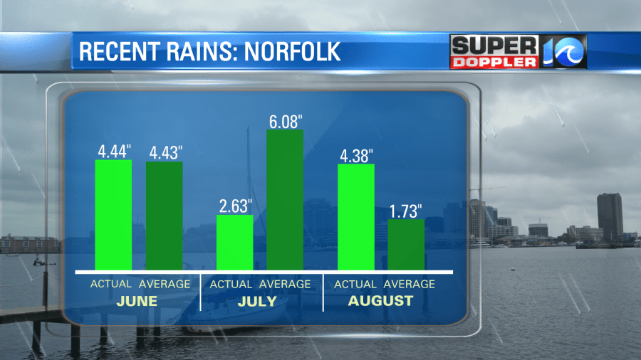
We had some localized flooding here over the last few days. Norfolk is running 2.65″ above average for the month already. We were below average last month, but August is making up for lost time.
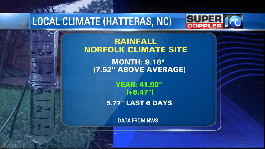
Keep in mind that some other locations had much higher rain totals over the last few days. Here’s a good example: Hatteras, NC has already had 9.18.” This is 7.52″ above the average for the month … so far.
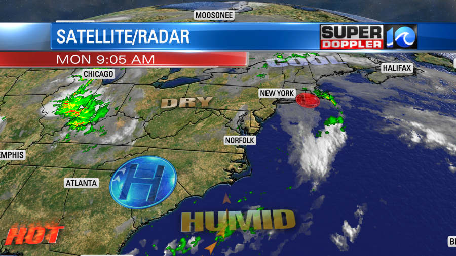
The big stationary front that sat over the region for days has moved offshore and fallen apart. The most recent area of low pressure that sat over us has moved off to the northeast.
High pressure will now sit over the region for a while. We’ll be mostly to partly sunny today. Surface winds will start to be more out of the south. So high temps will rise to the upper 80s to near 90 degrees. I’m not expecting any rain today except for a stray shower or storm in the entire region. We’ll have similar weather tomorrow. High temps will be mostly in the low 90s. The heat indices over the next 2 days will be in the low-mid 90s. However, by Wednesday the temps will build to the low-mid 90s, and the dew points will rise into the mid-upper 70s. This will produce a heat index near 100. We’ll stay hot and humid for the rest of the week. However, there will be some isolated to scattered showers and storms later this week. I’ll talk more about that in tomorrow’s weather blog.
There are currently 2 tropical disturbances in the central Atlantic.
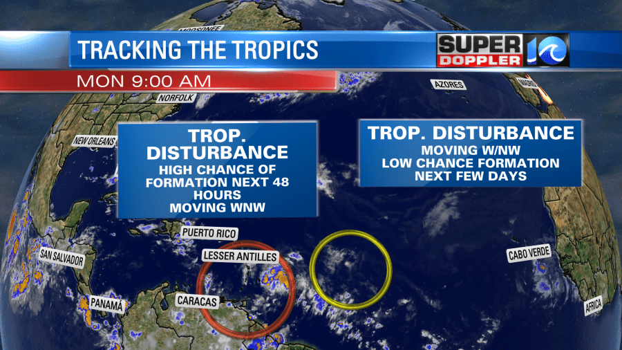
This is down from 3 features. The one that is farther west has a high chance of becoming a system in the next 2 days. Whether it forms or not, it will likely bring some brief heavy rain to the Lesser Antilles soon. The disturbance that is farther east has a lower chance of formation. However, the chances of formation for all of these disturbances have gone up and down over the last few days. We’ll monitor them, and we’ll bring you the latest.
Meteorologist: Jeremy Wheeler