
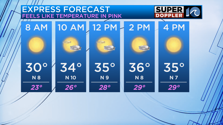
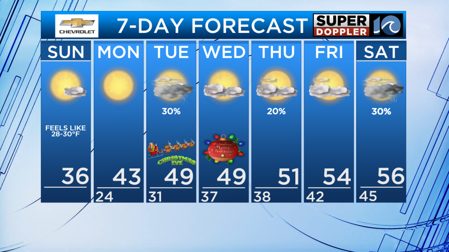
Sunday will be the coldest day of the season, thus far. And it’s likely to be the coldest day since last January! We’ll be in the mid 30s for highs Sunday, but feel colder thanks to a N wind that will blow 10-20 mph at times.
A few bay-effect flurries will also be possible Sunday especially at the coast. Not widespread, but a few could pop up just to add a bit of excitement to the cold!
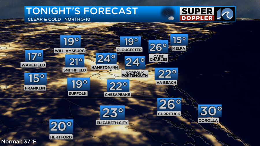
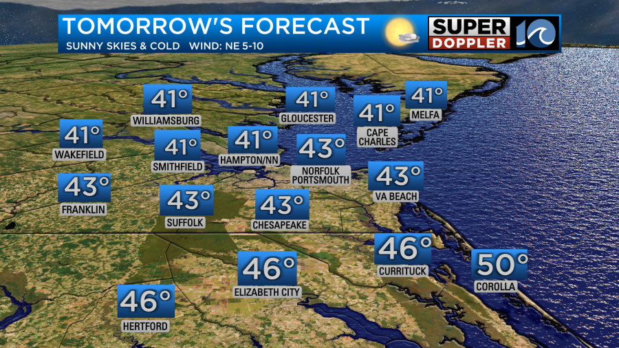
By Monday morning lows will be in the 20s once again for the coast. Inland spots will begin the day in the teens! Warming up a *little* bit more for Monday, into the low 40s. With less wind, it should actually feel like the temperature more on Monday.
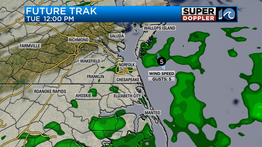
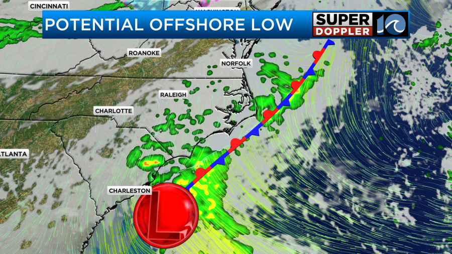
A few rain showers are possible for Tuesday, especially for the Outer Banks as an area of low pressure tries to form off the coast. We need to watch Tuesday morning carefully, as there’s a chance for a brief period of freezing rain in the morning *if* moisture moves north before temperatures warm up through the morning hours and turn things over to all rain. The best chances for this would be across interior portions of VA/NC near Southampton, Surry, Gates, Hertford – away from the coast.
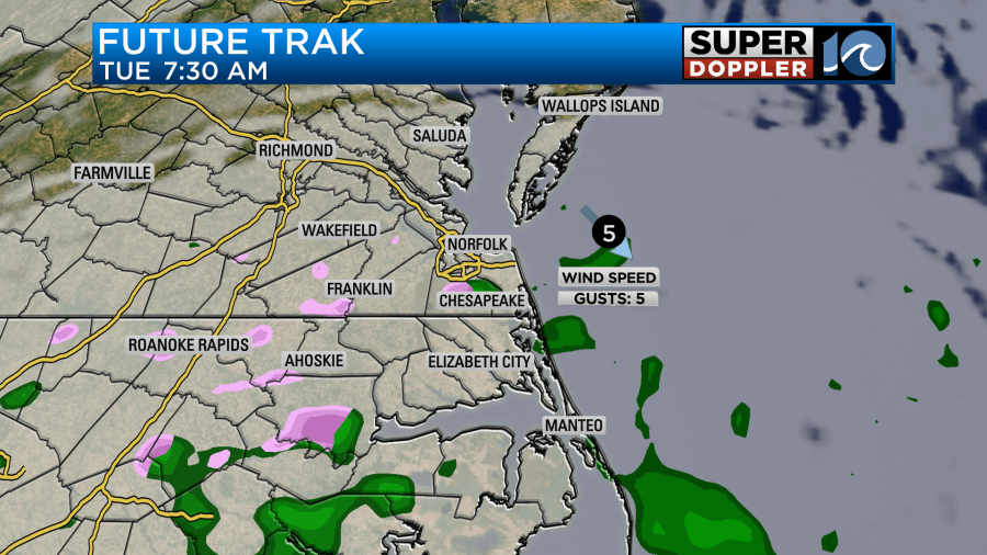
There is a high level of uncertainy with this setup though. Some models develop the low off the coast, while other’s keep us dry. Check back for an update tonight/early Mon morning as we get a little more data on this potential.
Temperatures should be a little closer to normal (53) by Tuesday afternoon. Highs in the upper 40s to low 50s Christmas Eve. For Christmas Day, we’ll see partly to at times mostly cloudy skies with highs in the low 50s. A warming trend occurs towards the end of next week, with temperatures climbing into the mid 50s during the afternoon. Some more rain showers are possible towards the end of the week into the weekend.
Meteorologist Ricky Matthews
Follow Ricky on Facebook and Twitter


