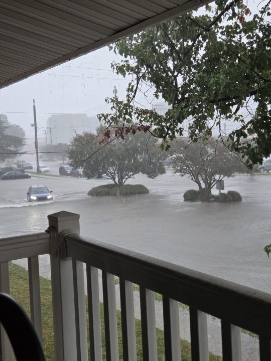
Yesterday our area was hit with a relatively weak area of low pressure. However, it had a lot of moisture and some instability with it. So there were some bad effects over the region. The biggest effect was the heavy rainfall. We had some pretty bad flooding in Virginia Beach.
Rainfall was very heavy there around midday, and then a second round of heavy rain hit there in the evening.
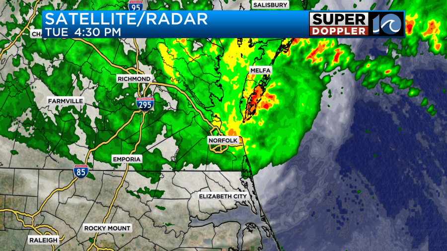
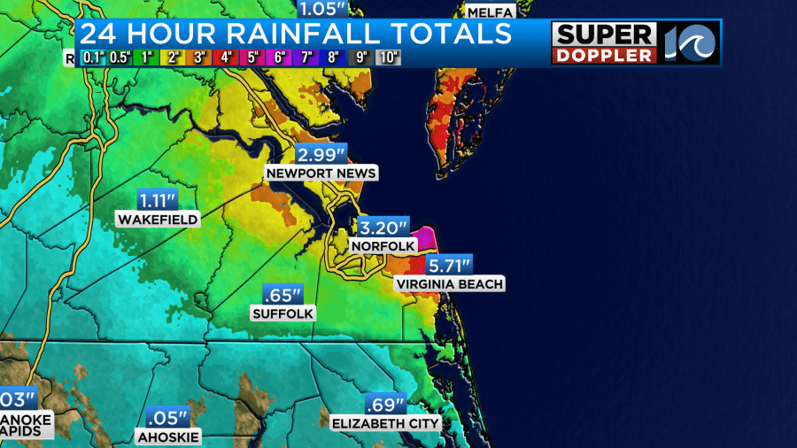
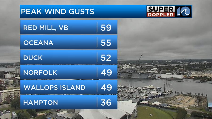
It was heavy in some other spots as well like the lower Eastern Shore, Norfolk and Portsmouth. There was some flooding in some of those locations as well. Here are the 24 rainfall totals.
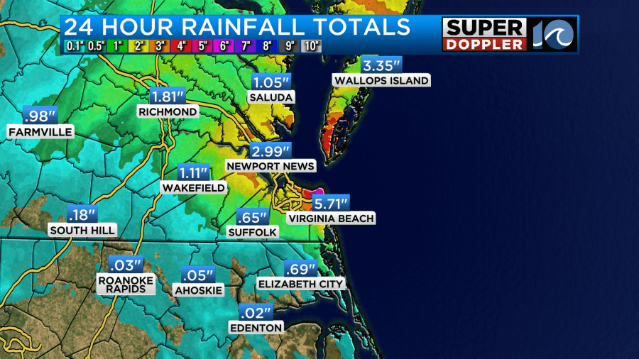
While NAS Oceana recorded 5.71″ in Virginia Beach. Some other places in the city had over 7″.
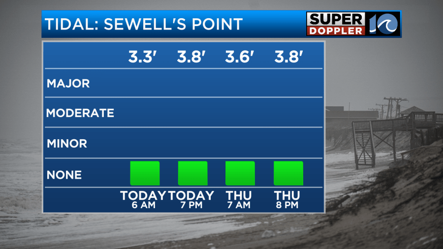
Truth be told, we really needed the rain. But we didn’t need the flooding. Along with the heavy rain there was also some tidal flooding and strong gusty winds. Some of the winds gusted to over 50mph.
The area of low pressure moved slowly to the north/northwest. It did not move northwest/west like our Future Trak model expected. Instead it moved more northerly and then it drifted west in the evening. Now the low is weaker and inland.
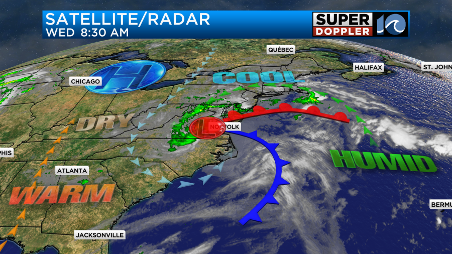
There is also a weak upper-level low overhead. Both of these will continue to weaken today, but they will also drift east. As the low drifts east there will be some scattered rain showers also moving towards the coast.
The good news is that these will be mostly light and scattered. There will also be some drizzle at times on-and-off through the day. Winds will be much lighter. They will run out of the southwest/south at 5-15mph. This will keep the tides down today. They will be below even nuisance tidal flooding levels.
Some pretty cool air has wrapped around into the system. So high temps will only be in the upper 60s to around 70 today.
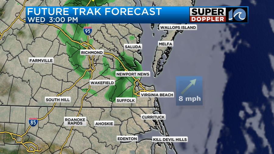
By tonight the low will weaken even further. It will also start pushing out to sea. By tomorrow the low will be pushing farther offshore. We’ll start with some clouds and some isolated rain showers, but we’ll have gradual clearing through the day. We’ll become partly cloudy with highs in the mid-upper 70s. There will be a light northwest wind. Then we’ll have quiet weather for Friday and Saturday. High temps will warm to the mid 80s on Friday, but we should cool a bit into the 70s on Saturday. We’ll be in the 70s on Sunday as a cool front stalls out just offshore. This could bring us some isolated showers on Sunday, but we’ll see.
Meanwhile, the tropics are getting busy again. This morning Tropical Depression 7 formed over the central Atlantic. It is on a northwest track.
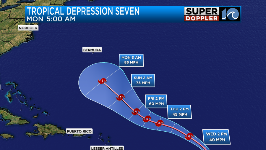
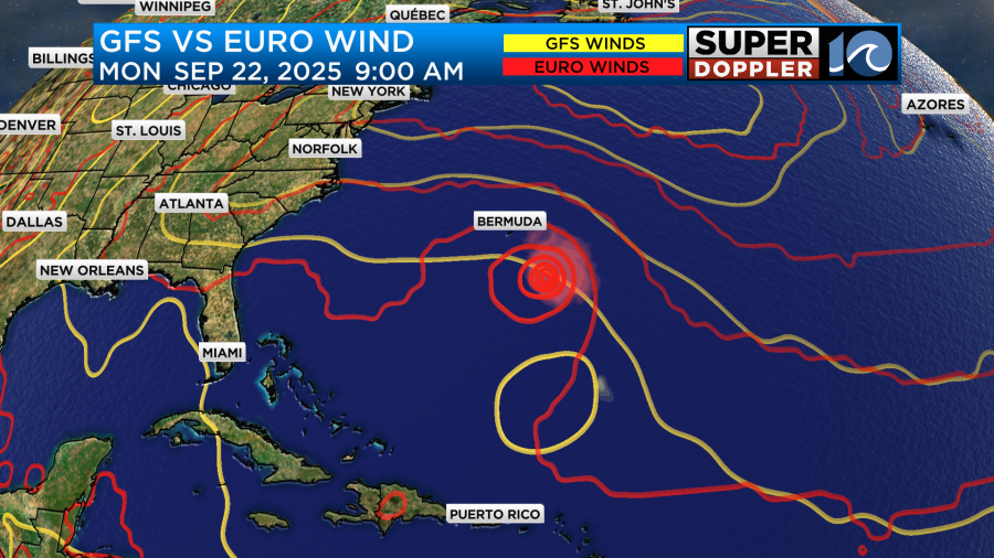
This is forecast to become tropical storm Gabrielle in the short-term. Then it will move northwest and strengthen some more. It could become a hurricane in 3-5 days. The models are pretty split in that time frame as far as the track goes. Here are some of the latest models.
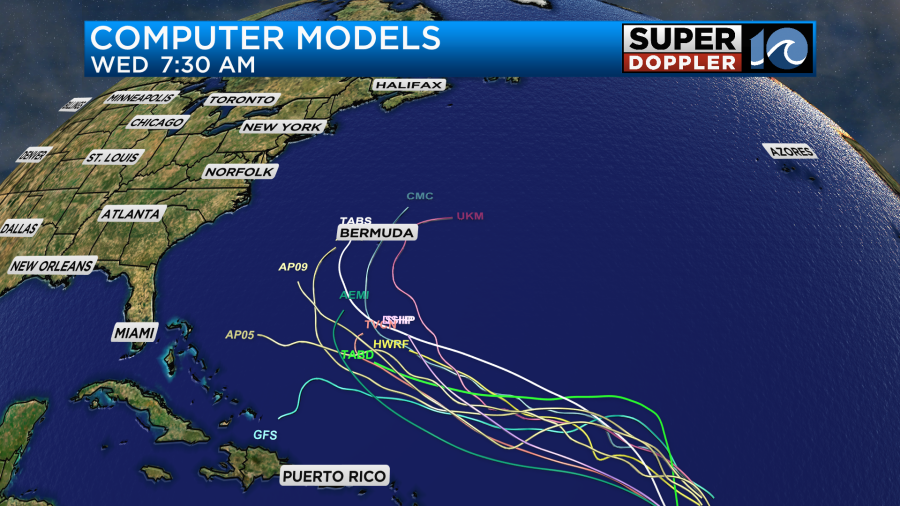
The GFS model had it moving northwest then southwest for a time and falling apart. The new update came out this morning. Now it keeps it weak, but it does have the track closer to the European model.
We’ll keep a close eye on it over the next few days. There is another weak disturbance in the eastern Atlantic that has a low chance of formation as it moves to the west.
Meteorologist: Jeremy Wheeler


