After several days of chilly temperatures, Sunday looks to be a little warmer, with highs in the upper 40s to low 50s region wide. Expect partly sunny skies and a touch of SW wind Sunday. Temperatures will cool down in the low 30s to upper 20s inland again overnight.
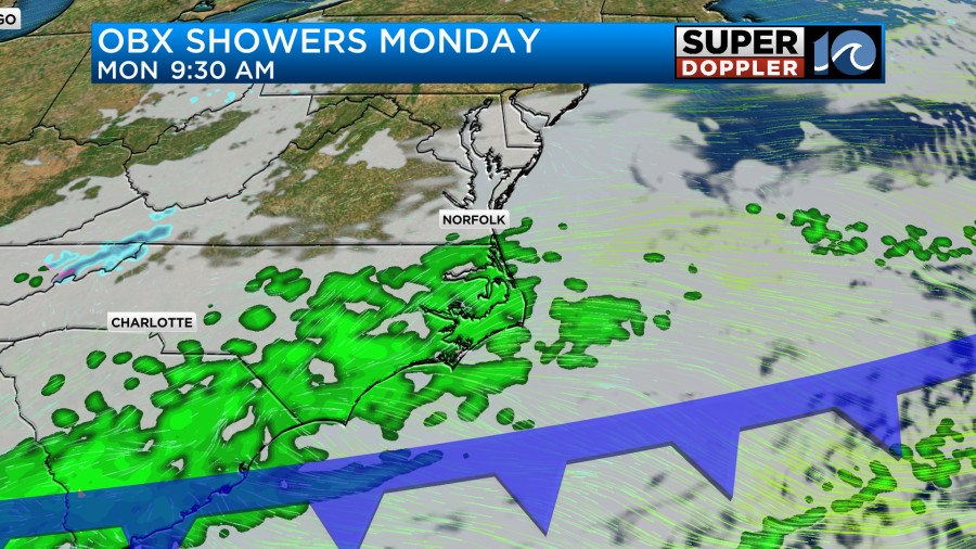
We’ll start off the week on Monday with another decent day of temperatures in the upper 40s to low 50s. A few showers will be possible, mainly in NE NC as a weak system slides through. Maybe a few of these impacts southern VB and Chesapeake too – but most of the moisture should be over NE NC.
Aside from this rain chance Monday, much of the week looks dry with calm weather conditions. It will be a little breezy Tuesday, with highs in the low 50s.
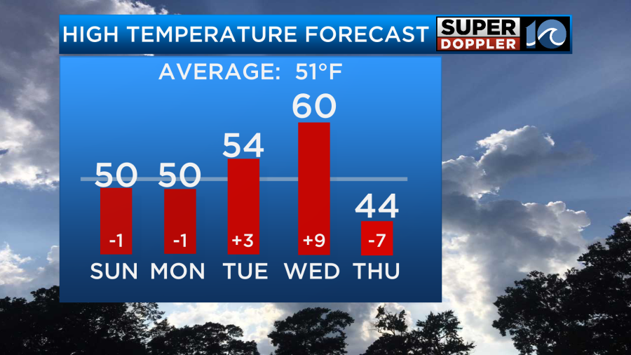
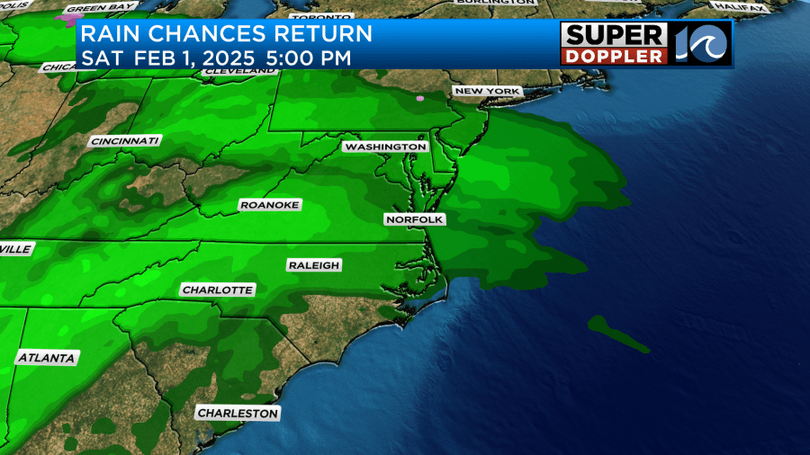
By Wednesday, look for an afternoon temperature near 60°. A mainly dry cool front moves through Wednesday night, resulting in temperatures falling some into the late part of the week. Another system could approach next weekend, bringing us an additional rain chance. However, that’s awfully far ahead in time to make an accurate prediction, so timing on this could change.
Hope you have a great week and are doing well. I’m filling in today and sometime in February to give the rest of the guys on the weather team a break from this busy weather pattern we’ve been seeing!
Meteorologist Ricky Matthews


